← Home About Archive Also on Micro.blog
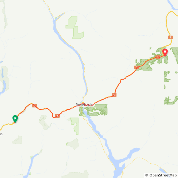
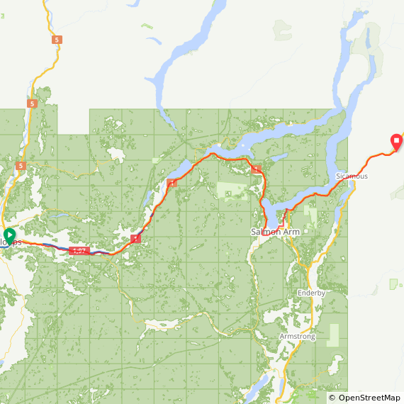
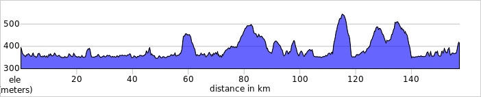
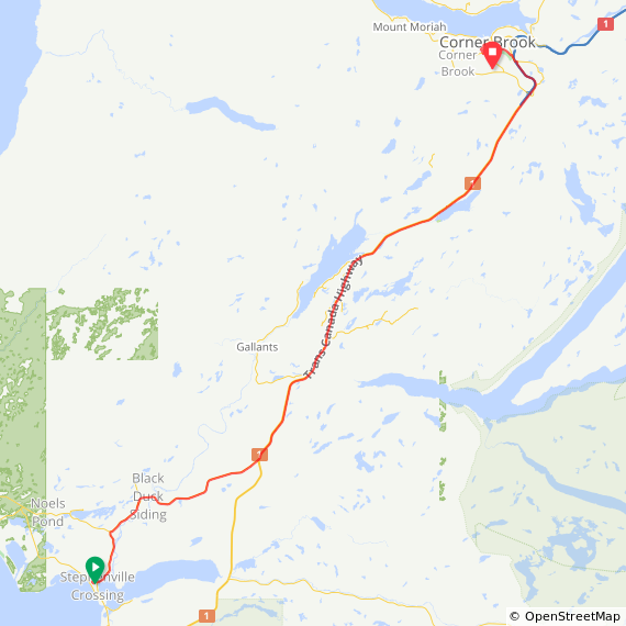
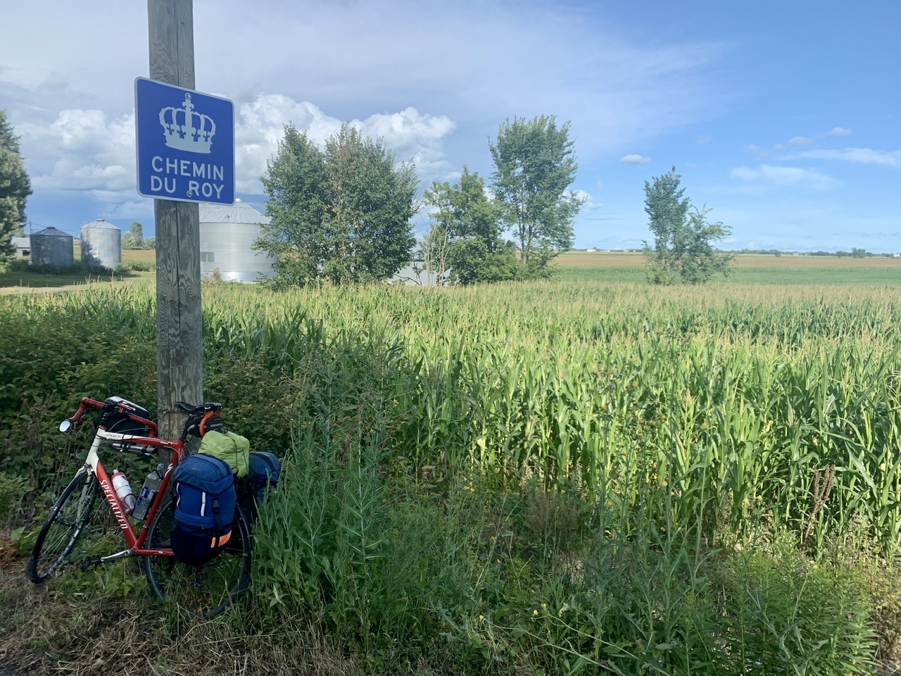
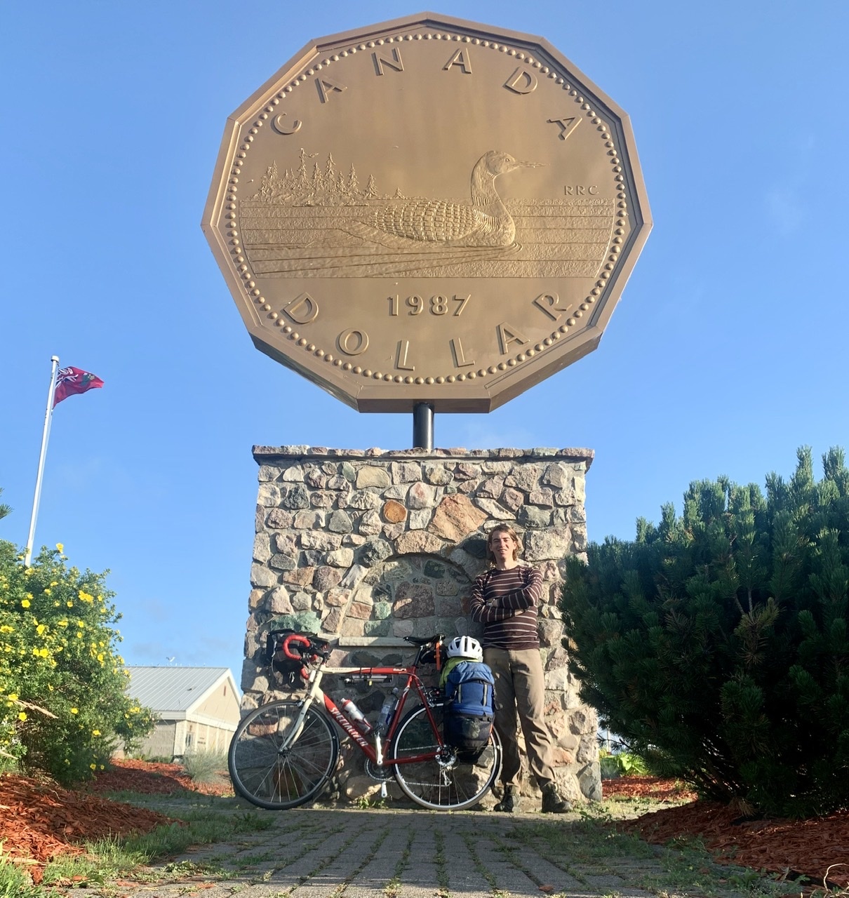
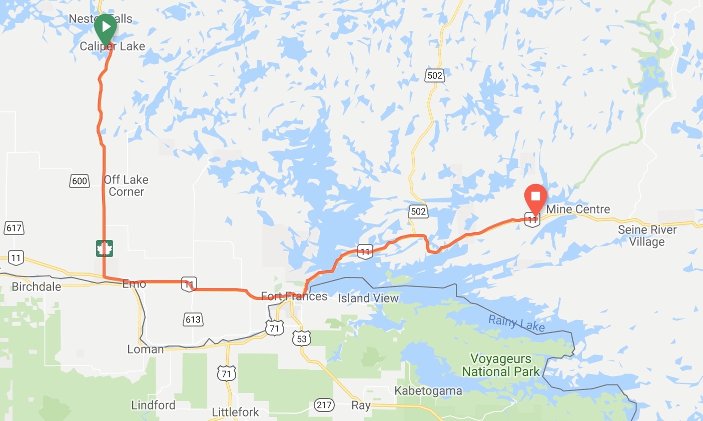
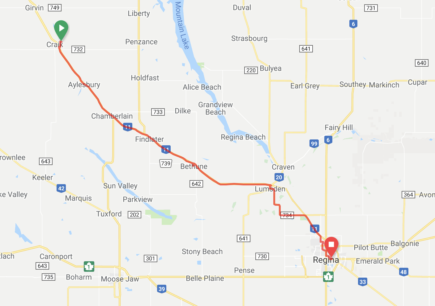
  • Biking Across Canada Day 67 — Whitbourne to Cape Spear, NL: All Good Things…

    Today's the day I finish my long journey. It's going to be strange going back to regular life after having this trip occupy my thoughts for the past two years.

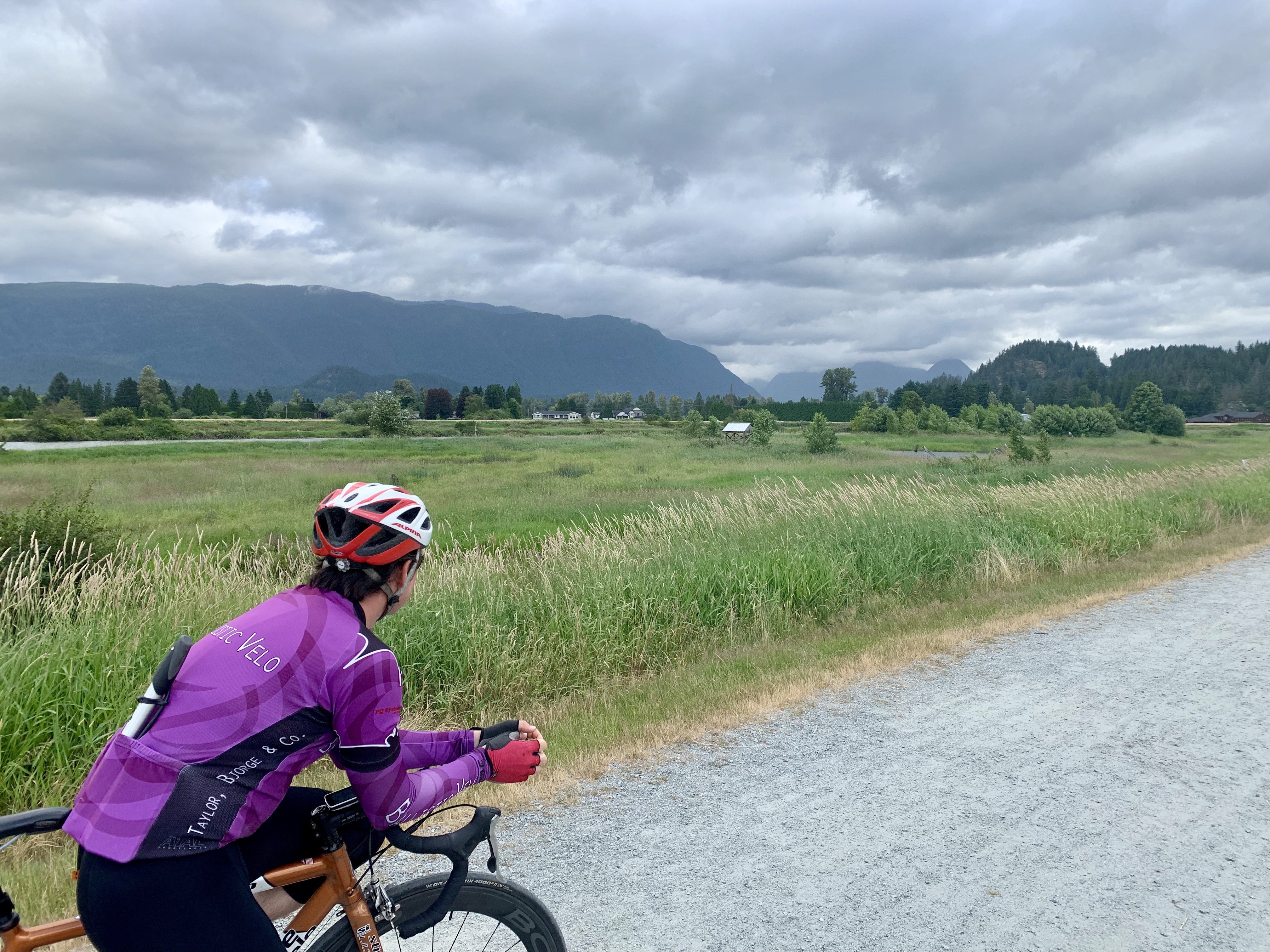
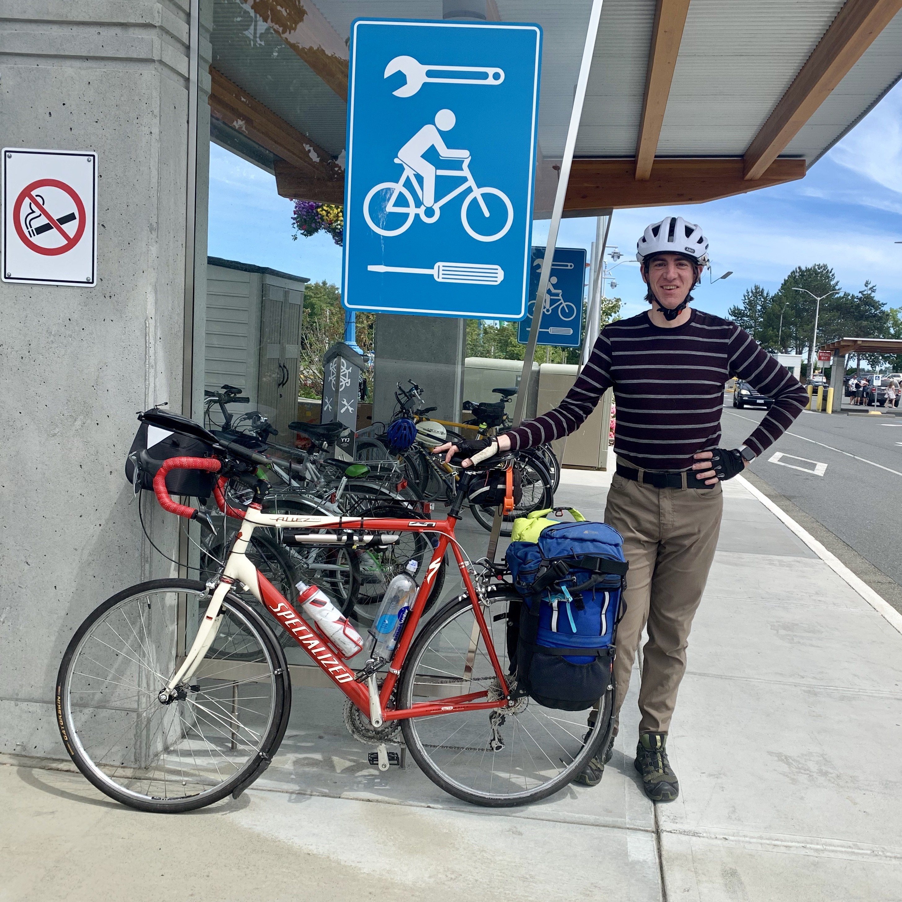
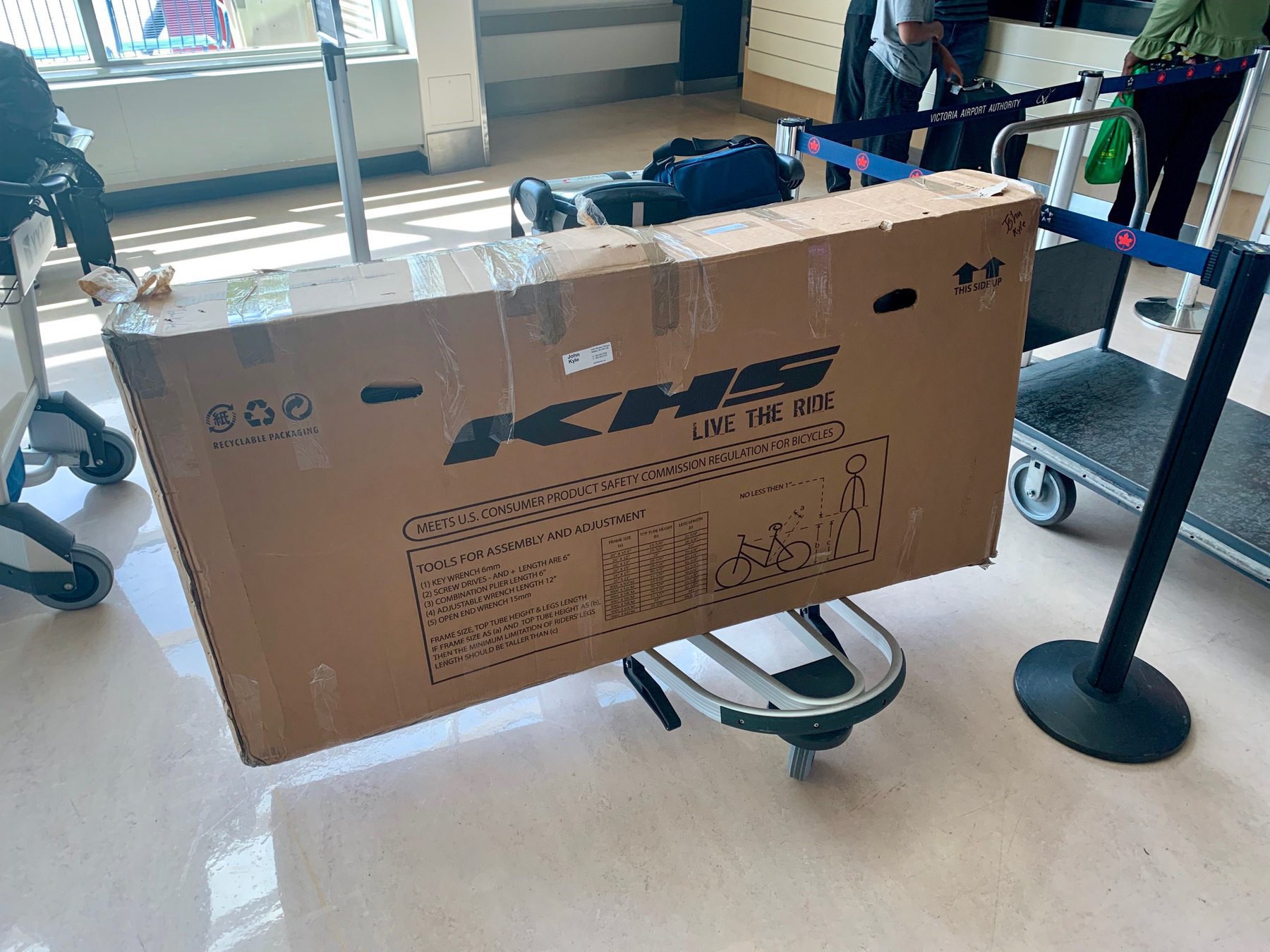
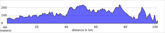
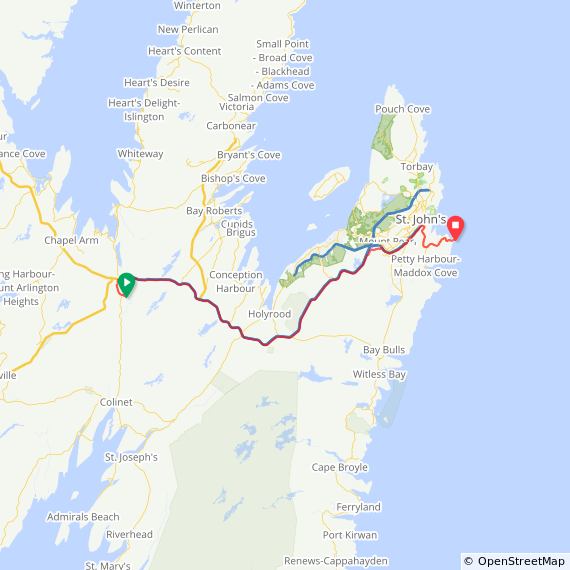
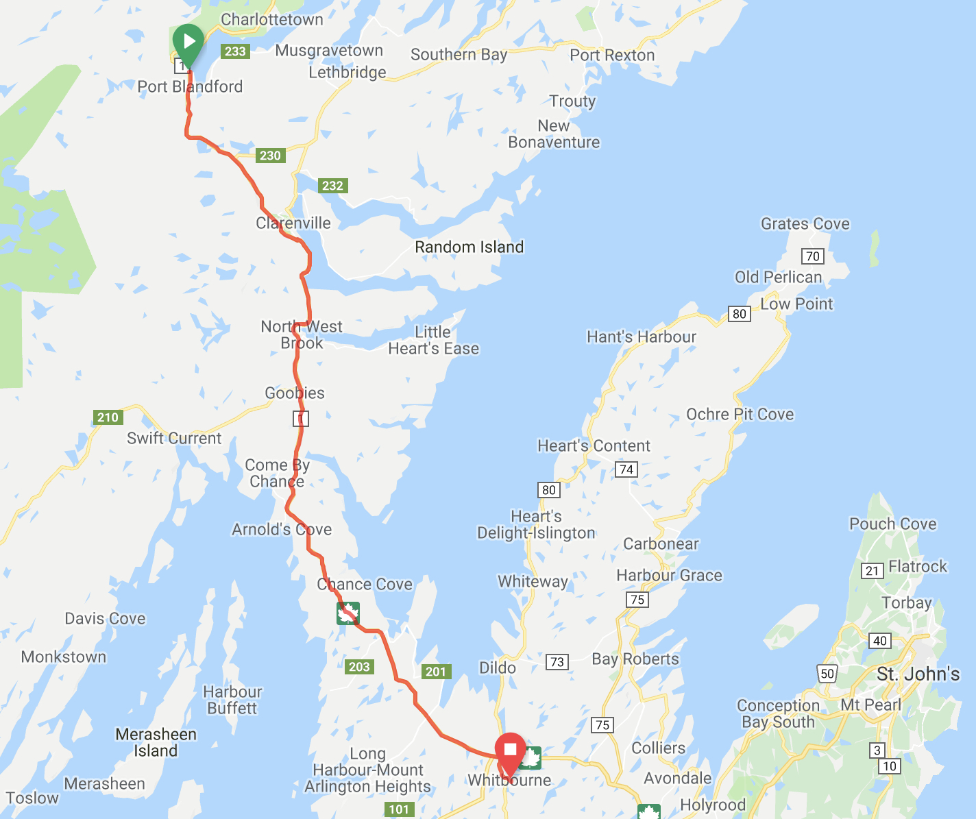
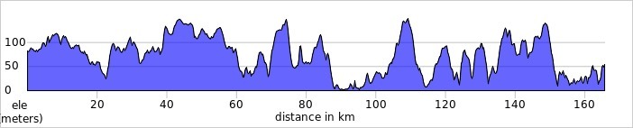
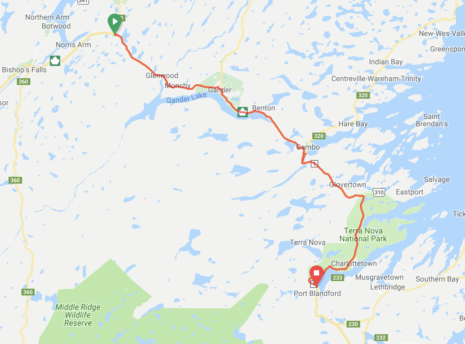
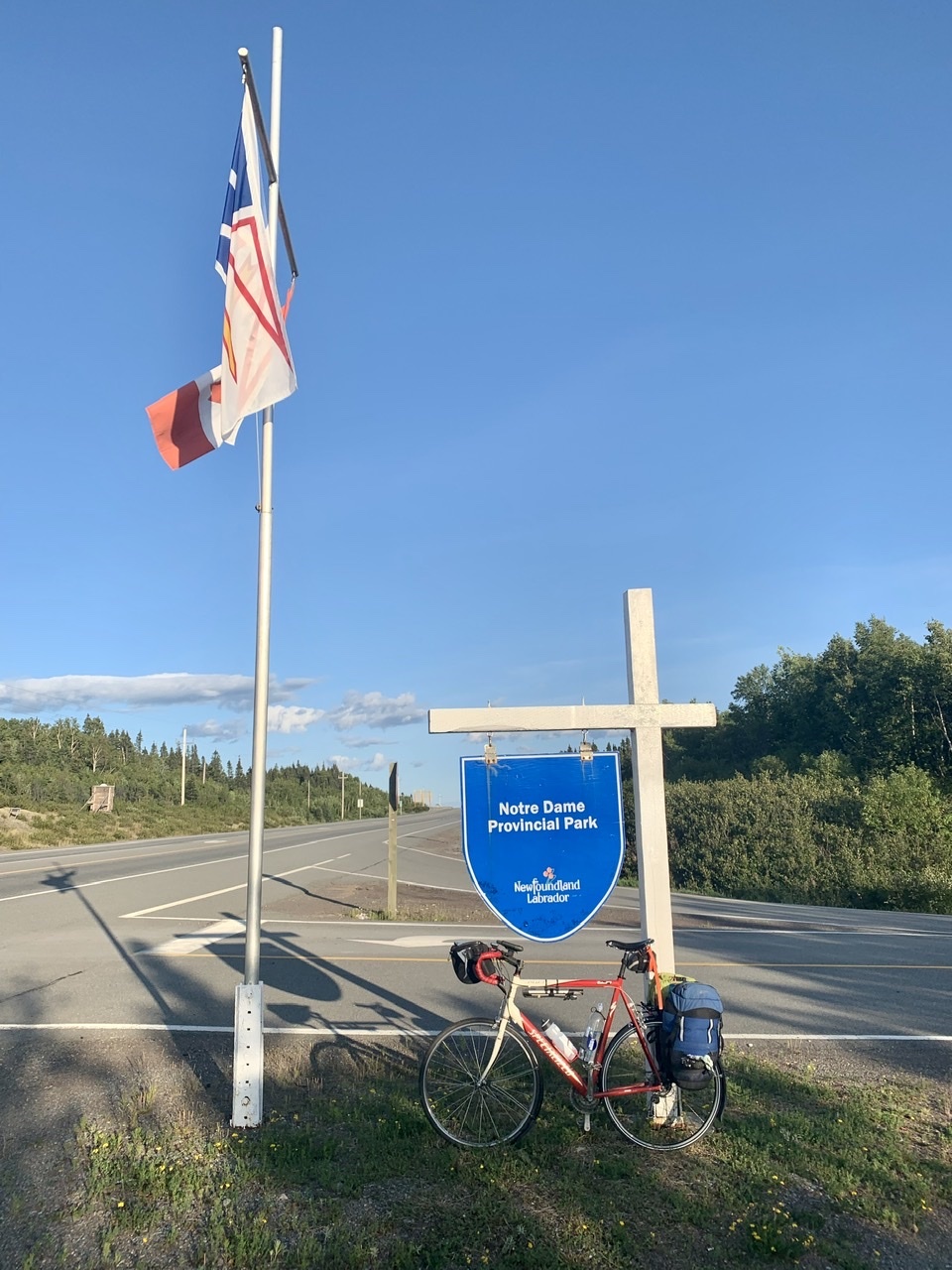
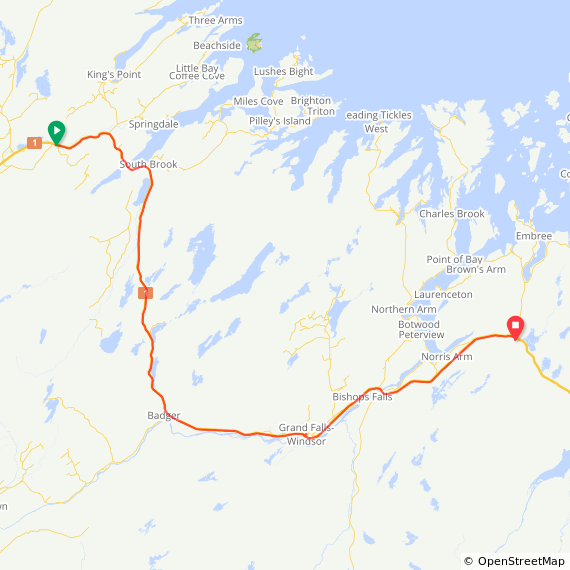
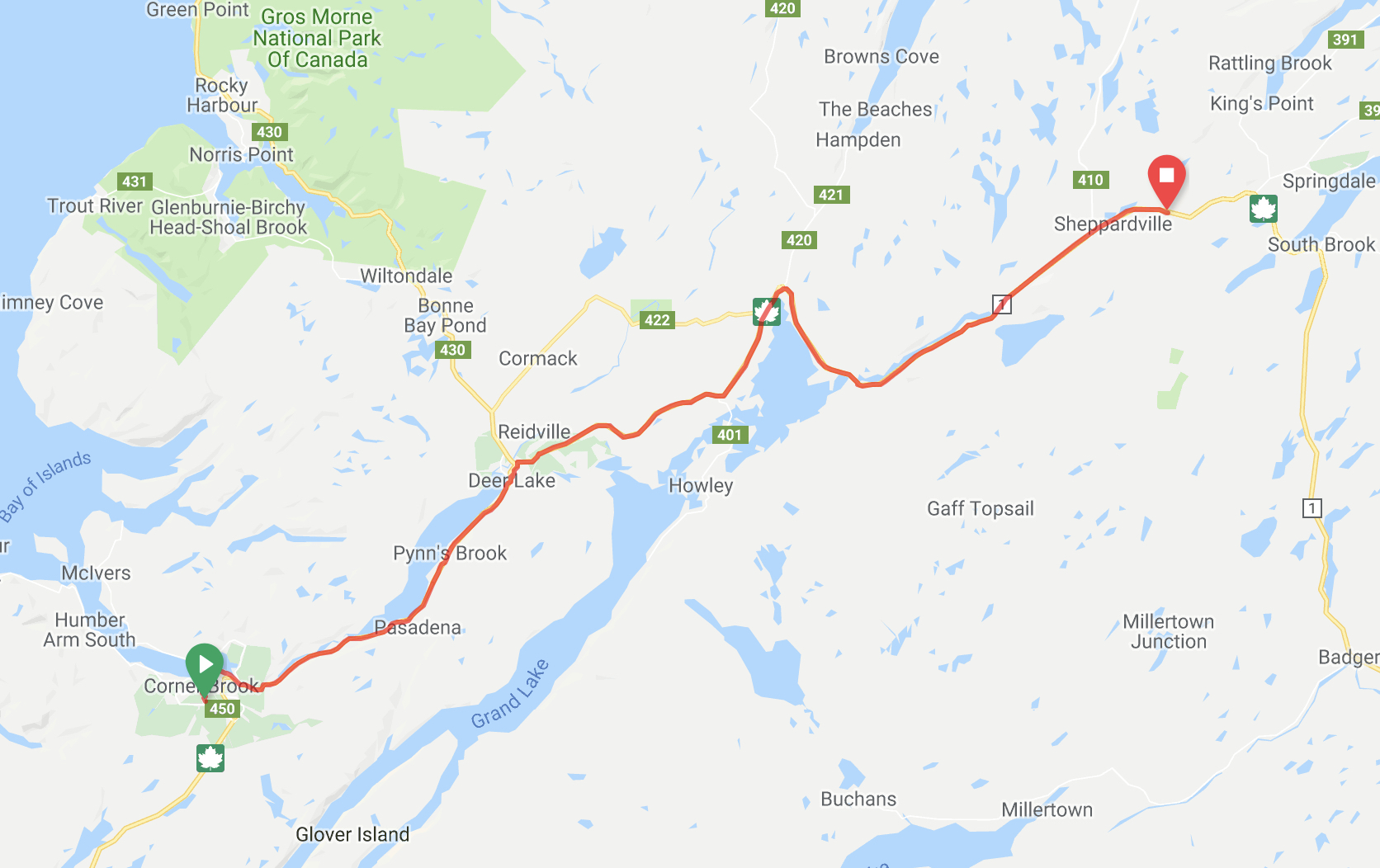
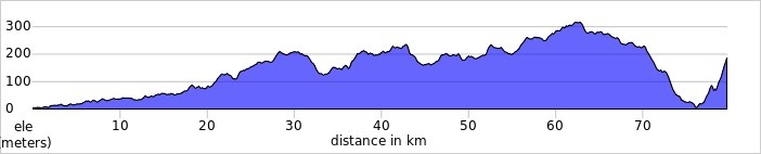
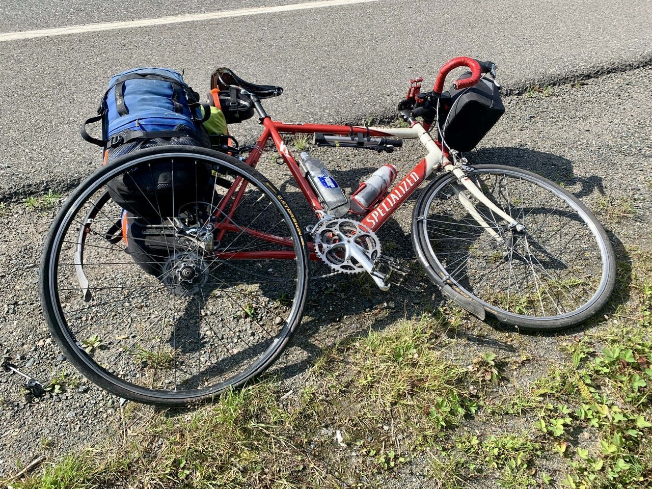
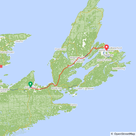
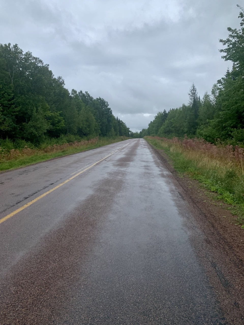
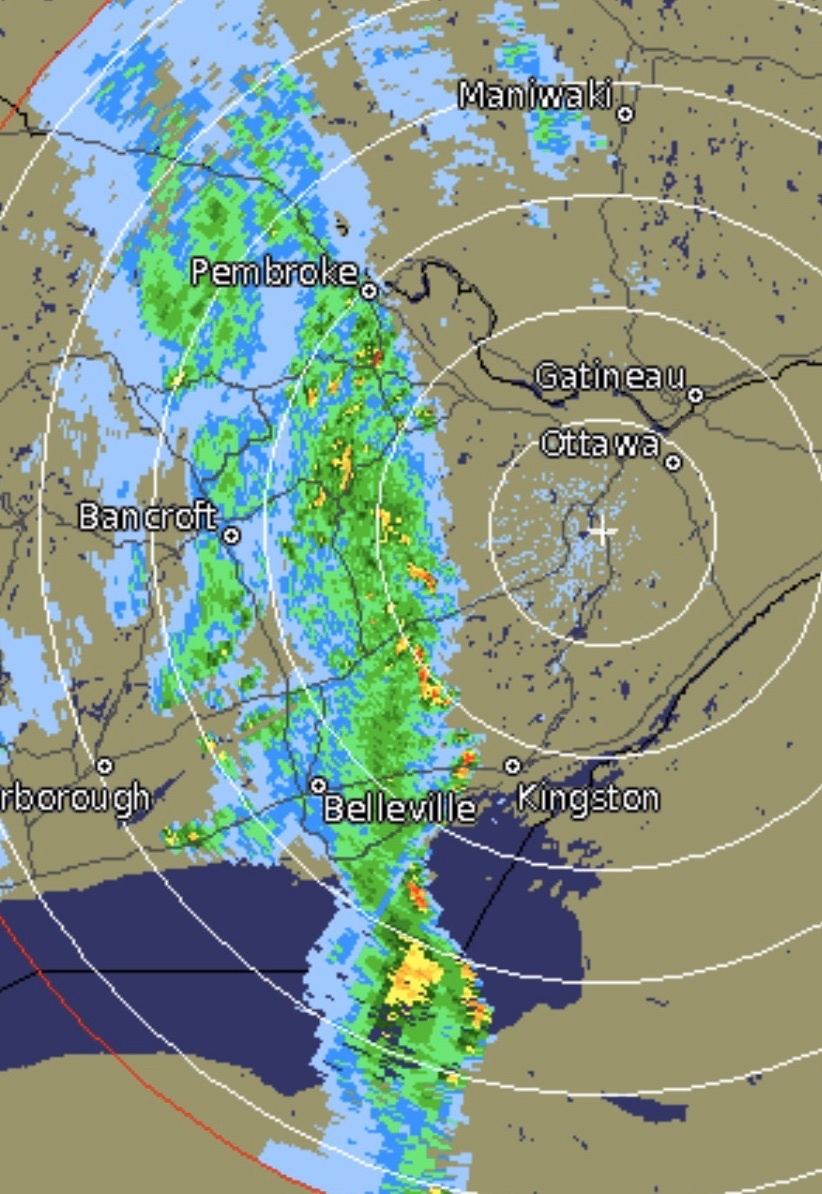
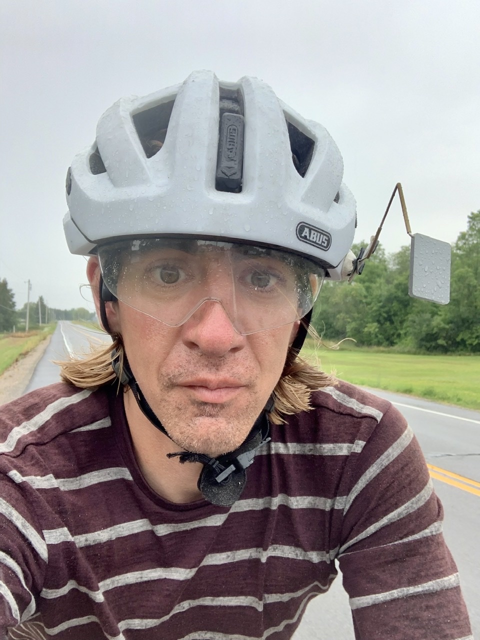
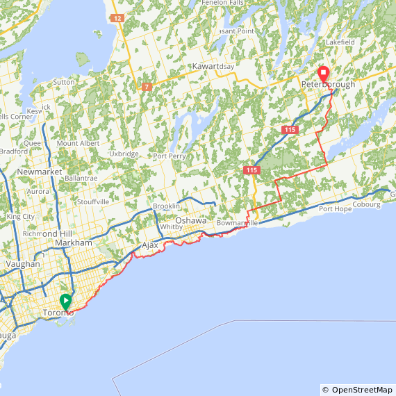
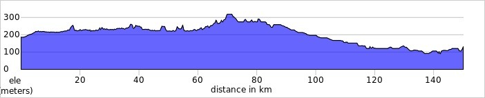
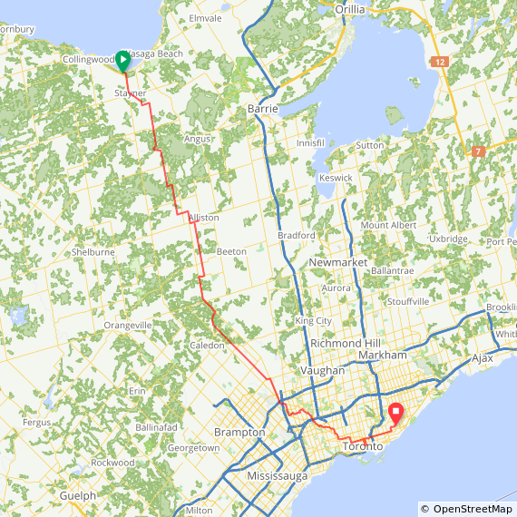
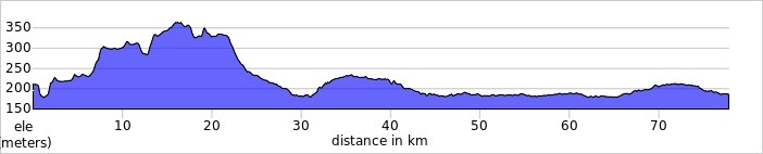
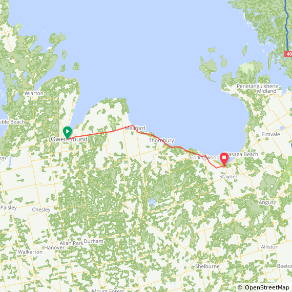
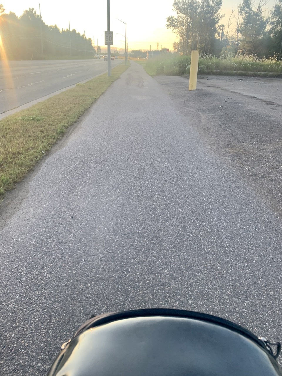
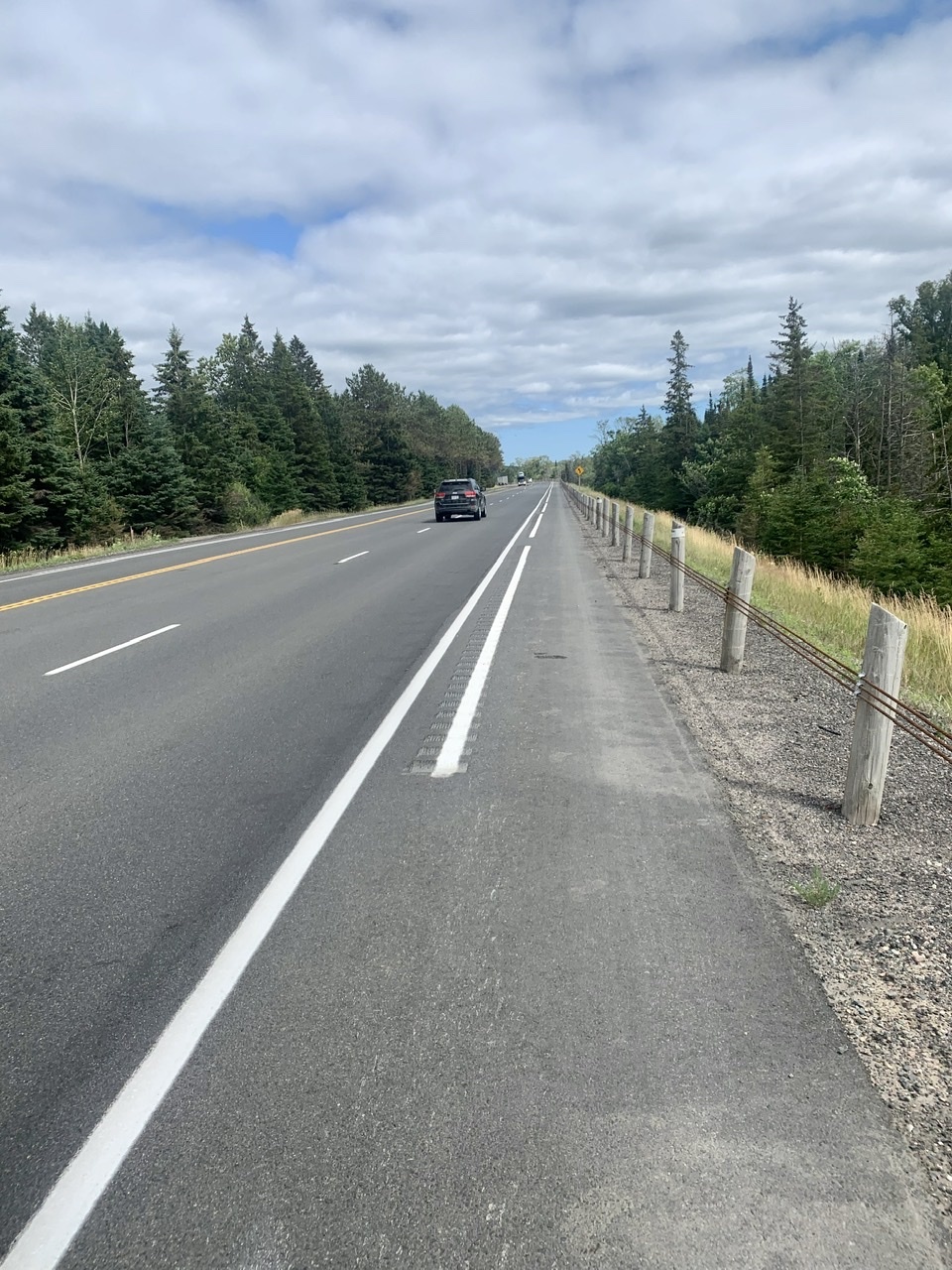
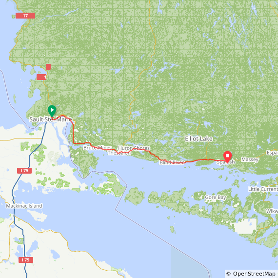
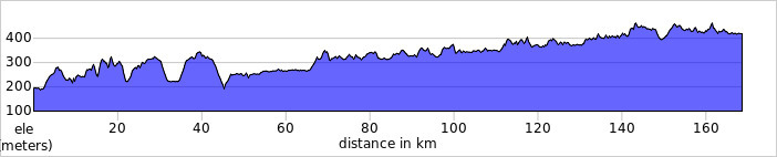
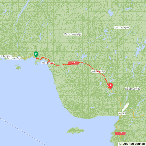
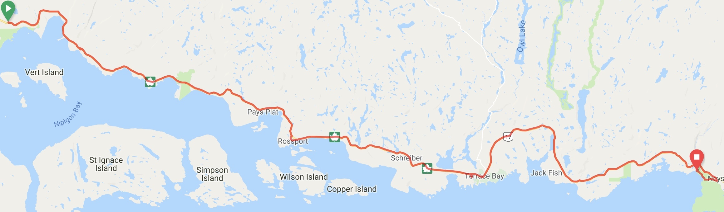
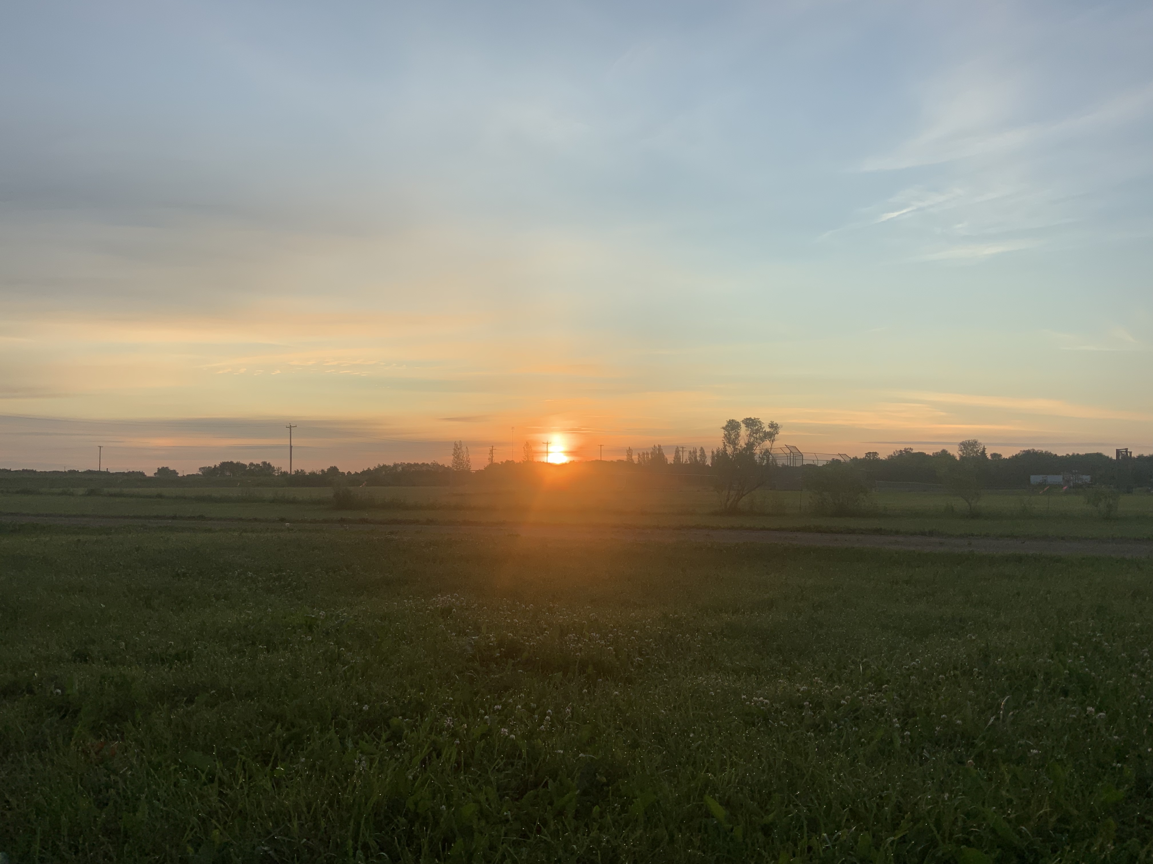
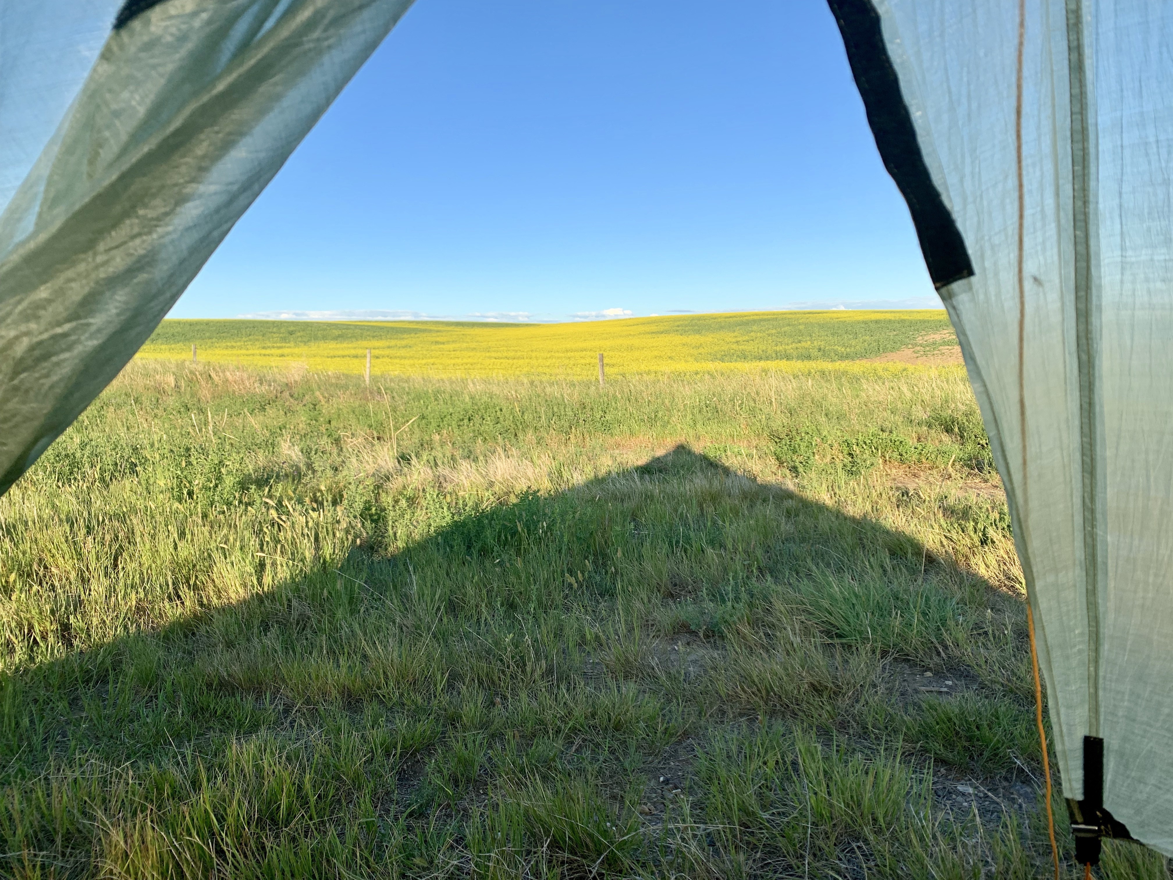
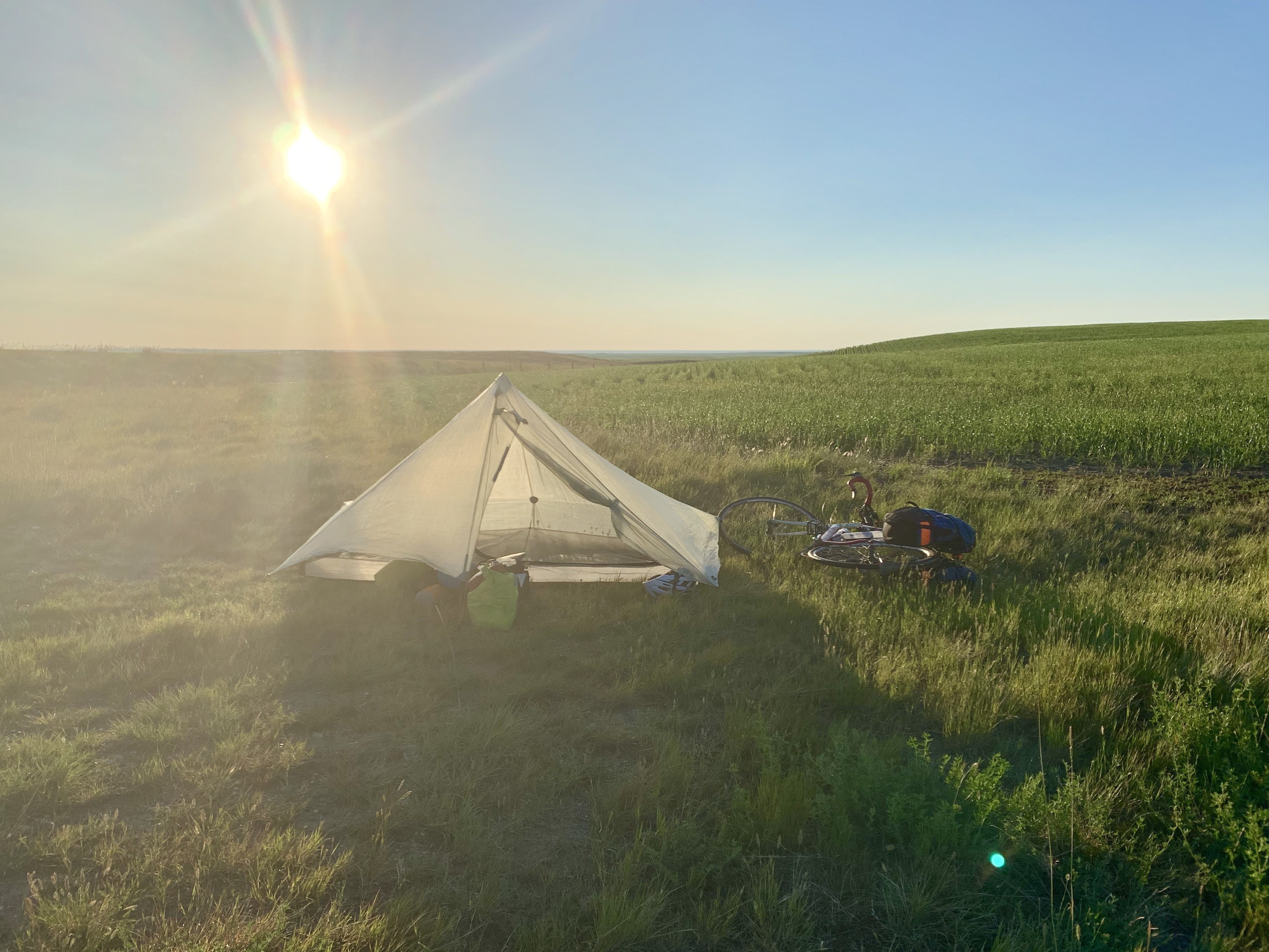
    We got up before dawn and started riding as soon as we could. The forecast was calling for the wind to change from southwest to southeast at noon (i.e. from a tailwind to a headwind), and we wanted to get as far as we could before that happened. Newfoundland is difficult enough, so we don't need to ride in hard mode if we can avoid it. I also needed to get my bike to a shop to have it boxed up in time to catch a plane home the next day, so the pressure was on to finish early.

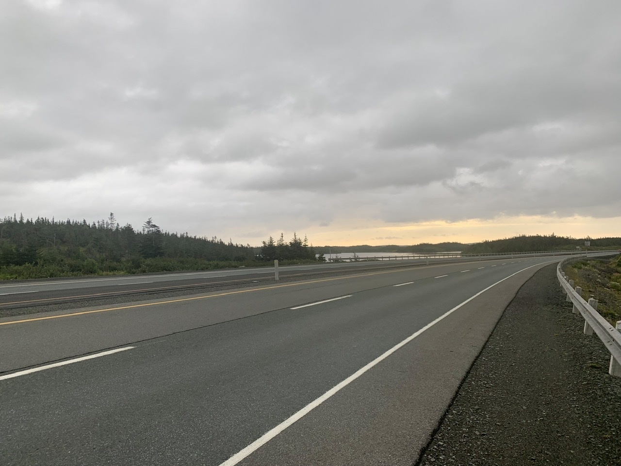
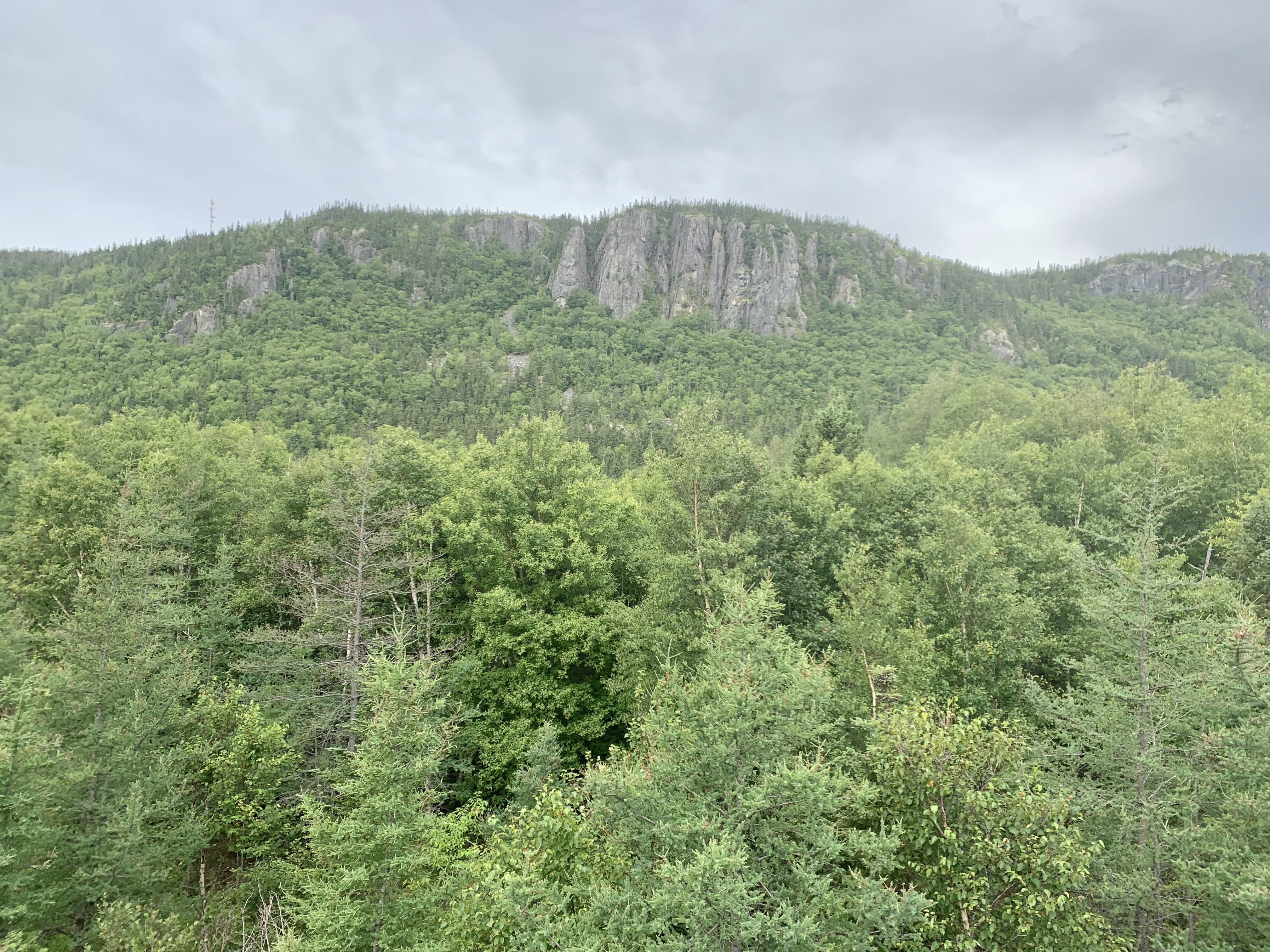
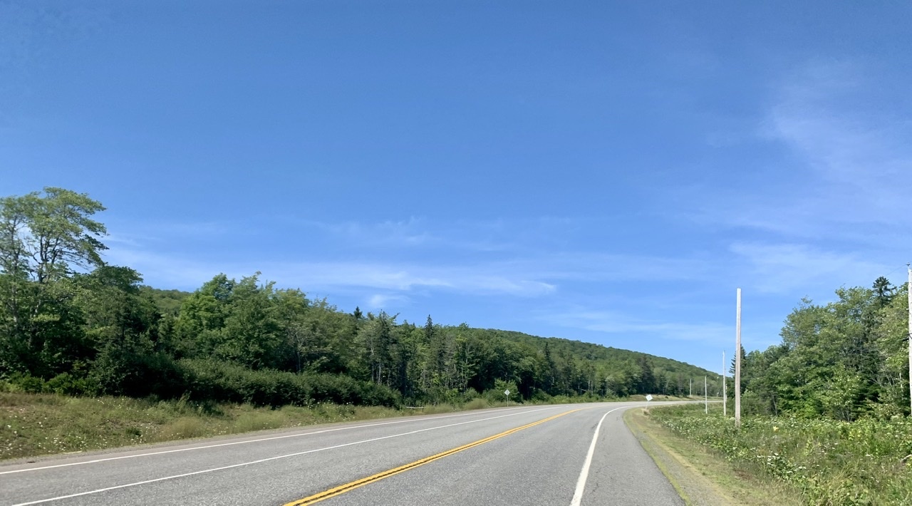
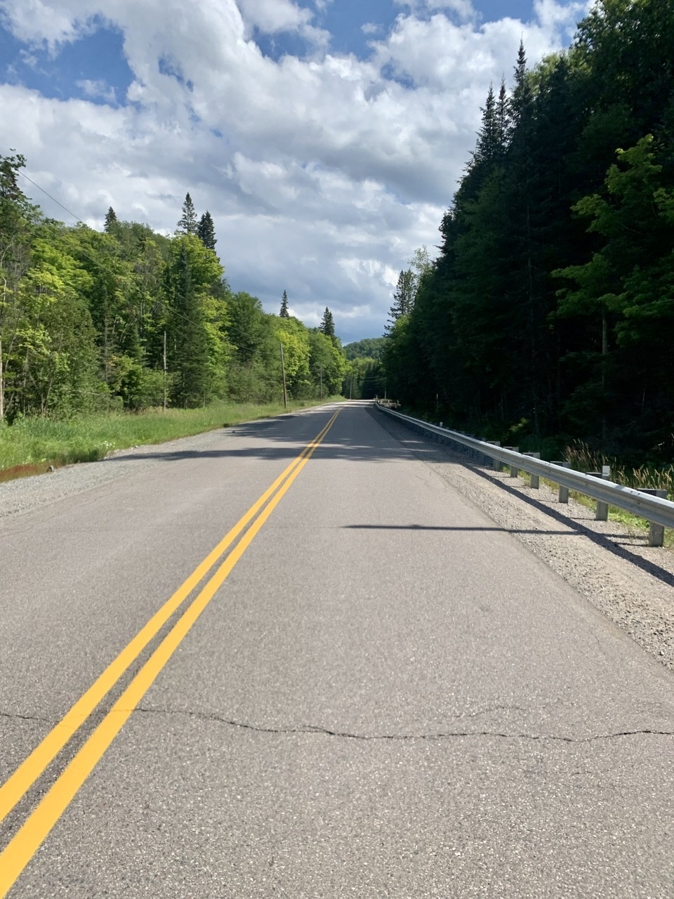
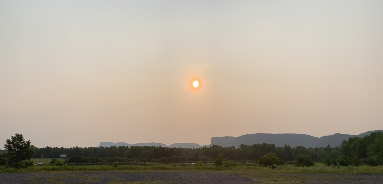
    We had a cross/headwind for the first couple hours until our route swung northward near Holyrood. This inflection point was also at the peak of the tallest hill of the day. I did a celebratory fist pump when I reached the top, knowing that the day would get easier from here on.

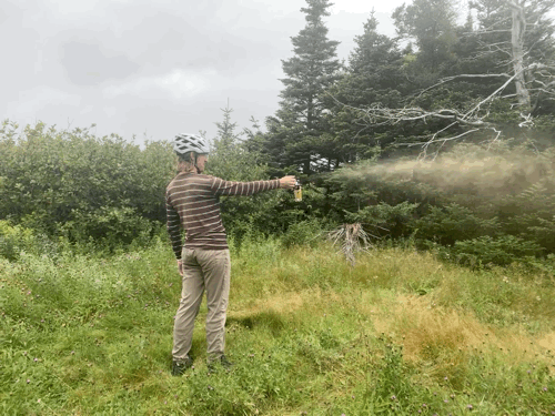
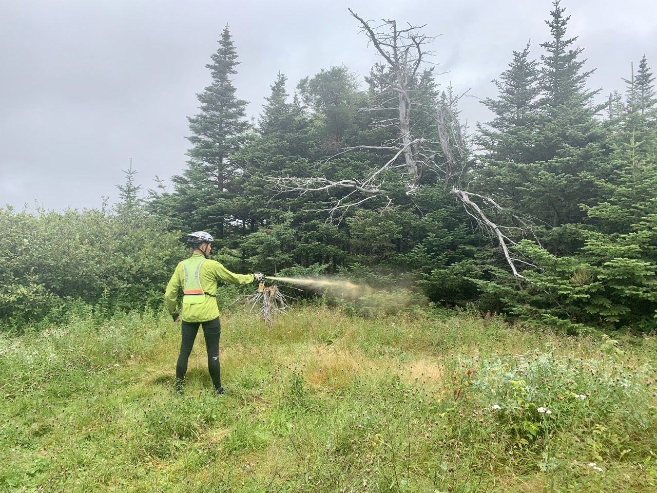
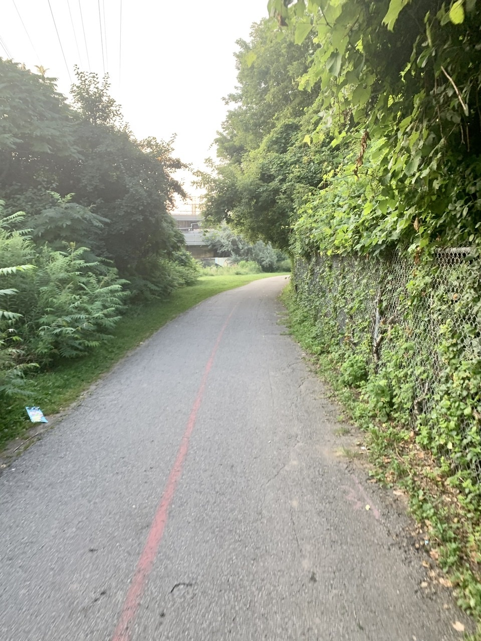
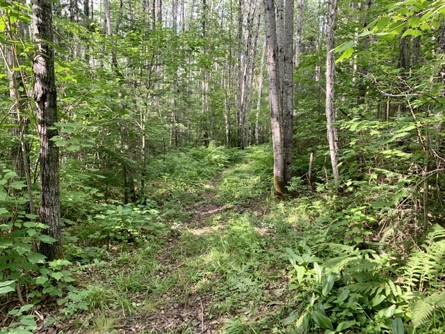
    As we got closer to St. John's we pulled off on to an ATV trail to find an area protected from the wind to empty Mark's bear spray canister. He can't fly with it, and the serial number is registered to his name so he doesn't want to throw it out in case it's used for nefarious purposes. So we had an excuse to practice using it on an imaginary bear. Target practice, as it were. It was useful to know the practical range of the pepper spray if we were every forced to use it. After the first few sprays we had to run back to the road, laughing all the way, as we could feel the effects of the capsaicin in the air. I left it to Mark to finish off the canister on his own once the air was breathable again.

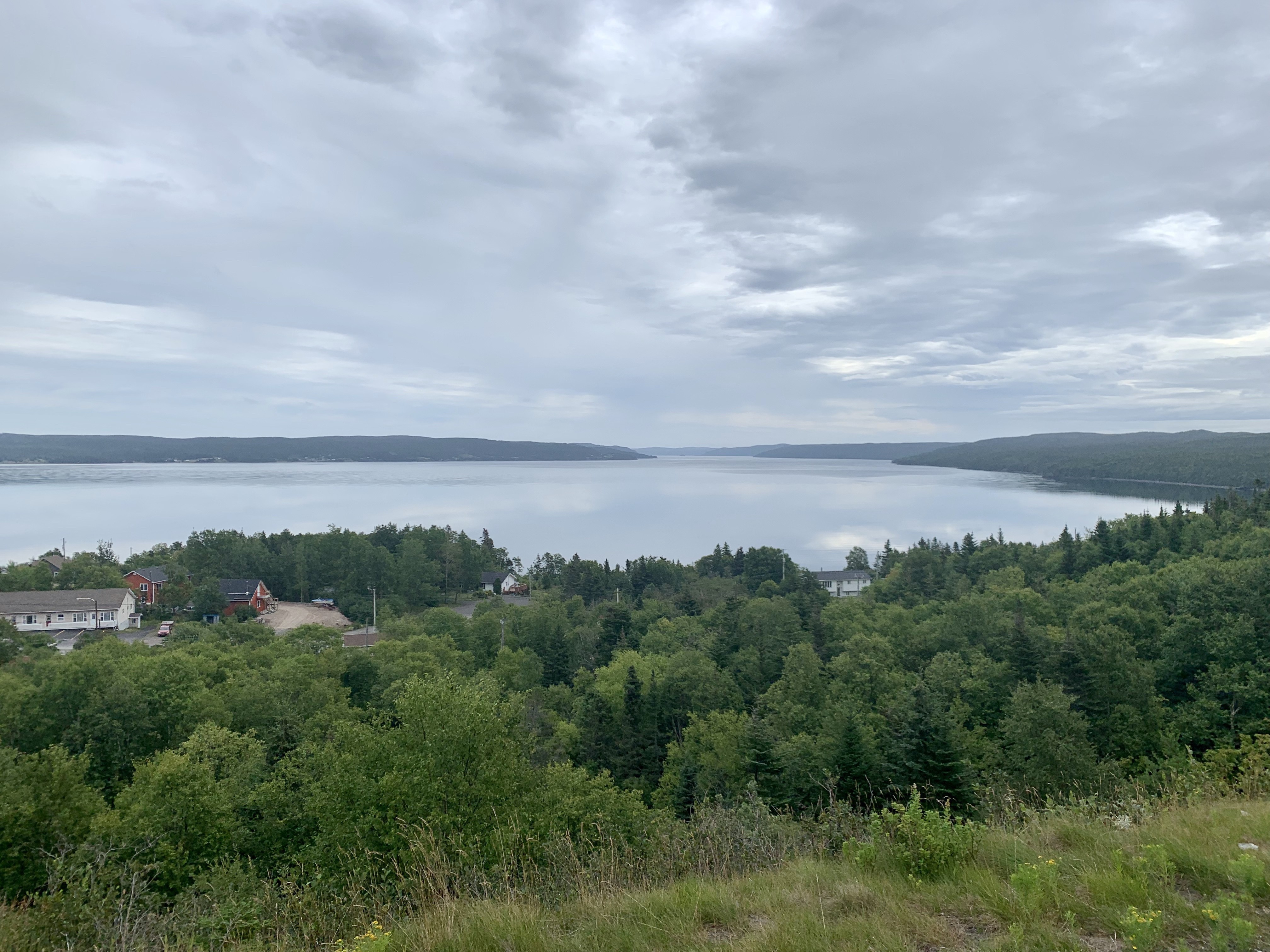
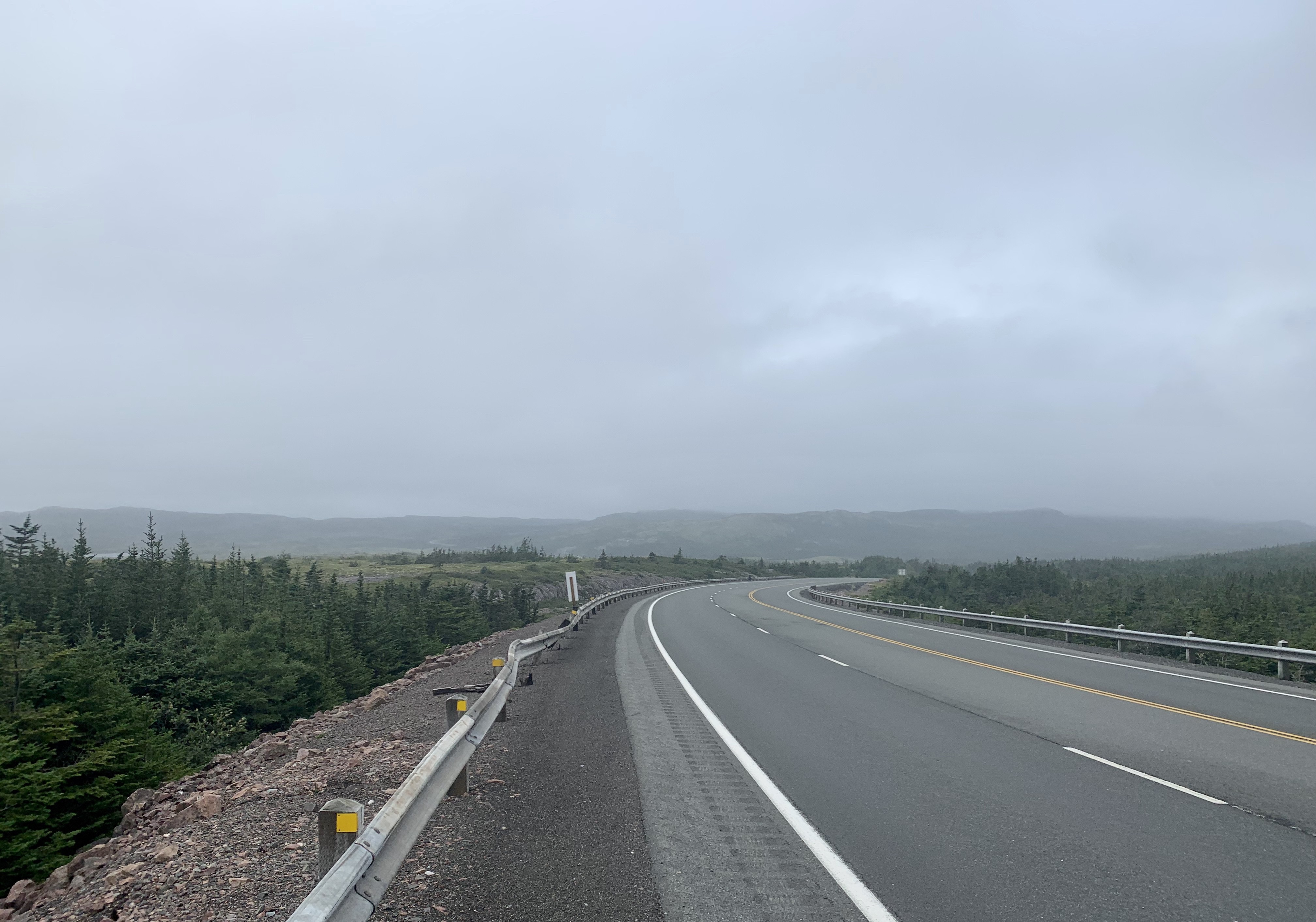
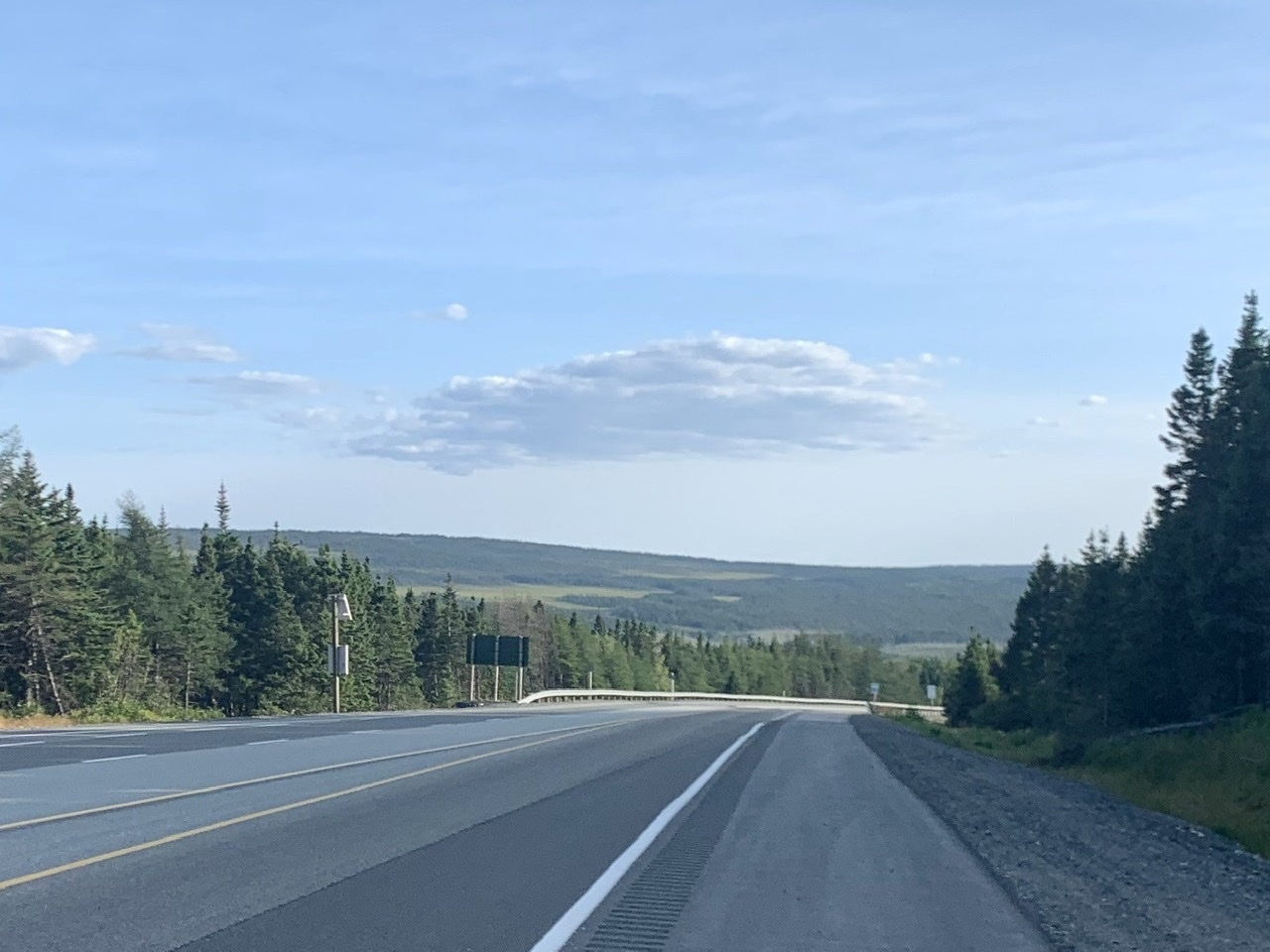
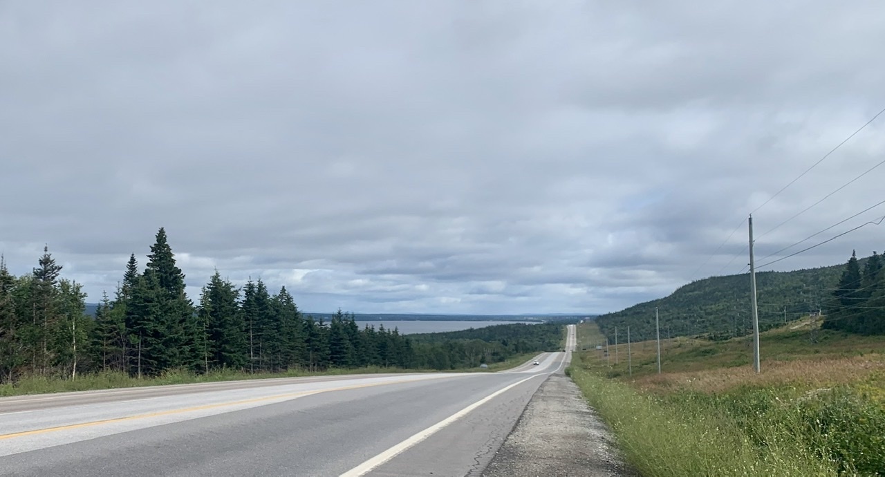
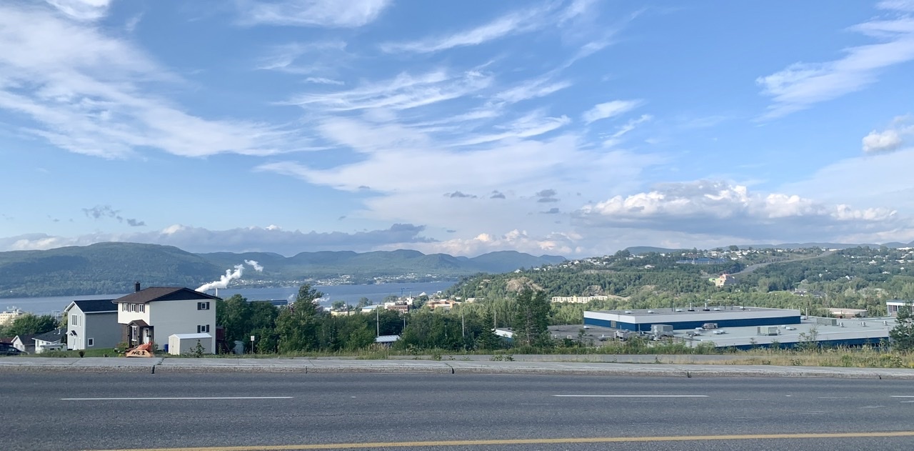
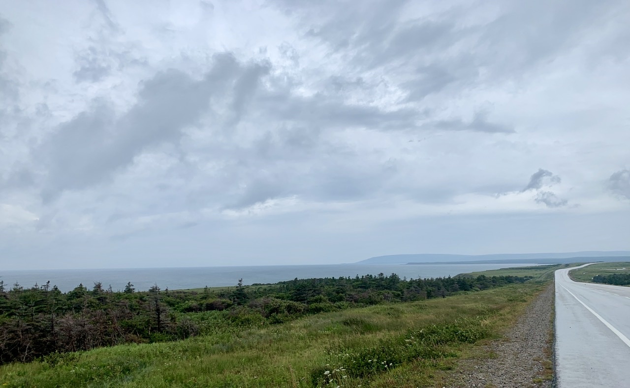
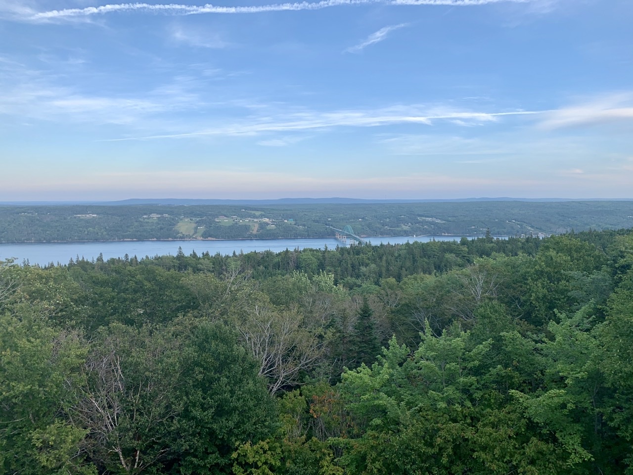
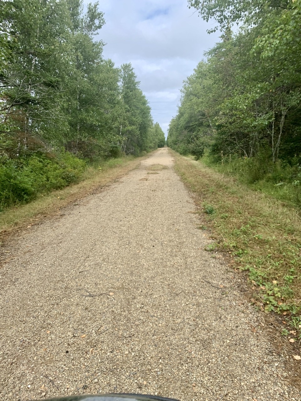
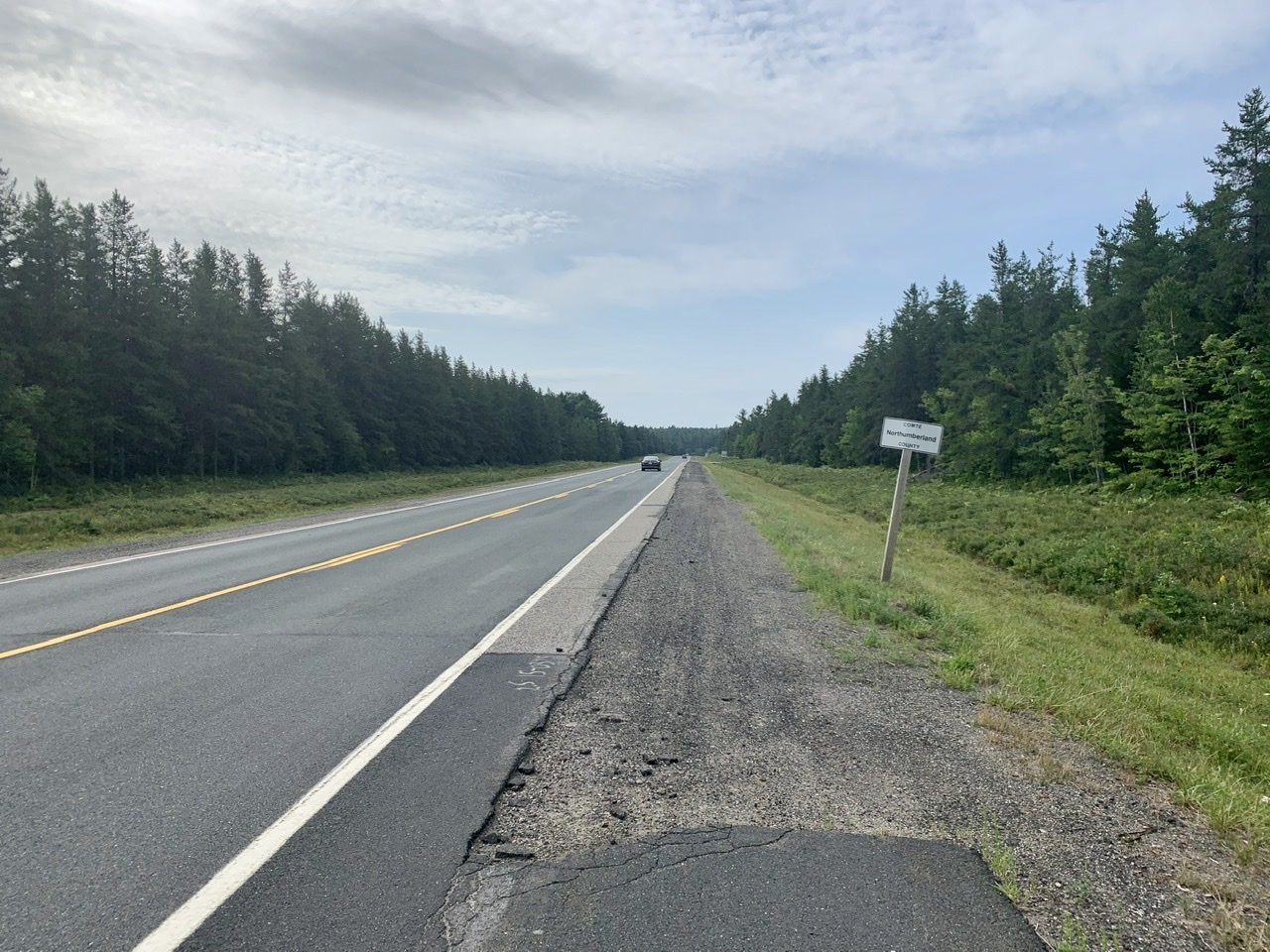
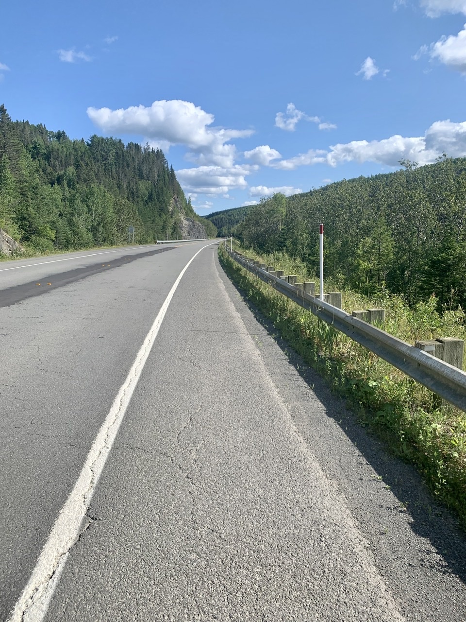
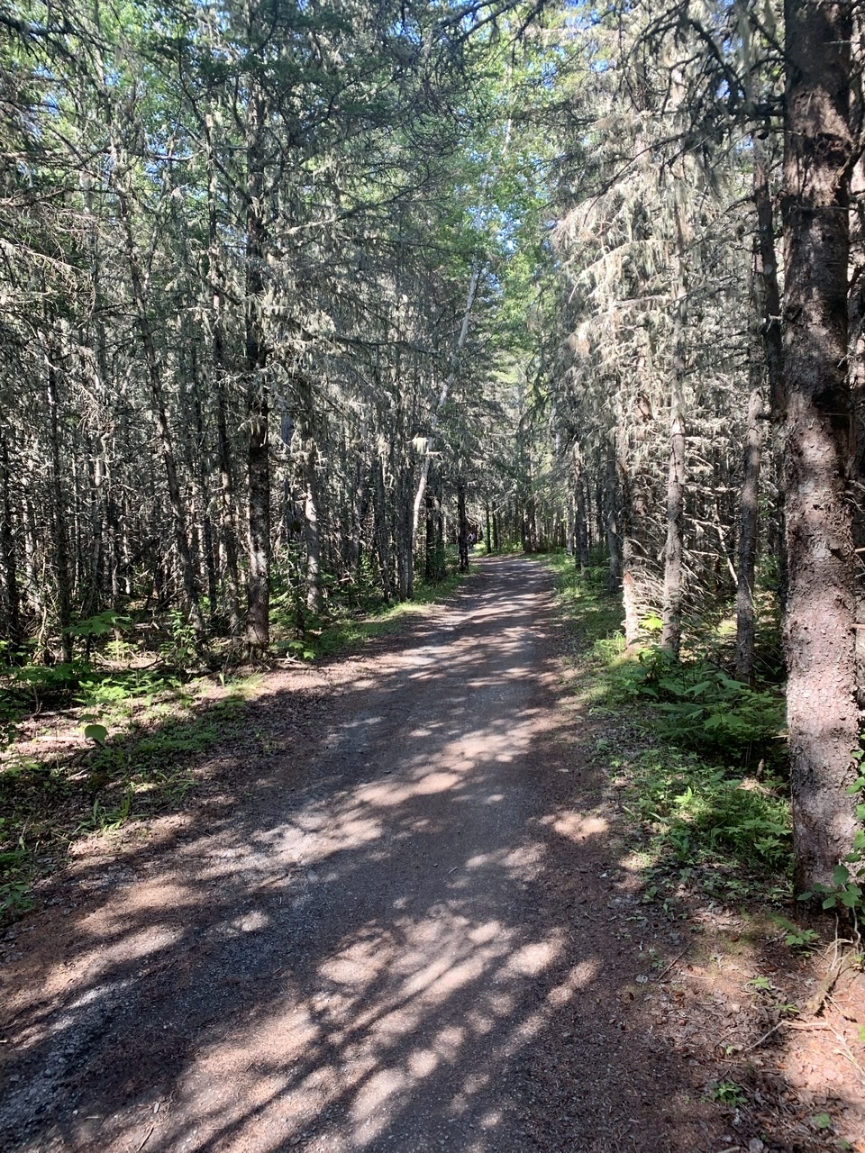
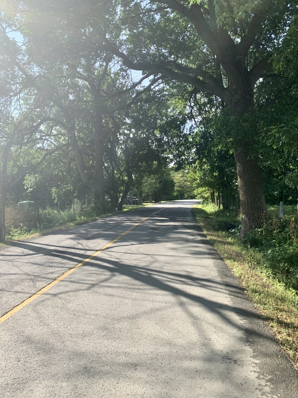
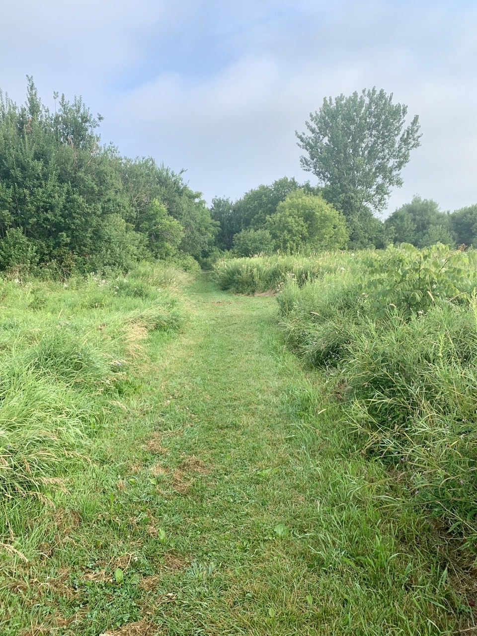
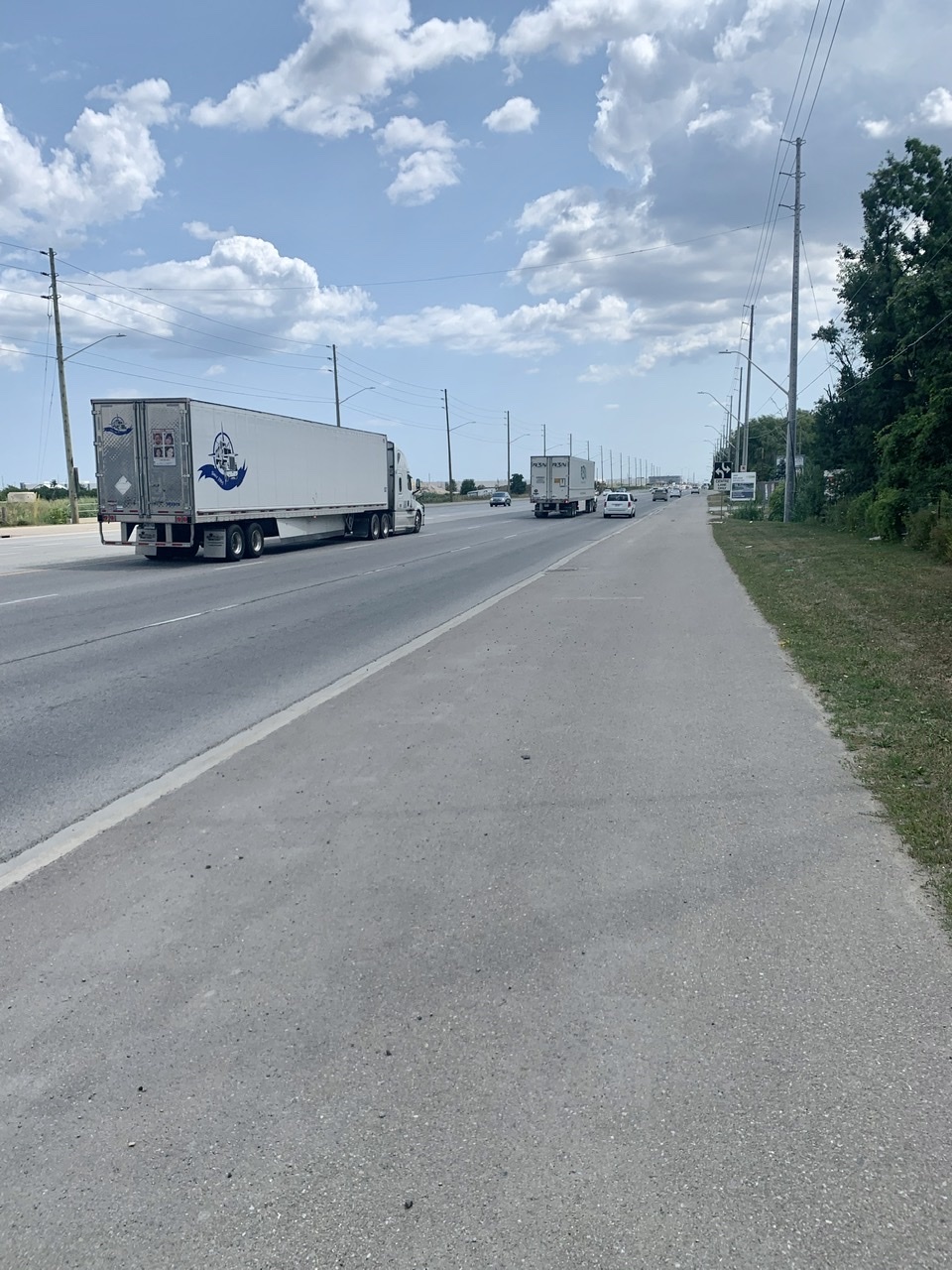
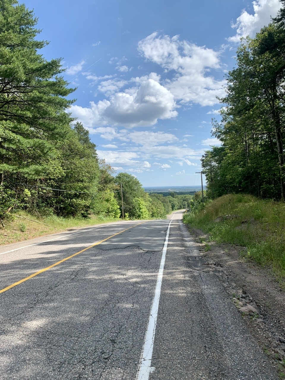
    We got off the Trans-Canada at the first opportunity outside St. John's, mainly because it chopped off some distance for us. We spotted a route along Beaumont Hamel Way that seemed promising—paved, without much traffic—only to realize it was the road leading to the water tower, which meant a steep climb. It was still preferable to the highway we'd been riding on all week.

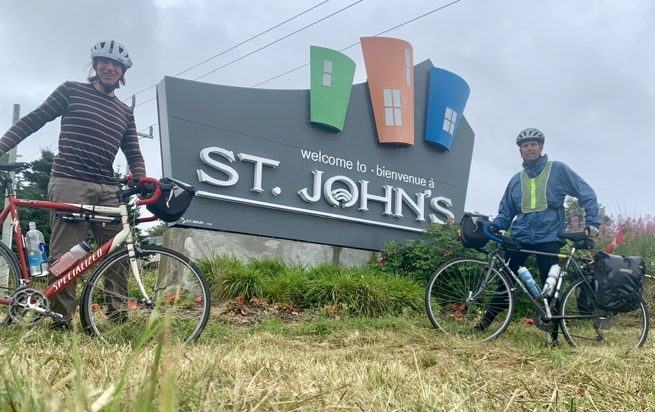
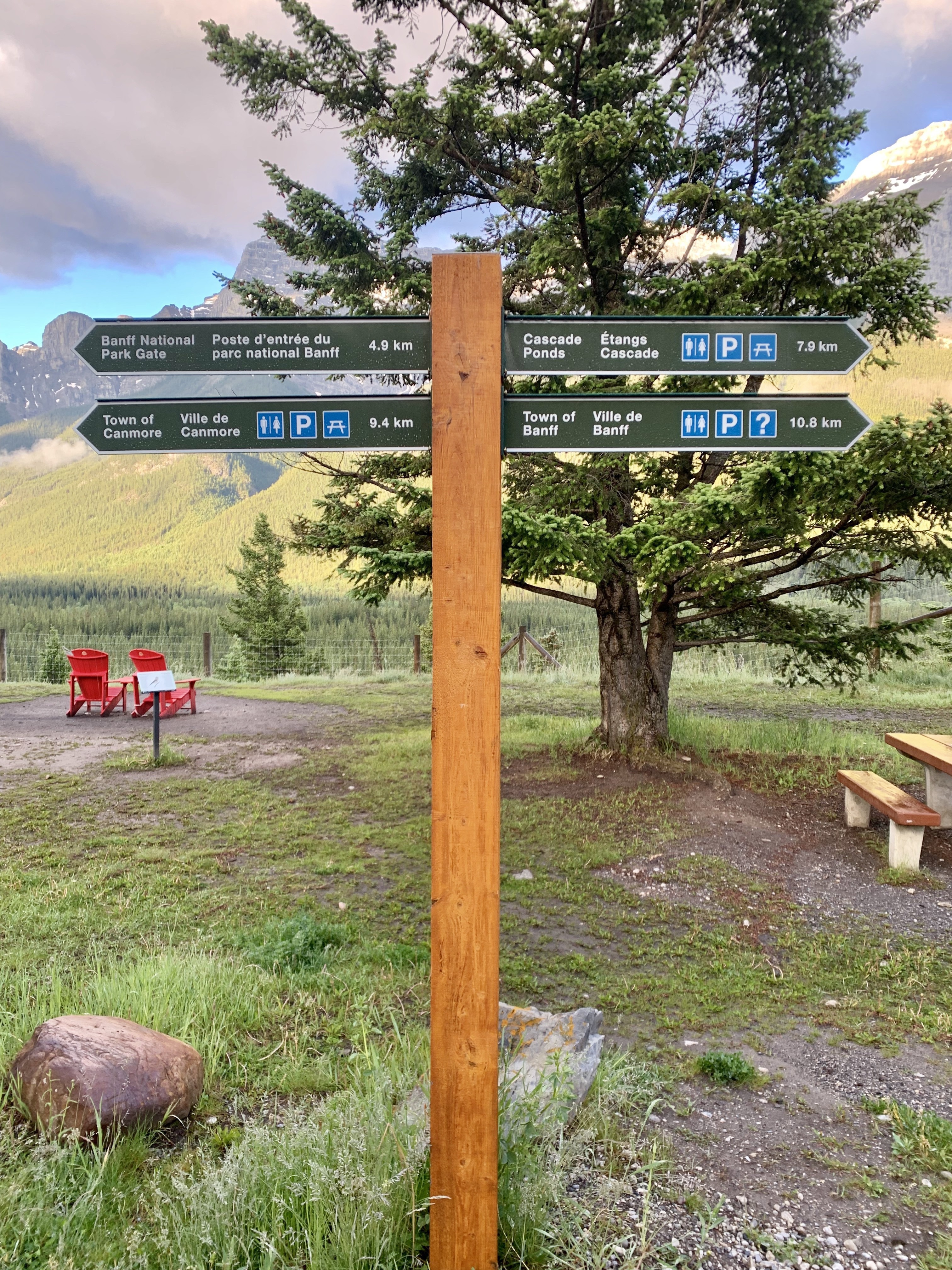
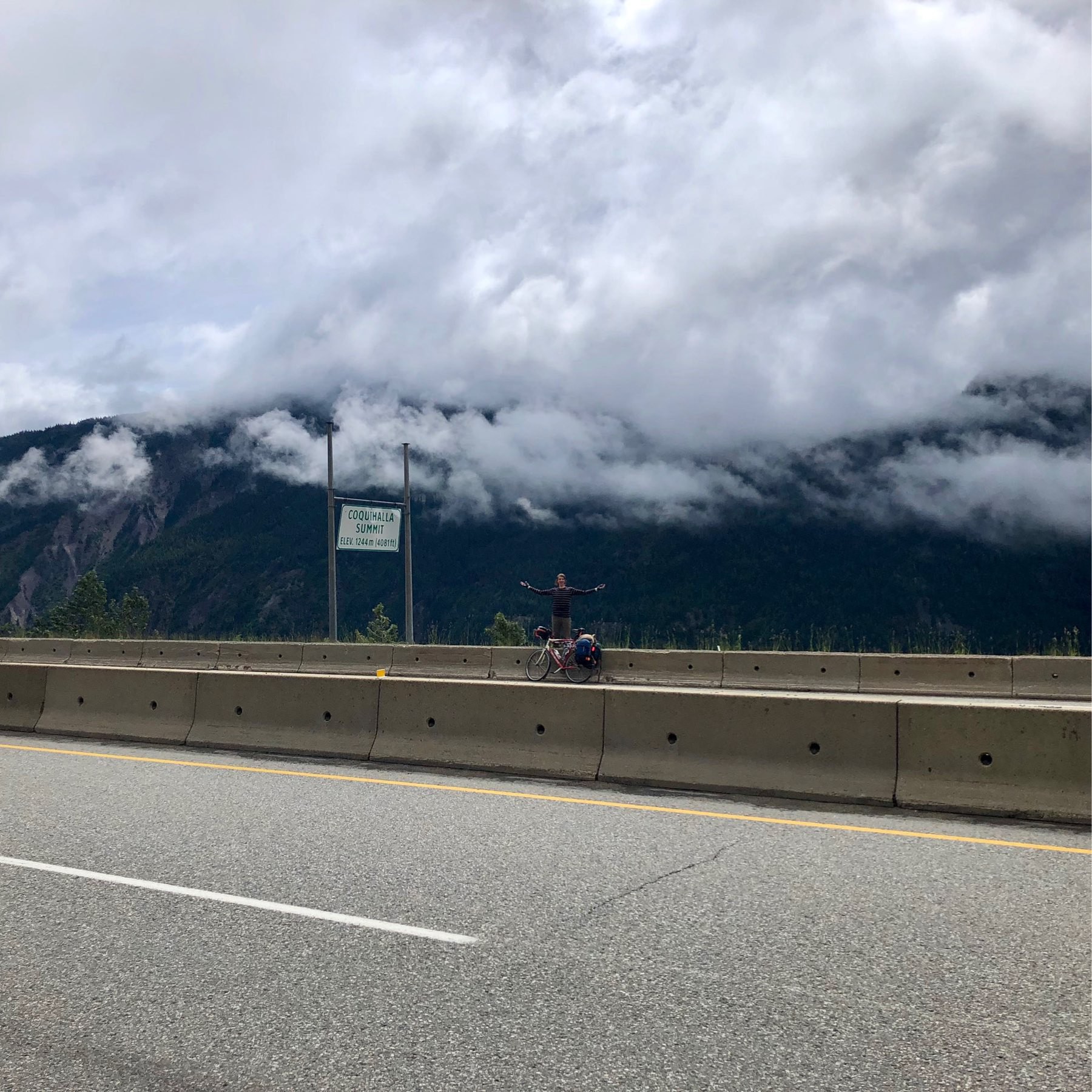
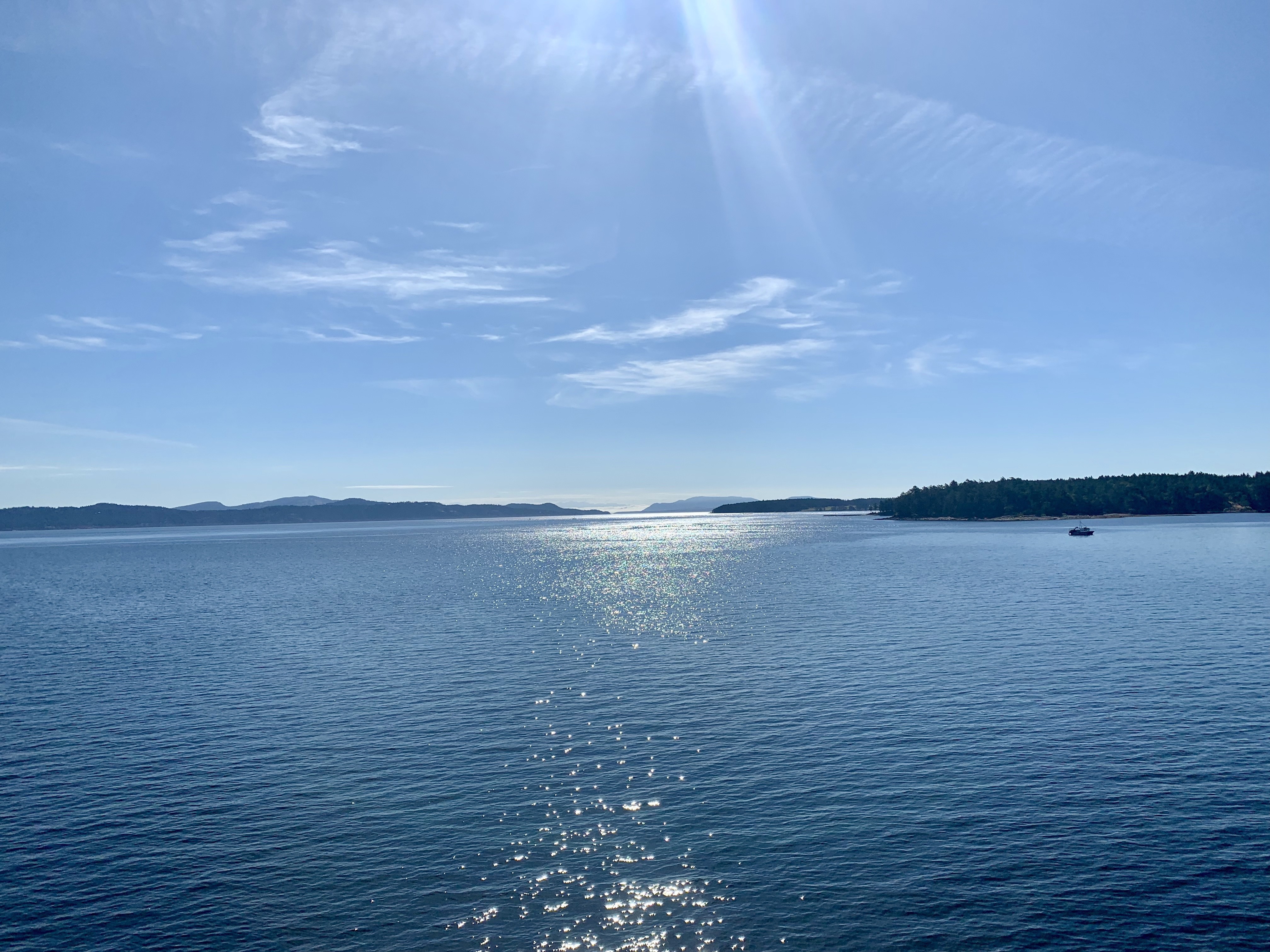
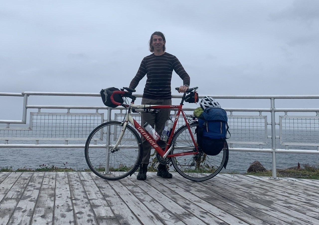
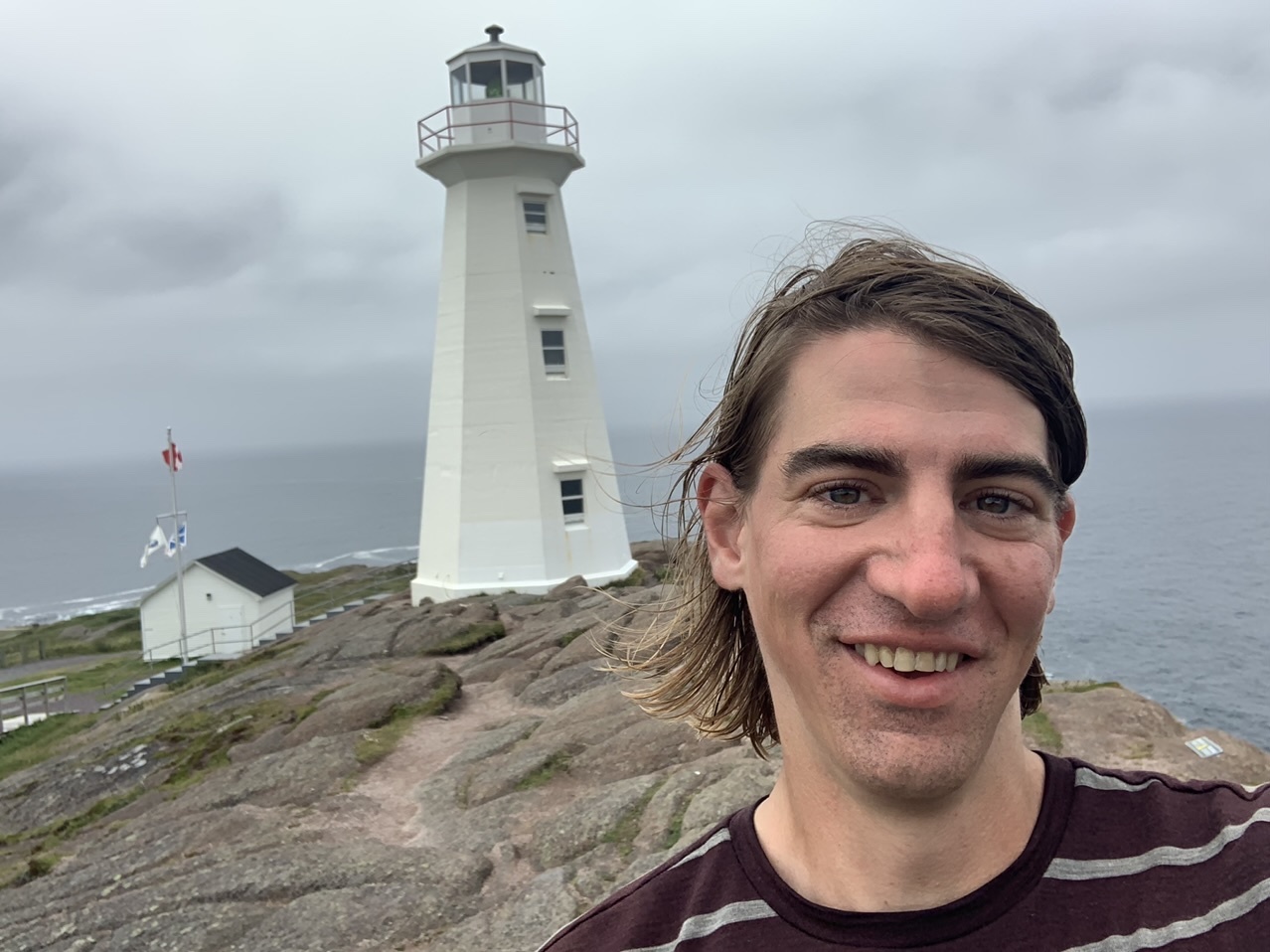
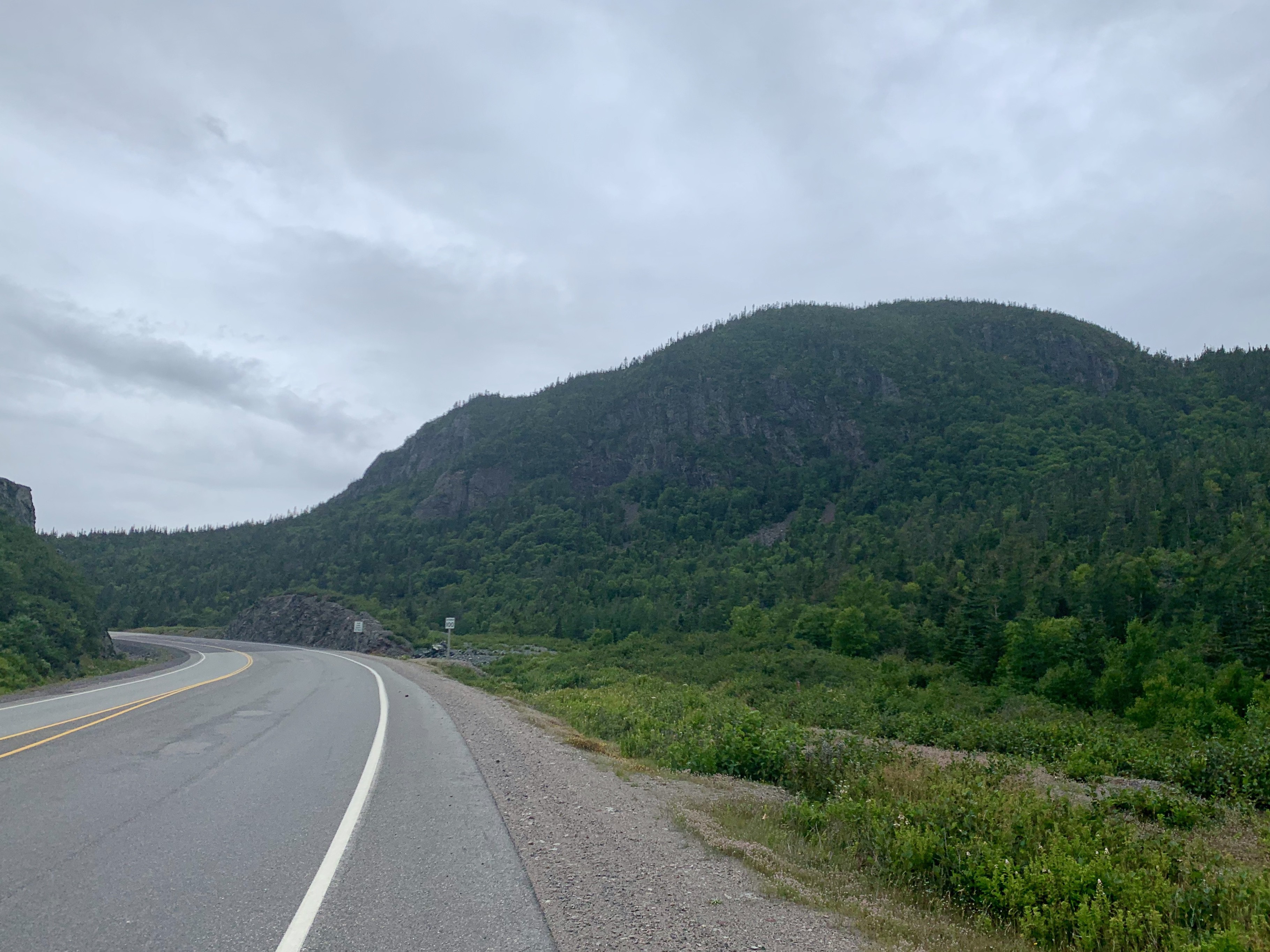
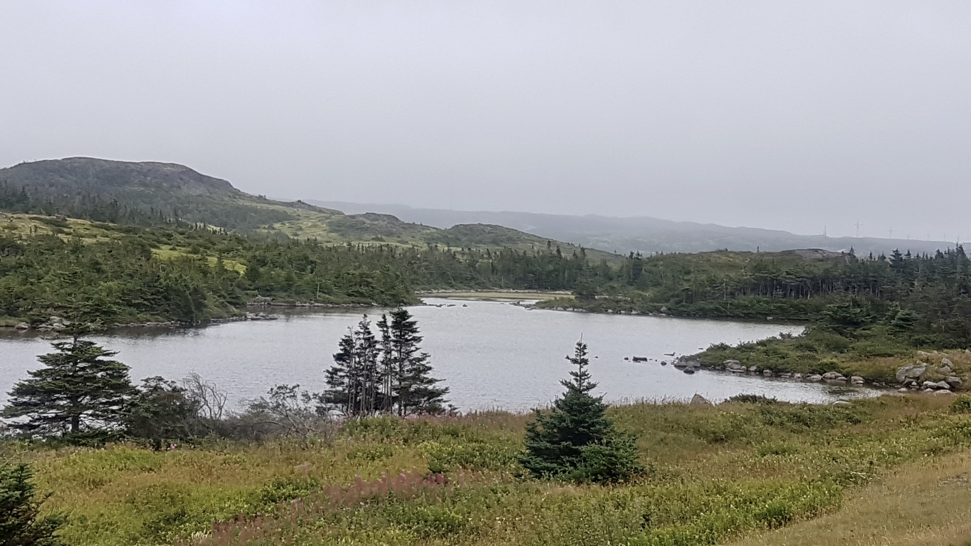
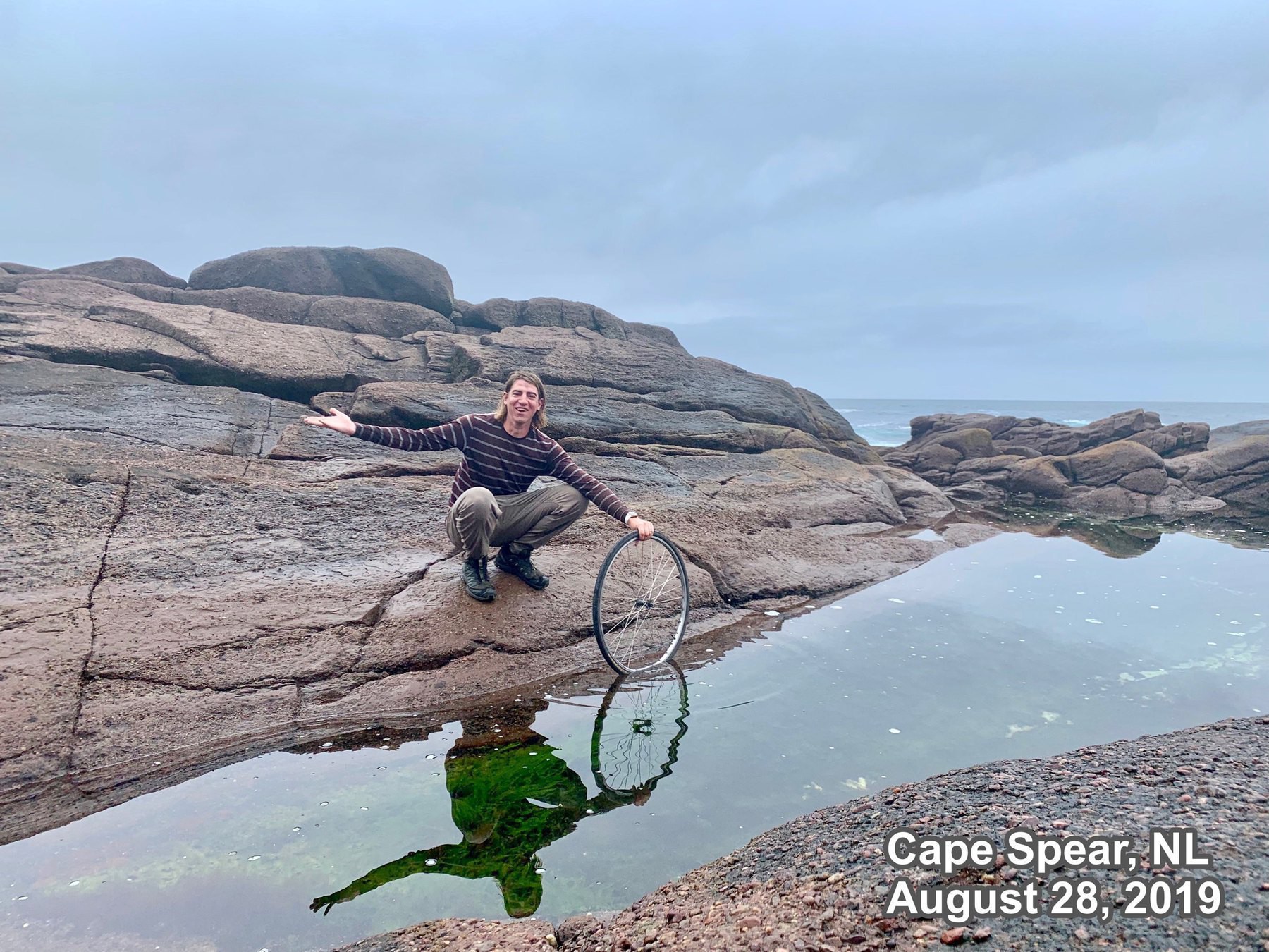
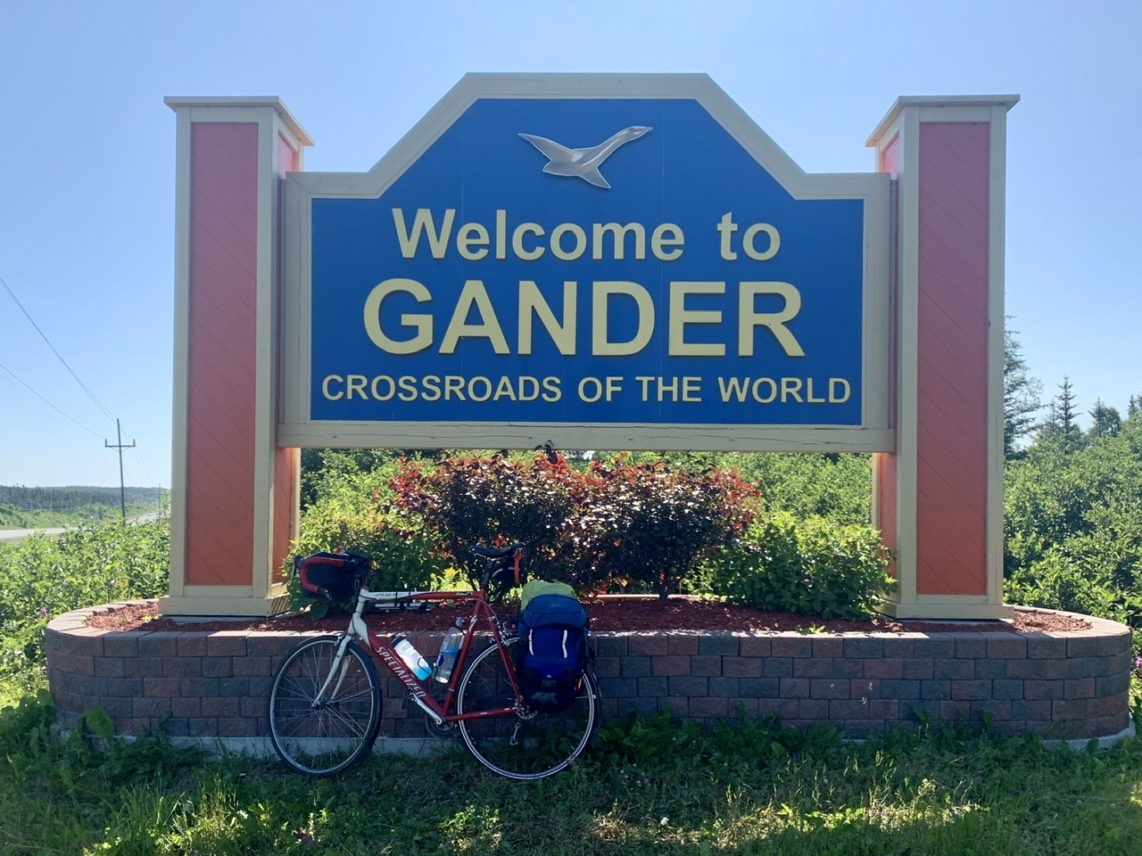
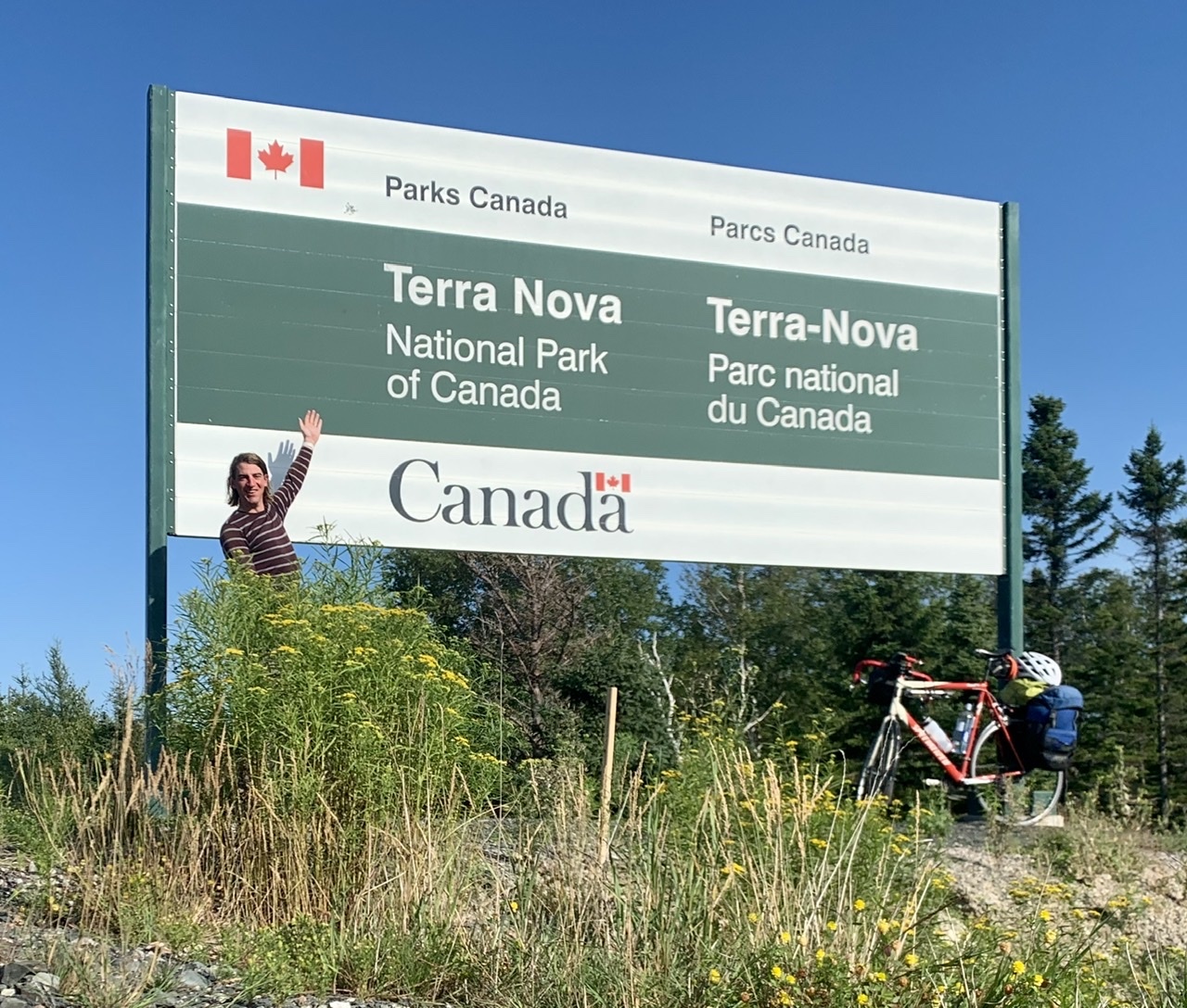
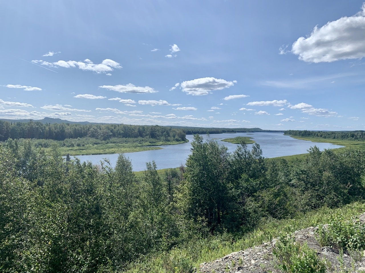
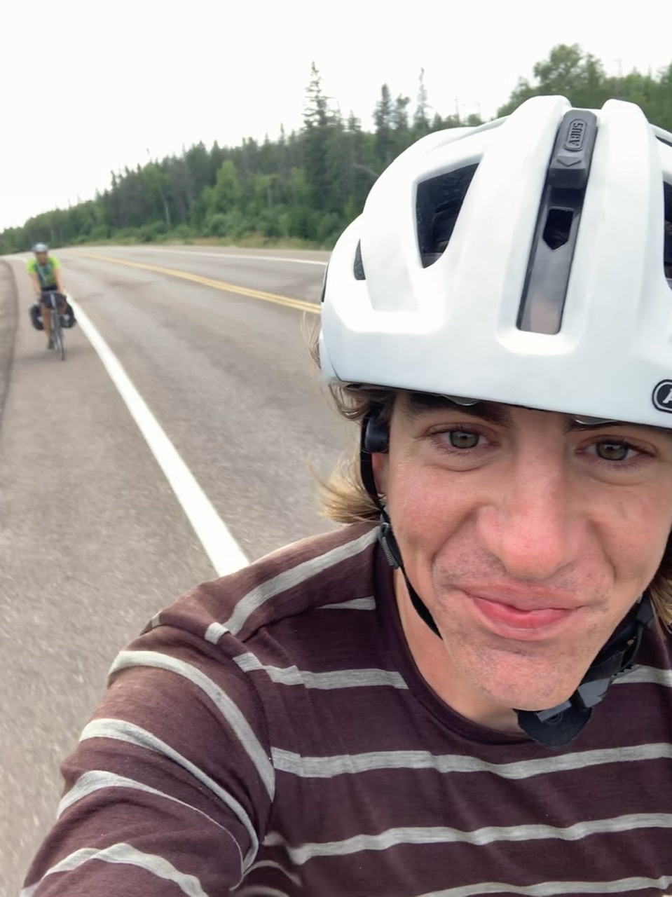
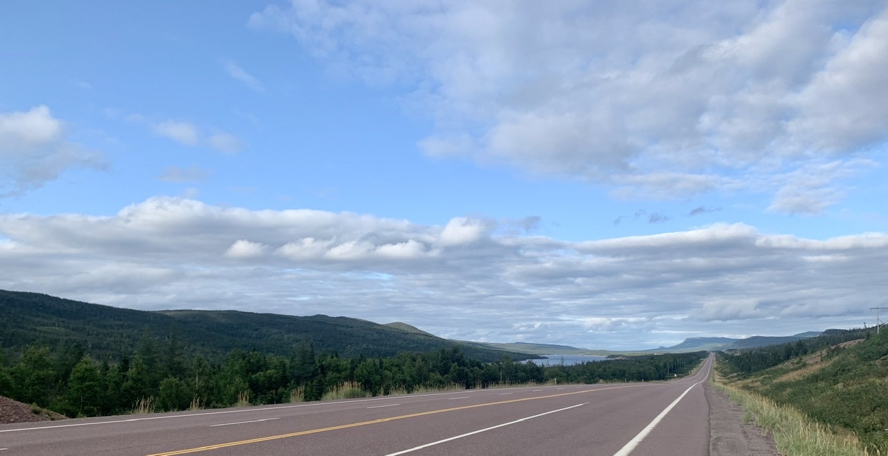
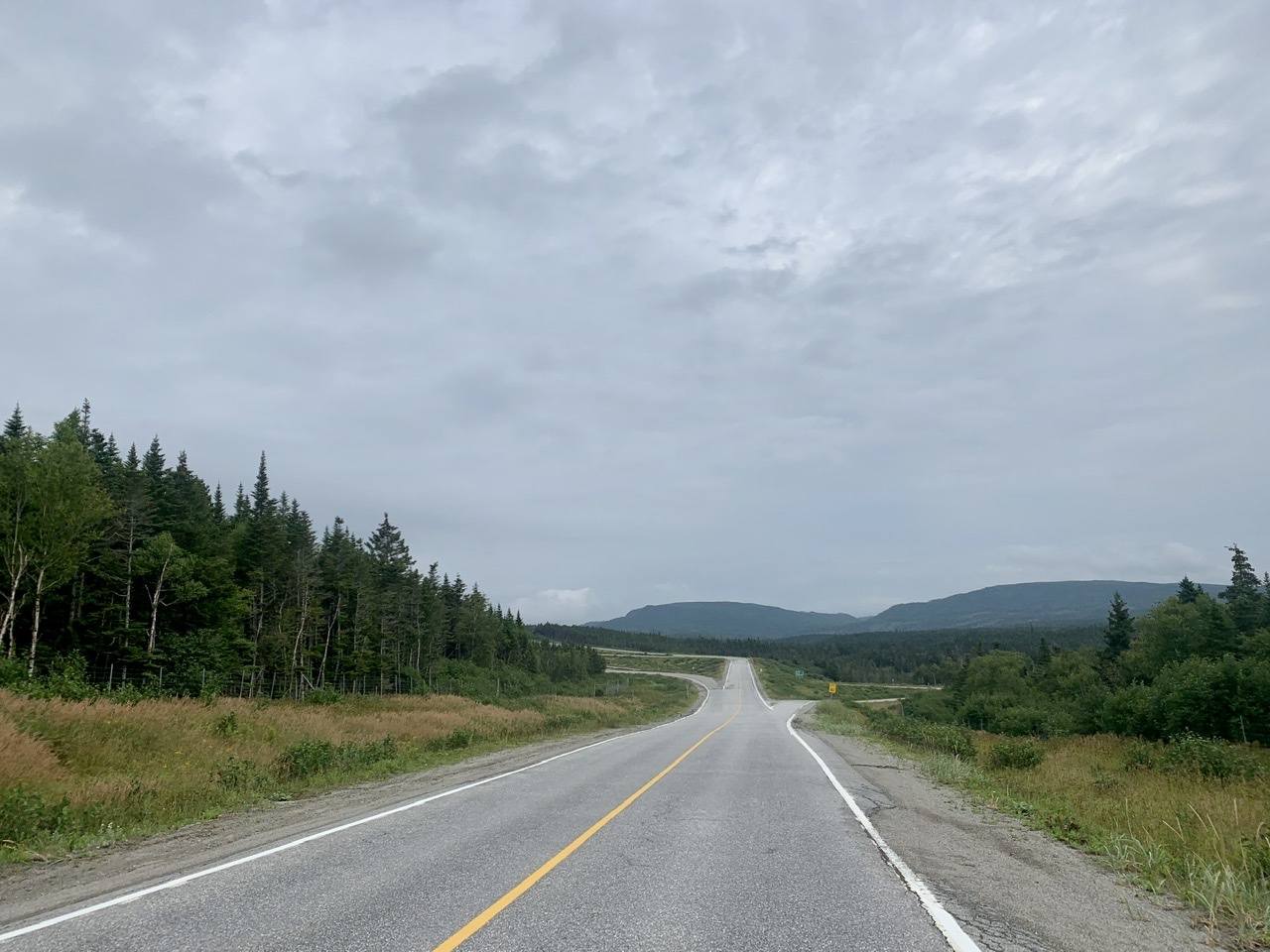
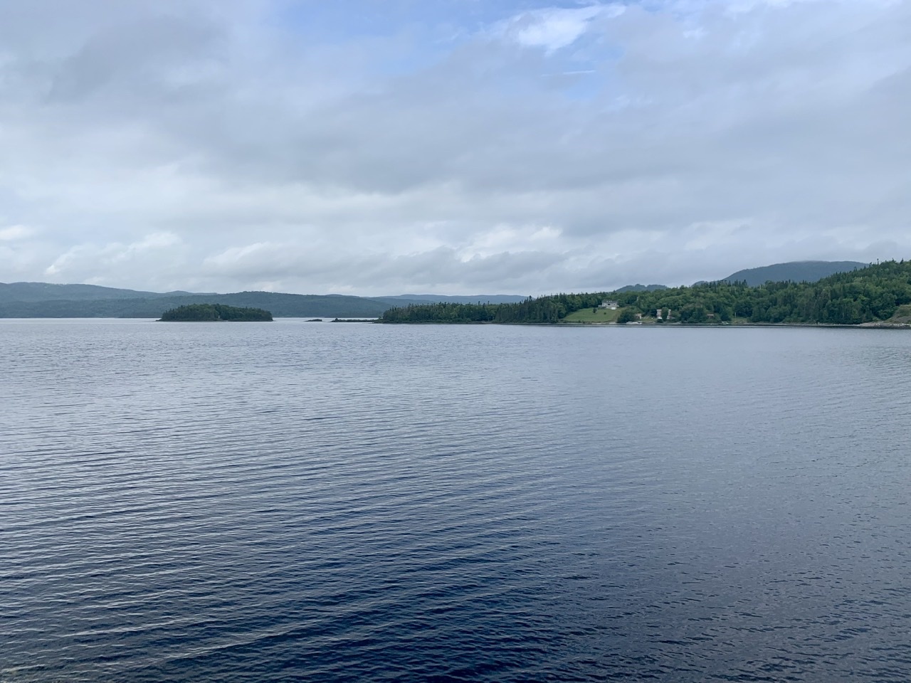
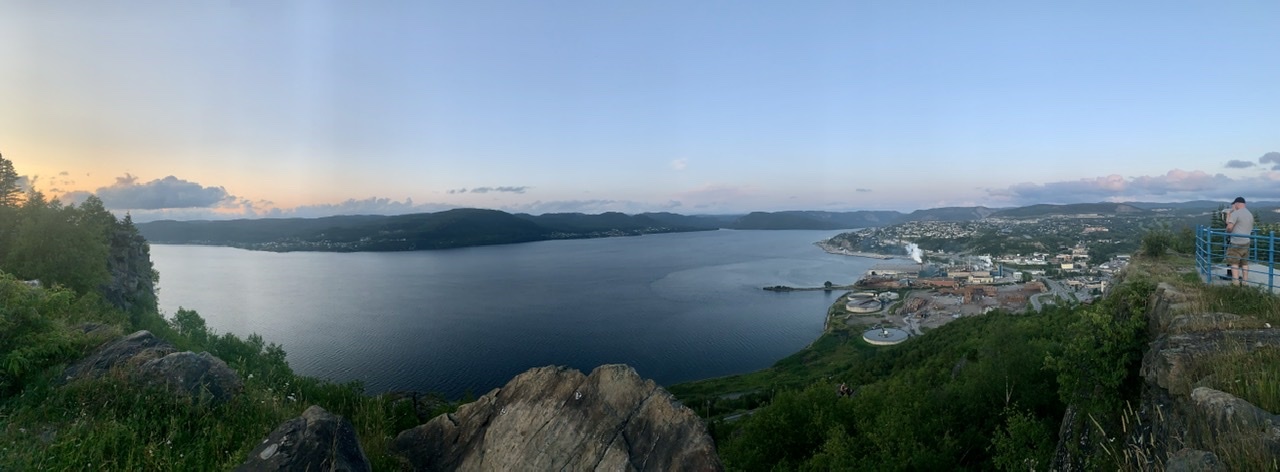
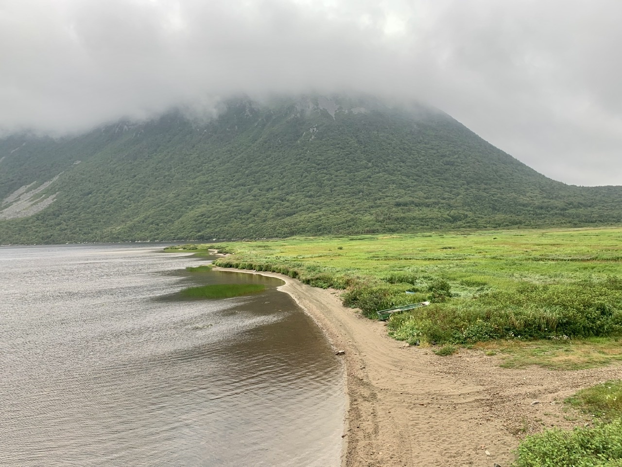
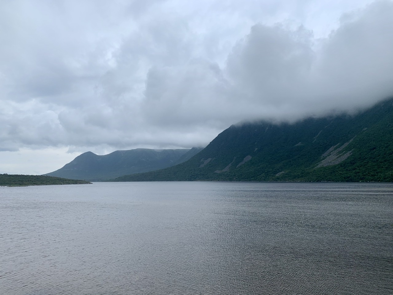
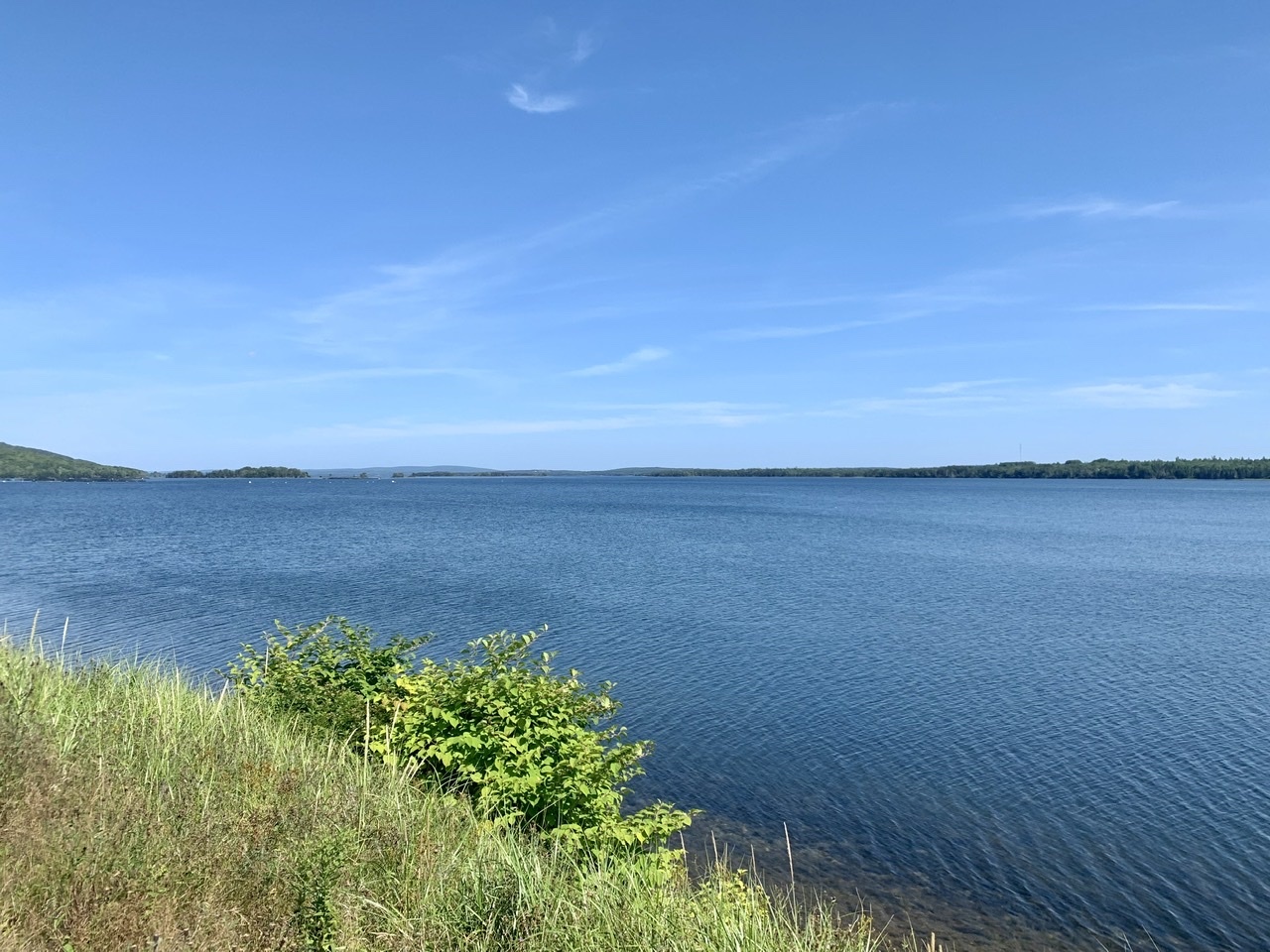
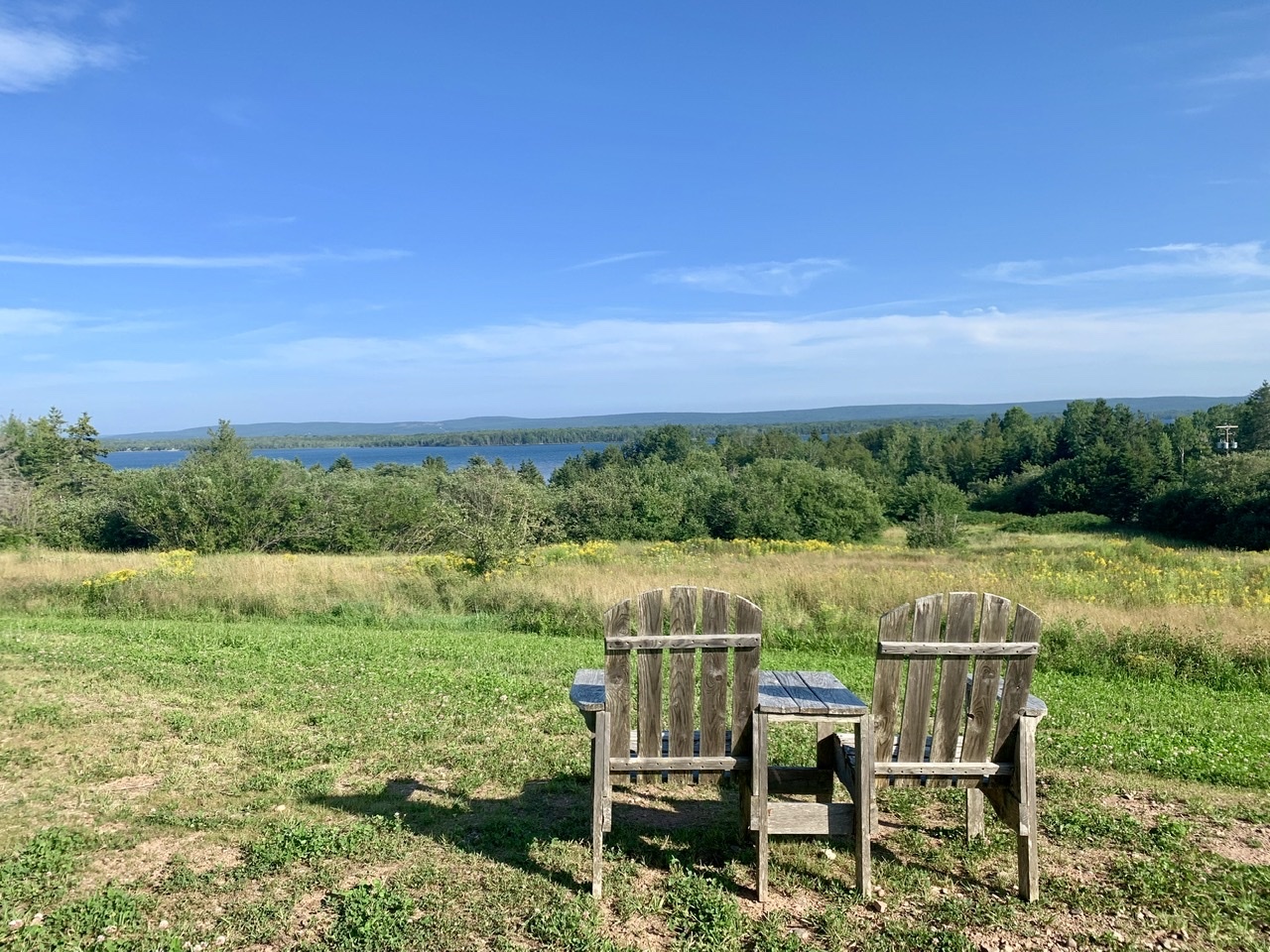
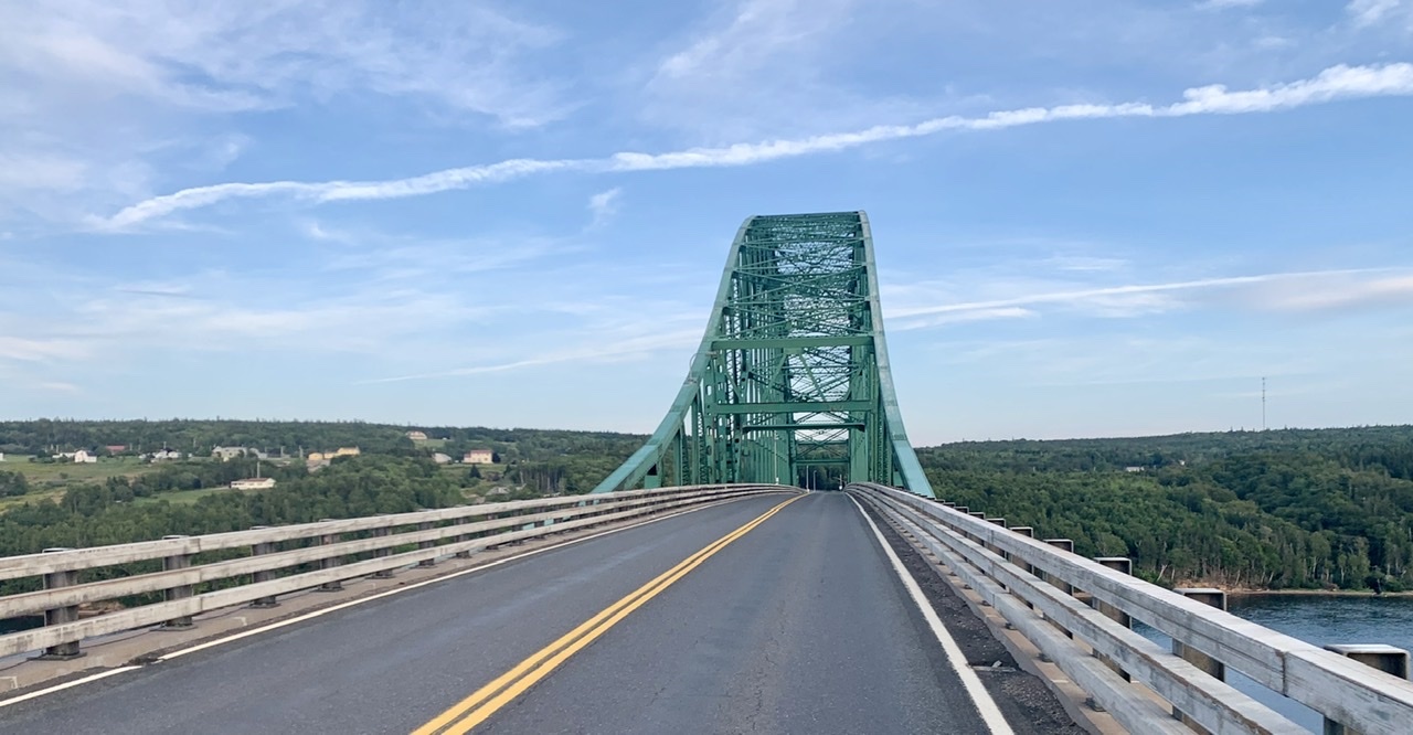
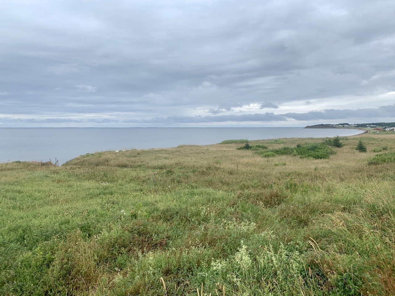
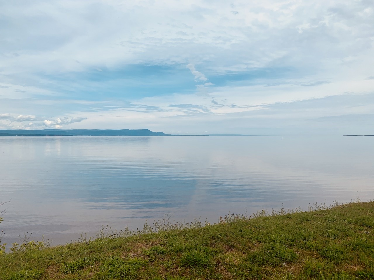
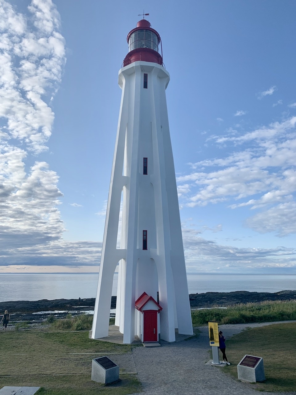
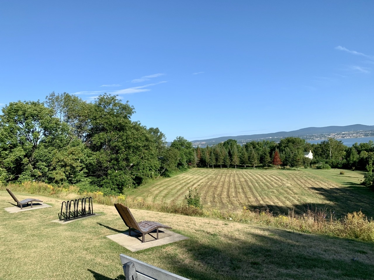
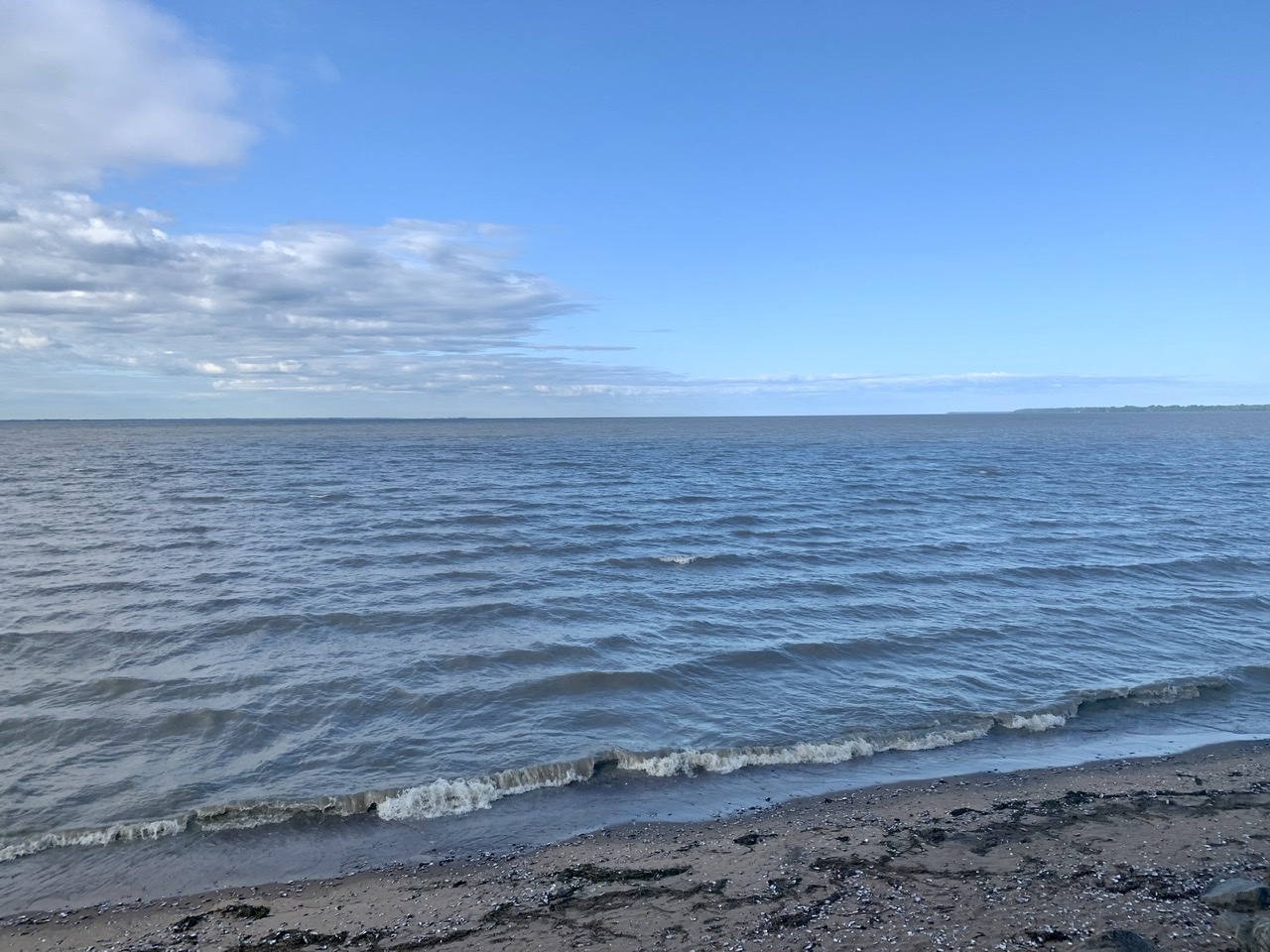
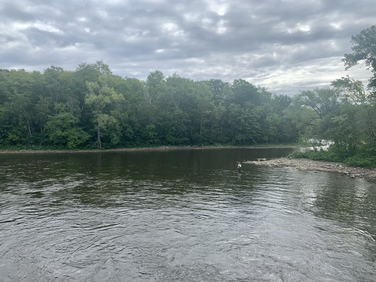
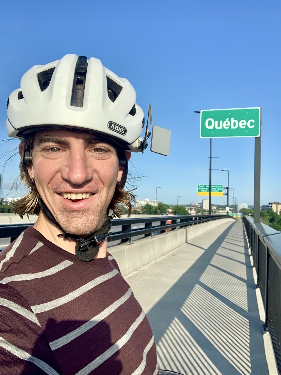
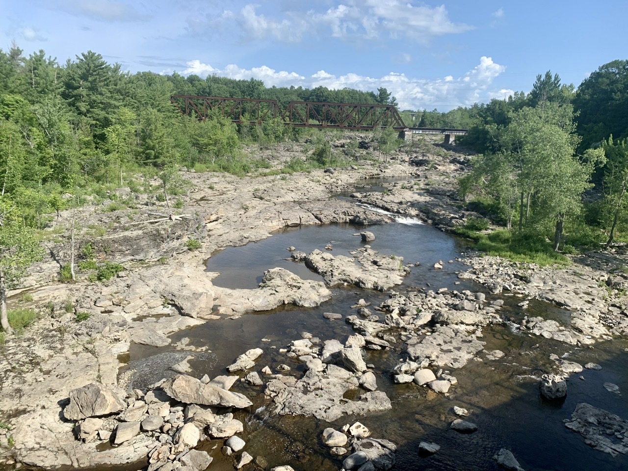
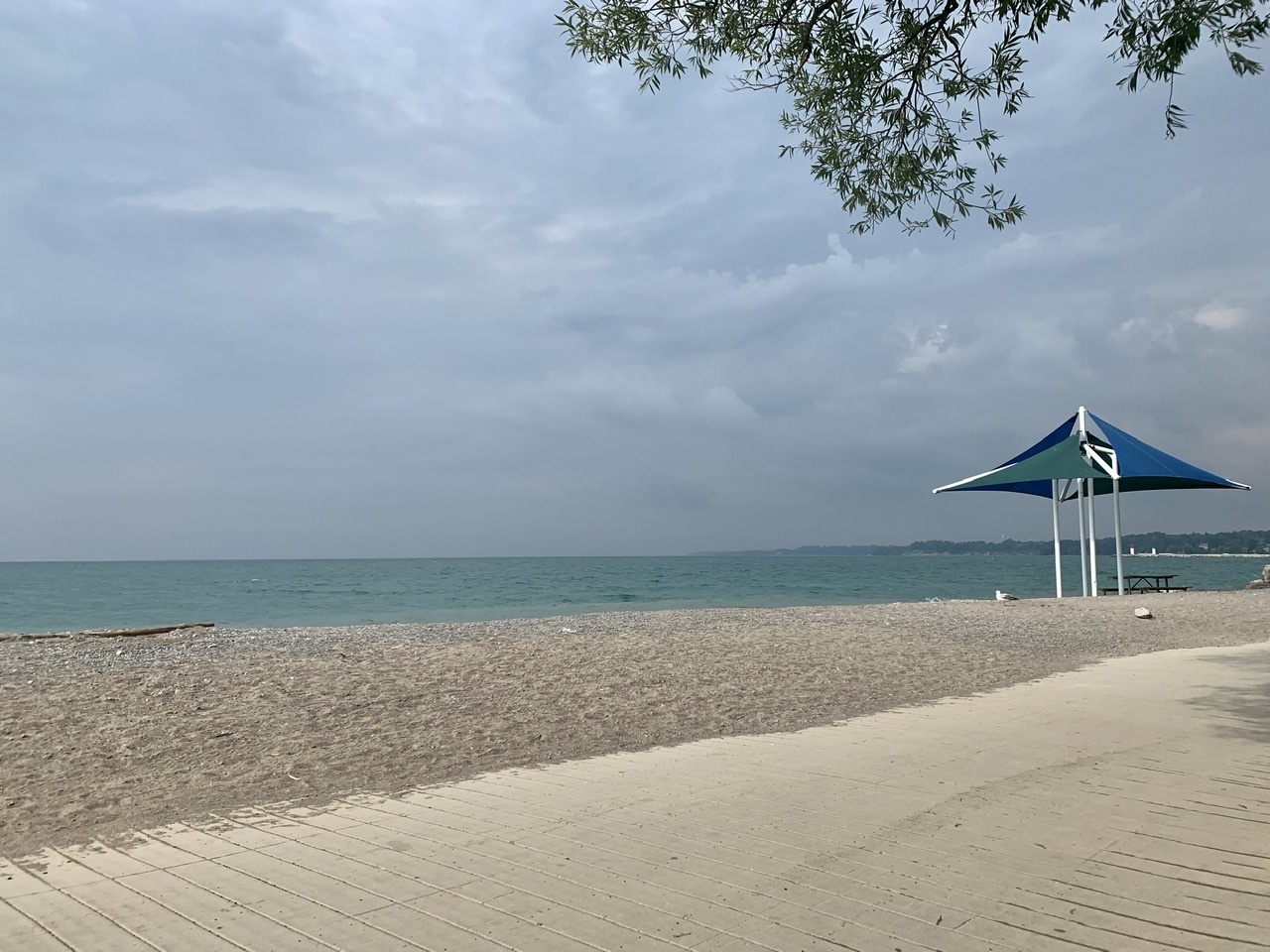
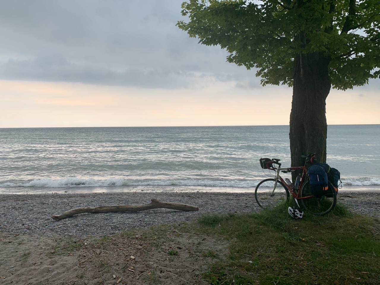
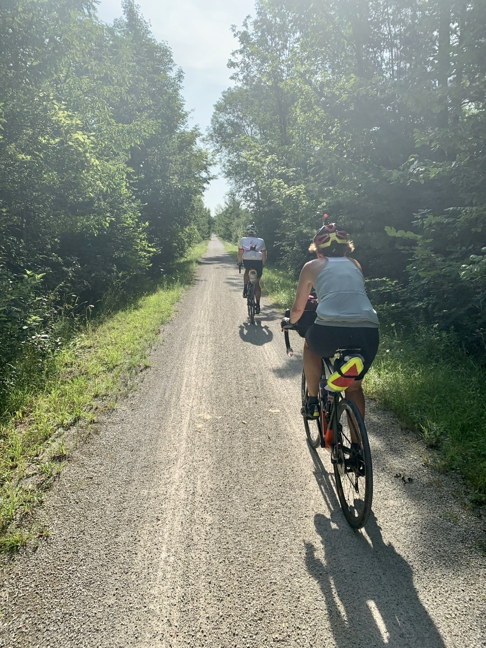
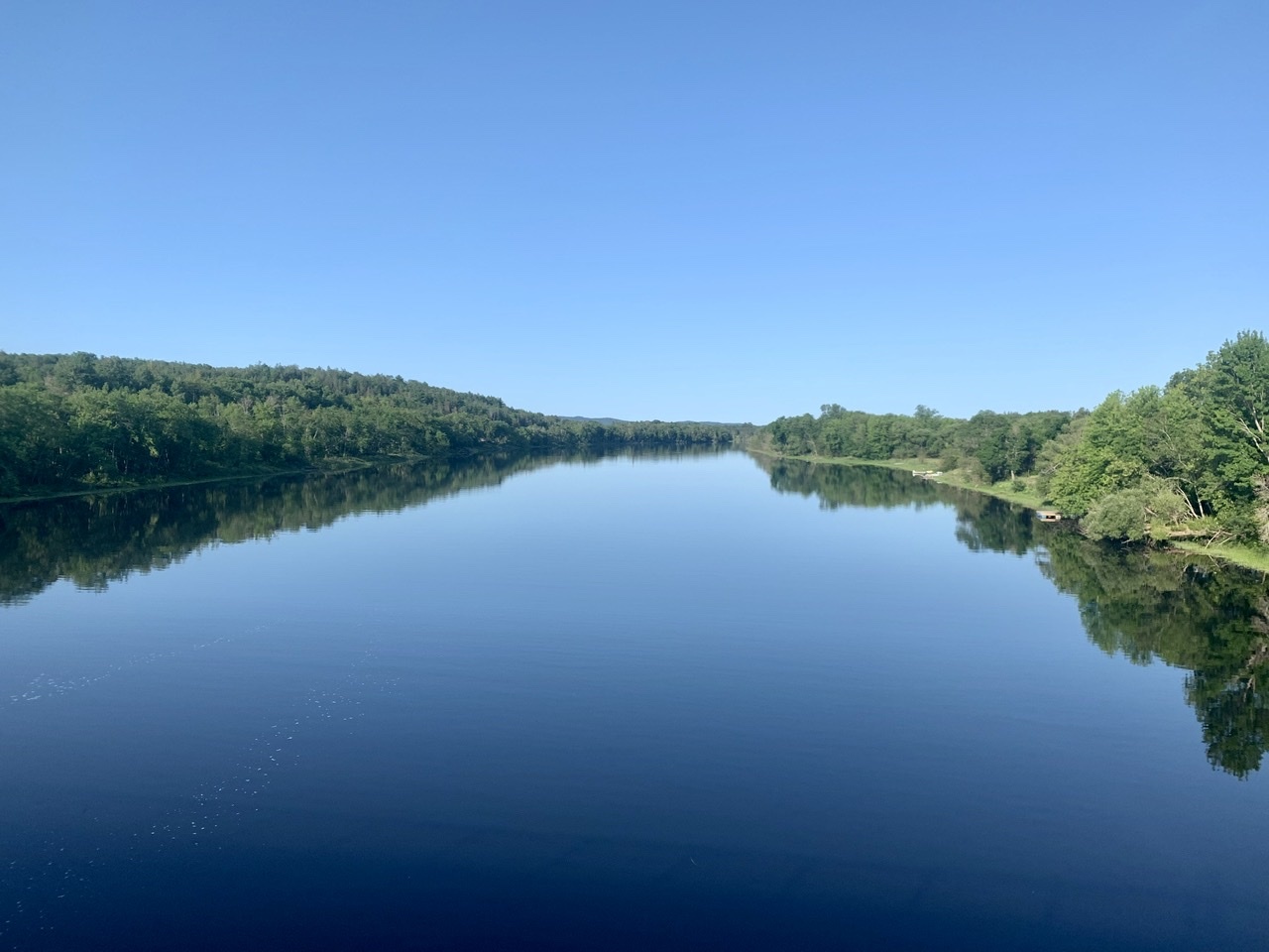
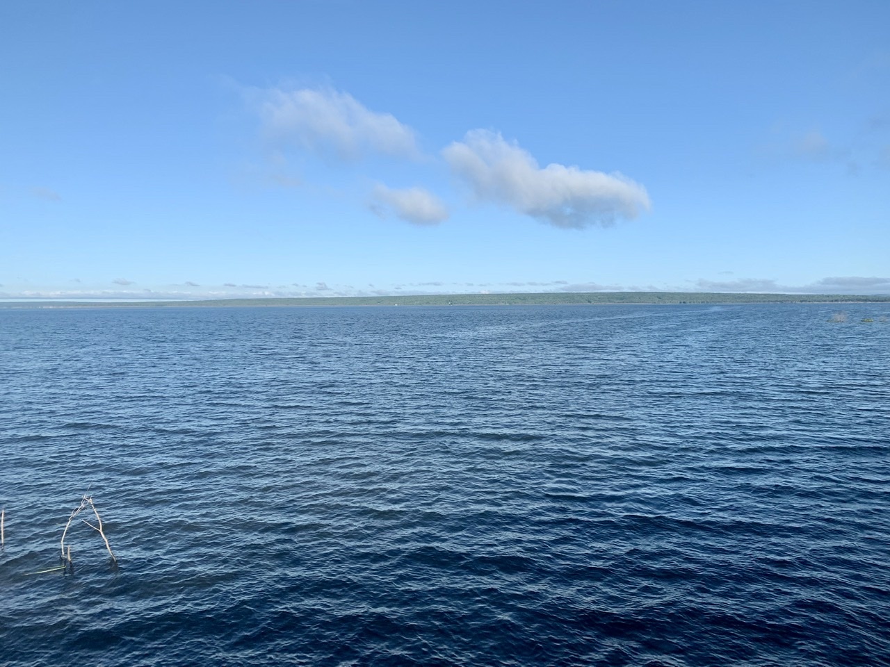
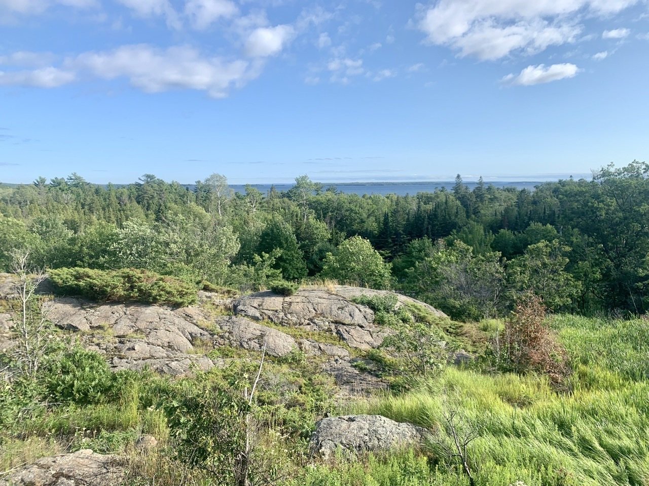
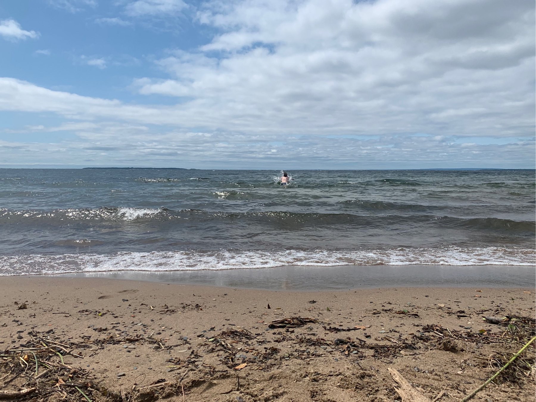
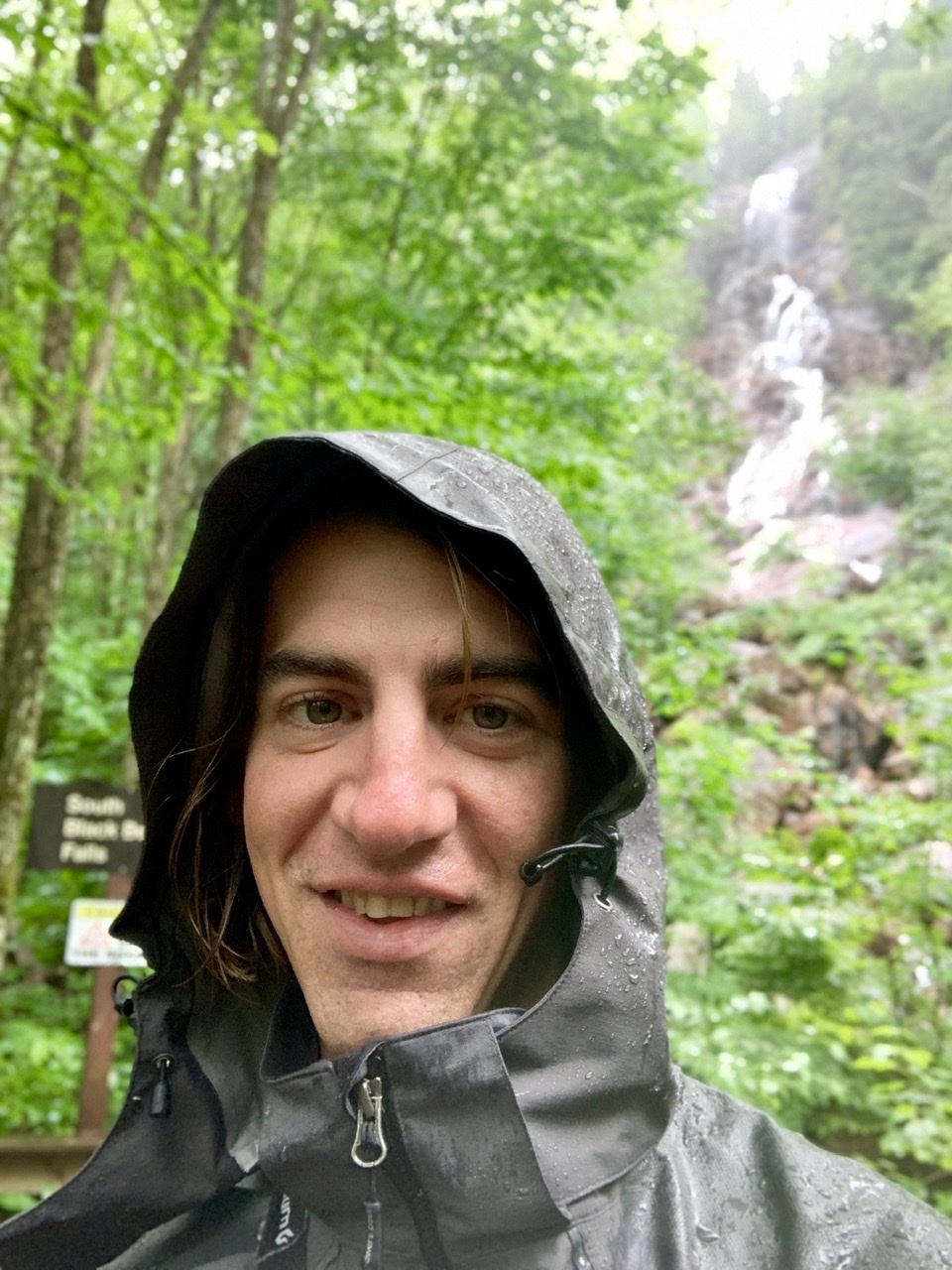
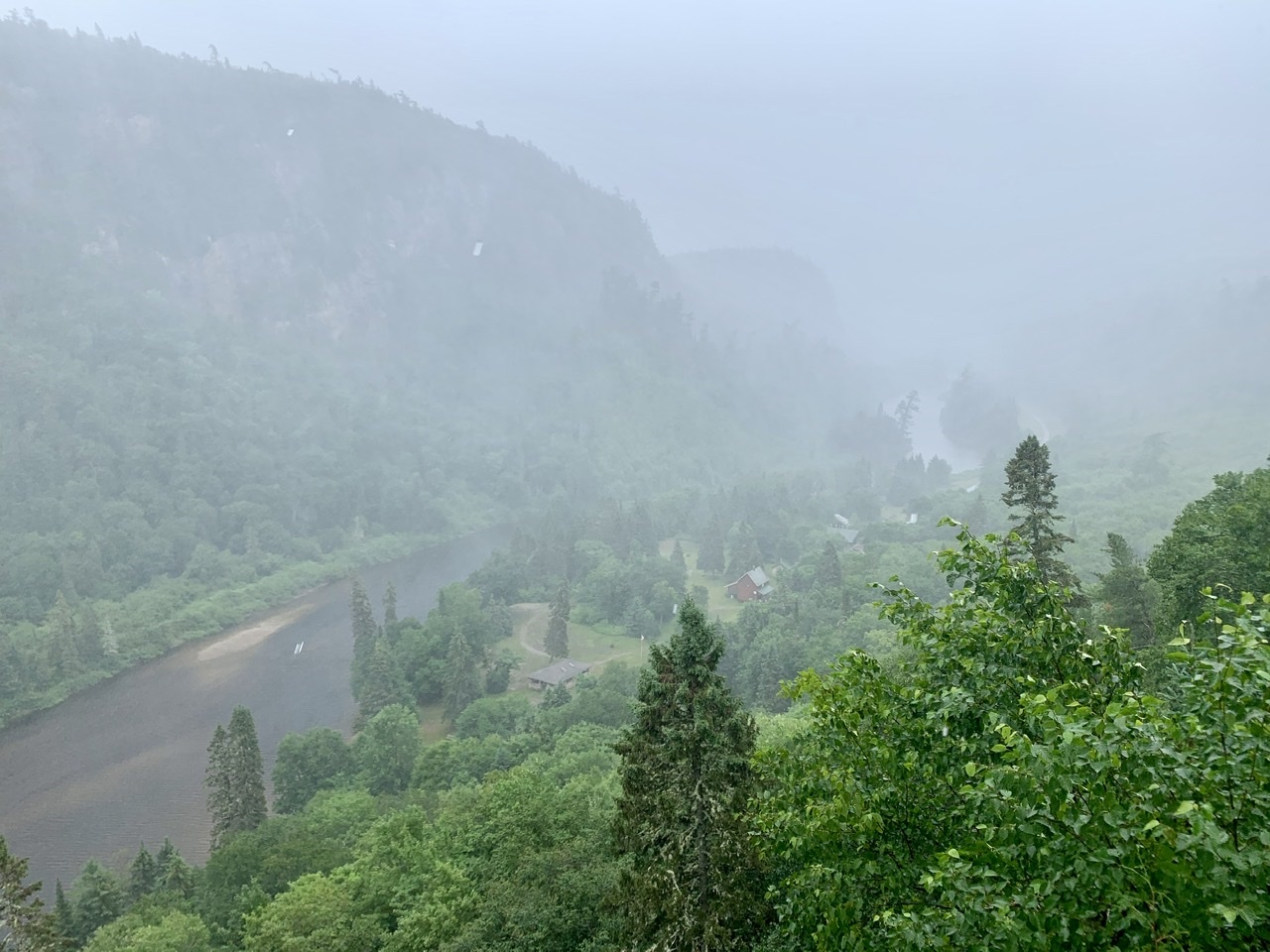
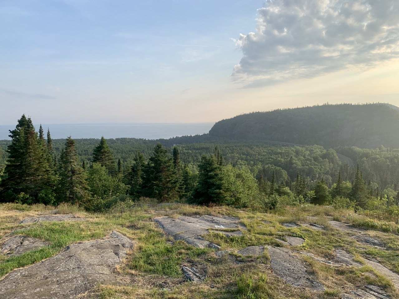
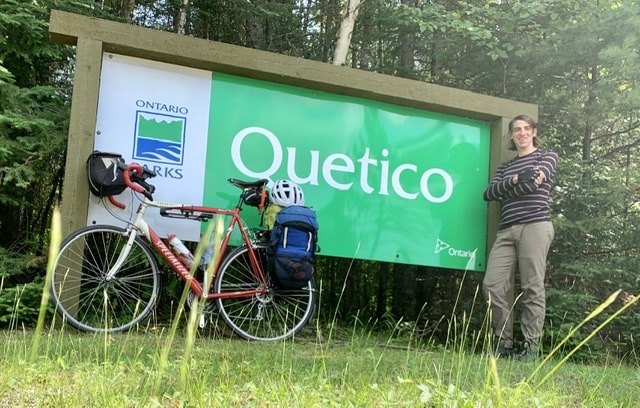
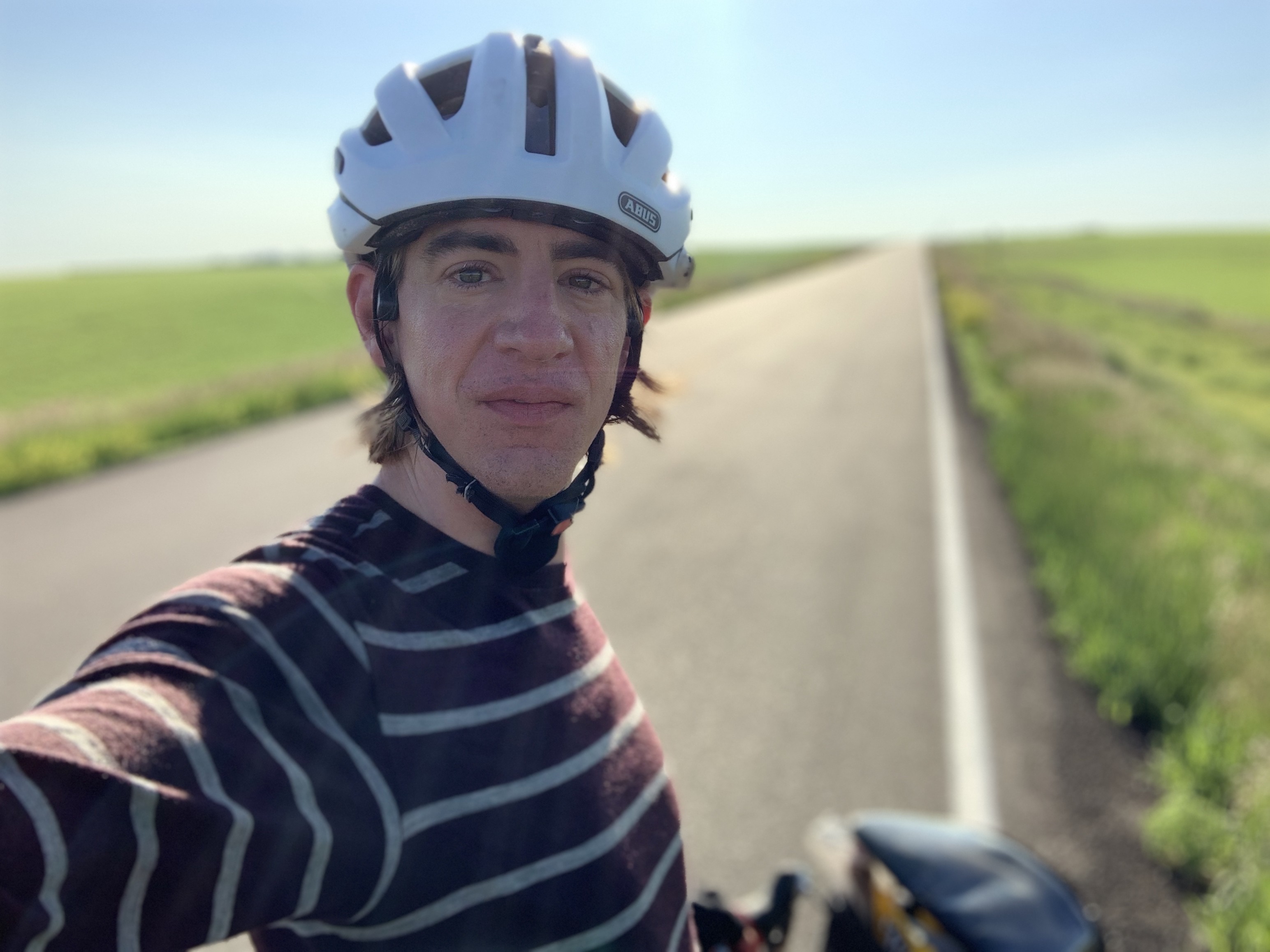
    We stopped for a picture at the St. John's sign, then rode on for another five kilometres until the turnoff to Cape Spear where we parted ways. Mark was satisfied with making it to St. John's, but I couldn't resist heading to the easternmost point in Canada. After a hug and many handshakes we said goodbye and I continued up the very steep hill to the lighthouse. The hills on this road were among the steepest of the trip. I barely made it up them in my lowest gear, but eventually I saw the unendending views of the Atlantic that Cape Spear has to offer.

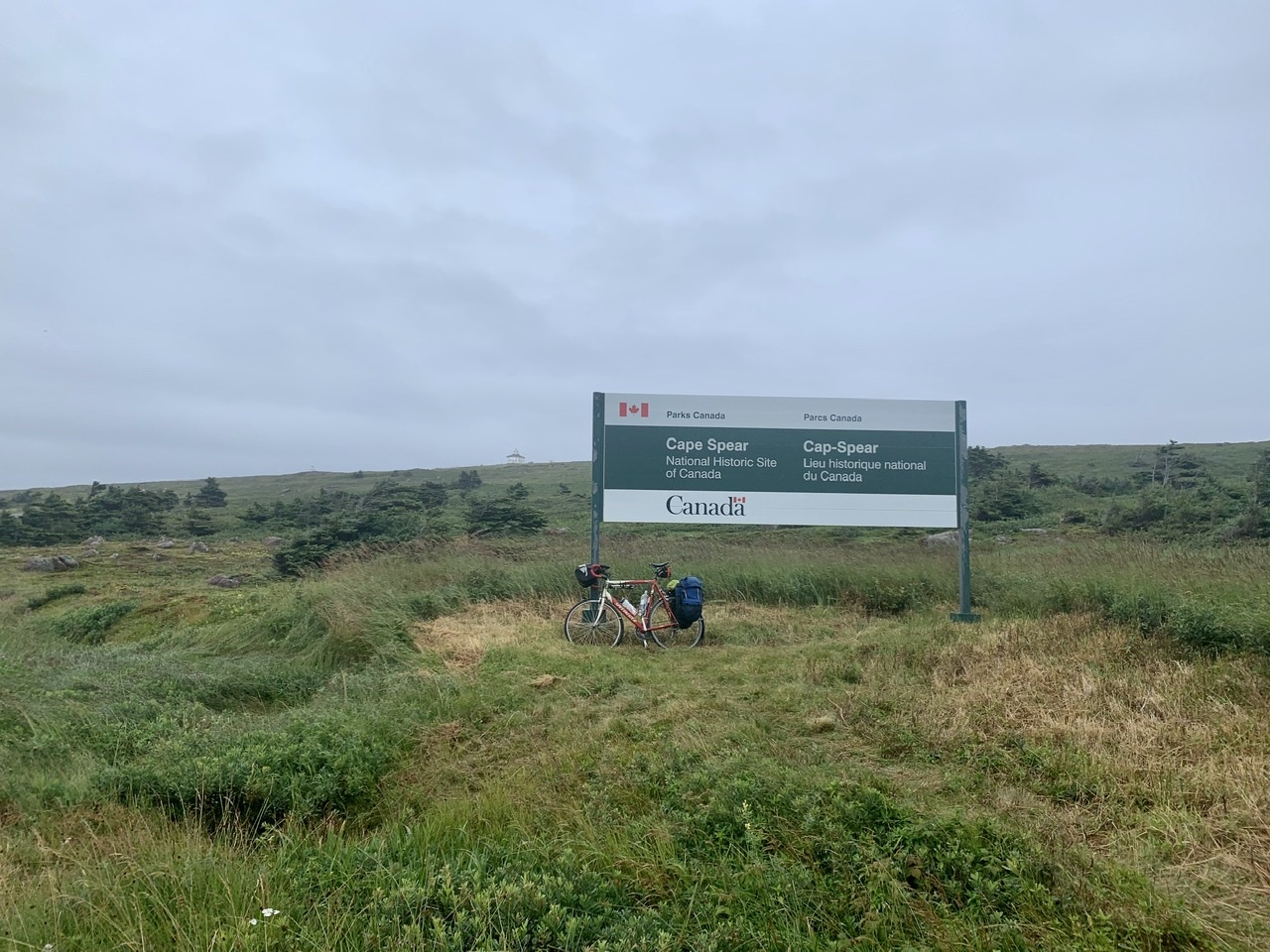
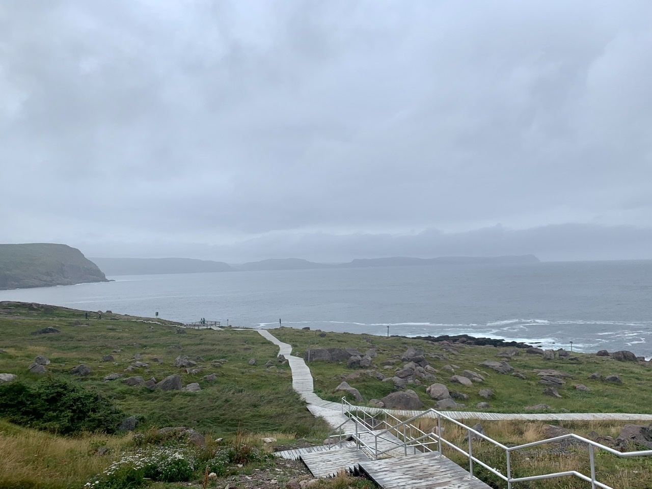
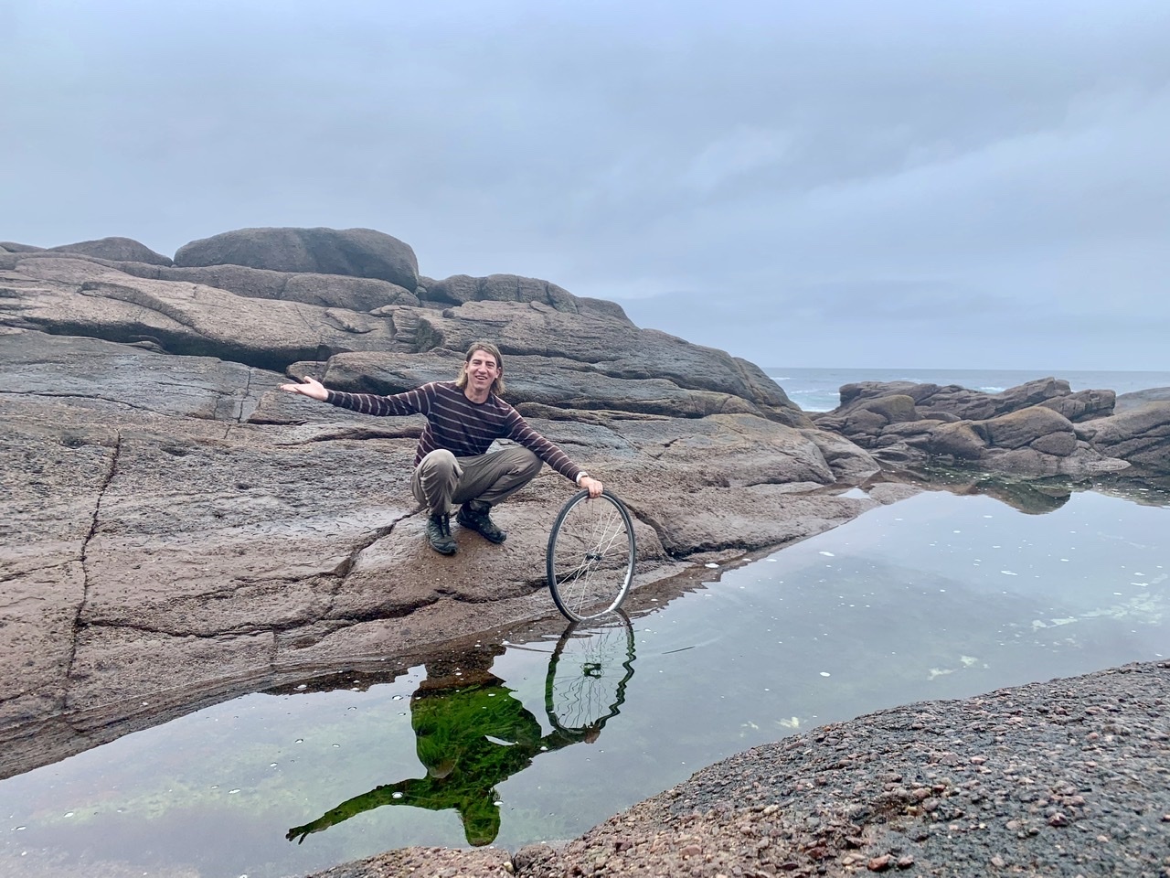
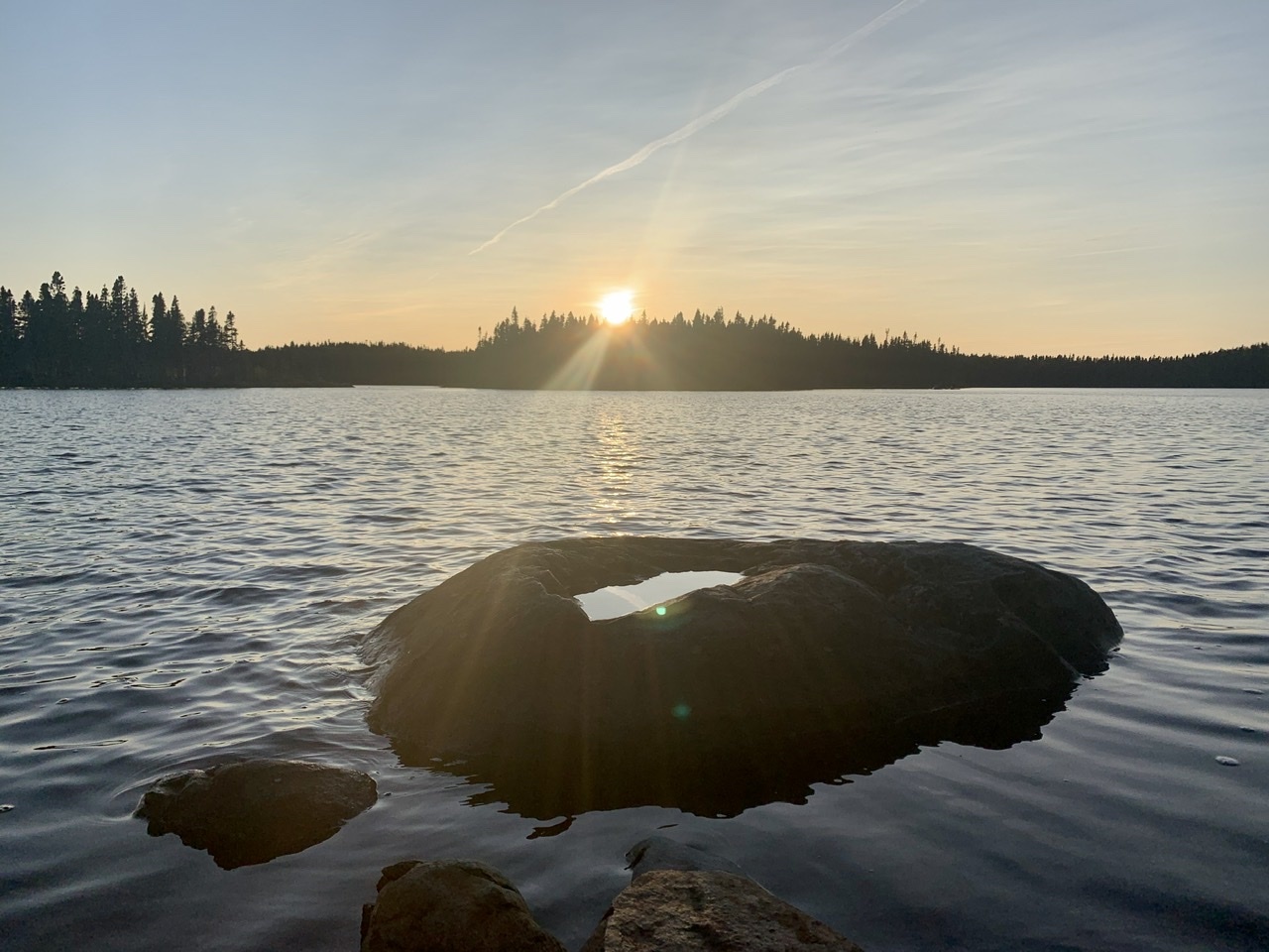
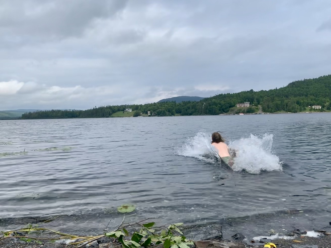
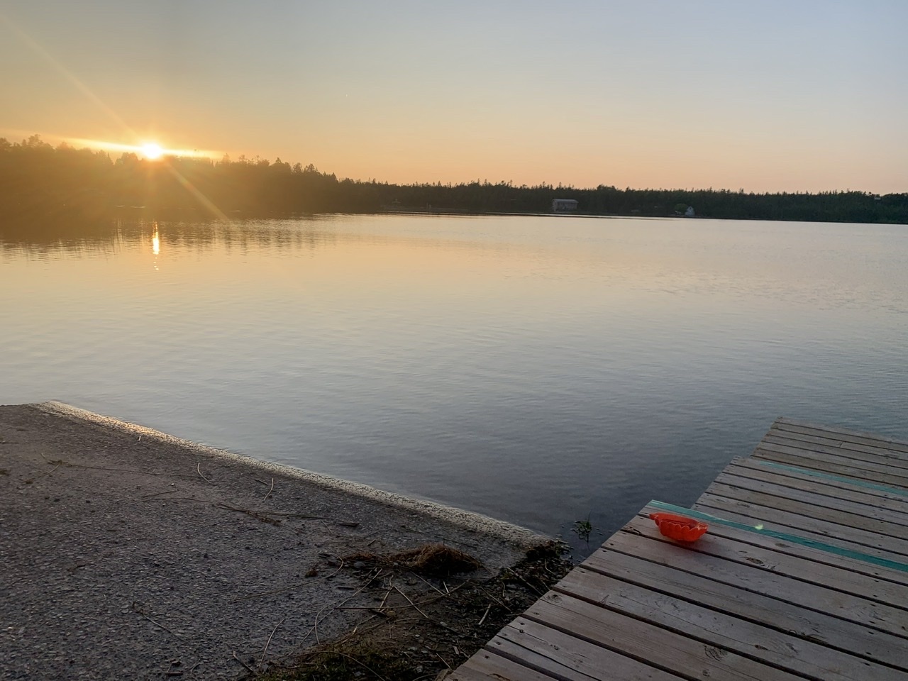
    I had hoped to find a way to bring my bike down to the shore to dip the front wheel in (after dipping the rear wheel in the Pacific Ocean in Victoria), but the waves were too rough and the cliffs too rocky to do it safely. I had to be content with only bringing my front wheel. Fortunately there was a tidal pool away from the dangerous waves that I could reach, but even getting to that required some scampering over rocks to get to.

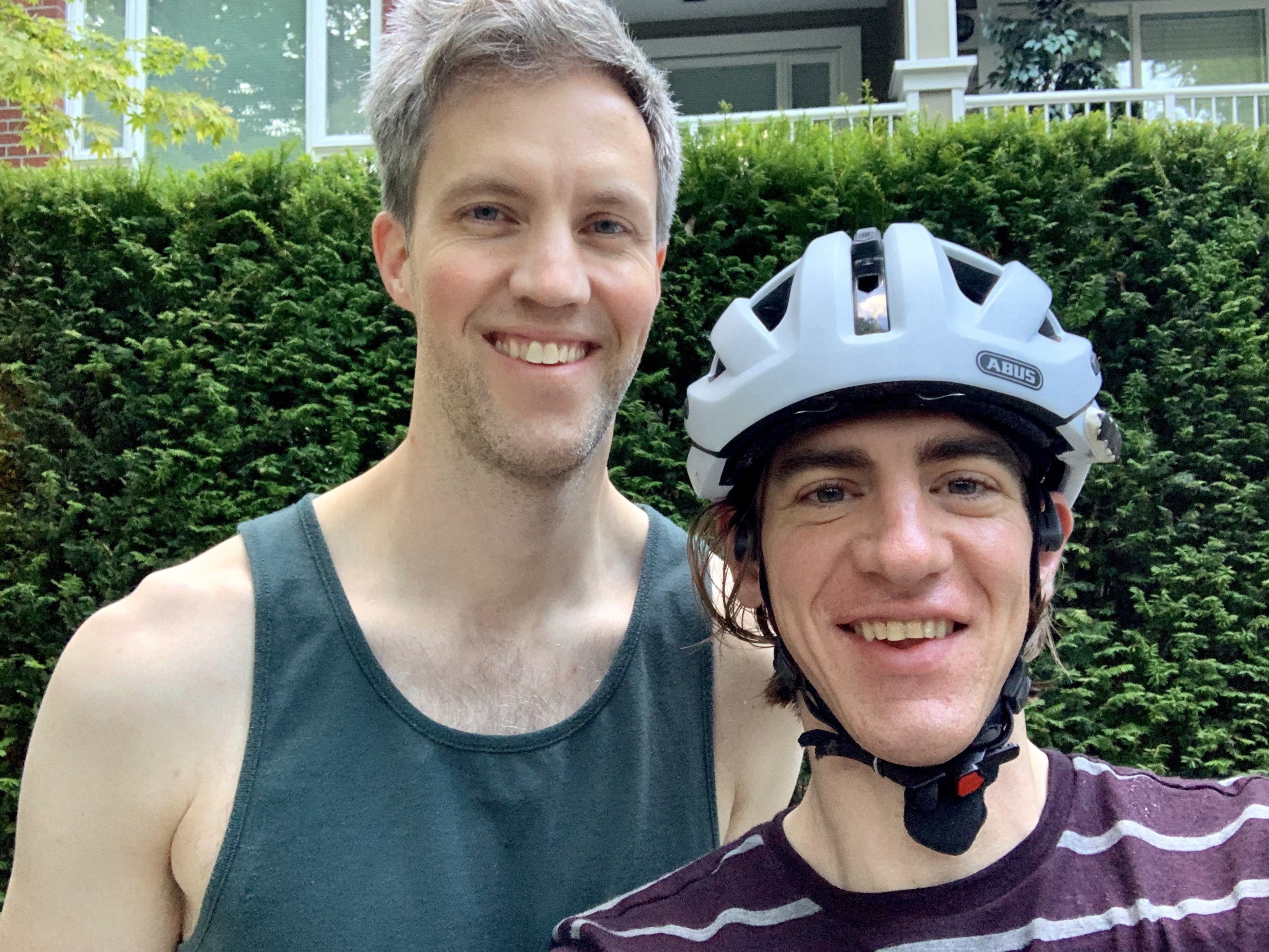
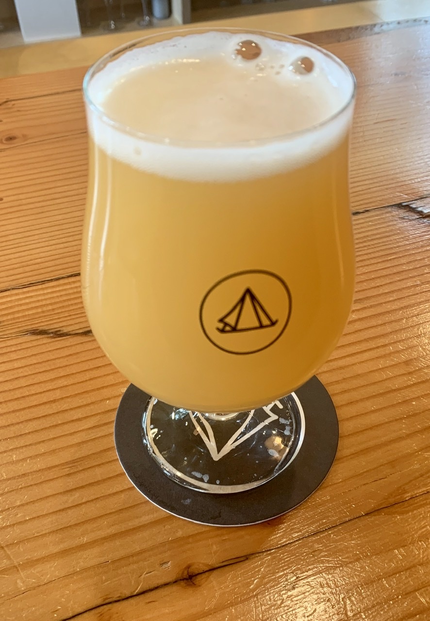
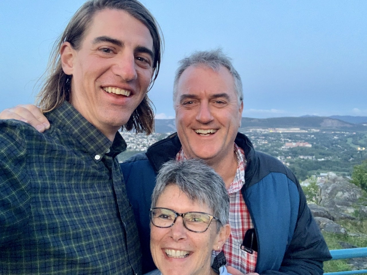
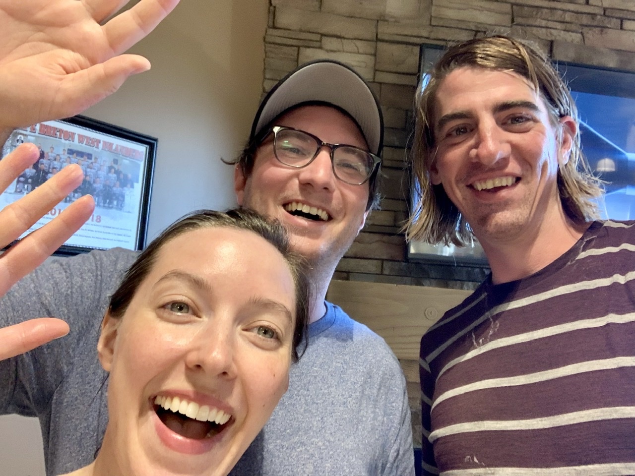
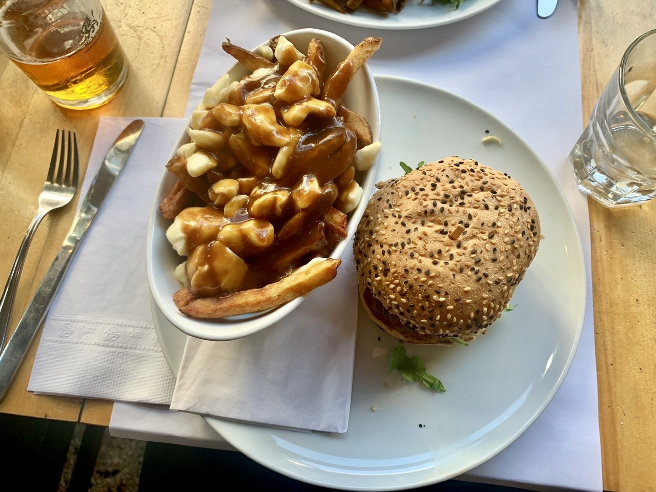
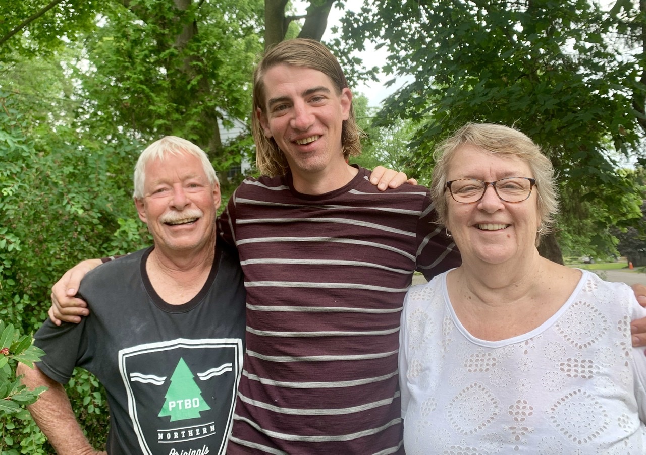
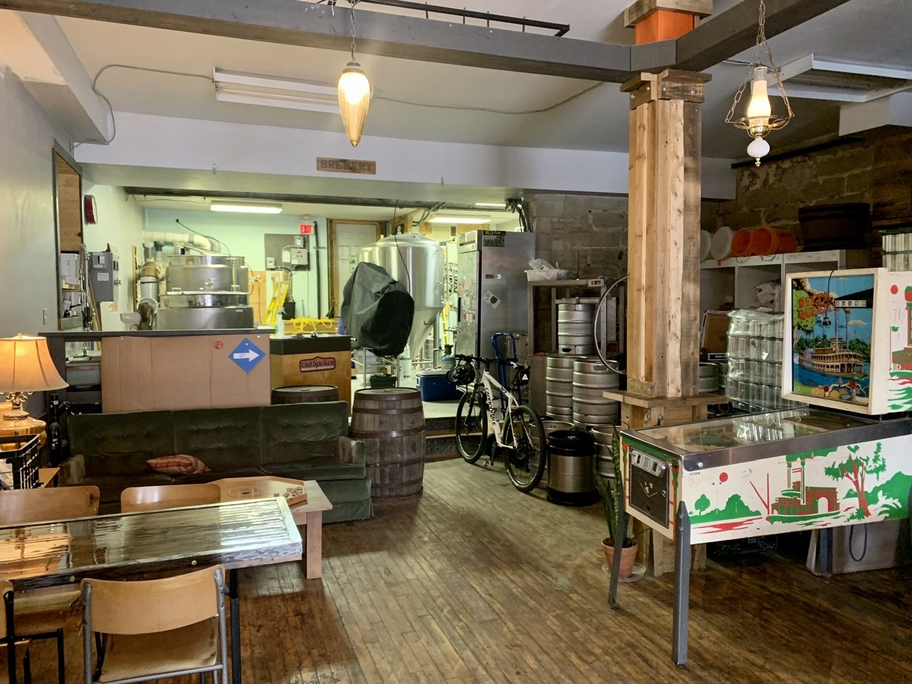
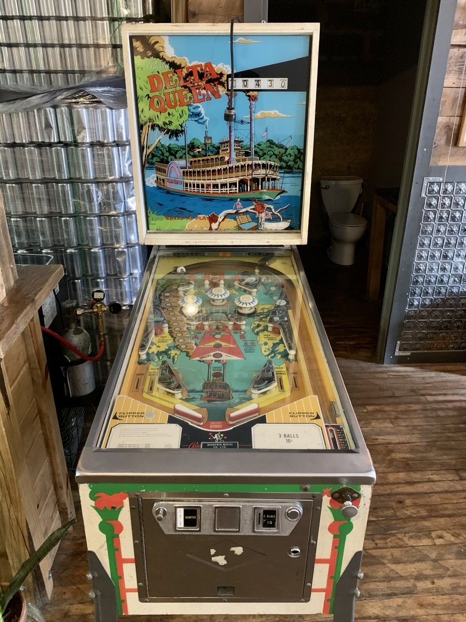
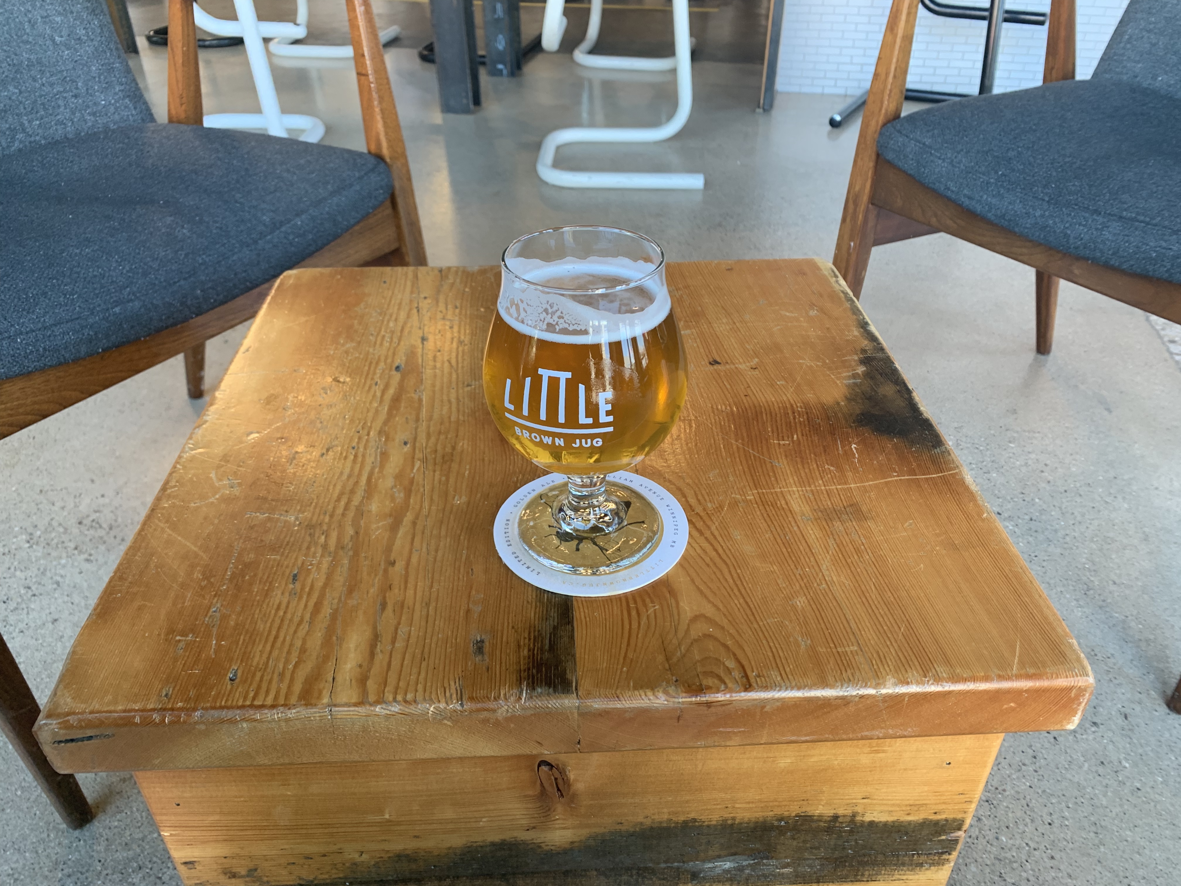
    Once I was done getting my selfies I texted Marty, classmate of my friend Jillian from Halifax, (along with Justin that I stayed with in Winnipeg) She's put me in touch with great people this trip! He came out to get me in his Rav4, saving me the hilly ride back into town. I had nothing left to prove at this point, so was happy for a car ride and a chance to rest. We dropped the bike off at Canary Cycles to be boxed up, then after I had a shower and changed into dry clothes we went out for a beer to celebrate at the new brewpub around the corner from their place.

    Bannerman Brewing’s hazy DIPA paired well with their Sriracha cauliflower “wings”

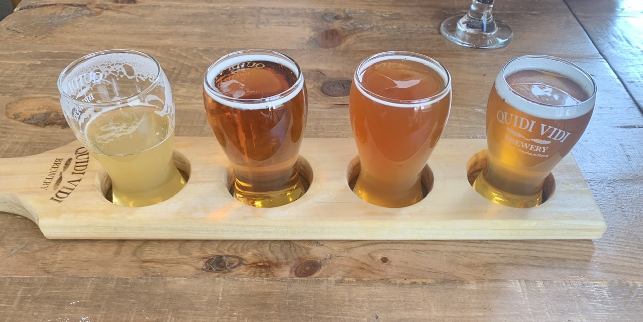
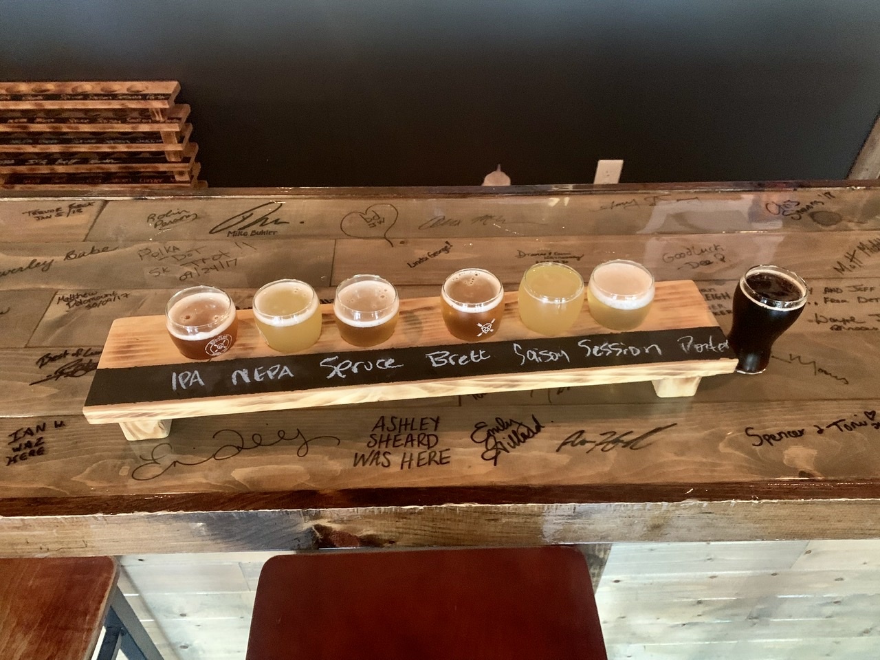
    After some food and drink Marty suggested going to Quidi Vidi Brewery. I'd been there back in 2006 on our honeymoon when they were more of a microbrewery than a craft brewery. Marty said they'd changed a lot since then to embrace brewing more interesting beers. We caught a cab and had a flight there, and he was right—Their beer offerings have much improved. Marty's wife Kara was done work by the time we were done at Quidi Vidi, so she picked us up and the three of us went out for dinner at a gastropub around another corner from their house. There was a lot of celebrating to do.

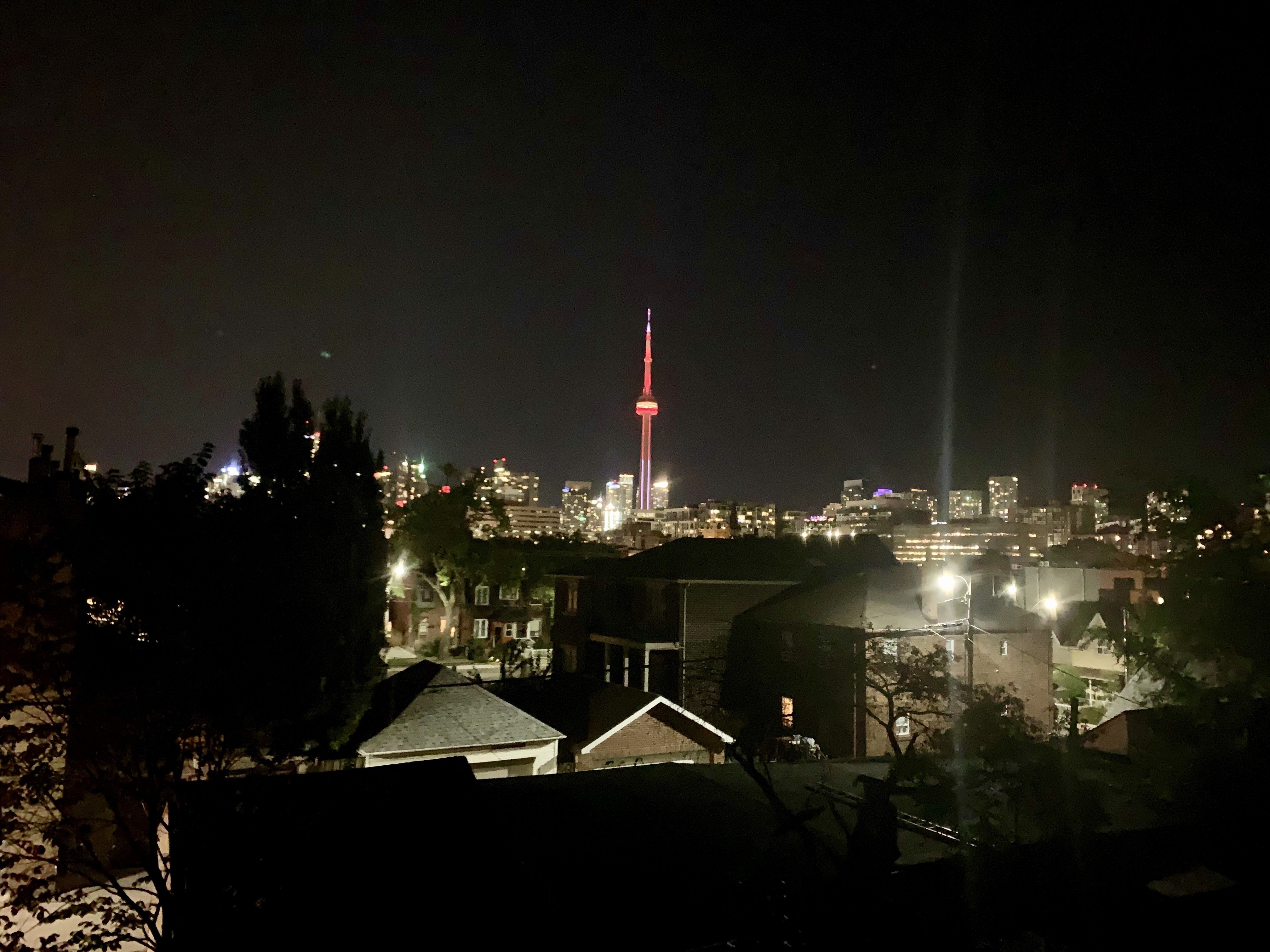
    I fly back home tomorrow (Thursday) evening, so I'll have a chance to do some more sightseeing in St. John's before I go. This is my third time visiting, and there's always more to see here. It'll be good to have a transition day before resuming regular life on Friday.

    My biggest question now is: what next? I've accomplished the goal I've wanted to do for so long, and it feels like a weight's been lifted from my shoulders. I'll take some time to reflect on this trip (I still have some more blog posts coming about trip logistics, and I'll probably write a summary post), but knowing my how my brain works I'm sure I'll have some new obsession soon. At least in the meantime I can get back to reading books and watching movies & TV shows, all things that I haven't done for the past 10 weeks and that significantly declined over the past two years as I'd been busy planning. To be continued, I guess?

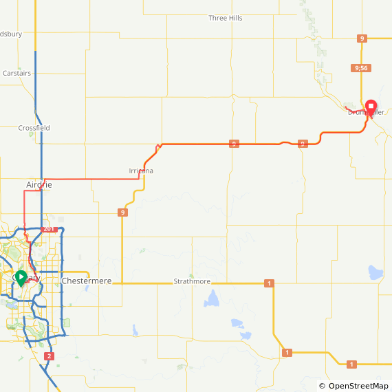
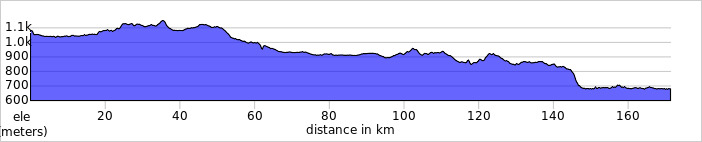
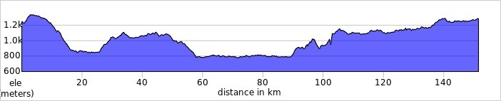
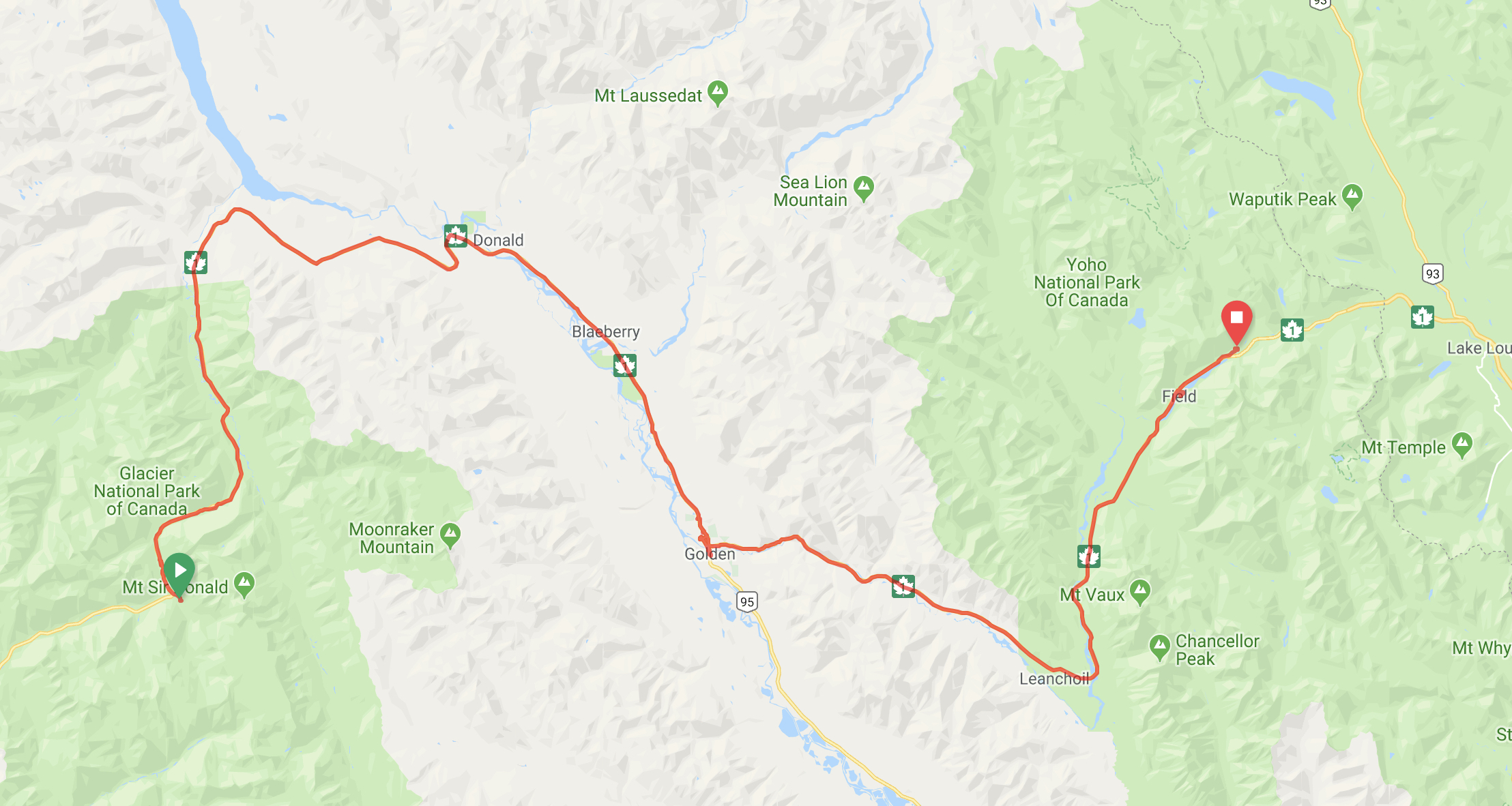
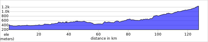
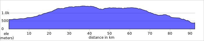
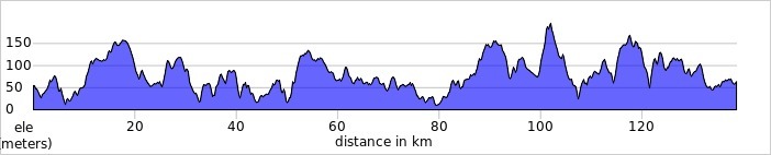
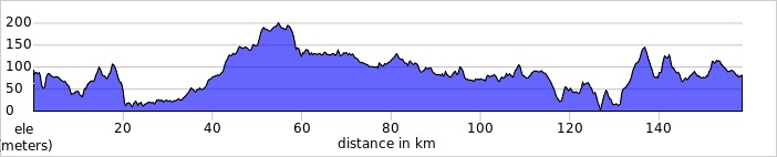
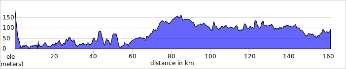
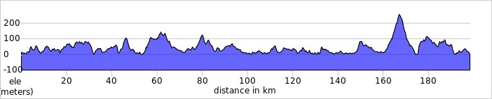
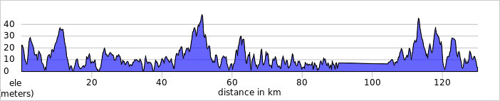
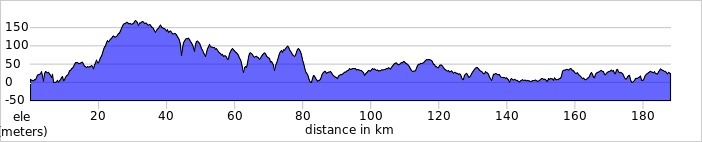
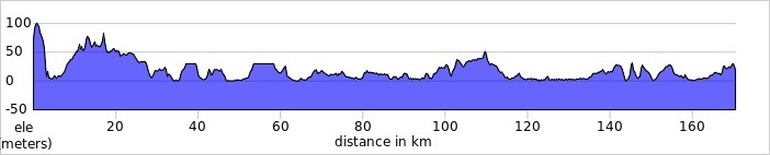
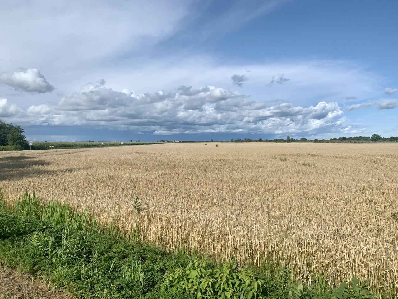
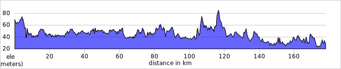
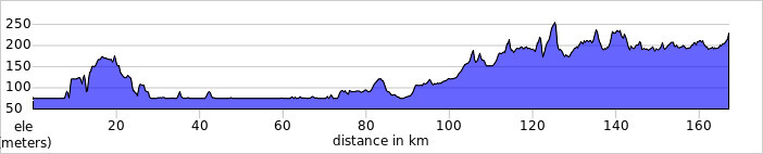
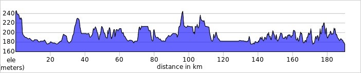
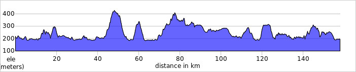
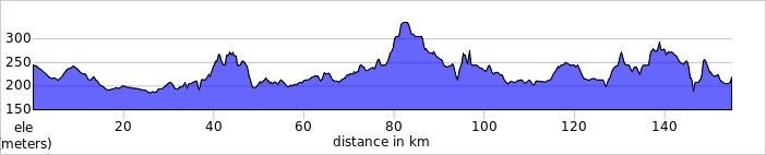
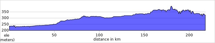
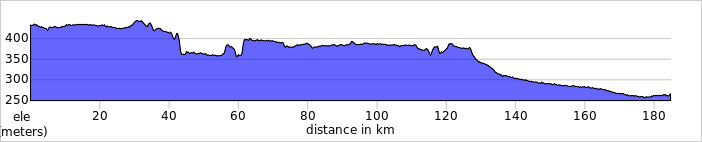
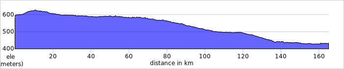
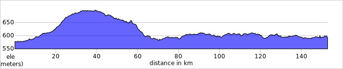
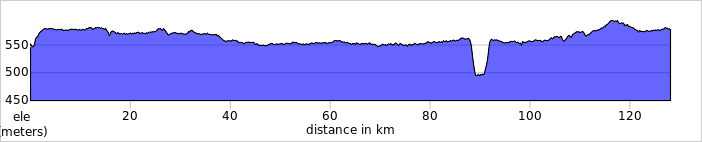
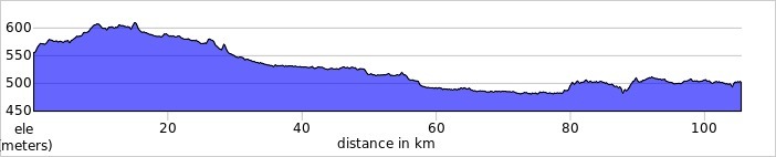
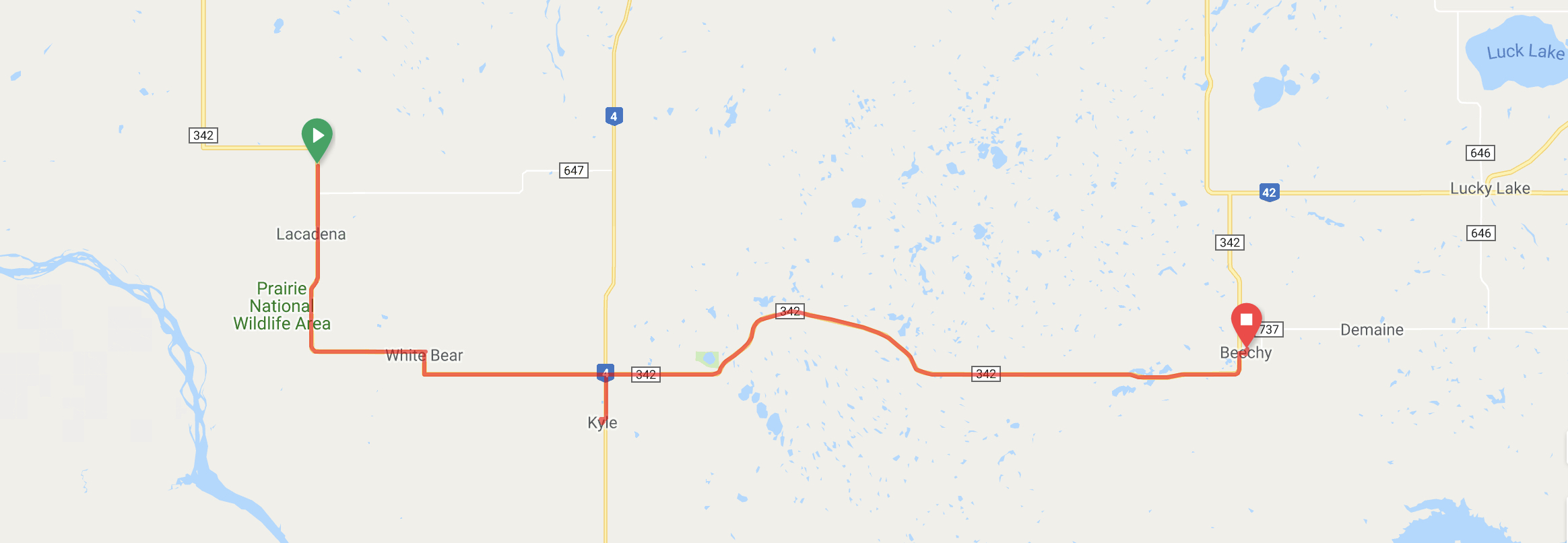
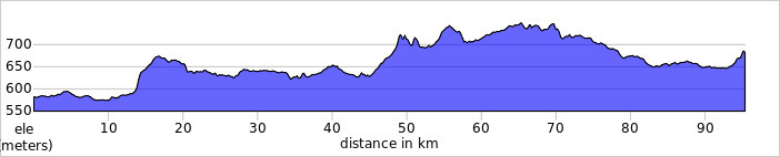
    Today's Distance: 102 km

    Total Distance: 8413 km

    → 10:04 PM, Sep 4
  • Biking Across Canada Day 66 — Port Blandford to Whitbourne, NL: The Hills Never Get Easier…

    Riding into Bespin

    Mark and I got up at dawn and foraged for more blueberries while tearing down camp. We decided to ride to Whitbourne tonight as there's not much past there to stay in, and we are both wanting a bed to sleep in before our last day of riding. We found a two-bedroom AirBNB to stay in and booked it while eating breakfast. It's the first time I've reserved a place to stay more than a few hours ahead of time. I guess I'm feeling confident I'll make it—having a riding partner makes that easier.

    My little tentbed
    Early-morning sky
    Lake Thorburn

    Rain is on the forecast for the afternoon, with headwinds all day, so we tried to make as much progress as we could before they hit. I normally write a blog post in the morning about what I did the previous day, but I skipped that this morning so I could use that time for riding. The sun disappeared shortly after we hit the roads. I don't mind as I think Newfoundland looks better when it's not sunny. The scenery looks more majestic when it's obscured by fog.

    The rains started around noon as promised. The rest of the day was spent riding in heavy downpours, scattered showers, or foggy drizzle. Just as my clothes would dry off, I'd get soaked again. During one of those dry spells we were flagged down by a couple towing a small camper. It actually took them two attempts as the first time they didn't give themselves enough lead time, so I rode past them before they could get out of the car. Dan and Donna biked across Canada in 1980, and now stop to give chocolate bars to any touring cyclists they pass. Their cross-Canada adventure started as a cross-America trip, but when Mount St. Helens erupted they were forced to head north to avoid all the ash spread across the US. They developed a love of vacations in Canada as a result, often doing canoe trips in the same spots in Ontario that I would go. This year they are driving across Newfoundland for the first time, camping along the way. We had a great time chatting with them, but eventually had to leave when the skies opened up again.

    It was a difficult day of riding, with many steep hills made worse by the winds. Our daily climbing total is comparable to the Rockies. Usually the hills will block most of the headwind, but not in Newfoundland. After stopping at the top of a particularly long and steep climb, Mark commented that he thought the hills would get easier after weeks of riding, but they never did. We're still grinding away in our lowest gear all the way to the top. We just get better at accepting them as part of the journey.

    You can just barely see Mark riding up the hill.

    Late in the day as we were nearing our destination, the sun came out. We hardly recognized it, but it brough a rainbow with it. Though it didn't last long, I took it as a good omen on our penultimate day of riding. We stopped at the grocery store on the way into town to buy some vegetables and beer, but a hot coffee was the first item of business when we got to our accommodation as we were cold and damp. The beers came out as we cooked dinner. Tonight is the traditional last-night-of-the-trip feast, where you cook all the food you don't need to carry any more. This was made easier because we had access to a garbage can to throw out any leftovers (there is nothing worse than cooking too much food in the backcountry because leave-no-trace guidelines means you have to eat it). Some of that food I'd been carrying since Kamloops. I'm glad to be rid of it, and my food bag will be nice and light tomorrow.

    An early bedtime is in order as we're getting up before dawn tomorrow for our final ride to St. John's.

    Today's Distance: 139 km

    Cumulative Distance: 8411 km

    → 9:52 AM, Aug 29
  • Holy cow, I did it! 8511 km of cycling across Canada.

    mp-photo-alt[]=

    → 1:06 PM, Aug 28
  • Biking Across Canada Day 65 — Notre Dame to Port Blandford: The World's Largest Joey Smallwood

    The view from Joey’s Lookout

    After staying up late burning off my extra camp fuel (I can't fly with it, and I can't dump it), I slept in a little past sunrise. A grey jay came to visit me as I was packing up. I suspect it's used to getting fed by other campers. Today was nice and sunny for a change. Rain is coming tomorrow, so I feel the need to cover as much distance today as I can. That'll also reduce the amount of riding I do on my last day, which is only a couple days away now.

    I rode for a few hours, then stopped for groceries and coffee in Gander. This is the biggest town between here and St. John's, so I'm stocking up for a few days here. My mom was stationed here for six months in the seventies, and speaks fondly of it. Sadly I didn't get to check out the international terminal at the airport, where celebrities from your grandparents' days used to wait for their planes to refuel before flying across the Atlantic.

    A ways past Gander is Gambo, home to Joey Smallwood, the man who helped convince Newfoundland to join Canada. There's a lookout named after him, an interpretative centre about his life and Newfoundland's joining of Confederation, and a larger-than-life statue of Joey himself. You can even hold his hand! I took some selfies with Joey, then toured the museum. It was interesting. Lots of information on his life as a journalist, union organizer, and broadcaster before he became "the only living father of Confederation." There were artifacts from his life, and handsets you could pick up to hear excerpts from his "Barrelman" radio shows. I had a good time here, spending almost an hour reading the displays.

    Joey’s trademark silver shovel, used for groundbreaking events

    As I left Gambo, Mark (the cyclist I met two days prior) was waiting for me at the onramp to the Trans Canada. We'd been texting our location to each other throughout the day in the hopes we could meet back up. He started the day in Grand Falls-Windsor and still managed to catch up to me—he's fast. We ended up riding together for the rest of the day, and will likely ride all the way to St. John's. Mark let me set the pace this time so there was no danger of me falling off the back today.

    Sometime after Gambo we came to Terra Nova provincial park. My wife and I did a brief backpacking trip here as part of our honeymoon driving across Newfoundland, and had a memorable encounter with a moose who insisted on sharing our campsite. No moose today, though. I had thought I might camp here, but we were making good time and decided to press on. It was hilly, scenic, and beautiful. Challenging but rewarding cycling.

    As we reached the other end of the park we passed by another cross-Canada cyclist named Jon, who Mark had met earlier. He's taking a much slower pace, and won't reach St. John's for another week, so it was a brief reunion as Mark and I were riding faster than him.

    A typical Terra Nova view before a big descent

    We reached Port Blandford as the sun was setting and found an ATV trail to ride down until we found a small clearing just off the highway. As we were setting up our tents I found a pleasant surprise—our site was surrounded by wild blueberry plants. This drastically slowed my pace of getting my gear set up as I was forced to take frequent foraging breaks. We went to bed as soon as we can. Tomorrow is calling for rain in the late morning, so we want to get an early start and ride as much as we can while it's dry.

    Today's distance: 166 km

    Cumulative distance: 8272 km

    → 8:21 PM, Aug 27
  • Biking Across Canada Day 64 — Sheppardville to Notre Dame Provincial Park: Smooth Sailing

    Today was a straightforward, uneventful day of riding. Nothing exciting, nothing unfortunate. It was welcome.

    I got up at 7 am, having slept almost 10 hours last night. The winds were quiet when I started riding, but I knew they’d pick up and turn into a headwind so I kept a steady pace, riding all morning, knowing that when I made it to Badger it’d shift direction and turn that headwind in a tail/crosswind. I still had a couple hours of headwind riding, but it was fine compared to yesterday’s all-day slog.

    Normally I hate roadside billboards for cluttering up the view, but they’re really helpful on this trip when I’m constantly playing “When Will I Get There?”
    I’ve seen so many beaver dams but no beavers.

    I stopped in Badger around 1:00 to write a blog post, but the Internet connection was too poor to upload it. I pushed on to Grand Falls-Windsor where the magical Internet fairies were much stronger. Mark and I had been texting to see if we could meet up again here, but he went through some sort of whole town power shutoff in Springdale that led to him starting the day late, so we couldn’t make it work.

    I couldn’t figure out what this pipeline thing was.

    I rode on for a few more hours until I arrived at Notre Dame provincial park. This place was great. A lake (or pond as they call it) to swim in, warm showers, and wooded sites, all for the low price of $20. The only downside was a boil water advisory, but I have a lot of extra fuel to use up before catching a plane home, so I spent some time eating potato chips and calling home while boiling water before heading to bed.

    Today’s distance: 159 km

    Cumulative distance: 8107 km (I hit 8000 today!)

    My Gear

    I spent a lot of time, effort, and money to get my gear as small and light as possible as I didn’t want to have to carry any more weight than I had to. Back when most of my outdoor excursions involved canoe trips I didn’t have to care so much about weight, but now I do. I also did a backpacking trip in the Grand Canyon last year (where people die every year from overexertion), so used that and this trip as an excuse to buy lighter gear. Most of my gear was 15–20 years old and was due for replacement anyways. I spent a lot of time reading posts on Reddit’s forum for lightweight hiking gear to help me pick out better gear, and I’ve been really happy with what I chose.

    My tent

    Mid-march backyard trial. I couldn’t wait to use it once I got it.

    I chose a single-walled Aeon tent from TarpTent, a small tent maker based out of Seattle. It’s made of Dyneema Composite Fibre (DCF), which is also known as cuben fibre. It’s lightness and strength was first used for sailboat sails, but some cottage manufacturers are using it for tents and backpacks. It’s designed to be used with a single hiking pole instead of traditional tent poles. I brought a 48” pole instead of a hiking pole. It has some clever aspects, like corner struts that save on weight while doubling as closable vents. The single-wall construction saves weight, but does mean the inside can get dew condensing on it, which the vents help reduce. I still spend a few minutes wiping down the tent with a rag in the morning so that I don’t pack it away wet, but that’s worth it to me for the weight-savings of not needing a fly. It also makes setting it up and tearing down in the rain better as the inside is kept dry. Most importantly, I can stretch out and sit up in it, and the whole thing weighs just over a pound.

    In the stuffsack. Peanut M&M for scale
    The single pole
    Corner struts

    I did make some modifications to it. I added some longer pegs for more holding power and in case I lost or broke some on the trip. I added longer guylines for more flexibility when pitching on rocky ground. I also used a larger stuff sack so it wouldn’t take as much time and effort to fit it into the small stuff sack it came with.

    Room to sit up

    Sleeping Pad & Pillow

    Sleep is really important to me—it’s the best performance-enhancing drug you can get, and the sleep tracking I’ve done over the past year confirms that. So I’m willing to spend extra money and weight on something that helps me sleep better than the self-inflating Thermarests I used to sleep on. I got an insulated inflatable mat from Exped (the SynMat UL long/wide), and it’s magical. I’m a side sleeper, so I like having something thicker to keep my hips off the ground. The Exped mats come with a clever stuff sack that doubles as a pouch to capture air to fill it with, so it only takes a minute or so to fill. I like it so much that I have two of them now—a summer one and a winter one.

    I also got an inflatable pillow from Big Sky Products that is wonderful. It packs down small, and has structure to it when inflated to keep your head from rolling off. I use my buff as a pillow case for it, and it’s way better than the stuff sack full of clothes I used to use that would compress down to nothing as the night went on.

    Sleeping Bag

    Instead of a sleeping bag I have a sleeping quilt. With most sleeping bags the insulation underneath you is wasted as your bodyweight compresses it too much for it to be useful. Quilts do away with that extra material and keep you warm by tucking under your sleeping pad instead. A couple shockcord straps keep it in place when you toss and turn. Mine zips up at the footbox if I need it, but most nights I leave it open like a duvet. I got mine from Feathered Friends because they have a reputation for manufacturing standards, and for using ethically-sourced down (as much as that is possible). It’s rated for 0º, but your milage will vary. I supplement it with my puffy jacket when it’s around 5º or lower.

    In the stuff sack. It gets even smaller when stuffed into my pack.

    Cookset

    Clockwise from top-left: Fuel bottle, pot and cutting board, rolled-up windscreen, spoon, stove

    I ditched my white gas stove for an alcohol stove from Trail Designs that only weights a few grams. Alcohol doesn’t require a pressurized canister, so you can use any old water bottle to store it, though I use one with a measuring capsule built into it. The genius part of my cooking setup is the windscreen that is custom-sized for my pot (a 1.3l titanium pot from Evernew) to position it in the optimal height for heat transfer, and to seal in as much heat as possible.

     It doesn’t simmer, it only boils water, but I don’t mind as most meals I’m cooking only need boiling water. I also have a long-handled spoon so I can eat directly out of the package when I’m making freeze-dried camping meals or Sidekicks. Doing dishes is my least-favourite part of camping, so I’m happy to avoid that when I can.

    I’ll write more about my clothes and electronics in another post.

    → 11:47 AM, Aug 26
  • Biking Across Canada Day 63 — Corner Brook to Sheppardville: Falling Off the Back

    Headwinds make the road seem never ending.

    Tough headwinds made for a long day of riding until sunset, but at least I made my target distance.

    Lynne made me the biggest breakfast today. She just kept offering me more and more options. My plate got so full that I couldn't eat them all—eggs, steak, mushrooms, toast and more. It was much heartier than the Pop-Tarts I usually have for breakfast. Eventually I got out the door with a full belly and a full foodbag, and headed down the hill and out of town.

    On the way out of town I passed an old locomotive from the defunct Newfoundland Railway, which has been dismantled and turned into a rail trail that is unfortunately suited only for ATVs (or "quads" as the call them here). It keeps tempting me on the map—look at the shortcuts I offer!—but I know I'd get stuck in the rocky gravel somewhere in the middle of nowhere. I also stopped to see a local rock formation called the Man in the Mountain. We came by here last night but it was too dark for me to make out, but this time I could recognize it.

    If you squint hard enough you can pretend you see the Man in the Mountain

    Leaving Corner Brook brought me through the beautiful Humber River gorge. I had to keep stopping to admire the views. Entering the gorge also brought me into a localized rain storm that lasted for about an hour, and disappeared once I made it out the other side. 

    Then it was nice and sunny all day, giving me the chance to dry out but also bringing a strong and steady headwind that lasted all day. I haven't had many of them this trip, but they really slow me down when they happen. I started to worry whether I would make my self-imposed destination of Sheppardville for the day.

    Whether I'm on schedule or not is a matter of interpretation, and also depends on which version of the schedule you're looking at. I originally planned to ride the 977 kilometres across Newfoundland in six days, but realized that didn't give me enough wiggle room if I ran into difficulties (like mechanical issues and headwinds), so I chose to take the overnight ferry from Sydney to buy me an extra day of riding. I then spent half of that extra day in Corner Brook. So I'm ahead of my original six-day schedule, but behind on my seven-day schedule. I wanted to ride 160 kilometres or more today to bring my remaining average daily distance down, but the winds were putting that in doubt.

    Another cyclist!

    Just as I was stuck in my head thinking about this, Mark came riding up behind me. He's from Calgary and also riding across Canada, though taking more time than me so he can do less distance in a day. We rode together for about an hour, chatting the whole time. It boosted my spirits and I was able to ride faster for that time, before I ran out of energy and Mark rode on ahead of me. ("I'd ridden an extra 50 km before he started his day" could be my excuse, but the truth is I'm not that fast of a rider, just willing to pedal for more hours in a day than most). We exchanged contact details in case we cross paths again, which is likely given our mismatch in speed and daily distance.

    After Mark's departure it was just turning the pedals over until sunset. There was some beautiful scenery along the way, some of which I took pictures of, and some I just rode by. I even got a seven-kilometre respite from the wind after a switchback around a bay but that was over all too quickly.

    Eventually the sun set and I found an access road to the power-line clearcut that parallells the road, where I set up camp for the night. It's going to be cold—the forecast calls for a low of 2º—so for the first time since the rockies I'll be sleeping in my puffy jacket and toque. There's no cell service to be had, which makes planning the next day harder, but also means I'm not tempted to stay up later than necessary checking out what's happening in the world, so I'll manage an early bed tonight. I need the rest. My legs are exhausted from today's effort.

    Today's distance: 161 km

    Cumulative distance: 7948 km

    → 3:21 PM, Aug 25
  • Biking Across Canada Day 63 — Stephenville Crossing to Corner Brook: Isolated Showers

    It was overcast as I left. I haven’t seen the sun yet in Newfoundland, and it may be a few days before that happens. Fortunately that means it won’t be hot, so I won’t be needing as much water in these remote areas. I was especially glad for that when I realized I left my water bottles in the fridge this morning. By the time I realized I was an hour from town, and didn’t want to make a two-hour return trip to collect them. Stephensville Crossing was under a boil water advisory, so I’d actually gone to the trouble of boiling water, then cooling it in the fridge for today’s ride. Oh well. At least there’s a bike shop in Corner Brook where I can get replacements.

    Georges Lake

    I hadn’t gone swimming in who-knows-how-long, so when I saw Georges Lake I had to fix that. The water temperature was perfect—cool without being cold.

    When I got back on the bike I noticed my rear wheel was flat. It took me a while to find the leak, but it was another sidewall-failure-induced blowout. I was out of adhesive tire boots, but was able to find a $5 boot in my wallet (literally a $5 bill). I definitely need to replace that tire in Corner Brook. Oh, and it started to rain while I carried out the repairs, then stopped once I was ready to start riding again. I needn’t have dried myself off after the swim. Or maybe it’s a sign I should have taken a longer swim.

    I finally made it to Pinchgut Lake just after lunch, where there was a seasonal convenience store I could get something to drink at. I cleared out their stock of Gatorade, along with a couple ice cream treats. The cashier asked if I wanted a bag, then laughed when I said I was going to have it all right away.

    Just as I was finishing the ice cream treats, the clouds opened up, bringing a torrential downpour and a stiff tailwind. I raised my metaphorical sail and started pedalling. It was raining so hard all I could do was laugh as my shoes filled with rain. A pick up truck driver even stop to offer me a lift, which I graciously declinde.T he rain tapered off when I got to Corner Brook about an hour later, and as I descended into town the roads were dry. I managed to go through a very isolated storm.

    In Corner Brook I stopped at Cycle Solutions, which was recommended to me by Matthieu at Highland Bike Shop in Antigonish. It’s the last bike shop before St. John’s. I had them check my spoke tension, put on a new tire, and I bought another spare tire, more tubes, and a water bottle. That should get me through to the end. 🤞

    There’s a craft brewery here, so I had a (gigantic) flight after my bike was ready. There were some decent beers, including a brett which uses a different strain of yeast (brettanomyces instead of saccharomyces) than typical beers.

    After a stop at the grocery store I headed to the home of Lynne and Victor, parents of Jessie from Halifax. Turns out the lived at the top of a very long and steep hill. Getting to their place was the toughest climb of the trip so far. Lynne came out to greet me. They treated me to a giant dinner of corn, chicken, and salad, then took me for a tour of Corner Brook. They only moved here from Nova Scotia a year ago, so they still have an outsider’s sense of wonder about the place.

    This was only halfway up the hill.

    We stopped at the Captain James Cook national historic site, where there are incredible panoramic views of Corner Brook and the Bay of Islands. Then the drove me around town to figure out the best (least steep climb) way to get to the highway in the morning, letting us compare different routes for grade and distance.

    Me and Cook

    When we got back to the house Lynne emptied out her cupboards while I ate ice cream, offering me lots of food and treats to take with me. I won’t have to visit a grocery store for a few days. They’ve been amazing hosts.

    With Lynne and Victor

    Today’s distance: 80 km

    Cumulative Distance: 7787 km

    My Bicycle

    Circa 2017

    WARNING: Inside-baseball bicycle talk follows. If you’re curious about the bicycle I’m riding, read on. If this type of talk bores you to tears, then I won’t be offended if you stop reading here.

    I’ve wanted to bike across Canada for a long time. I also wanted a road bike for many years but never felt I could afford a proper one. When I got into long-distance riding in my early twenties all I had was a mountain bike since that was the dominant style sold in bike shops at the time. Road bikes were out of my price range then—the cheapest model you could get at the time was over $1000, and as an underpaid student I couldn’t justify it. (I even “competed” in a duathlon on my mountain bike—the climbing gearing came in handy as I rode past all the double-chainring road bikes walking up the Niagara Escarpment). So I decided to build my own bike. It would let me pay for little bits at a time, and I’d learn a lot about bikes in the process, though the latter benefit I realized in hindsight.

    So I started with a frame I bought off eBay. At the time I watched a lot of Tour du France coverage so I picked out a racing bike frame. I figured when I would bike across Canada I’d do it with Tour du Canada where there’d be a support vehicle to carry my gear for me. I bought a Specialized Allez Sport frame because it had mounts for a rack so I could carry what I needed for the day, and for reasons I still don’t understand I was obsessed with the Specialized brand. It was red, because red is best.

    Over the next year-and-a-half I bought all the components I needed bit-by-bit. I would meticulously research the options, then order one piece at a time. I wouldn’t buy the most expensive or the cheapest, instead looking for getting the best bang for my buck (e.g. buying Ultegra but not Dura-Ace). I had to learn about bottom bracket widths and threading, derailleur cage length, handlebar diameter, and all sorts of other minutia that you avoid by buying a bike off the shelf. All that knowledge has come in handy in the years since. I can have educated conversations with bike shop mechanics and salespeople. I can also take care of nearly all repairs myself, and I know what skills are above my paygrade (or patience).

    So I built myself a very nice racing bicycle. But as I prepared for this ride I realized I wanted to ride solo instead of with a group so I could have more flexibility to visit the people and places I chose. That meant I needed to carry all the gear myself, and a racing bike isn’t suited for that. For financial and sentimental reasons I still wanted to take that bike I’d built, and that meant modifications were in order, some of them inadvisable for a trip as long as mine. The frame had short chainstays which meant there isn’t a lot of heel clearance once you put panniers on. It was never intended to have fenders and wide tires. It wasn’t really intended to have a heavy-duty rack on it. I was still determined.

    Partially-modified for my 2018 tour around western Nova Scotia

    I brought home a selection of tire widths to determine the fattest tires I could put on it. 700x28 was the limit, even though many bicycle tourists won’t ride with anything smaller than 700x32. I had to cut my fenders in pieces since they wouldn’t fit under the crown. I flipped my stem so it would have an upward angle instead of downward, giving me a more upright riding position. I had new wheels built to replace the racing wheels I had on (which would be impossible to repair since replacement spokes have been discontinued by the manufacturer). I picked out a rack that would shift the panniers backwards, giving more heel clearance but making it more wobbly as the weight was shifted up and back. I replaced my racing pedals (“designed” by Laurent Jalabert, my favourite racer at the time) with flats so I wouldn’t have to bring an extra pair of shoes. I put on a big handlebar bag so I’d have easy access to snacks and other gear at the expense of handling (this was the best thing I did).

    All those things I changed made the bike better for touring, but the addition of fenders and wider tires meant I very fine tolerances for wheel trueness. If my wheels were no longer true the tire would rub against the fenders or frame, which has definitely been an issue this past week. But I wanted to ride this bike across Canada, and I was determined to do it, so I accepted the risks involved.

    I also spent an incredible amount of time and money getting my gear to be as small and light as possible, as I didn’t want to carry any more weight than necessary. I’ll expand on that in a later post, but all that effort has really paid off.

    → 12:18 PM, Aug 24
  • I’m getting a lot of friendly honks on the highway today. Newfoundlanders seem genuinely excited to see a touring cyclist.

    → 11:39 AM, Aug 23
  • Biking Across Canada Day 62 — Port Aux Basques to Stephenville Crossing, NL: The Final Frontier

    Newfoundland: The final frontier
    These are the voyages of the bikeship Red Rocket
    Its ten-week mission: to explore strange new provinces
    to seek out new beer and new pelotons
    to boldly go where many cyclists have gone before.

    I finally made it to Newfoundland, the last province of the trip. I’ll be here for a week, which makes the two days I spent in PEI and Nova Scotia seem extra short (not to mention the three weeks I spent in Ontario).

    The ferry arrived around 6:30 am, but took a while to actually dock. I slept okay considering I was in a chair on a ferry, but not enough to recover from yesterday’s riding. I’m planning a shorter day that ends in a bed tonight instead of camping.

    Bleary-eyed and sweat-stained ferry selfie
    Pulling into the Rock

    After riding off the ferry with the motorcycles I headed for Alma’s Family Restaurant for breakfast while I waited for the grocery store next door to open. I passed by a Tim Hortons on the way that was lined up onto the road with people from the ferry looking for coffee. By contrast, I was the only person in the restaurant for quite some time until a few other ferry travellers showed up.

    I stopped at the tourist information centre to see if they had any material for cyclists, not really expecting much, but was pleasantly surprised to be given a double-sided piece of paper listing every place to stop on the Trans Canada between here and St. John’s. Perfect!

    Living up to its stereotype, Newfoundland was foggy and rainy today. It made the scenery seem even more rugged, desolate, and majestic. I didn’t mind at all. Plus the rain rinsed out the sweat stains in my shirt that had accumulated since leaving the Wedges. (I also learned today that I left my razor behind there, so I’ll be a bit shaggy until I find a drugstore to buy some disposables. Fortunately a friend of the Wedges can bring my regular one back to Halifax for me.)

    There are very few places to stop in this part of the province (okay, the whole province). I hoped to ride about 120 km, then treat myself to a B&B with the money my mom sent me to celebrate making it to the Rock, but they were all booked up. The closest I could find was an AirBNB rental in Stephensville Crossing, which was farther than I wanted to travel, but choosy beggers, etc. The hills and winds really picked up in the afternoon, so I was struggling at this point and had to take frequent breaks so I didn’t keel over. I was relieved when I finally made it, collapsing onto the bed until I had the energy to walk the three minutes to the nearby grocery store for supplies. (I exaggerate slightly, but I was wiped.)

    Fortunately tomorrow will be a short day, only going 80 kilometres or so to Corner Brook, where I’ll be staying with the parents of my friend Jessie from Halifax. I can sleep in and take my time.

    My scenic rest stop when I started to feel dizzy.
    Crossing into Stephensville Crossing

    Today’s Distance: 154 km

    Cumulative Distance: 7708 km

    → 8:52 AM, Aug 23
  • Newfoundland: the final frontier

    → 9:10 AM, Aug 22
  • Biking Across Canada Day 61 — Antigonish to North Sydney, NS: Fear is a Powerful Drug

    I once had no fears, none at all, and then when I had some
    To my surprise I grew to like both, scared or brave without them
    The thrill of fear, thought I’d never admit it
    The thrill of fear, now greatly enjoyed with courage
    When I once was untouchable, innocence roared, still amazes
    When I once was innocent, it’s still here but in different places
    […]
    Fear is a powerful drug. Overcome it and you think that you can do anything.
    Untouchable innocence. It’s still here but in different places

    Björk, _Innocence_

    Today I was a man with a mission in two or three editions, as Elvis Costello would say. My plans to take the long way across Newfoundland were in jeopardy, and I was determined to salvage them if I could. Just like when my wheel broke outside of Drumheller and I ended up breaking 200 kilometres for the first time, my broken wheel provoked a similar reaction today, prompting me to ride, ride, ride as long as the sun would let me. The fear of not achieving your goals can be harnessed in surprising ways.

    Tearing down camp

    Chapter One: We Didn’t Really Get Along

    The bike shop didn’t open until 9:30, so I was able to sleep past sunrise. For the first time since those 4:30 am prairie sunrises I used my sleep mask to block out the sun. After packing up camp I got to the Highland Bike Shop a few minutes early, where the owner saw me outside and let me in right away. I was really impressed with the service there. Matthieu took his time truing my wheel, taking multiple passes to get the dishing dialled in to compensate for my off-centre dropouts. Matthieu biked across Canada himself in 2010, so we were able to have some good conversations about bicycle touring while he fixed my bike. Highly recommended. I stocked up on spare tubes, and got out of there in 45 minutes to hit the road.

    First view of Cape Breton

    After leaving the shop I was on the Trans Canada for quite a while, which was not great for cycling but at least it was direct, and I needed as much help as I could get today if I hoped to make it to the ferry terminal before it left just before midnight. I also didn’t want to do any more riding in the dark than I had to.

    Chapter Two: I Think I Fell in Love with You

    After a few hours of riding, and a quick stop for coffee I made it to the Canso Causeway, gateway to Cape Breton. After this the riding improved considerably. It was hilly but scenic, with far less traffic. Thanks to his noodly appendages, I was blessed with tailwinds today that let me travel higher than my typical average speed.

    You Said You’d Stand by Me in the Middle of Chapter Three

    I made it to Whycocomagh after a couple more hours of riding and stopped at Tim Hortons for more sustenance. My friend Evan who gave me the fun e-bike tour around Calgary on day 13 was visiting family in Cape Breton and spotted my bike outside. It was a brief but fun reunion, as I had to keep moving to make my goal tonight.

    But You Were Up to Your Old Tricks in Chapters Four, Five and Six

    Whycocomagh was just past halfway between Antigonish and North Sydney and I still had almost 4.5 hours before sunset. I was starting to feel confident enough to look at booking a ticket on the ferry. I was quickly punished for my hubris with a flat tire. Just like yesterday it manifested as a slow leak, and I was able to quickly tell it was due to a hole in the sidewall caused by my tire rubbing against they frame. I was out of spare tires at this point but have carried the same tire boot in my repair kit for probably 18 years. Now was finally the chance to use it! I didn’t even bother patching the tube. I just put in one of the new ones from Highland as I’ll have more time to fix it when I’m not racing against the setting of the sun. All-in-all I only lost about 25 minutes of sunlight to the flat.

    I’m Giving You a Longing Look

    After the flat tire it was mostly smooth sailing, with some steep hills thrown in. The scenery was even more beautiful here as I rode along Bras d’Or Lake and the ocean shores. 

    The climb to the top of Kellys Mountain was a challenge, especially after a long day of riding, but I had some strong motivation to get me through.

    I got to the ferry terminal about 25 minutes after sunset, with enough twilight that I didn’t need my bike lights to see (still wore them to be seen, of course). If I didn’t have that flat I would have made it before sunset.

    As the only cyclist, I got to ride on with the motorcycles

    Today’s Distance: 198 km

    Cumulative Distance: 7554 km


    → 8:57 AM, Aug 22
  • Very happy to be back home in Nova Scotia for a couple days!

    → 11:07 AM, Aug 20
  • Biking Across Canada Day 59 — Summerside to Brudenell River: Flights of Fancy and Friends From Home

    Charlottetown as seen from Stratford

    Today showed the value of not sticking too ridgidly to a plan.

    The Wedge family has a beautiful waterfront view.

    I left Summerside early this morning, but not before Richard made me espresso and eggs. Such a generous host, he also suggested some detours to take on my route. One of them was a side trip to Montague, where there were a couple craft breweries to visit. Looking at the map I realized it wasn't that far out of the way to my destination of Northumberland Provincial Park. I could stop there for dinner before riding for a couple hours to the campsie by the ferry terminal where I was planning on catching a ride to Nova Scotia in the morning.

    Good wayfinding signs on the trail

    I had planned on sticking to the Confederation Trail for most of the day, but Richard also had some suggestions of where to hop off and take the road to shave some distance off, which I also followed, so it was a mix of road and trail to Hunter River where I stopped at the By the River Bakery and Cafe for second breakfast and cinnamon buns.

    Picnic tables and washrooms are also welcome trail additions

    From Hunter River I mostly took the trail to Charlottetown where I made a few stops. First at Upstreet Brewing for a flight and some map-reading. Then I stopped at McQueen's Bicycle Shop for a new chain (I managed to replace it before it wore out my cassette this time!). As I entered the shop I saw a cyclist with lots of touring gear ahead of me. The woman behind the cash said jokingly "You're not biking across Canada, too, are you?" to which I was able to say, "Actually, yes." The man with all the gear was from Japan, spending three months biking from Vancouver to Halifax. I'd heard of him from other cyclists, so it was nice to meet him in person, though the language barrier made swapping stories difficult.

    Planning my route at Upstreet

    After the bike shop I headed to the legislative assembly, where many details of Canada's confederation were worked out in 1864. They call it the birthplace of confederation, but (as Richard pointed out) it's really the place of conception—the birth happened in England when the British North America Act was signed, though it's one of those rare situations where the conception was probably more work and less fun than the birth. The assembly is undergoing extensive renovation, so I headed next door to the George Coles Building where the legislature is temporarily housed.

    As I was on my way to Montague I got a text from my friends Deb and Doug from Halifax. They were in PEI, had just biked by a brewery offering flights, and were wondering where I was. As luck would have it that brewery was in Montague, so 90 minutes later we were having flights together.

    Red sand road, a common sight here

    They were staying in Brudenell River Provincial Park, about 15 kilometres northwest. Over the course of dinner I decided to stay with them instead of by the ferry terminal. It'll add about 40 kilometres to tomorrow's ride, but how often do you get a chance to stay with friends unexpectedly? Plus I get to make jokes about stealth camping in the provincial park. Seemed like a fair trade off.

    We rode together on the Confederation Trail nearly all the way to the campground. We shared a campfire together and caught up some more before it was bedtime for all of us. Tomorrow I'll be back in Nova Scotia for a couple days before heading to Newfoundland.

    Group ride

    Today's Distance: 131 km

    Cumulative Distance: 7232 km

    → 10:24 AM, Aug 20
  • Biking Across Canada Day 58 — Bouctouche to Summerside: …and the Livin' is Easy

    I'm really racking up the provinces quickly now, though everything seems quick after three weeks crossing Ontario.

    I slept in those woods

    I left my stealth campsite shortly after sunrise. It was a quick teardown as rain was approaching. Much of the morning was spent riding along the Northumberland Strait, often through torrential downpours. I stopped for a photo at Shediac's giant lobster, but the busload of tourists meant I didn't get a chance for the traditional trapped-in-the-claws photo. Oh, well.

    I avoided the main highway where I could which offered me beautiful views of the salt marshes and coastal shores. 

    Quiet roads out here

    When I reached the edge of Cape Jourimain where I'd be catching the shuttle across the Confederation Bridge I opted for a rail trail, but that proved unwise. It was very soft gravel with lots of debris, and some sections that were unrideable. I was glad when I reached the end of that trail.

    Cape Jourimain trail
    Waiting for the shuttle

    As I crossed the bridge our shuttle driver told us a group of swimmers had left New Brunswick at 9 am. Most had already made it across (it was mid-afternoon by now), but some were still at it as we went by.

    The swimmers and their support vehicles (sea kayaks)

    In PEI I biked along the roads to Summerside where I'm staying with the Wedges, parents of my friend Ben who I stayed with in Toronto.

    I met the Wedges last year at the end of Ben's bike ride across Canada. They were great hosts today, taking me on a tour of Summerside, then buying me oysters and local beer at the yacht club before a dinner of sous-vide pork chops and salad made fresh from their garden. Richard was full of advice on what to see and do in PEI, and which roads and trails to travel on. I was definitely spoiled tonight.

    There was cold PEI beer waiting for me at the Wedges
    We stopped at the start of the Trans-Canada Trail, which is a like a box of chocolate for cyclists
    View from the yacht club patio

    Today's Distance: 116 km

    Cumulative Distance: 7101 km

    → 10:46 AM, Aug 19
  • Made it to another province today!

    → 3:30 PM, Aug 18
  • Biking Across Canada Day 57 — Bathurst to Bouctouche: All of the Lights

    Morning in downtown Bathurst

    Cop lights, flash lights, spotlights, strobe lights, street lights (All of the lights, all of the lights)
    Fast life, drug life, thug life, Roc life, every night (All of the lights, all of the lights)
    Turn up the lights in here, baby
    Extra bright, I want y’all to see this
    Turn up the lights in here, baby
    You know what I need, want you to see everything
    Want you to see all of the lights

    We going all the way this time (We going all the way this time)

    Kanye West, All of the Lights

    Today was a long day of riding, sometimes in the rain, as I tried to build up distance so I’d have time to spare in PEI, where I’ve never been before.

    I left before my hosts got up, so I didn’t have a chance to say goodbye but was happy not to disrupt their sleep. I’ve written before that I feel a little bad when people get up early to see me off, though at least the sunrise is at a more reasonable time than it was in late June further north.

    Highway 134 outside Bathurst

    It was quiet roads for a while through Bathurst and beyond as I was able to stick to secondary highways. Eventually I was dumped onto the main highway which initially had wide, smoothly-paved shoulders that let me ignore the traffic flying past. That ended abruptly when I reached Northumberland County where the wide shoulder disappeared, leaving me a thin, crumbly stretch of pavement next to 100km/h traffic. That was less fun, so I was happy when I found a quieter alternative near Miramichi.

    Jane told me they are ripping up the shoulders in New Brunswick. (shakes fist emoji)
    Found a friend at a rest stop
    The mighty Miramichi River
    Beautiful bridge, though unpleasant to ride across

    It was raining on-and-off again today, but at least it was warm, so I kept on riding. I normally listen to podcasts when I need something to keep my brain occupied, but after seeing news of the new neon-light mural unveiled in Dartmouth the day before I listened to Kanye West’s All of the Lights song on repeat for maybe an hour. I first heard it during one of my many training spin classes, and had to ask my instructor what the name of it was because the horn section riff reminded me of a song from one of my favourite Bjork albums (every Bjork album is one of my favourites). I’ve since come to appreciate that song for its own merits—a great hook, complexly-layered vocals, and epic sound.

    Training for the Tour

    I’ve always been a cyclist: riding around the neighbourhood as a kid, commuting downtown from the suburbs in high school, 35-km round trips to my summer job at the factory, year-round commuting as an adult, and long weekend rides for leisure. So I had a good base to start with, but had slowly been gaining weight after having kids. I knew I needed to lose weight and get stronger legs for this trip, so in late January I signed up for a two-week trial membership at Spinco, a spin gym in downtown Halifax. My plan was to go to a spin class every morning before work. I wasn’t sure what to expect—their marketing materials seemed a little cultish, with talk of “one team, one bike” and finding your purpose, but I quickly grew to love the sessions. They were different from the spin classes I did in the nineties. Here we pedalled in time to the beat of the music, spending a lot of time out of the saddle so we could do pumps and dips and work out the rest of our bodies at the same time. 

    Winter ride to Spinco

    It was challenging, especially at first as I built up my coordination and stamina, but we did it all in a darkened room so you didn’t have to worry about how you looked to other people (plus you’re focussing way too much on keeping the rhythm to pay much attention to them). I kept going day after day, becoming one of the 6:15 am regulars, then coming back on the weekends and my lunch breaks. I did 160 classes between late January and mid-June, usually going 8–12 times a week. I got back to my pre-pregnacy weight (losing all the weight I gained from having kids), built up a lot of endurance, and had a blast doing it. I also learned to appreciate a lot of pop music songs that I would otherwise have ignored. I’m planning on signing back up when I return to Halifax.


    I pedalled on lest I get engaged again.
    Saint-Louis de Kent

    I passed by Kouchibouguac National Park in the late afternoon. I had hoped to stay here when I was planning the trip as I have fond memories of getting engaged here during our 2004 New Brunswick vacation, but the timing/distance didn’t allow for it today. I kept riding, not knowing where I’d end up, just trying to cover as much distance as I could. I passed through Bouchtouche just before sunset, and found a picnic rest station between Bouctouche and Cocagnejust as the sun was setting where I set up my tent out of sight in the woods. Tomorrow I’ll reach Prince Edward Island for the first time in my life.

    I rode through an empty construction site instead of the long detour around it. (All detours are long when you’re on a bike).

    Today’s distance: 188 km

    Cumulative distance: 6985 km

    → 10:14 AM, Aug 18
  • Biking Across Canada Day 57 — Matapedia to Bathurst: Incident at Restigouche

    Morning along the Restigouche

    I spent the day riding along the Restigouche River and the Baie des Chaleurs, finally back in the Maritimes after exactly two months away.

    It was cold when I left the campground, cold enough that I wore my jacket, toque, and mitts until I warmed up. I had my choice of when I entered New Brunswick this morning, and opted for another twenty kilometres of riding la Route Verte before crossing over at Pointe-à-la-Croix into Campbellton.

    Restigouche national historic site, where I saw a fox cross the meadow.

    When I went by the national historic site at Restigouche, the interpretive centre was closed, so I can't tell you more about the 1760 naval battle you may have learned about in high school. Instead let me tell you about the police raids on indigenous salmon fishers that happened in 1981, where the separatist government of the time, advocating for independance and self-governance for the Québécois was working to deny those same rights to the Listuguj Mi'gmaq people. Alanis Obomsawim made a documentary, _Incident at Restigouche_, about it. Incredibly, she was told by the NFB to only interview natives, not white people, which she thankfully ignored, otherwise we wouldn't have the unforgettable interview with Lucien Lessard, fisheries minister at the time of the raids.

    Incident at Restigouche , Alanis Obomsawin, provided by the National Film Board of Canada


    The bridge to New Brunswick
    A new province! Reason to celebrate.

    After stocking up on peanut M&Ms in Campbellton it was a nice ride along the shore to Dalhousie, where I mailed my Route Verte guide home. It's been the only paper guide I've relied on this trip, and I'll miss having knowledge of where all the places to get water are along the route. From now on I'm back to riding blind, though I still have fellow cyclists' GPS tracks to follow.

    Fortunately not the Dalhousie I work at. Still have nearly two weeks before I have to go back.
    The view from Charlo

    It rained on-and-off in the afternoon. I sheltered under a church awning for the worst of the rain. Normally I ride through the storms, but I had a relatively short amount of distance to cover today so I was able to take my time.

    Sea corn in the Belladonna
    Lots of inspiration for my rain garden back home.
    I was struck by how empty the smelter looked despite how noisy it was. Then I rode by the picket line of locked-out workers.
    This beachside park in Petit-Rocher would be lovely on a sunny day. Picnic tables, snack bar, water fountain, bathrooms, outdoor showers, a playground and a stage for musical acts.

    Just after suppertime I arrived in Bathurst. I'm staying with Jane McCullogh, the trail consultant and advocate from Saint John, who heard about my trip from Twitter and invited me to stay at her parents' cottage. How could I say no? She pulled some strings at city hall and surprised me with a bag full of Bathurst swag which her dad collected and presented me with. It was so flattering I didn't know how to respond. Fortunately Jane offered to mail it to me so I don't have to carry it. (I carefully weighed everything I packed before leaving on this trip since I didn't want to carry any more weight than I had to, so that offer was greatly appreciated.) I'm staying in a lovely old farmhouse tonight, with a beautiful old quilt on the bed. It's charming and homey and a testament to the friendliness of people who I'd never met in person before wanting to support my journey. I'm extremely grateful.

    Jane’s dad Brian carrying out the traditional passing-of-the-swag ceremony.

    Today's Distance: 137 km

    Cumulative Distance: 6797 km

    → 2:08 PM, Aug 17
  • Biking Across Day 56 — Mont-Joli to Matapedia: It Belongs in a Museum

    The Via train taking that railway at night instead of day is borderline criminal.

    After a good sleep in a bed I was ready to see the Gaspe peninsula in daylight. I've wanted to come out here for a while, and was disappointed when Via Rail ended the Chaleur route from Matapedia to Gaspe in 2013 as it was high on my list of train routes to take. Last year I considered a bicycle tour around the peninsula as a test run for this trip, but ended up doing the western half of Nova Scotia instead due to scheduling constraints. That was also a great trip—the Acadian shore between Yarmouth and Digby is remarkably similar, with many large tin-roofed churches along the coast.

    The church in Mont-Joli that I slept next to

    I was able to get most of my hill climbing done early in the day, with a sharp ascent and descent followed by a long steady climb as I shifted from the Mitis river valley to the Matapedia. Once I was on the latter river it would be an all-day rolling descent.

    Like changing orbital planes, changing river valleys requires a lot of propellant.
    Saint-Moise
    Lac Matapedia at Sayabec

    At Amqui I started to encounter the old covered bridges characteristic of the region, some of which reminded me a bit too much of the start of Beetlejuice. I stopped for lunch at Microbrasserie La Captive where I had a flight and a burger, and got to practice un peu de francais.

    After lunch I spent the rest of the day following the Matapedia river, seeing the fishers angling for salmon. It was such a flat, peaceful river, I really enjoyed riding along it. It reminded me of riding through the flatter parts of the Rockies. I tried to go swimming but it was too shallow, so had to settle for a bit of wading. That ended up being okay because it was also quite cold—so cold I didn't dare lean back to get my torso wet.

    Late in the day I arrived at Camping Matapedia, where I stayed at what has been my favourite campground so far. It was small and quiet, with a heated swimming pool, hot showers, free Wifi, and plentiful power outlets to recharge all my devices. All that for only $20. A bargain. Next door was the shuttered Motel Restigouche which had the most amazing elevated sign. I could take pictures of it day after day and never get bored. After a very relaxing swim float in the pool, I went to bed at eight pm, looking forward to hitting New Brunwick tomorrow.

    Today's Distance: 148 km

    Cumulative Distance: 6660 km (That's 10 numbers of the beast, for those of you keeping track)

    → 1:03 PM, Aug 16
  • Two unusual events this morning: 1. I wore a toque and mitts to ride my bike in mid-August. 2. I crossed into another province. Bonjour, Nouveau Brunswick!

    → 9:26 AM, Aug 16
  • Biking Across Canada Day 55 — Saint-Andre to Mont-Joli: Bring on a Brand New Renaissance

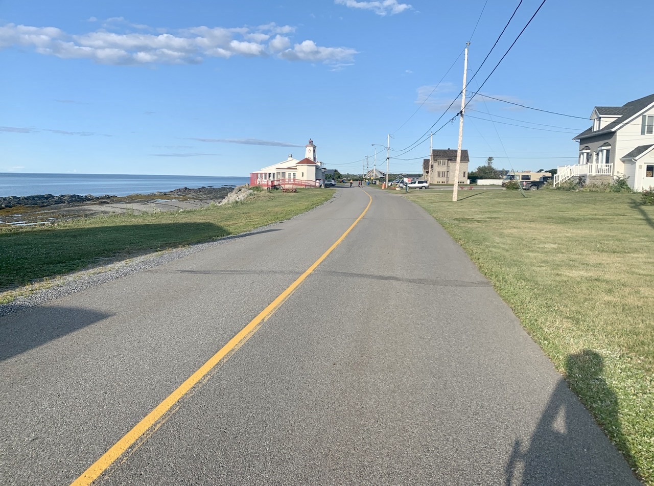
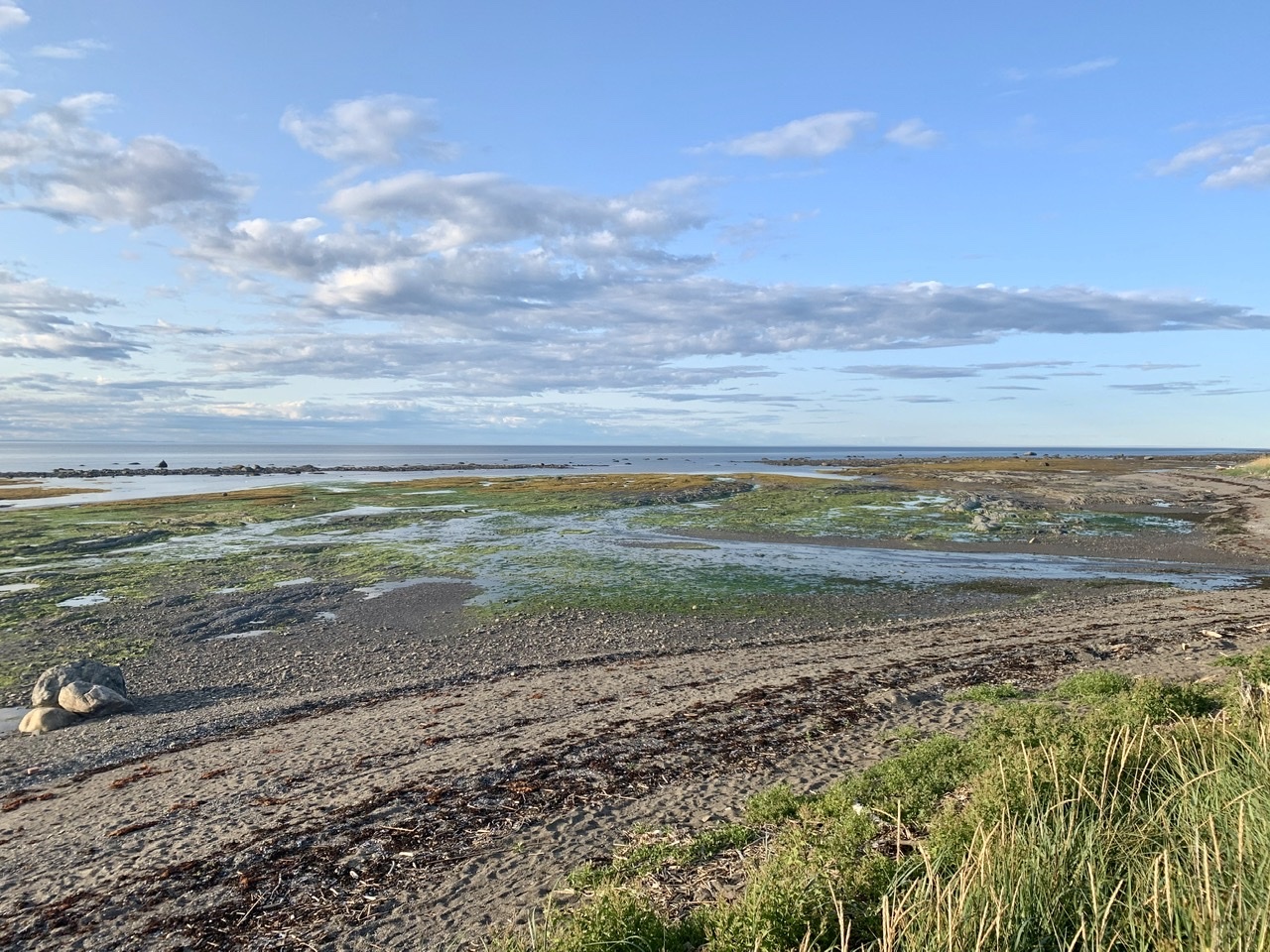
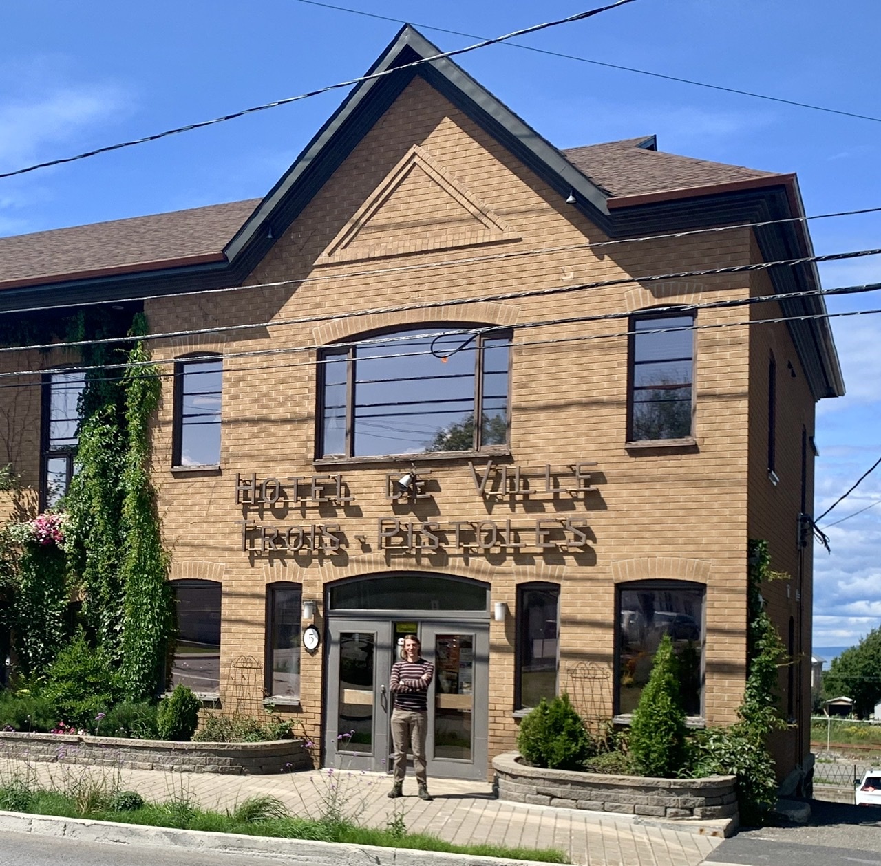
    I'm three pistols strong today.

    Well, Tom Thompson came paddling past
    I’m pretty sure it was him
    And he spoke so softly in accordance
    To the growing of the dim
    He said, “Bring on a brand new renaissance
    ‘Cause I think I’m ready
    Well, I’ve been shaking all night long
    But my hands are steady”

    The Tragically Hip, Three Pistols

    I feel like I have my bicycling mojo back. After some slow progress in southern Ontario and the outskirts of Montreal, I’m feeling good on the bike and ready and eager to crush out some mileage. It’s good to be back.

    Sunrise outside Saint-Andre-de-Kamouraska.

    Being closer to the eastern edge of the time zone means early sunrises are back, which I like as it gives me the chance to do some early riding before most people are awake. So a 5:30 wakeup meant I was on the road at 6:15. The Saint Lawrence has many beautiful places to stop, so less than an hour later I had my feet up on a rock watching the water go by as I ate some snacks.

    At Riviere-du-Loup I stopped for groceries and a quick hike to the lookout. Later I passed through L’Isle-Verte where a plaque told the brief history of the five bridges built over the river. My favourite was reading of the 1850 wooden bridge located near the falls and its poetic end. “Unfortunately, it was carried away like a wisp of straw during the ice break-up of 1895.”

    A typical grocery-store purchase. I ate almost all of this today.
    Riviere-du-Loup lookout
    The River Verte

    After lunch I biked through Trois-Pistoles, which I mainly know from the Tragically Hip song. They’ve sung about a lot of places in Canada that have made me want to see them, and this song combines things I studied in high school (the Group of Seven and Shakespearean tragedy) in a way that made me curious to finally see this place. I didn’t really have any expectations for it to meet, but there was a neat horse sculpture outside a big church, so thumbs up, I guess?

    The afternoon brought me through Parc National Du Bic, with a mix of challenging paved hills along the shore, and challenging gravel hills through the woods. A park ranger told me they have bicycle-specific campsites, so this is a place I’d like to return to.

    That’s the national park up ahead.
    There were some steep climbs to be had here.
    Someone in the town of Le Bic has a garden with an incredible view.

    I’d originally planned on camping just west of Rimouski, but when I arrived I wasn’t done riding for the day, so I pushed ahead. Rimouski has a lovely promenade de la mer that separated the cars, bikes, and pedestrians from each other, and would change the pavement whenever there was a chance for the different modes to mix.

    I thought the digital tide marker was a nice touch.
    The paving stones were a tactile reminder to cyclists to slow down for pedestrians crossing.

    At Pointe-au-Pere I avoided a proposed shortcut, and I’m glad I did as I stumbled upon a historic maritime site with a lighthouse from 1909 and a submarine.

    If I translated correctly, this is the second-oldest lighthouse in Canada.
    Mermaid selfie

    Then it was a fast ride along a quiet road full of cyclists. I latched onto another rider and we sped along the waterfront until it was time for him to turn around. At Sainte-Flavie it was time to bid the seaway adieu as I turned inland to cut across the Gaspesie. I didn’t manage to go swimming in the Saint Lawrence, so I made sure to do some quick wading here.

    To quote Frog and Toad, it was a fine, fast ride.
    It was a treat to smell the ocean again.
    Where I went wading.

    The camping options weren’t great here, but I found a cheap room in a former domitory attached to the church to stay in. I’ve learned that having a bed is a great motivator to do extra distance, so now I’m about 40 km ahead of schedule. Mojo!

    My room still has the original furniture—notice the cross on the wardrobe.

    Today’s distance: 177 km

    Cumulative distance: 6512 km

    Look a that descent at 110 km, and the fine, fast ride from 140–170 km.

    → 1:54 PM, Aug 15
  • Biking Across Canada Day 54 — Quebec to Saint-Andre: So This is What I’ve Been Sleeping Through

    Berthier-sur-Mer

    You know how you can tell your friends love you? When they know you love sour cherries but have trouble finding them fresh so they buy some and having waiting for your arrival. Ewan and Aimee did that for me. They were _miam_.

    Everyone in the house is an early riser, so Ewan and Aimee were able to give me an escort to the ferry terminal, recreating some of the many rides we took together in Halifax. We took Cote de al Montagne down to the riverfront, and I can confirm it is much more pleasant downhill than uphill, though it's so steep and windy that I had to squeeze the brakes the whole way down.

    They too have heard all the tandem jokes.
    We stopped for my traditional photo of the legislature
    Quick group photo before the ferry left

    I took the Levis ferry with some commuter cyclists, and some recreational riders, but no bicycle tourists that I could spot. It connected me directly with the Bas-Saint-Laurent section of la Route Verte. 

    Leaving Levis the trail was paved and well away from traffic, offering beautiful views of the river. I spent the day moving from town to town watching the Saint Lawrence widen as it transitioned from river to seaway. Many of the towns added a sur-Mer suffix to their name, possibly to distinguish themselves from all the other ones that started with Saint so-and-so. I'm sure they eventually ran out of saints to name their towns after and needed other distinctions.

    This was a lovely place for a morning snack.

    I had lots of opportunities to stop and enjoy the scenery as there were frequent parks and picnic areas, most with water fountains and bathrooms. Like the Chemin du Roy it was a welcome treat to never have to worry about those basic needs unlike everywhere else in Canada. Once you've gotten used to this it's frustrating to know these aren't offered everywhere. It makes travel of all kinds so much simpler.

    Montmagny Falls
    L’Islet-sur-Mer

    Eventually the hills and mountains started to rise out of the river plain, offering some spectacular views. I've taken the train through here many times, but like Saskatchewan it always goes through at night, so this is a welcome change. Coupled with the smell from all the lavendar fields, it's a treat for all the senses.

    I stopped for the night at Camping de la Batture, a campground run by a local non-profit group that promotes kayaking, rock climbing, and other outdoor activities in the Saint-Andre region of the lower Saint Lawrence. All their campsites were full when I arrived, but since I was travelling by bicycle and they participate in the Bienvenue Cyclistes program, they found me a place by the picnic gazebo. There was a microbrewery 500 metres down the road, so I opted to have a flight and dinner there rather than cooking for myself. I watched the sun sink behind the mountain from inside the bar, and got back to camp right at dusk, where I promptly went to bed.

    The beers at Tete d’Allumette were on point.

    Today's Distance: 169 km

    Cumulative Distance: 6334 km

    Look at that descent down Cote de la Montagne!
    → 10:05 AM, Aug 14
  • Biking Across Canada Day 53 — Rest Day in Quebec City: Celebrate with Poutine

    I didn’t get up to a lot today, which was great. I spent the day at Ewan and Aimee’s house, poring over spreadsheets and maps as I planned out the final weeks of my trip. I’d been concerned that I’d been signing myself up for more than I can chew as I head towards Newfoundland, as I’d calculated the rough distance between cities by bicycle, but I knew the real distance would prove longer. That’s been happening the whole time, but as my end-of-trip deadline approaches I need to be more certain of what I’m up against. So I spent time plotting the rest of the route to get accurate numbers, and the good news is that I can make it if I stick to an average of 150 km/day. That’s exactly the average I’ve kept up to now, so I’m going to proceed as scheduled, though I still reserve the right to take the short way across Newfoundland if I get behind schedule.

    I’ve been having a wonderful time visiting with Ewan and Aimee and their kids. We first met them on a Halifax Bike Week ride in 2009, where we both showed up on tandems and obviously had to become friends. We did. Though they moved to Quebec City in 2011, we still kept in touch, making sure to visit each other when we can. Aimee’s mom was also visiting while I was there, so it was a full house of fun and friendly people. We went out for drinks on Sunday night, spent lots of time on their deck, and then Aimee’s mom treated us to dinner at le Cheval Blanc, where (as suggested by Twitter) I finally celebrated my arrival in Quebec with poutine. C’est bon.

    Today’s distance: 0 km

    Cumulative distance: 6165 km

    → 4:05 PM, Aug 13
  • Biking Across Canada Day 52 — Louiseville to Quebec City: So Close and Yet So Far

    My haul from the fromagerie. The squeaky wheel might get the grease, but the squeaky cheese curds get eaten.

    Today was one of my best riding days yet. After struggling to make my destinations the past few days, I finally made it somewhere ahead of schedule. The little tune-up I did to my bike made a big difference, so now I don’t feel like I’m fighting my bike to make progress.

    Louiseville’s church. The churches start to blend together after awhile.

    I got up at dawn, packed my stuff on the bike, and headed for Quebec City. I wasn’t sure if I’d make it as I didn’t make to Trois-Rivieres as I’d hoped to yesterday, so that added another 40 km to my route today, but I was going to try anyways since I had friends waiting for me. I told them to expect me at sundown.

    The road out of Louiseville was lovely.
    The St. Lawrence is huge.
    This is where I stopped to write my blog post. Pity they were closed.

    The Chemin du Roy is full of nice, human touches. There are frequent signs telling you when to expect access to drinking water and toilets. They’ll also point out fresh produce and ice cream stands. Every small town has a park or two with public bathrooms and picnic tables, so this was the first day that I didn’t worry about where to find water. I didn’t have to stop at a coffee shop just to deal with my bodily functions, and it felt freeing. I don’t know why more places don’t do this, as I was able to stop and shop at a greater variety of places since I didn’t have to be so picky about whether they would have a bathroom and place to fill my water bottles. All those rest stops and picnic spots were packed full of people, so they’re obviously successful and popular.

    Much better than signs for gasoline
    One rest stop had a fence made of bicycle parts, which is like catnip for me and my camera.

    In Trois-Rivieres I biked by the Motel le Marquis, where my wife and I stayed in 2010 after finding our planned campground closed for renovations. That’s where I memorized how to say “do you have a corkscrew?” but not “yes I would like wine glasses” and was unprepared for the flurry of followup questions. The dangers of only speaking a bit of the local language is you can quickly get way over your head.

    Part of Quebec’s Bienvenue Cyclistes program, the motel offers secure indoor bike parking along with a pump and repair tools.
    From our 2010 visit to the motel, when I thought you needed to wear a lot of specialized gear to go for long bike rides. Those blue panniers were a wedding present, and I’m still using them on this trip. I feel like I should have used a sepia filter on this picture.

    I saw a lot of cyclists today. Turned out it was the day of the Grand Fondo Quebecor, a 120-km ride from Trois-Rivieres to Saint-Augustin-de-Desmaures that attracts cyclists with a wide-range of abilities. I never saw the main peloton, but lots of solo or paired cyclists here and there. I also think there were a lot of people taking advantage of the sunny weather to go for a leisure ride.

    Cheese stop!
    Watching the ships pass through the channel reminded me of the Narrows in the Halifax Harbour

    As I remembered, the ride was flat until I got to Quebec City. Last time I wasn’t in as good condition, and was suffering from a poorly-fitting saddle and shoes, so the hills were an unwelcome occurance. This time I was prepared. The hill at Cap-Rouge is still formidable, though. Last time we had to walk the tandem up, so I’m a little proud to have cycled all the way to the top.

    I don’t have to ride up there, do I?
    Yes, I do. Time for the granniest of granny gears

    After Cap Rouge I followed the wonderful paved trail along la Promenade Samuel-De Champlain until my navigation devices told me I was only a few hundred metres from my friends’ house. Unfortunately those metres were vertical, with a cliff separating us, and Google Maps helpfully directing me to take my bike up the steep Cap-Blanc stairs. I found a detour through Old Quebec along Cote de la Montagne, the steepest street I’ve encountered yet. I “opted” to walk up that one. At the top I was close enough to the Chateau Frontenac that I popped over for a picture, then biked the rest of the way to my destination for the night. The tailwinds had been good to me, so I arrived at dinnertime instead of dusk, and my friends had pulled pork and Pernod waiting for me. I love visiting Quebec City, and try to come here every few years, so tomorrow is a rest day that I’m looking forward to.

    la Promenade Samuel-De Champlain 
    You don’t see streets like this everywhere

    Today’s Distance: 181 km

    Cumulative Distance: 6165 km

    → 1:48 PM, Aug 12
  • Biking Across Canada Day 51 — Oka to Louiseville QC: Avoiding Montreal, Embracing the Chemin du Roy

    We had quite the storm last night. Fortunately I was so tired that I slept right through it. I got up and left right after sunrise, ignoring all the amenities that the campground offered.

    The canopy above my campsite that protected me from the storm.
    Can you guess where my tent was?

    It didn't take long to reach the endless suburbs of Montreal. Last time I did this ride we took the ferry at Oka and headed for a friend's at Verdun. This time I'm opting to spend more time in Quebec City, so I did my best to skirt the big city, going through Laval and Terrebonne instead. Still it was a slow and convoluted ride, even with the help of la Route Verte. I was happy when I finally reached Repentigny where I'd get to ride freely again.

    Though the lanes are narrow, it’s nice to see a clear separation of cyclists and pedestrians on multi-use paths. Otherwise they can be a constant source of conflict.
    This is a good way to do paths through the woods. Fresh paint to make them look cared for, and lighting to make them safe at night. Too many paths designed by men ignore lighting.
    My first glimpse of the St. Lawrence was crossing the bridge into Laval.
    I had a nice lunch and nap at the artificial beach in Repentigny.

    Between Montreal and Quebec City you can follow the old Chemin du Roy, which takes you through many old towns full of tin-roofed houses and churches. The roads in between are spectacular. Very quiet, with big skies and fields interspersed with forests and rivers. The high humidity added amazing clouds to the horizon today.

    What’s not to love about a road like this?

    I'd set the goal of Trois-Rivieres for tonight, but realized that I'd have to ride right until sunset to make it. It's been too many days of that lately, and I found myself avoiding interesting stops and meanders along the route just so I could make it to my destination sooner. I gave myself permission to stop earlier and booked a motel for Louiseville. As soon as I did that I was able to relax and enjoy the riding more, and started seeking out those detours again. As the saying goes, "all work and no play makes Homer something something."

    I got to the motel around six, bought a salad, chips, and beer from the grocery store down the street, called my kids, fixed my bike, and went to bed early. That was a much better plan than riding until I collapsed.

    Today's distance: 152 km

    Cumulative distance: 5984 km

    → 9:42 AM, Aug 11
  • Biking Across Canada Day 50 — Ottawa to Oka: The Wringing of the Hands

    New province, who dis? I started the day by crossing into Quebec, which means I've ridden across five of Canada's ten provinces. To get there I rode along the Rideau Canal and past the prime minister's (vacant) house. It's been a long ride through Ontario (30% of the trip) so it's nice to be crossing off another province.

    Much of the riding between Ottawa and Quebec City I've done before—my wife and I took our tandem through here before we had kids—so when I was riding somewhere I didn't recognize I thought it must be a new addition to La Route Verte. Nope. I just missed my turn and went on a seven-kilometre round trip down a (beautiful) peninsula.

    The road less travelled

    I spent the day following the Ottawa River, sometimes closely, sometimes from a distance. I'm still a little intimidated to order coffee en francais, so when I was ready to stop and write a blog post I went to the supermarket where chocolate milk was on sale, loaded up and spent a lovely hour at Parc national de Plaisance, tucked in between a marsh and the river.

    It was another long day of riding. My schedule between Toronto and St. John's is much heavier than beforehand, and I'm finding it a little demotivating. I think I may have to retool it so I'll have more leisure time. It's a little tight, and the mechanical difficulties I've had make me think I need to plan more time for preventing them.

    How to tell you’re in Quebec: big churches
    View from the lookout tower. I ate dinner here.
    These woods were cool and misty on our 2010 trip. A highlight of that day.

    My new gloves that I was so excited to buy proved problematic today. Fun fact: your biking callouses develop based on where the padding of your gloves sits, and these gloves have padding in different spots. I kept having to give my hands a break as they were cramping up. Lots of hand-wringing happened today.

    I was very confused until I realized these were ice fishing huts being stored until winter.

    I made it to Parc national d'Oka right at sunset where I paid the ludicrous fee of $51 for the night. I'm sure it's a lovely park and worth the money if you're spending time exploring it, but I'm just there to pitch my tent and sleep. There was a thunderstorm imminent, and no other campsites nearby, so this begger chose not to be choosy. The rain started just as I got my tent up, so I skipped a shower and went right to sleep.

    You might remember Oka because of their poorly-thought-out plan to build a golf course on indigenous land. It's not my story to tell. Just watch Alanis Obomsawim's excellent documentary instead.

    Kanehsatake: 270 Years of Resistance, Alanis Obomsawin, provided by the National Film Board of Canada

    Today's Distance: 178 km

    Cumulative Distance: 5832 km

    → 10:54 PM, Aug 10
  • Biking Across Canada Days 48–49 — Peterborough to Ottawa: If You Called Your Dad, He Could Stop It All, Yeah

    ‘Cos everybody hates a tourist
    Especially one who thinks it’s
    All such a laugh
    Yeah and the chip stains and grease will come out in the bath
    […]
    But still you’ll never get it right
    ‘Cos when you’re laying in bed at night
    Watching roaches climb the wall If you called your Dad he could stop it all
    You’ll never live like common people
    You’ll never do whatever common people do

    Pulp, Common People

    Wednesday, August 7:

    I knew I was sleep deprived leaving Toronto and that it contributed to my slow progress and low spirits, so I did something unusual and didn’t set an alarm for the morning, resolving to get up when I felt I’d had enough sleep. Glenn cooked bacon and eggs for me, and after a leisurely morning I hit the road around 9 am. The Trans-Canada Trail ran past the end of Clare and Glenn’s street and went all the way to Ottawa, so I hoped to have a few days of pleasant trail riding ahead of me. That turned out to be a bit naive.

    The trail started out great, with nice bridges over the Trent-Severn waterway and some paved multi-use paths. Outside of Peterborough it turned into a typical crusher dust rail trail which lasted for about 35 clicks until I made it to Hastings, where I stopped for a nice second breakfast.

    Bridge over the locks.

    After Hastings they allow ATVs to use the trail, and conditions quickly deteriorated from a wide level trail to two bumpy ruts. I got off the trail and took the road for a while but was soon left with a Hobson’s choice of a long section of busy highway or a shorter section of trail. I was far behind schedule at this point so I took the trail which looked passable again. Then it got even worse, and by the time I realized how unrideable it was I was committed to another 30 kilometres of rocky logging-road-like conditions. With a cloud of deer flies chasing me. The rain turned the trail into sticky mud, that was clogging my fenders and slowing me down even more, so at one point I was forced to do a comically-choreographed dance where I stopped, threw on my jacket to stop the flies from biting me, and removed my fenders, flung off my jacket, and rode on. I took the first opportunity to get back on that busy highway, but by that point my rear wheel had taken a beating from all the bumps so I wasn’t sure how far I’d make it.

    I should have treated the blocked-off bridge as an omen.
    This was before it got so rough and fly-infested that I couldn’t stop to take pictures.

    Fortunately my parents were visiting friends in Ottawa, so I called in one of my lifelines and arranged for a ride to Ottawa where I could have a bike shop look at my wheel. I managed to get to Sharbot Lake Provincial Park, my original goal for the night, right at sunset. Family-friend Doug drove up a few minutes later and we stuffed my bike in the back of the SUV and drove the hour to Ottawa where my parents had dinner waiting for me.

    My favourite cover of Common People is the Archie Comics version.

    Thursday August 8:

    I got up and rode my bike about a kilometre along quiet streets and protected bike lanes to the nearest bike shop, where they fixed my wheel while I waited and only charged me $12. We’ll see how it holds up, but that quick repair gave me time to get back to where I left off yesterday and still make it (back) to Ottawa on schedule. So we stuffed the bike back in the SUV and this time everyone piled in for the drive to Sharbot Lake. Now I was finding out what it would be like to have a whole team supporting your ride, if only for one day.

    In a good cycling city you don’t seek out the bicycle infrastructure, you just come across it.
    My support team: Doug, Peggy, Mom, me, Dad

    I’ve been wanting to ride across Canada for a long time. One of my previous schemes was when our kids were just born and my wife and I were taking turns being stay-at-home parents. I thought we could buy an RV in BC and take it east, with a set of grandparents helping with the driving. I could never quite make it work. Today was reminding me of that pipe dream.

    After avoiding all suggestions of gravel, I took busy highway 7 to Perth where I could see a big storm following close behind, so I sought refuge at the Perth Brewery. The beer was so-so, but the roof was five stars.

    It was a busy brewery.
    These conditions were better experienced indoors
    Red patches on the radar is never good.

    After the worst of the storm passed I started riding in the rain for a while to make sure I got back before sunset. I took some much quieter local roads until I got to the suburbs of Ottawa where it was a mix of arterial roads and multi-use pathways. 

    Dorky-rain-visor selfie

    Eventually I connected with the Ottawa River trails which I took all the way to Parliament Hill. Then a quick stop at some bike shops looking for replacement cycling gloves before a ham dinner with the folks and off to bed.

    New gloves vs. old. I think the old ones lasted for 17 years so I can’t complain.

    Wednesday’s Distance: 168 km

    Thursday’s Distance: 136 km

    Cumulative Distance: 5654 km

    → 1:21 PM, Aug 9
  • After three weeks of Ontario I finally made it through to another province

    → 8:48 AM, Aug 9
  • Biking Across Canada Day 47 — Toronto to Peterborough: Pathetic Fallacy

    I was in a funk while riding today as I was feeling sad from missing my friends and family, so of course it rained most of the day to mirror my feelings. (If you want a hint as to how I was doing on a scale from zero to melancholic, my soundtrack for the day was R.E.M.’s Nightswimming, Miss You by the Rolling Stones, and the Cure’s entire Disintegration album.) The rain and low spirits made for slow travelling, exacerbated by the winding and disjointed route I took out of Toronto. I knew a trip like this would be at much a mental challenge as physical, but I also know not to quit on a bad day, and that a few bad days are to be expected on a 70-day adventure, so I pushed on despite part of my brain telling me I’ve done enough.

    I got up early and said goodbye to Ben, who is also an early riser so I didn’t need to worry about the burden of my early departures. Then it was a quick ride to the Lower Don Valley trail and the connection to the Waterfront Trail where I would spend my entire morning on.

    The Lower Don Trail, which didn’t exist when I last lived here.
    The Beaches, or The Beach, depending on your preferred name for this neighbourhood.

    The eastern section of Toronto’s Waterfront Trail has some nice sections, but they’re broken up because so much of the Lake Ontario waterfront is privately owned. You have to take a lot of confusing detours through crescents and cul-de-sacs. It was made harder by the record-high water levels on the Great Lakes this year. Many paths were flooded or covered with washed up sand, necessitating some detours at times. After a few hours of this and little milage to show for it I ditched the waterfront and headed inland in search of straighter roads.

    One detour brought me to the Scarborough Bluffs
    View from the Bluffs
    A cyclist braving the flooded path
    I managed to get a swim in here just before the rainstorm hit.

    It was hillier inland but at least I didn’t have to make as many turns. I headed for a highway that would provide a more direct route to my destination of Peterborough, but it turned out to be one that prohibited bikes. That left with with following a hodgepodge of minor highways and concession roads for the rest of the way, of which I took no pictures because I just wanted to keep riding, especially with the scattered showers I was encountering. The route also had the side effect of not riding by anywhere to stop and buy food. Fortunately I had enough provisions with me to make it through.

    I made to Peterborough an hour before sunset where my moods were lifted by seeing Clare and Glenn, family friends who I’ve known as long as I’ve been alive. They’ve been friends with my parents since before I was born, and our families would go camping together every year when I was growing up, something that I credit with inspiring my love of the outdoors. They had a lovely dinner prepared for me and a comfy bed which made today’s long day of riding worth it.

    Today’s Distance: 167 km

    Cumulative Distance: 5350 km

    → 1:51 PM, Aug 7
  • Biking Across Canada Days 45–46 — Two “Rest Days” in Toronto: Photographs on the Dashboard

    The photograph on the dashboard taken years ago
    Turned around backwards so the windshield shows
    Every street light reveals a picture in reverse
    Still it’s so much clearer

    R.E.M., “Nightswimming”

    There’s not a lot I can write about my rest days in Toronto. It’s still an emotional tangle. I spent time with people I love dearly and had gone far too long without seeing only to have to leave them after too short of a time. I spent an evening with my friends from university. I spent a whole day with my friend who used to live upstairs. My family travelled up from London to see me. I saw my friend who biked across Canada last year and has lots of advice to share. I barely took any pictures because I wanted to live in the moments instead of documenting them. I’ll spend the next few days alone on the road thinking wistfully about this time. I’ll need to come back more often in the future now that I’ve been reminded what I’m missing. I was also reunited with Boris who was a kitten when I last saw him.

    → 10:57 AM, Aug 6
  • Biking Across Canada Day 44 — Wasaga Beach to Toronto: Waxing Nostalgic

    I'm back in the places I know so well. Ever since I got off the ferry in Tobermory I've been excited to be back on roads and geographies I've travelled on. The same thing happened when I entered Ontario and the Canadian Shield. There it was a sense of place—the shape and look of the land. Here it's that too but I've actually been on some of these roads.

    I lingered in the Beach House right in my blog post instead of my usual practice of hitting the road right away. Then it was a full day of riding through southern Ontario farmlands. I managed to find quiet roads and avoid busy highways. 

    The Greenbelt Route
    This trail had horrible barriers. Just wide enough for my panniers to clear the fence, not wide enough for a trailer.

    Once you get near Toronto though all roads are busy. Eventually I got onto the Humber River Trail and past the expressways into Toronto proper

    OK, this part sucked.
    The intersections were downright hazardous.
    Humber River path
    Surprise! Stairs!

    Biking in Toronto felt so right. They say you never forget how to ride a bike, implying that you'll remember how to ride once you get back on the saddle; it turns out you never forget how to ride a bike in Toronto. I know these streets, I know this traffic, I know how to ride aggressively and fast and it feels so freeing to be the most efficient way to get around.

    Davenport, which I rode everyday when I lived near Casa Loma
    Shaw Street always functioned as a bicycle contra-flow street. Nice to see they formalized it with bike lanes, though the parked cars are in the wrong place.

    When I lived in Toronto I biked _everywhere_. Nearly every downtown street I'd travelled by bike. I'd been out to the suburbs for errands, for recreation, or just to explore. Today I was back on those roads and it was like I'd never left. I biked by the place we used to live. I biked down the streets I rode to go to work and school. I biked in those murderstrips that seemed like our safe refuges at the time because we didn't know how much better bike infrastructure could be. Bloor, Danforth, Church, Young. Davenport, Weston, Taylor Creek. All the places whose fine details I'd forgotten but came flooding back as I rode them again. 

    I rode down this street in 2007 as part of the first Bells on Bloor ride demanding safe bike lanes.
    It’s a dream come true to finally ride on a protected lane on Bloor.
    My regular parking spot at Ryerson was free. I once shovelled it out after a winter storm when the school failed to do so.

    Some of the building and shops have changed, but they've changed in the way that Toronto has always changed as long as I've known it: old buildings are replaced by bigger new ones, old shops, too. The streets, the streets are just as they were: ready to be conquered by those on two wheels, if you can squeeze in between the parked and moving cars.

    My favourite CD store (Sonic Boom) is gone, and my favourite theatre next door isn’t the same.
    I still love this use of a facade as the entrance to an underground gym, creating parkland behind.
    Rear view
    This public square is a nice addition.
    Interesting use of shipping containers to make a food court in the former Salad King location.

    But cycling shouldn't require the level of skill that takes years to develop. If a four-year-old can ride a bike, then they should be able to safely travel the city the live in. Toronto still has a long way to go to make its streets safe for active transporation users of all ages and abilities. That painted line on Davenport that felt so progressive 15 years ago seems archaic now. How many times has it been repainted without someone shifting those parked cars over to protect the bike lane? Why isn't there a physical barrier to prevent shoddy parking jobs from rendering the lane unusable? A whole generation has been been raised to adulthood since these meagre lanes were installed. Why haven't they been made safe?

    The tentacles are a good sign this isn’t your usual pub.

    I met up with my friends Jesse, Graham, and Dave for drinks at a geek-themed pub. We studied broadcasting together at Ryerson, majoring in audio production, and worked together on our all-consuming fourth-year practicum project of making a series of surround-sound sci-fi radio dramas. That meant a lot of long days and late nights in the recording studios, the kind of intensive bonding that leads to lasting friendships. But then I moved away to Halifax ten years ago and haven't seen them since. It's mostly a matter of circumstances than choice; Halifax isn't the type of place that people have reason to travel to like Vancouver, and whenever I came to Ontario I'd be visiting my family in London instead of travelling to Toronto. I'm also not good at maintaining long-distance friendships. So it was nice that we were able to pick up like old times, returning to the same banter we'd had in school. The bar's theme helped—we all loved being able to order a Pan-Galactic Gargle Blaster—and those three never stopped seeing each other regularly so their conversational routines were still alive. 

    Roll a D20 to determine your burger
    A Pan-Galactic Gargle Blaster: "having your brains smashed in by a slice of lemon wrapped round a large gold brick"

    For the first time on this trip, most of the conversations didn't revolve around biking across Canada. We were too busy filling each other in on what we'd been up to over the past decade to get into what I'd been doing for the past month. But like the rest of my visits this trip, it ended too soon. I get just enough time to have a sense of what I've been missing before we have to say goodbye. It's hard.

    Today's distance: 150 km

    Cumulative distance: 5183 km

    → 12:05 PM, Aug 4
  • Biking Across Canada Days 42–43 — South Baymouth to Owen Sound to Wasaga Beach: Joining the Peloton

    I got to experience two days of riding in a group and find out what I’d been missing by going solo.

    On Thursday I got up, packed up my gear, and rode the kilometre to the Chi-Cheemaun ferry terminal. This ferry treats bicycles as vehicles, so I got in line with the cars and bought my ticket from the booth, but was then directed to park my bike over by the railing and be back at thirty minutes before the ferry leaves as bicycles are the first to load. They never checked for my ticket when I got on. I think I could have just headed for the bike loading area and rode for free.

    Since I had some time before they started loading the ferry, I walked over to the line of restaurants near the entrance to the ferry line. I encountered four rogue Tour du Canada riders who’ve separated from the group this morning in order to spend a rest day closer to Toronto instead of Tobermory. The were Ben and Fiona, a couple from England that I’d met the day before at Tim Hortons; Dustin, a teacher from Hamilton, Ontario; and Brahm, and experienced bicycle tourist from the Netherlands. We boarded together and had breakfast on the ferry, sharing stories the whole time. They also knew of Hali, the Iranian with the overloaded bicycle, and asked about Boone and some other riders they’ve encountered.

    Waiting at the front of the line
    Riding on board. Most ferries make you walk your bike, but not this one!
    View from the bow
    The Breakfast Club
    The Georgian Bay version of the Peggy’s Cove lighthouse

    We split up after the ferry ride as there was a brewery in Tobermory I wanted to visit, and they were eager to start riding. When I got to the brewery I found a note on the door saying they were opening late that day, and I didn’t feel like waiting so I headed out of town. On the way out I met Ian, a cyclist splitting a ride across Canada over four summers, raising money for and visiting diabetes camps along the way.

    I rode along the hot and busy highway 6 until I was able to divert towards Lion’s Head, where I ran into the off-piste TdC riders who had stopped for a break. We decided to ride on together, each of us taking turns breaking the wind for the others, and chatting the whole time. All of us were heading for Owen Sound for the night. They had all booked rooms in the same motel so I decided to join them—my first motel stop of the trip. I figured it would make going out to dinner together easier if I stayed with them, and the motel offered free breakfast in the morning so it made the splurge worth it.

    Dustin and the Niagara Escarpment. He could ride it all the way home to Hamilton
    Georgian Bay selfie
    Following the paceline
    View from the top of the bluff

    After a shower we all walked downtown to the Mudtown Station brewpub, which has done a lovely job of restoring the old train station, keeping as many of the original fixtures as they could. We ordered our meals, then kept ordering more appetizers since we were all so famished. If you ever want to feel like a superhero, meet up with a bunch of cyclists on a supported ride when you’re travelling self-supported. They kept complimenting me on being able to ride with all that gear. They were also marvelling at how light I’m travelling which I appreciated since I put so much time, effort, and money into getting my load to be as light as possible since I didn’t want to carry any more weight over those mountains than I had to. I’ve had multiple riders say I’m the most organized rider they’ve met which is a bit of a surprise as I don’t consider myself particularly organized or disciplined. I’ve just had the benefit of two years to plan this trip and test out equipment prior to leaving for Victoria.

    Owen Sound’s waterfront. Poor Dustin forgot to pack civilian clothes
    Mudtown Station
    A bunch of slightly-less-hungry cyclists

    On Friday I met Ben and Fiona at breakfast. Brahm and Dustin had already left as they had a longer day of riding and didn’t want to wait until 7am for breakfast. Ben and Fiona are riding towards Barrie today where a friend will meet them to whisk them off to an island cottage on Georgian Bay. I’m heading the same direction, though only to Wasaga Beach, but we made plans to ride together.

    We had some big hills leaving Owen Sound as we climbed an escarpment heading towards Meaford. Heading down one of those hills I came very close to wiping out. I let myself get distracted on a section with unpaved shoulders and rode into the deep gravel. When you hit gravel you can’t brake or swerve or you’ll go down. Amazingly I managed to stay upright, but there were about three or four times in quick succession where I though I was going to lose it. Fiona commented afterwards that if I was wearing clipless pedals I probably would have fallen as I had to quickly stick my leg out to maintain balance, and if I had to unclip first that would have failed. I felt like a dolt afterwards, but Ben and Fiona were good about making lighthearted jokes to help me feel better. “I bet that’s the highest your heart rate has been all trip!”

    View from the top of the ridge
    Meaford

    When we got to Meaford I was able to route us onto the Georgian Trail, a former rail line that goes all the way to Collingwood and beyond. We were all greatful to get off the highway. The trail was immediately cooler and quieter. It’s easy to forget how hot all that asphalt and exhaust makes a highway until you’re off it.

    A welcome escape from the heat and traffic
    View from the bridge in Thornbury
    One of the Blue Mountain ski hills we thankfully went around instead of over
    A real multi-use pathway

    We parted ways in Wasaga Beach, where I have a house near the beach all to myself for the night. I was going to stay with my friend Kelsey’s mom in Collingwood, but since she’s travelling she found a place for me with Kelsey’s sister who is also away but has a keypad lock on the front door so I could get inside. Wasaga Beach is a bit out of the way for me, but it’s hard to say no to a free place to stay in a beach town. I was able to go for a swim and relax for the afternoon since I had a relatively short ride today—less than 80km. I was also able to walk to the grocery store and buy real food to cook with since there’s a real kitchen! It’s the first time I’ve been able to cook a meal with more than one pot this whole trip. Spaghetti, pasta sauce, and salad are on the menu for tonight.

    A very crowded beach. I found a quieter spot to swim
    Lots of cyclists using the beach road

    It was interesting to hear the experiences of the TdC riders travelling with such a big group, and made me realize I made the right decision to go on my own. I noticed I stopped less to take pictures or swim while I was riding with them, and I’ve really enjoyed that flexibility. It was nice to have people to chat with and support you while riding—I’ll miss that in the days ahead.

    Thursday’s Distance: 138 km (plus a 105-minute ferry ride)

    Friday’s Distance: 78 km (shortest ride of the trip)

    Cumulative Distance: 5033 km

    → 9:05 AM, Aug 3
  • Biking Across Canada Day 41 — Spanish to South Baymouth: Selective History

    Today I finally met up with the Tour du Canada riders. Tour du Canada is nonprofit group that organizes a ride across Canada every year. I had originally planning on going with them when I got this idea in my head 18 years ago or so. They sort out all the logistics for you: carrying your gear, booking campsites, buying food. I had their trip in mind when I built the racing bike I'm riding 15 years ago. But in the past couple years when I started actively planning this trip I realized I wanted to stop and visit friends and family along the way, and that meant long self-supported sections on a purportedly supported trip. The amount of time I'd want to depart from the TdC itinerary meant I might as well do the whole trip myself since it would involve the same amount of preparation for my gear and bicycle. I also had a chance to like the Grand Canyon last summer so I replaced a lot of my heavy canoeing equipment with lightweight options I could use on this trip, so here I am travelling solo. Adapting my racing bicycle for self-supported touring required a lot of modifications and trade-offs but I will save that for a future post.

    Sunrise at the Marina

    I followed the Spanish River for most of the morning, heading through the Lee Valley until I got to Espanola where I met the TdC riders at Tim Hortons. We chatted for an hour before we all turned south towards Manitoulin Island. They were able to travel much faster than I so we quickly split up, then I was on my own again. The last time I was through here was 15 years ago, driving at night with my wife towards the put-in for a canoe trip in Killarney Provincial Park. It was nice being able to see it in daylight. Lots of quick changes through farmland, shorelines, and granite rockcuts.

    Spanish River
    Lee Valley
    Road to Manitoulin

    I crossed the swing bridge at Little Current onto Manitoulin Island. I arrived at the perfect time as the swing bridge was turning back around to let cars across after letting boats through. I stopped at the Manitoulin Island Brewing Company for a flight or two and to blog the previous day's experience, then more riding after that as I wanted to get to South Baymouth to be able to catch the first ferry to Tobermory tomorrow.

    If I met another cyclist one of us would have had to go backwards
    Strawberry Lookout

    Partway between Little Currant and South Baymouth was Ten-Mile Lookout where there was an interpretive plaque that made me angry. Instead of telling us about the thousands of years of local indigenous history, it tells us about the seven months some white dude lived here for. The “defeat and dispersal of the Hurons by the Iroquois” isn’t even the focus of the last sentence, the missionary's departure is. If that was a European war there would be dozens of plaques detailing its events. Instead there is nothing.

    At least the view from the plaque was nice.

    I made it to South Bay campground an couple hours before sunset, giving me time for another swim. This place had a little waterslide, too!

    Sunset swim

    Today's Distance: 162 km

    Cumulative Distance: 4817 km

    → 11:21 AM, Aug 1
  • Biking Across Canada Day 40 — Sault Ste. Marie to Spanish, ON: Accidentally Crashing the Group Ride

    Lunchtime swimming in Lake Huron

    Today the favourable winds, flat terrain, and temperate weather turned me into a kilometre machine. Feed me peanut M&M's, put me on a bicycle and I will crank out easy distance all day long.

    I wish I could have told you how Sault Ste. Marie's bike infrastructure compared to the other cities and towns I've visited on this trip, but I didn't see any. I saw lots of people on bikes, but nothing to keep them safe on the roads. The closest I saw was an ashphalt pathway that lasted a few blocks, but I'm not convinced that they didn't install that instead of a sidewalk as a cost-cutting measure.

    I spent most of the morning following the St. Mary's River which takes the water from Lake Superior to Lake Huron. 

    Echo Bay

    Partway along is Echo Bay, hometown to the late Robert-Ralph Carmichael who designed the dollar coin we all now know as the loonie. They installed a "big loonie" in 1992 which serves as a counterpart to Sudbury's big nickel which I'll miss out on seeing since I'll be going through Manitoulin Island and Toronto instead of continuing on highway 17 through North Bay.

    Just a couple of loons

    Outside of Desbarats I got my first flat of the trip. The bike shop in Sault Ste. Marie warned me that my rear tire needs replacing. I'd planned on doing it in Toronto or at my first flat, whichever came first. The flat came first. I can't complain, as I got about 6000 flat-free kilometres out of the tire. When I looked at the tire I couldn't believe it was still holding together—there were large patches missing rubber. Fortunately I've been travelling with a folding spare after hearing horror stories from another cyclist of a catastrophic tire failure in Northern Ontario that required a friend to do a 400km-round-trip tire delivery. They say you pack your fears—this was a fear I was willing to pack for.

    I stopped for coffee in Bruce Mines at the Copper Bean Cafe. The town was oddly decorated with dozens of spray-painted bikes. Later when I stopped in Blind River I saw lots of signs welcoming cyclists and the GWTA. After a bit of googling I realized I'd been matching up with the itinerary of the Great Waterfront Trail Adventure, a multi-day ride from the Soo to Sudbury put on by the Great Lakes Waterfront Trail. I accidentally managed to crash their party. Lucky me!

    Bruce Mines bicycle decoration
    I added my bike to the motif
    Museum in Iron Bridge
    The mannequin that inspired the warning

    After stopping at the Blind River information centre to cook dinner, I was ready to keep going, so I rode on another 50 km until I made it to Spanish River where I stayed at the Almenara en el Rio Marina and Campground, formerly known as Vince's Resort prior to the gentrifying renaming effort. None of the staff were around when I arrived, so a seasonal resident directed me to a little spit out on the river. I had just enough time for a lovely river swim and shower before sunset.

    Wide, buffer- and rumble-strip-protected shoulders made cycling relatively worry-free.
    Okay, there were some hills today, but they made for nice views of Lake Huron
    Serpent River Falls
    Home for the night

    Today's Distance: 190 km

    Cumulative Distance: 4655 km

    → 4:31 PM, Jul 31
  • Hello, Lake Huron. I know just what to do here.

    → 2:47 PM, Jul 30
  • Biking Across Canada Day 39 — Rest Day on the Agawa Canyon Train: Haven't I Done Enough Training‽

    You have to like trains to enjoy a day like today. Fortunately, I love trains. You might have guessed from this trip and others I’ve mentioned that my ideal vacation involves movement, whether that’s on a canoe, hiking, biking, or taking the train. I’m not the type to take a beach vacation and just sit on a beach. That’s not to say I don’t enjoy a beach day or week, just that I prefer the sense of progress I get from a journey. Today was four hours riding to the canyon, 90 minutes to sightsee while you’re there, then four hours back. Sometimes the train sits on the siding while we wait for a freight train to go by, which can be annoying if you’re trying to get somewhere. In this case, that was 20 minutes of bonus train time. It was cold, windy, and raining, but I didn’t mind as I was warm, sheltered, and dry. The timing was perfect for a rest day as otherwise I’d be riding through the inclement weather. The only downside to the rain is that it made it hard to take pictures as my phone kept focussing on the raindrops on the window instead of the scenery beyond it.

    All aboard!
    View from the vestibule

    I got up before dawn for the 45-minute walk to the train station, and got on as soon as I could to secure a window seat. Turns out I needn’t have bothered. The train is undersold to ensure everyone’s comfortable, and an entire tour group cancelled last-minute so we were really able to stretch out. I had an entire four-seat area to myself. The seats are arranged in a manner that you can recline without bothering anyone. It’s like the opposite of air travel. I was able to read and look out the window, nap and look out the window, watch a video and look out the window, have a beer and look out the window. All the while northern Ontario is going by, with all the lakes and trees and rocks and trestle bridges. It was glorious.

    From the trestle over the Montreal River

    They did something clever on this train: at each end of the car is a TV connected to a camera on the front of the train so you can get a sense of what’s coming up. Sara and I once took the train from Prince George to Prince Rupert, then back through Prince George to Jasper. On that train the engineers would use their walkie-talkies to tell our conductor when anything interesting (bear, moose, scenery) was ahead. That was a two-car-long train so it worked well. This train was six cars long so the closed-circuit signal was invaluable.

    If I had more time I might have gone boating

    At the canyon stop you have your choice of short hiking trails, leading to waterfalls and a lookout. There’s just enough time to do them all if you’re dedicated, which of course I was. I put my raingear on and set out as soon as the train stopped. The rain and fog obscured the views of the canyon but you could still get a sense of the place. I’d like to come back on a sunny day, but that’s mostly because it’s a pleasant trip; I don’t feel like I missed out on anything because of the weather.

    Steps to the lookout
    View from the lookout trail

    The washrooms are old enough that they still have the crank-operated paper towel dispensers, which I haven’t seen in decades. I took this train in 1987 on a family vacation and I barely remember it, but I bet those towel dispensers were here on that last visit. It’s an odd thing to get excited about, but it brought me back to elementary school where I used them everyday.

    My brother and I on the train in 1987. Photo credit: Mom.
    The train interior hasn’t changed, but my choice of beverage has.

    The problem I had with my wheel outside Drumheller never really went away, despite the best efforts of two bike shops. I suspect I damaged the rim on a curb or a big pothole somewhere. Fortunately Sault Ste. Marie has a great bike shop named Velorution. I was able to call ahead and have them order a new wheel for me and they fixed it while I was on the train. I’ve been riding for the past 2500 km with a slight hop to the wheel. Every time it spins I bounce up and down a little bit. I’m looking forward to it not doing that anymore. They also noticed the chain and cassette needed replacing and did that for me as well. It’s been a very productive rest day.

    Velorution and their pump track out front.

    Today’s Distance: 0 km (228 miles of train-riding, tho)

    Cumulative Distance: 4465 km

    → 1:06 PM, Jul 30
  • Biking Across Canada Day 38 — Agawa Bay to Sault Ste. Marie: You Gotta Make Way for the Homo Superior

    Today I said goodbye to Lake Superior. You really are inferior only to the ocean.

    I got an early start again, getting up before dawn so I’d have time to do some sightseeing in Sault Ste. Marie. It was quite hilly at the beginning of the ride, but it flattened out near Pancake Bay. I had a nice long lunch stop at Pancake Bay Campground, where I went for a swim and cooked a hot lunch while writing a blog post. Normally I just graze all day or stop at a restaurant, but there places to buy food are scarce in Lake Superior Provincial Park, so this seemed the better option.

    Sandhll cranes

    I grew up within a few hours’ drive of three great lakes, so their vastness always seemed normal to me. Now that I’ve lived near the ocean for a decade, it’s strange to see an inland ocean without it being salty.

    Later I passed through Chippewa Falls, roughly the halfway point of the Trans-Canada Highway.

    Chippewa Falls

    Shortly afterwards I reached Whitefish Bay where I said goodbye to Lake Superior. We’d spent five days together, and I enjoyed its grandeur and rugged beauty. The swimming was great, too.

    Whitefish Bay

    I followed the route suggested by my guide at Agawa Bay campground, turning off the Trans-Canada onto a quiet secondary road for the climb out of the Goulais River valley, and doing the same for the descent into the Soo.

    Dropping into the Soo on Landslide Road

    After dropping my stuff off at Velorution bike shop, which offers a free campsite for bicycle tourists, I headed downtown, and made it to Outspoken Brewery just before the closed. Their beers are in such demand that they only had one choice on tap. All their other beers were sold out. It was a good IPA, and the bartender gave me a free drink when she found out about my trip.

    Outspoken’s taproom

    Then I was off to the train station to buy tickets for tomorrow’s journey into the Agawa Canyon, followed by a walk along the waterfront, then a ride bike to Velorution for a short sleep before another early morning so I can catch my train.

    WW2 Memorial Tower
    Bridge to USA
    This thing kept ringing, though I don’t know why
    Shuttle planter outside the Roberta Bondar building
    Velorutionary Road

    Today’s Distance: 142 km (+ 13 km riding around town)

    Cumulative Distance: 4425 km

    → 9:26 AM, Jul 29
  • Biking Across Canada Day 37 — Obatanga to Agawa Bay: Come On Forest Fire, Burn the Disco Down

    We’re all standing our parent’s shoulders
    The boats across the ocean
    And they stand on their parent’s shoulders.
    Missionaries that never went home
    And they stand on their parent’s shoulders
    Wagons in a row
    And they stand on their parent’s shoulders
    Churches built from bones

    […]

    Ask the colonial ghosts what they took
    And they’ll tell you that you’re dancing on it.
    Oh, you’re dancing on it

    Come on forest fire burn the disco down

    Rae Spoon, “Come On Forest Fire Burn The Disco Down”

    It’s hard not to feel some sort of settler guilt while I’m doing this trip. Knowing all these roads I’m riding on—sometimes literally dancing down the highway—were taken from indigenous peoples gives me pause. I see people like Hannah Tooktoo riding across Canada raise awareness about the alarmingly-high rate of suicide among indigenous youth, and I’m just on vacation? Our settler culture can’t come to grips with the truth of what we’ve done much less start the process of reconciliation. Reparations aren’t even on the table. Listening to Rae Spoon makes me want to cry. It’s hard not to agree with their sentiment of burning it all down and starting over.

    I woke up this morning to find all the mosquitoes in the forest inside my vestibule, sheltering from last night’s rain. I got a lot of steps in while tearing down and eating breakfast just trying to get away from them.

    They’re waiting for me…

    From there it was slow riding in the rain and fog until another cyclist caught up to me and gave me a fist bump. His name is Phillip, and he’s from Quebec City riding from Vancouver to home with his friend Jason. Just seeing another cyclist gave me the energy to start riding fast again. We took turns breaking the wind all the way to Wawa where we stopped at Subway for an early lunch. After half an hour Jason joined us, followed shortly by Hali, who I last saw outside Canmore.

    Phillip breaking the wind for me.

    I learned more about Hali from Phillip. He’s Iranian and has become well-known amongst the cyclists heading east partly because of his incredibly relaxed demeanor and partly because of how heavily loaded his bike is. By comparison, I’ve got a 10 L dry bag on top of my rack. Hali has an entire dry bag duffel bag with a spare tire strapped on top. He’s easy to recognize in the distance because of it.

    It was incredibly foggy in Wawa, so much that I kept my bike lights on in the middle of the day. The fog disappeared as I dropped down out of Wawa, turning into a beautiful sunny day. I realized we’d been in a cloud the whole time, funnelled by the winds off Lake Superior much like in the BC’s Fraser River Valley.

    From fog to sun

    After making it it to Lake Superior Provincial Park, I stopped at Old Woman Bay for a swim. I met a nice British man driving from Vancouver to Montreal who also couldn’t resist the water, and was able to offer some travel advice to him which he seemed to greatly appreciate.

    Old Woman Bay. Worth the stop.

    It was late in the day when I made it to Agawa Bay, which meant I didn’t have time to do the hike I had hoped for, but I still had time for more swimming and a shower before sunset. While I was waiting to check in to the campground another guest asked me where I was biking to. When I said Sault Ste. Marie would be my next stop she drew me a map of her preferred route to get into town.

    Agawa Bay

    As I was cooking my supper I hung out with Shahz and Jason, two friends from Winnipeg who are heading to Montreal for the Osheaga music festival, then to Halifax just to see the east coast. They were fun. They shared some beers with me as we watched the sunset, and I could offer them some advice about what to see and do in Halifax and New Brunswick (along with the obligatory warning about staying off the black rocks at Peggy’s Cove). I went to bed at the ridiculously-late-for-me time of 11pm.

    I’m over half done the route I set out for myself. I’m pleased.

    Today’s Distance: 150 km

    Cumulative Distance: 4322 km

    → 1:39 PM, Jul 28
  • Biking Across Canada Day 36 — Neys Provincial Park to Obatanga Provincial Park: Some Parks Are Closeder than Others

    Today had a little bit of everything, (some sun, some rain, some headwinds, some hills, some flats), and a lot of riding. Big Superior Hills and southerly winds made for a long day of riding until dusk.

    I got up around sunrise, said goodbye to Boone, and hit the road.

    Everything lined up at our campsite.

    After a few hours I made it to Marathon where I stopped at a grocery store attached to a mall, bought a bag of Decadents, and ate them while writing my blog post. Then back on the road. I've realized my response to all wind conditions is to ride more. Tailwind? Better take advantage and keep riding—who knows what tomorrow will bring. Headwind? Better keep riding to make as much progress as you can as tomorrow might be worse. I'd rather have a few long days and then a short day then get caught short of my next destination. It’s a good thing I like bike riding.

    The Marathon visitor centre had some spirited sidewalk decoration.

    Late in the day I made it to White River, where the the town celebrates its tenuous connection to Winnie The Pooh (the bear that Christopher Robin would name his teddy bear after was bought from a trapper here before ending up in the London Zoo). There hadn't been a good roadside statue for a while so I took advantage.

    Pooh selfie
    Winnie the Pooh collection inside the visitor centre
    The railway station where the bear purchase took place.

    Even though the light was fading, a thunderstorm was forecast, and there was free camping at the town's visitor centre, I kept riding so I could keep on schedule. I made to Obatanga Provincial Park just before sunset, where the campground closed in 2013 due to budget cuts, where I met a local parked at the gate for some late-evening fishing. I pushed my bike around the gate and we walked and chatted until he hit the lake, and I biked another kilometre until I found a place to settle undisturbed for the night. I managed to get my tent set up just moments before the rain started. I slept with earplugs in just to block out the noise of the heavy rain.

    Storm threatening over the reeds

    Today's Distance: 169 km

    Cumulative Distance: 4173 km

    → 1:02 PM, Jul 27
  • Biking Across Canada Day 35 — Nipigon to Neys Provincial Park: Superior, You Are Inferior

    Great Lakes, Do I have what it takes
    to make it through to the other side?

    Lake Superior, you are only inferior
    To the ocean, but I wouldn’t worry about it.

    -Rae Spoon, “Great Lakes”

    I’ve been wondering if I have what it takes to make it through Superior, at least according to my planned schedule. Unfavourable winds and mountainous terrain has made for some long days yesterday and today. I’m at a weird spot with my schedule. I’m technically about a day ahead since I made it to Kenora early, but I want to spend that extra day in Sault Ste. Marie taking the Agawa Canyon tourist train. Since I stopped a few hours short of Thunder Bay to stay with Sue and Gerry, I’ve put myself behind on the leg between TB and the Soo, and have been trying to catch up, then cover extra distance as a buffer in case I run into worse conditions.

    I had a really good time chatting with Taylor yesterday. He went to school at the University of Saskatchewan, and had encounters at Sask. Polytech’s simulation centre, the same one that I toured when I was there, so we had lots in common besides biking to talk about. We didn’t make it as far as I’d hoped to yesterday (see the previous paragraph), but I didn’t mind as I was enjoying our evening together.

    Sedimentary layers exposed

    Today, though, I wanted to make it to Neys Provincial Park, and that meant another early start that turned into a long day. There were hills that were just as hard as in the Rockies. Fortunately the longest climb was a construction zone that gave me a pylon-protected lane all the way to the top.

    I kept seeing signs for lookoffs and picnic spots saying “Cars Only.” I realize the mean “No Trucks” but why not say so? I stopped at those spots anyways. I’ll leave it to you to decide whether that was solely out of spite or not.

    I’ve been looking forward to swimming in Lake Superior, as I don’t think I’ve ever done it before. I’d get hot riding up a long climb that took me away from the shore, than cool down on the descent so that by the time I had a chance to swim I didn’t want to anymore. That and the fear I wouldn’t make to to my destination prompted me to keep riding whenever I was at the shore.

    One of the beaches I skipped
    Aguasabon Falls outside Terrace Bay.
    The Terrace Bay lighthouse looks lost.

    I finally made it to Neys Provincial Park about an hour before sunset. I got caught by a train at the park entrance, and it was fortunate that I did. As I was waiting another cyclist rode up. It was Boone, who I met just outside Canmore on day 12! We shared a site together and filled each other in on what we’d been doing these past weeks. I also made sure to go for a swim in Superior at the campground. It was rewarding.

    Our campsite is down in that forest by the river mouth.

    Today’s Distance: 158 km

    Cumulative Distance: 4004 km

    → 12:13 PM, Jul 26
  • Biking Across Canada Day 34—Gammondale to Nipigon: Reunion Tour

    Bridge selfie

    Today I was reunited with the Great Lakes, and started seeing bicycle tourists again for the first time in weeks.

    Due to a timezone-change misunderstanding, I managed to get up well before sunset, so I got on the road at a reasonable time. Sue left out some delicious homemade Saskatoon Berry pie in case I wanted more for breakfast, but in my poor judgment I opted for toast instead.

    Sunrising over the sleeping giants

    I took a detour through downtown Thunder Bay, and got to experience some of the city's strange attitude towards cycling infrastructure. My first encounter was taking highway 61 towards Thunder Bay which had signs saying bicycles are prohibited to take the James Street swing bridge. Which burned down in 2013. Fortunately I'd listened to Canadaland's Thunder Bay podcast before coming here and knew not to take that route.

    City hall. I don’t think that bus is coming.

    There were some single-block-long bike lanes, and a long section at sidewalk level, which I dislike because it turns every driveway into a potential conflict, and often causes cyclists to ride uncomfortably close to pedestrians. I rode on the street next to it instead. I also spotted multiple signs allowing parking in bike lanes from November to April, because we all know people on bikes sprout wings for the winter months and start flying instead of riding, or just stop needing to go anywhere.

    Which side would you ride on?
    At leas you can ride your bike at night in the winter.

    The worst experience was trying to visit the (spectacular) Terry Fox memorial which is located on a highway that's forbidden to people on foot or bike. I ignored that prohibition, but it's galling that if Terry Fox were doing his run today, he wouldn't be allowed to visit his own memorial.

    Why would you want to make it hard to visit this?

    At the memorial I had a nice long chat with Mark, who lost his dad to cancer two years ago. It was a good reminder that there are more important things to be indignant about than indifferent and dangerous cycling infrastructure.

    After a long rainy ride out of Thunder Bay I started to see bicycle tourists going the opposite way. I hadn't seen many since Alberta. Then about 30 kilometres west of Nipigon I stopped at a convenience store with a big sign saying "Cyclist Haven" and met Taylor, a nurse from Saskatoon. We started riding together towards Nipigon, chatting wherever the traffic and shoulders allowed. He'd never done a bicycle tour before, and decided about a month before he left that he wanted to bike to Halifax. He bought a bike and gear and hit the road, uncertain of how long it will take him. It's quite a contrast between my carefully-planned tour, and I'm envious of him in some ways.

    The late sun hitting the red granite was striking.

    We stopped for dinner in Nipigon at a very strange Esso-run restaurant. While we were parking our bikes another cyclist came by to say hi, and we both did a double-take. It was Richard, the cyclist from Niagara Falls that I shared a campsite with in Illecillewaet, on day eight! His riding partner, Aaron, went home in Regina, so he's travelling solo now. We caught up for a few minutes before he rode back to the campground he's staying at for the night.

    Taylor and I continued on for another hour before stopping at a cellphone tower for the night. Along the way we say a beautiful new bridge outside Nipigon, and their brand-new observation tower. Whoever designed that tower knew what they were doing. The views were amazing, and the tower was a spectacle itself.

    Taylor taking photos of Lake Superior
    View from our campsite

    Today's distance: 155 km

    Cumulative distance: 3846 km

    → 2:52 PM, Jul 25
  • Biking Across Canada Day 33—Quetico to Gammondale Farm: In the Big Rock Candy Mountain, You Never Change Your Socks

    Kakabeka Falls

    My socks smell. It doesn't seem to matter how often I wash and change them. I've been wearing merino wool socks with the hopes they wouldn't be as prone to odours as synthetic or cotton, but wearing the same shoes every day means my socks are absorbing smells from the shoes themselves. The rest of me smells fine (I think), but my feet are noticably offputting. This is the life I've chosen for myself.

    My campsite with the path to the beach on the left.

    I left Quetico before the other campers were up. The sun is rising later and setting earlier as I get further south, and further in time from the solstice. About an hour down the highway I came upon a giant plaque marking where the watershed changes from the Arctic Ocean to the Atlantic. Now I'll be following the waters towards the Saint Lawrence. That doesn't mean the hills are over. I'm getting into areas where I'll be doing as much climbing as in the mountains. At least I'm at an elevation where I can breath normally.

    This water goes to the Arctic

    I finally saw a moose today. I'm sure it's not the first I've passed, just the first I've noticed. He stood still and stared at me when I stopped near him, but as soon as I reached for my phone he spooked and ran into the woods. I've noticed cows do the same on this trip. I wonder if shooting a picture reminds them of hunters shooting guns? Or maybe my shape changes enought that I no longer look like a moose?

    Late in the afternoon I reached Kakabeka Falls, where my Quetico vehicle permit (license plate: BIKE) let me in without paying an entrance fee. The falls were impressive. I wish there was a way to get down to the bottom of the gorge so I could get pictures from there, too.

    After leaving Kakabeka, I turned off the highway into the Slate River Valley, home to Gammondale Family Farm, my stop for the night. It's located at the base of Candy Mountain, so I've had Big Rock Candy Mountain stuck in my head all day. That song was a favourite of my friends Rod, Bryn and myself when we took canoe trips together. Who wouldn't want to go where there's a lake of stew and whiskey too, and you can paddle all around it in a big canoe?

    Candy Mountain


    The farm is run by Sue and Gerry, friends of my aunt Eleanor. It's a pumpkin farm that holds events year-round, the kind of place that schoolkids take field trips to, and you ride horse-drawn sleighs in the wintertime. Their Percheron draft horses were amazing. So big and gentle, much bigger than the sport horses I see the Bengal Lancers riding in Halifax. I really enjoyed watching them be let out fo the barn and start rolling around in the dirt. This would be a fun place to come back with my kids.

    Today's Distance: 156 km

    Cumulative Distance: 3692 km

    → 10:45 AM, Jul 24
  • Biking Across Canada Day 32 — Mine Centre Rest Stop to Quetico Provincial Park: No Rest for the Wicked

    The rest stop I stayed at last night had a big sign say no camping 9 PM to 5 AM. I wasn't about to bike a few more hours to another place to stay so instead of hiding in the woods I had the bright idea to sleep inside one of the concrete privy huts. It was spacious and very clean inside, with a heavy duty deadbolt to lock the door. I could bring my bike inside, lock the door and no one would know I was there. I wouldn't even have to set up a tent so I could get an early start the next morning. I felt very clever. What I didn't consider was the hordes of mosquitoes that would invade the hut overnight.

    There's a phrase I kept reading in hiking forums called bug pressure. I never understood why they used that term until last night. It was like being surrounded by a gas that would force its way onto any exposed skin and bite me. It was too hot to sleep in my sleeping bag, so I put on all my rain gear since they couldn't bite through that. That still left a lot exposed like my hands and ankles and even with a bugnet on my head they would still find ways to bite through that. Every once in a while I'd have to get up and murder a horde of mosquitoes so they would leave me alone…until the next horde arrived. Needless to say I did not get a lot of sleep and was very eager to get up when the sun rose. On the plus side, I set a new record breaking camp—I was on the road in half an hour of waking up.

    I rode for a few hours until my exhaustion started getting the better of me, so I pulled over at the blocked-off road leading to a cell phone tower, set up my tent, and had a very hot and sweaty nap. But having a bug-free environment was a relief, and I felt a lot better after the nap. 

    Watching the swallows fly over the Seine River
    Site of my hot and sweaty nap

    Shortly afterwards I came upon Lerome Lake, one of the access points for Quetico park, where I spotted a group of paddlers making their way out. It's here that I had my first swim of the day.

    Paddlers on Lerome Lake
    Lerome Lake put-in and swimming hole

    After a few more hours of riding I made it to the Atikokan visitor centre, where I stopped to cook lunch. Spots to get supplies have been few and far between. This was the first place to stop and get water in nearly 150 kilometres. A gentleman from Rainy River spotted my bike and asked some questions about my trip. Afterwards he said he was out of the Rainy River pins he usually carried, so he gave me a Nascar lanyard instead.

    Another 30 km or so and I arrived in Quetico.

    Grouse I flushed off the trail
    Quetico hiking trail

    I did a lot of canoe trips in my youth starting in Algonquin Provincial Park then moving on to Temagami and Killarney in search of a more rugged and less-populated experience. (I once ran into someone from high school on an Algonquin portage.) There's been two parks I've always wanted to go canoeing in: Polar Bear Provincial Park and Quetico Provincial Park. Polar Bear because my friend Bryn spotted it on a map and the idea has haunted me ever since (much like this bike trip did before I started it). Quetico because my uncle Bill did a lot of canoe trips here and made it sound massive like Algonquin but without all the people. I won't have a chance to canoe on this visit but at least I fit in a hike to French Falls. There were another 8 km of trails I wanted to do but the impending thunderstorm told me that was a bad idea.

    The French River
    French Falls
    That sign makes we wonder what kind of traffic they are expecting on this trail.

    Two other trips I'd like to do sometime is see Canada's three northern territories (possibly by bicycle), and a bicycle trip in Iceland (my only international case of wanderlust).

    My site here is great. It has a little path down to the lake with a sandy beach, spot of my second swim of the day.

    Today's Distance: 128 km (plus 13 km of hiking!)

    Cumulative Distance: 3535 km

    → 6:24 PM, Jul 23
  • New milestone today. Didn’t even know this one existed.

    → 11:08 AM, Jul 23
  • Biking Across Canada Day 31—Caliper Lake Park to Mine Centre Rest Stop: A 30-Year Buildup to a Weak Punchline

    A dragonfly slept on my pannier overnight. It stayed there until the temperature warmed up enough for it to fly away.

    Jeff and I were up late (for me) chatting, so I let myself sleep in a little, getting on the road a little after 7am. Today featured less chances to swim, as the granite lakes were replaced by farmland as I followed the Rainy River along the border with Minnesota.

    Even the marshes were flat here.

    Many cross-country cyclists opt for the shorter route along Highway 17 between Kenora and Thunder Bay. I chose the southern route along Highway 11 because there were a few things I wanted to see: Quetico Provincial Park, the Noden Causeway, and the town of Emo. I also hoped that there would be less traffic this way.

    Good thing I brought my passport.

    My family and I drove from London to Kenora in '88. On the way back we passed through Emo. My brother and I, never ones to get along, found a moment of shared humour as we cried crocodile tears because "we'll never see Emo again." I don't know why we found it so funny. It may have taken me 30 years, but I finally saw Emo again.

    TFW you ride 3200 km to satisfy a 30-year-old family in-joke.
    Another Hitchcock/Cary Grant reference this trip: Devlin is the name of Grant’s character in Notorious. Why do I remember this?

    East of Fort Frances is the Noden Causeway, a nearly-5 km span that crosses Rainy Lake. It's big enough to have multiple lookouts and houses along its length. I saw it on the map and decided I needed to see it. It was impressive, and worth the detour (especially since I had to go through Emo to get there).

    Historic tugboat in Fort Frances
    Remnants of the fly-in tourism industry
    This bridge was massive.
    The causeway is big enough that you can take pictures of it while you’re still on the causeway.

    This section of the highway has long remote areas without campgrounds or places to stay. I knew I wouldn't have many chances to get water between Fort Frances and Quetico, so I filled up my spare water bladder as the highway was leaving Rainy River, and kept riding until I found a suitable place to stay. As it got closer to dusk I passed by a picnic rest stop, and that's where I camped for the night. Tomorrow I should make it to Quetico.

    Today's Distance: 152 km

    Cumulative Distance: 3407 km

    → 3:37 PM, Jul 22
  • Biking Across Canada Day 30—Kenora to Caliper Lake: This Summer I Went Swimming…

    …This summer I might have drowned
    But I held my breath and I kicked my feet
    And I moved my arms around
    Moved my arms around

    “Swimming Song”, performed by Kate & Anna McGarrigle, written by Louden Wainwright III.

    Today I finally caught up on all that swimming I’d been missing out on in the mountains and prairies, as the glaciers left behind lots of lakes and swimming holes to choose from. The McGarrigles’s Swimming Song has been a favourite of mine for a long time, and each summer I try to check off as many of the lyrics as I can: swimming in the ocean; a resevoir; informally; in my swimming suit.

    Swimming spot #1

    I knew I didn’t have a lot of distance to travel today, so I slept in a bit. I was also dependent on a boat ride off the island, so a late morning helped there (though I guess I could have taken a canoe into town). I still managed to hit the road before nine.

    R-L: My cousin Shannon, her husband Phil, Uncle Bill, Aunt Eleanor, and me

    The roads were beautiful today. Winding, slightly hilly, with no shortage of trees and rocks to look at. I stopped at Graphic Lake for a swim, where there a was a little campsite and trailhead right off the highway. The weather was warm enough that I didn’t need to towel off; I just threw my clothes on and hopped on the bike, knowing I’d dry off as I rode.

    An early-morning rest stop. Sadly, the plaque was missing from the obelisk.
    Graphic Lake

    I reached Sioux Narrows in the afternoon where I rode over what used to be the longest single-span wooden bridge in North America, but has since been reconstructed as a steel bridge with wooden cladding to preserve the original appearance. While I was there I stopped at Iron & Clay for a latte and homemade whoopie pie. It’s the sort of cafe where more people arrive by boat than car.

    Sioux Narrows Bridge: note the wooden cladding
    Iron & Clay’s scenic dock

    Nestor Falls was next, followed shortly by Caliper Lake campground, where I went for another swim and set up camp for the night. It was there I met Jeff, a motorcyclist from Winnipeg on a zig-zag tour of northern Ontario, an annual trip for him. We shared dinner, drinks, and a campfire together, chatting until dusk. I confirmed my long-held suspicion that motorcycle and bicycle tourists have a lot in common, looking for the same types of roads, and using similar gear (case in point: we were both wearing merino wool shirts for temperature and odor control). After riding alone all day, we both enjoyed having someone to talk to.

    Nestor Falls
    Caliper Lake: swimming spot #2

    Today’s Distance: 129 km

    Cumulative Distance: 3255 km

    → 1:15 PM, Jul 21
  • Biking Across Canada Day 29—Rest Day in Kenora: The Lake Life

    I probably did more distance yesterday than I should have. The last few hours I was fighting nausea from the heat and exertion. I couldn’t get enough calories into my body to sustain the effort I was doing, and was close to bonking. But I knew I had a comfy bed to sleep in, and could have a real rest day (or two) if I wanted, so in the end I’m glad I made it to Kenora in one day instead of two. I just can’t do that every day of the trip.

    The boathouse is bigger than my house!
    My uncle’s hand-built boats. He also built his own airplane.

    I made bacon and french toast for everyone in the house since that’s what they wanted. I don’t usually make either, but it turned out okay. After breakfast we took a boat into town so I could get my bike wheel looked at. I took it to the Hardwear Company, a bike and ski shop housed in the town’s former hardware store. They’ve kept the old library-style wooden ladders and charm. Like every bike shop in the summer, they had more work than they could handle, so all they could do was give it a quick true. I’ll have to do something about the wheel to fix the issue long-term, but I was greatful they could squeeze me in today.

    View from the bow
    When you forget Redditt is a nearby town, and not a social media site, signs can be confusing

    After the bike shop I went to the grocery store to load up on supplies, as I’ll be going through some remote areas over the next week. The grocery store has a dock for all the boats to stop at, which I find endearing. They also had chocolate milk for a dollar per litre, which is probably the thing I miss most about living in Ontario. I took full advantage of that sale.

    The rest of the day was helping my uncle with errands, and catching up on blogging and route planning. Two of my cousins still live in town so I was able to see them briefly in between their work and the Blue Bombers game. Later that night my cousin Shannon from BC arrived to begin an extended visit home. I had good timing arriving when I did.

    I also made time to swim, going in twice in the afternoon. I spotted a bald eagle flying around while I sitting on the end of the dock. If I had more time I might have taken a boat out to pretend to do some fishing (I got my boat license the last time I was here), but today I was content to laze about. Tomorrow I’ll be back on the bike and missing this place.

    I love all the labelled pictures on the walls of the cabin. Can you spot me at age 10 & 20?

    Today’s Distance: 3km (to the bike shop and back)

    Cumulative Distance: 3126 km

    → 4:23 PM, Jul 20
  • I will never get tired of seeing shooting stars and the milky way.

    → 1:11 AM, Jul 20
  • Biking Across Canada Day 28—Winnipeg to Kenora: Fruits of my Labour

    Got in my Mercury and drove out west
    Pedal to the metal and my luck to the test
    Baby, sweet baby
    I been tryin’ to enjoy all the fruits of my labor
    I been cryin’ for you boy but truth is my savior
    Baby, sweet baby if it’s all the same
    Take the glory any day over the fame
    -Lucinda Williams, “Fruits of My Labours”

    Today featured fresh fruits & berries eaten from my handlebar bag, and lots of riding as I moved out of the plains and into the shield. It was also a day of milestones and listening to Lucinda Williams.

    I spent the previous four days in Tampa, Florida attending a conference. It was my fourth year at this conference, so I’ve made friends that I look forward to seeing again, but all those social opportunities means sleep can be hard to find. I got back at midnight to find Justin waiting up for me. Then I was up at 5:30 to get an early start on the day. I knew leaving Winnipeg would take me over some busy roads, and I wanted to get started before traffic picked up. I also knew that making it to Kenora in one day instead of my planned two was a possibility, so I wanted the extra hours for that too.


    At a layover in the Minneapolis airport. They had a whole store devoted to Prince. Awesome. The Minneapolis airport also had a dedicated bicycle police force.

    An hour or so outside of Winnipeg I crossed the longitudinal centre of Canada, which depending on how you measure could mean I was halfway done. Everyone biking across Canada has to come up with their own definition of what counts as “across Canada”. With my chosen route I’m somewhere between 35 and 40% of the distance travelled, as I still have a lot of latitude to cover. 
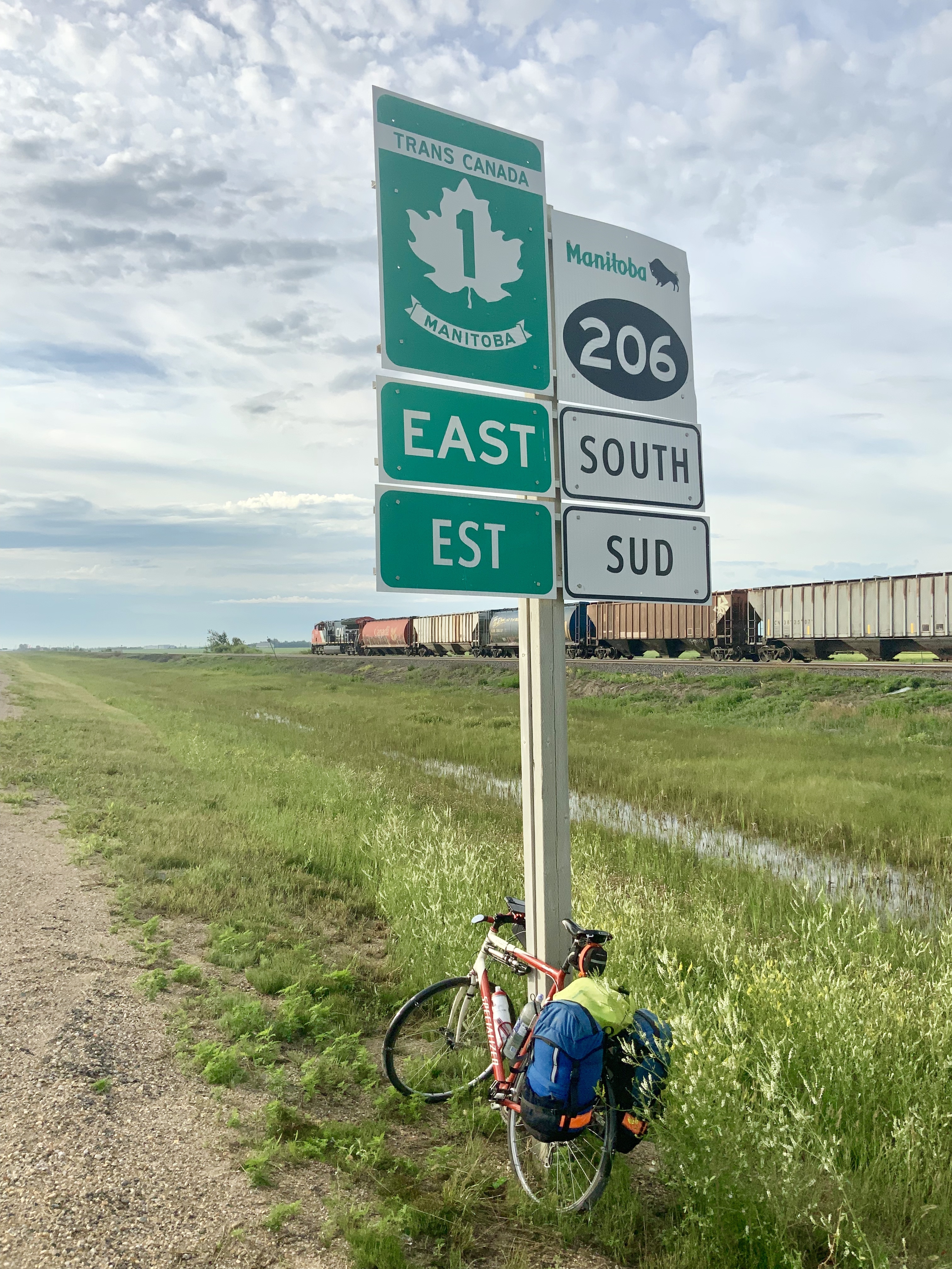
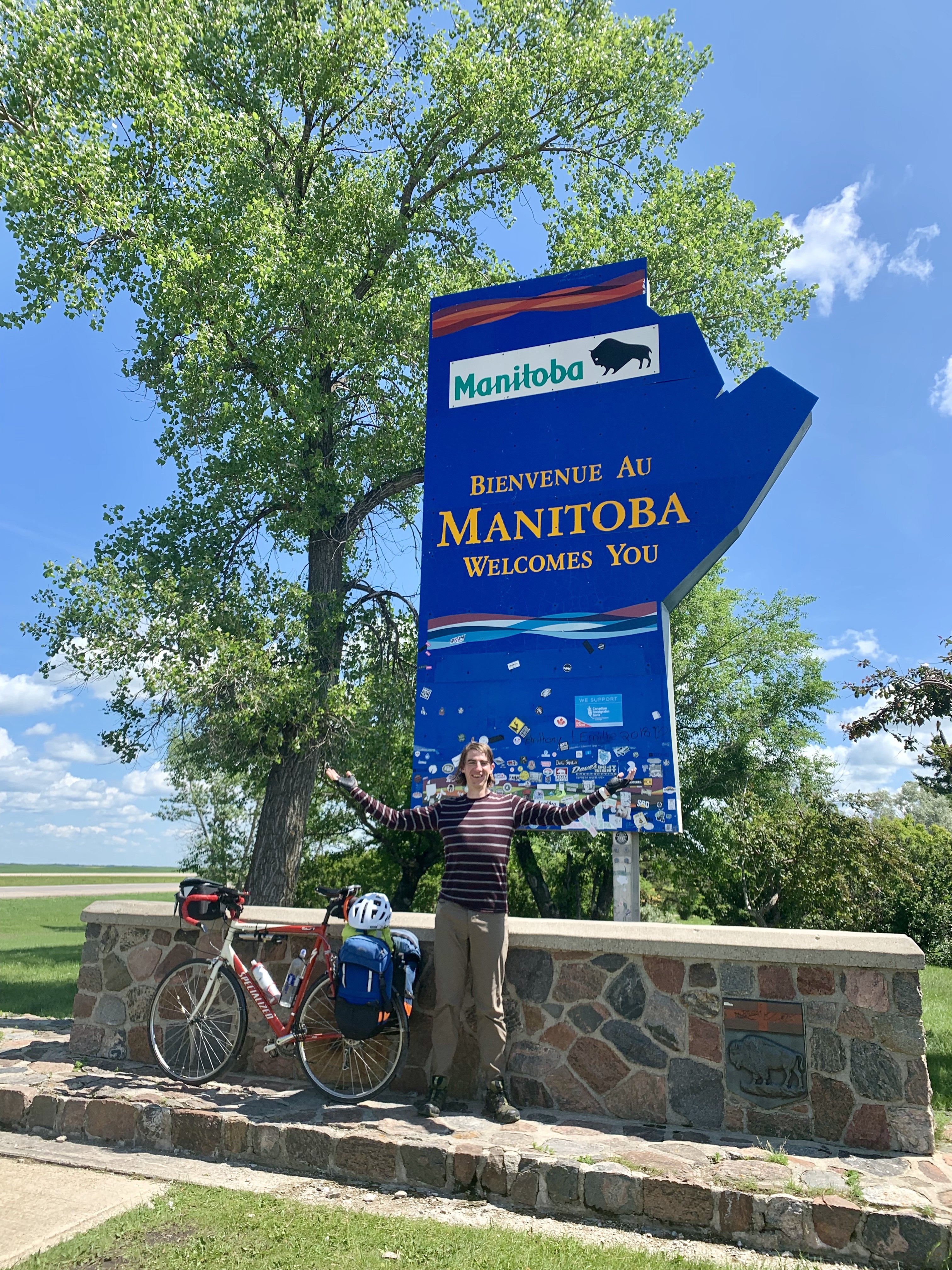
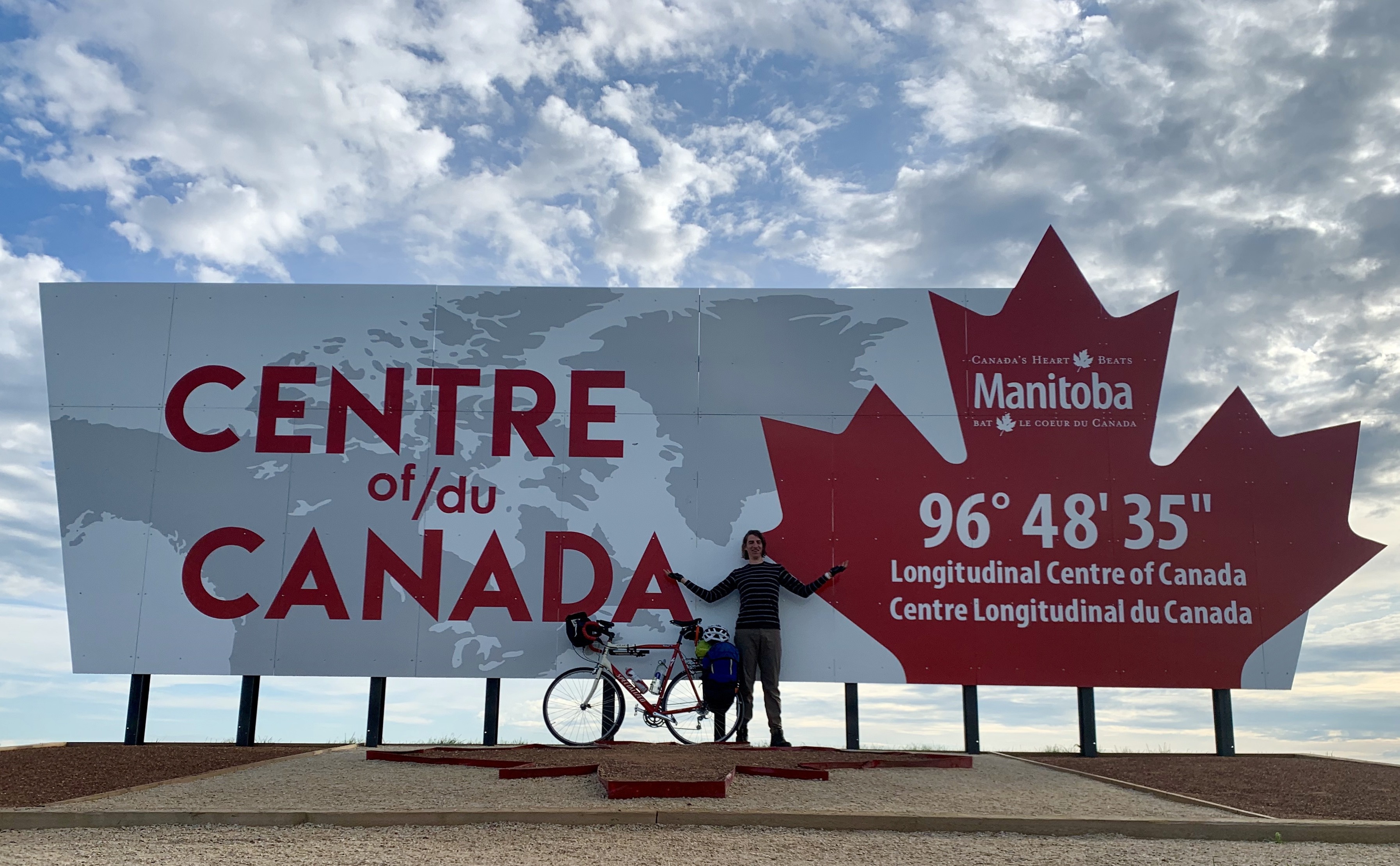
Just after taking my picture at the centre of Canada, an Apple Maps car drove by, so maybe my crossing can now be independantly verified?

    After passing the centre of Canada I stopped at a fruit stand where I loaded up on blueberries and nectarines. The seller knew I was travelling by bicycle and offered me special deals so I didn’t have to buy a whole basket of nectarines. They were so yummy to snack on while riding today.

    I also stopped at Geppetto’s, where you can get an Aidirondack Burger for $289.00. It’s a regular bacon cheeseburger that comes with a side of Adirondack chair. They hadn’t yet opened when I arrived, but Sandy who runs the snack shack opened early so I could get a milkshake. I stopped here with my family two years ago on a vacation, which led to me having to clean cotton-candy-ice-cream-coloured throw up of a car seat. Fortunately history did not repeat itself this trip. 
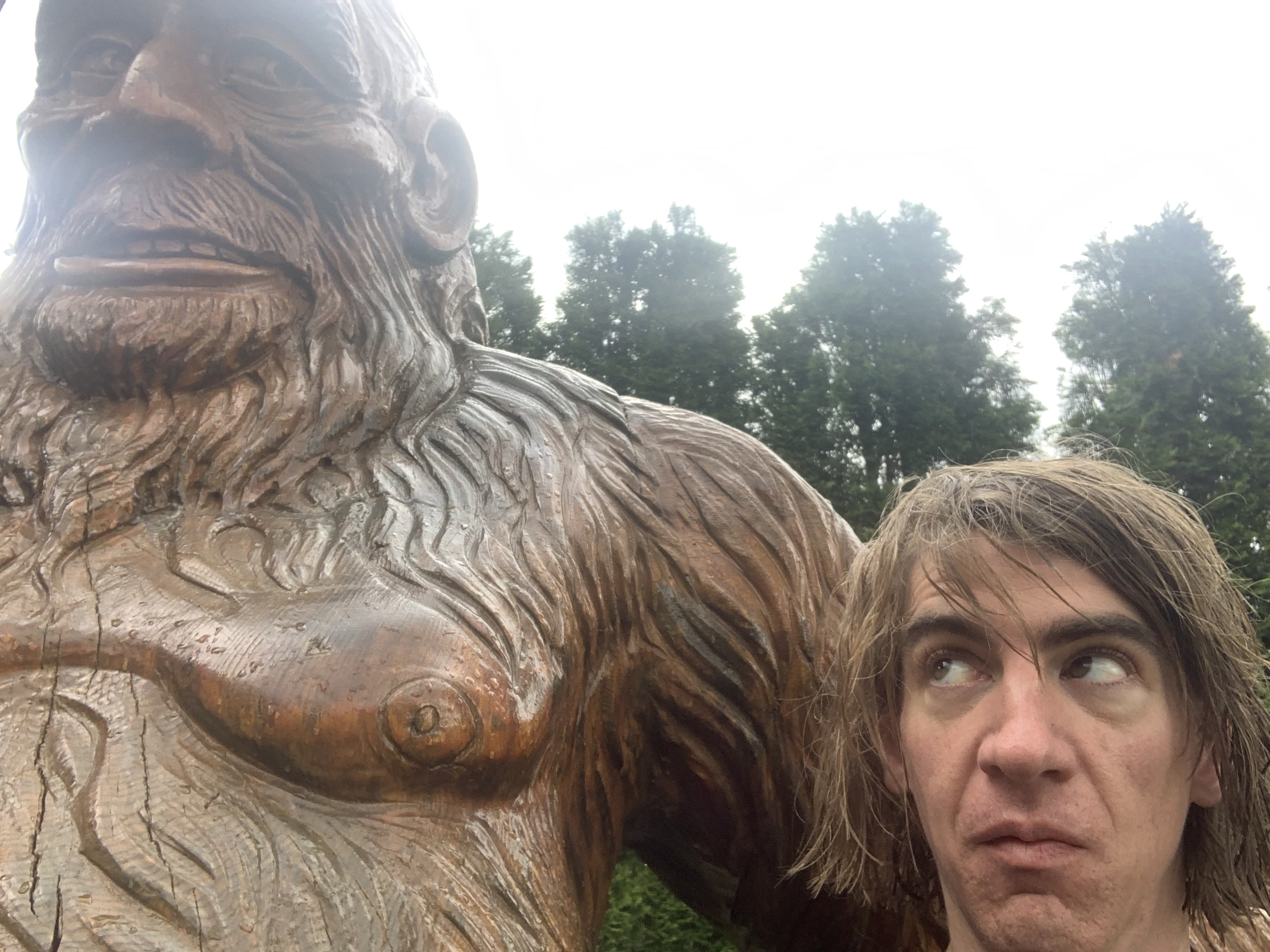
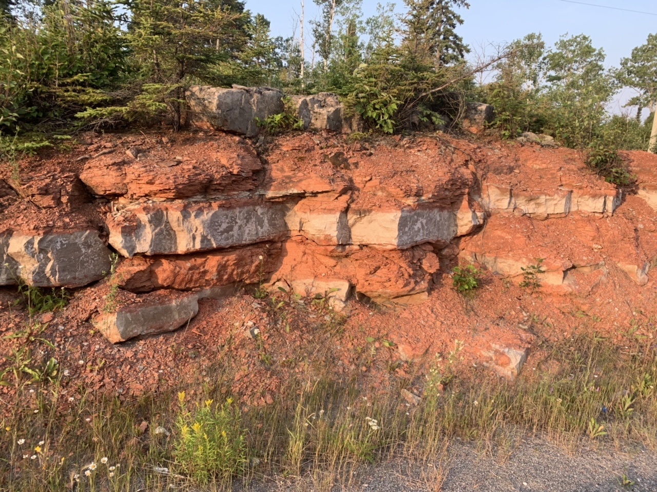
I’m not sure the labels help.

    I made it to Falcon Lake Manitoba in Whiteshell Provincial Park around 3:30. This was where I had planned to camp originally, but looking at the forecast I figured I could make it to my aunt and uncle’s in Kenora if I pushed on, so I called my aunt El who said to come on over. I had a coffee and hamburger at the Falcon’s Nest Cafe to give me the energy to keep going, then hit the road again. Shortly after I hit the Canadian Shield and the Ontario border, both of which filled me with excitement. Something strange seems to have happened to Ontario’s motto since I was last here. Nothing a little photoshop can’t fix, though. 
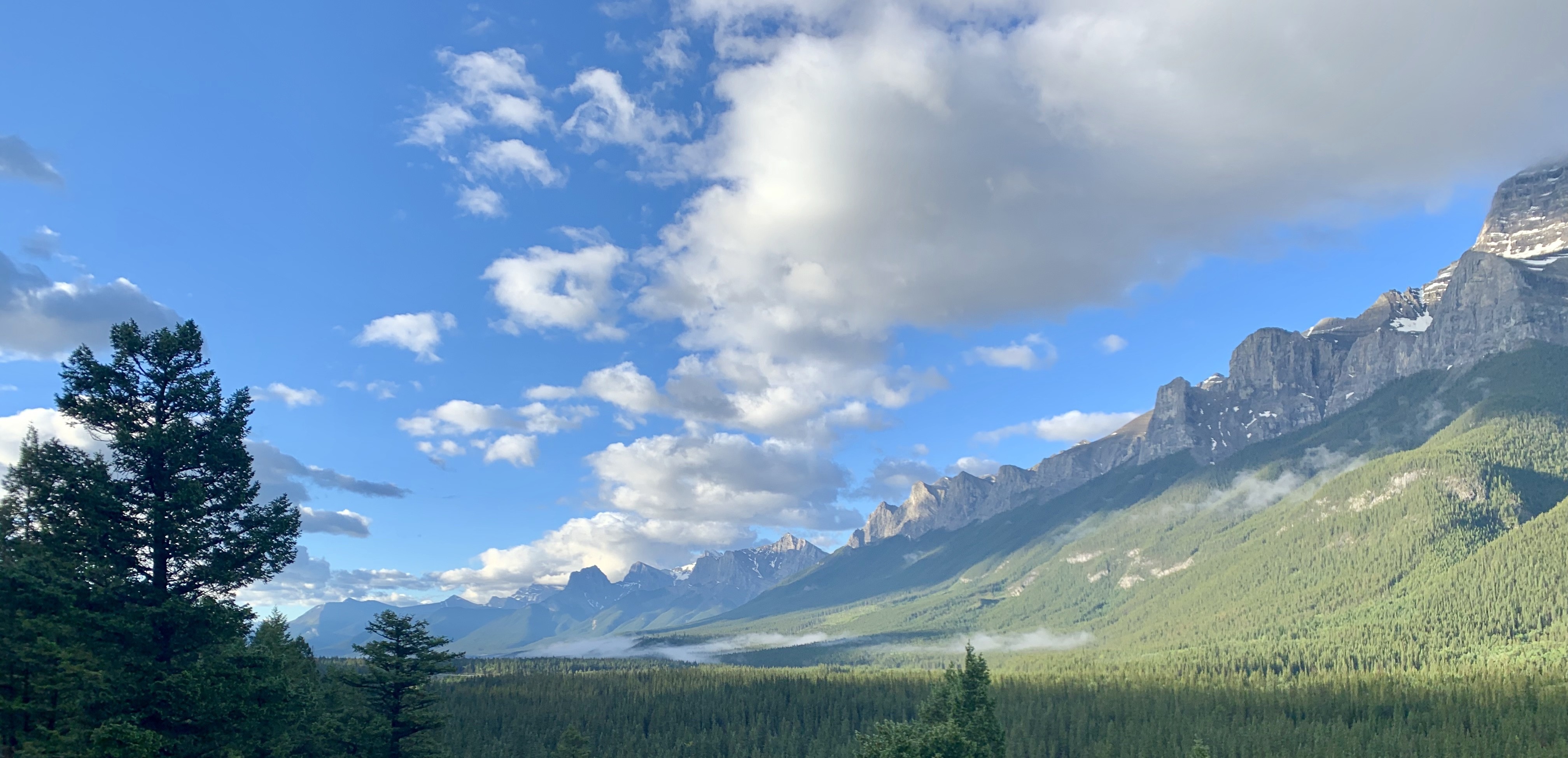
Just look at that granite.

    After a few more hours of riding I made it to Kenora, and took my picture with Husky the Muskie, my favourite of all of Canada’s oversized highway mascots. My uncle picked me up at their dock and took me to their cabin on Johnson Island, where I had a second dinner of fresh pickerel and veggies. It’s like staying at a resort. I’ll be here for at least a couple nights, seeing my cousins and meeting their kids. Tomorrow will be a chance to do some errands, and have the local bike shop take a look at my rear wheel (as I’m having trouble keeping it in true). Also to go for some boat rides, and swim off the end of the dock. I can already tell it’ll be a highlight of my trip.
    Did you know that Kenora is a portmanteau of Keewatin, Norman, and Rat Portage, three towns that amalgamated in 1905? 
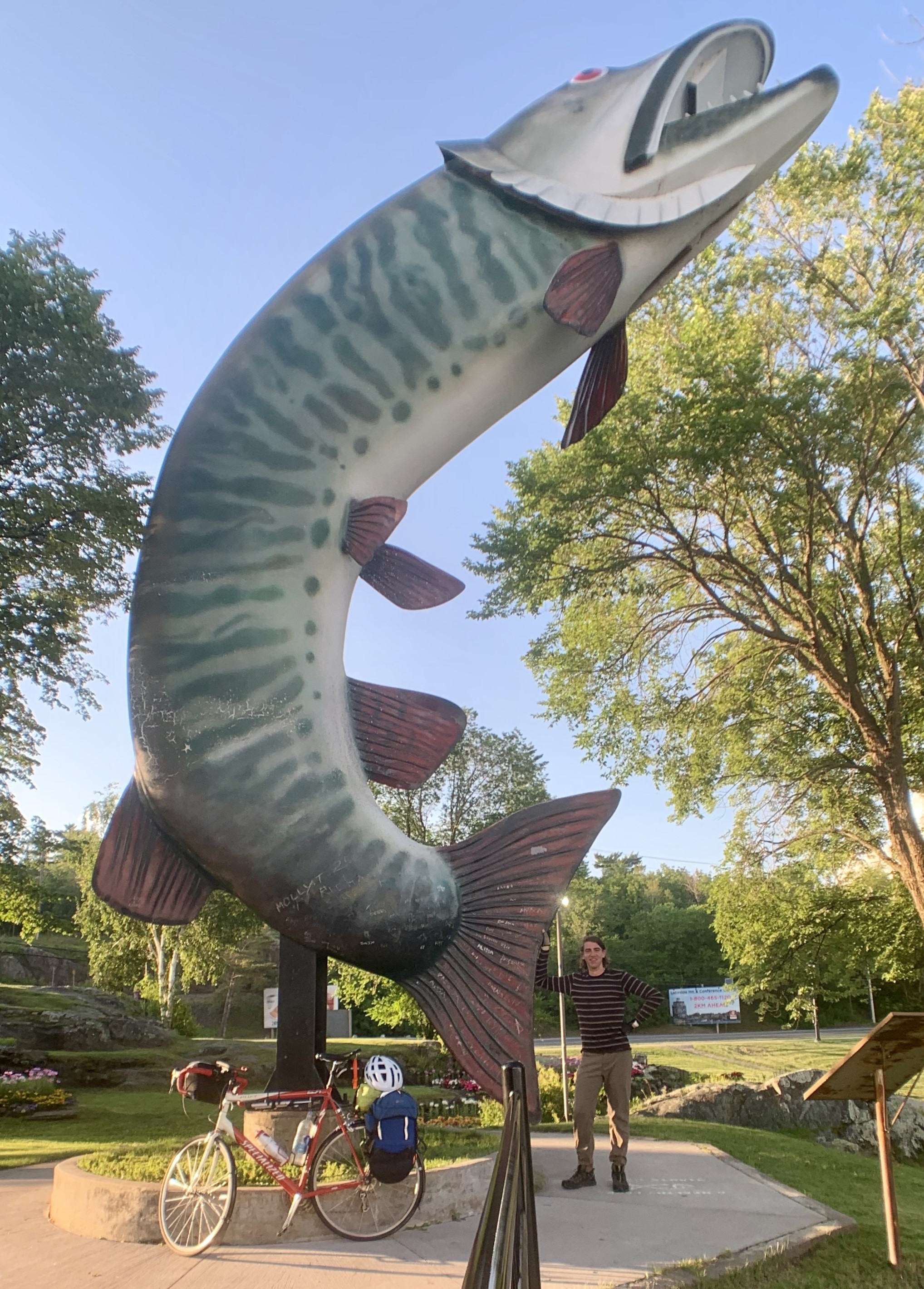
You should have seen the one that got away.

    Total Distance: 218 km (new personal record!) Cumulative Distance: 3123 km

    → 10:44 PM, Jul 19
  • A place to stand, a place to grow Ontari-ari-ari-o! Excited to be back in the Canadian Shield, home to many adventures of my youth.

    → 7:18 PM, Jul 18
  • Biking Across Canada Day 27—Rest Day in Winnipeg: A Fork in the Road

    Justin, Daphne, and Brooke were getting ready to spend the weekend at a cabin, so I helped out where I could before they left me and Lucy the cat behind. We’d spent the previous day getting to know each other. Justin went to grad school with my friend Jillian from Halifax. Turns out we both had a shared background working in radio. Justin worked at one of the radio stations that I’d distributed material to when I worked at the Canadian Press. We were able to bond over our experience dealing with Paul Harvey’s daily transmissions.

    After they left I headed downtown for some sightseeing and errands. For a place that owes its founding to rivers, it hasn’t done a good job making them accessible. I spent a good amount of the time walking near the Assiniboine without being able to see it, since the banks are blocked off by private residences. The street next to it was nice to walk along, though, with a well-used path in the middle of a wide boulevard with decent amenities for cyclists and pedestrians.

    Free books and air
    Lots of water stations for people and dogs.

    I walked around the legislature and forks before meeting Kevin at the Little Brown Jug brewery. 

    The Manitoba Legislature
    Human Rights Museum

    Kevin’s a transit planner and friend of Henry Lau from Saskatoon who’s working on revamping and modernizing Winnipeg’s transit network. Kevin brought along his toddler son Leopold in a stroller, and took me on a walking tour of downtown Winnipeg and Saint Boniface (Winnipeg’s historic francophone district). 

    This boutique hotel provides bikes for guests
    City Hall 
    Failed teleporter trip

    If you ever want to learn a city’s pedestrian failings, go for a walk with a planner dad who regularly pushes a stroller. I loved it, as I’d made many similar observations in the past during my times as a stay-at-home dad.

    This bike lane is nice, but ends in conflict.
    New protected bike lane in progress
    Pro tip: don’t go this way if you’re expecting to get anywhere, especially if you’re using wheels.

    Later, Kevin invited me back to his house for a bbq with the neighbours featuring local bison burgers and many fresh vegetables (the vegetables are much appreciated on a trip like mine). Afterwards, I took the bus back to Justin and Daphne’s, getting to try out the city’s bus rapid transit corridors along the way. I’ll be off the bike for a few days after this, attending a work conference in Tampa, Florida. I’m looking forward to it, getting to give a couple presentations, and seeing friends I’ve made from previous conferences. It’ll be a good vacation from my vacation.

    Nice branding on the barriers at the BRT station.

    Today’s Distance: 0 km

    Cumulative Distance: 2906 km

    → 1:17 PM, Jul 18
  • Biking Across Canada Day 25—Oak Lake to Portage la Prairie: Sun Dogs and the Portage of the Prairies

    Wheat Kings will always be my favourite campfire sing-along song (Cat Steven’s Trouble would be my second if I could ever convince someone to play it). Listening to Wheat Kings today while riding across Manitoba brought tears to my eyes. I guess I’m still not over Gord’s death.

    My wife and I joke that campgrounds are usually placed on land that no one wants because they’re right next to:

    1. a highway
    2. a railway
    3. both

    Oak Lake’s campground was firmly in 3 territory, but it’s hard to complain—seeing those locomotives close up in the middle of the night was thrilling, even if it did disrupt my sleep. They’re surprisingly hard to photograph.

    My attempt to take a picture of a nighttime train did not work.

    I got up before dawn because of timezone change confusion, but was treated to the sight of sun dogs (parhelia) shortly afterwards.

    I somehow missed my exit for Brandon, but that was serendipitous as the next exit followed the Assiniboine River valley—longer but far more scenic than the direct 1A. I stopped for coffee at a cafe that hid a skin clinic inside. I suspect the dermatologist running the place wanted better coffee than the neighbourhood offered so opened his own coffee shop rather than waiting for the block to gentrify itself.

    The river valley. Beats a busy highway.
    Brandon’s railyard

    I could tell the prairies were slowly changing over to Canadian Shield today, as I encountered hills and deciduous forests today.

    I wasn’t sure where I was going to stay tonight, but had been laying the groundwork over the past two days to possibly reach Portage la Prairie, which for reasons I cannot explain some part of me wants to see. Today the winds were favourable, so mid-afternoon I splurged and booked an AirBNB that would be a good base to explore from. I was zooming down the highway, easily sustaining speeds over 30 kph, leaving behind those troubles between Saskatoon and Regina. It felt so good, like anything was possible, and I let my heartrate race a little once I knew I’d make it. I arrived at 5pm exactly. Easiest 185 km ever.

    Where I’m staying tonight. Built in 1913.

    My host, Beverly, made me a bowl of (yummy!) homemade Mennonite zumma borscht along with cheese and cookies, and also gave me some bread and toppings to make toast for breakfast. I already had a comfy bed, room to dry out my sleeping bag and tent, and good wifi to do a video call with my kids, so this was icing on the cake.

    After dinner and FaceTime I went for a walk around the downtown area.

    The provincial building was a nice contrast to the small prairie houses nearby.
    A graveyard without bodies

    It was nice to see the Via Rail station from outside of the train, even though it looks abandoned. Even nicer was discovering the historic CPR station across the tracks, now operating as an interpretive site. Via, you should arrange to use that place instead, especially considering how infrequent your service is these days.

    There were some nice historic buildings, including the courthouse and city hall to see, though the charm and symmetry of city hall’s facade has been wrecked by garish strands of red Christmas lights and a bizarrely-bolted-on digital clock. They need to hire a better lighting designer, and find a better way to tell time.

    The courthouse
    City hall (& sign)

    The high heat and humidity brought about thunderstorm conditions, so I headed back to my room. Walking along Crescent Lake I spotted a double rainbow. Combined with the rainbow paint on the pathway it made for the elusive triple rainbow.

    Today’s Distance: 185 km

    Cumulative Distance: 2823 km

    → 10:20 AM, Jul 12
  • Biking Across Canada Day 24—Broadview SK to Oak Lake MB—Trains, Planes & Automobiles

    Okay, border crossings are an event.

    Today was a mostly uneventful day. Riding along the Trans-Canada means more chances to stop for coffee, but less scenery and wildlife.

    A typical view: highway on one side, railway on the other, scenery beyond.

    I spent a lot of time riding along the CP railway, seeing large trains pass me by. Outside Whitewood SK I stopped at the rodeo grounds because I had to make one of those dreaded calls to customer service. While I was on hold I saw a familiar sight—one of those cropduster planes that gave me the North-by-Northwest treatment outside Kyle. I could tell it was landing taking off and landing nearby, and sure enough I spotted the runway further down the highway.

    Restocking on fuel and fertilizer

    When I got to Wapella (I can only assume the name is an anglicization of the nearby Qu'Appelle River) I was ready for a stop to refuel and write a blog post. Google directed me to the Home Town Cafe, but it took a few rides by before I spotted the door. Inside was a place with long tables and homestyle breakfast. I had a nice chat with a retired fellow about his e-bike that he'll ride around town (the first of two I'd have today).

    The unassuming entrance

    When I stopped at the Manitoba border I had a nice chat with Diane and Ed, two teachers from Minneapolis exploring western Canada by motorcycle. We took each other's pictures with the Welcome to Manitoba sign, then ran into each other further down the highway at the tourism bureau. "Do you have a motor on that thing?" Ed joked at our reunion.

    Entering Manitoba meant switching to Daylight Savings Time for the second time this year (since Saskatchewan smartly abstains from the whole system). Maybe that's why I was grumpy when I got to Virden, where the traffic and poor roads made riding difficult. At the Co-op they were having a celebration of their local hockey team, with a free bbq and cake. Uncharacteristically, I turned down the free food because I didn't want to wait in line. I just wanted to get out of town. I also needed to by fuel for my stove, but in my haste I bought the wrong type which left a smelly soot all over my pot at dinner time. That grumpiness lasted a while.

    Once I got settled into my tent in Oak Lake I could watch horse riders practicing across the field. It's hot tonight—the first time I've gone to sleep without crawling into my sleeping bag first.

    Today's Distance: 161 km

    Cumulative Distance: 2638 km

    → 1:06 PM, Jul 11
  • Goodbye, Saskatchewan. Hello, Manitoba!

    → 4:44 PM, Jul 10
  • Biking Across Canada Day 23—Regina to Broadview: Blame it on the Grain

    This title doesn't make sense, but I couldn't resist the joke.

    Most of the hosts I stay with feel obligated to get up early to see me off. Tony is the first person that I've gotten up early for. He likes to start work in the summer at 6am so he can take a mid-morning break to go swimming for an hour. Tony was up and cooking blueberry pancakes before I even woke up. We were out the door and riding bikes together before 6 am.

    Tony in his garden

    I was glad to get an extra-early start as the highway out of Regina had frequent on- and off-ramps to cross that would not have been fun in rush hour. After an hour-or-so of riding, traffic quieted down and for a four-lane divided highway was actually quite pleasant. With the wide shoulders and uninterrupted periods, I could have read a book while riding if I wanted.

    Lots of small marshes by the highway

    I made it to Indian Head mid-morning, and stopped at the Indian Head bakery for coffee and a cinnamon bun (it was good!). Indian Head had a display of old farming equipment, and a scenic grain elevator next to the modern one.

    A train passed by in the distance, giving me an easy chance to count the cars: three engines pulling 110 cars. That's roughly two kilometres long!

    Off in the distance I spotted a shape in the shoulder, too small to be a car. Another cyclist? It turned out to be a hiker. His name is Bradley, originally from Airdrie, AB, and he's been walking the roads for over a year after having a spiritual awakening. He's circled around western Canada, Montana, California, and Oregon, relying mainly on providence for food and shelter as he's trying to avoid using money. We chatted for a few minutes, then wished each other a safe journey.

    Windmills and canola

    I stopped in Broadview for the night. It started to rain during dinner, and since I was the only person at the campground I ate in the bathroom, which was surprisingly nice inside, warm and roomy with a comfy plastic muskoka chair to sit in. It was actually preferable to the picnic table outside.

    Home for the night

    I should hit Manitoba tomorrow (Wednesday).

    Today's Distance: 153 km

    Cumulative Distance: 2477 km

    → 12:54 PM, Jul 10
  • Biking Across Canada Day 22—Rest Day in Regina: R v Kyle (2019)

    I spent the day wandering around Regina, seeing the city by foot.

    City Hall
    City Hall’s parking garage manages to conceal all the cars contained within
    These penny-farthing bike racks are large enough for a bike and trail-a-bike or trailer.

    I walked downtown for breakfast, stopping at Victoria Park and City Hall on the way. I was impressed by Regina’s tree planting program. The boulevards have trees of various size, planted decades apart—a sign the city is proactively preparing for the older trees to die, ensuring they’ll have ones ready to replace them in the canopy. Too often cities have a monoculture of trees all planted at the same time, and when one dies it can be devastating for the neighbourhood as it will be decades before that shade is restored.

    I wandered over to the Cathedral Village neighbourhood in search of a recommended donut shop that makes Saskatoon-berry donuts. Sadly the shop was closed, but there was lots of public art and independent shops that made the journey worthwhile.

    There were multiple sculptures like this, each unique and double-sided.

    Later I walked over to the warehouse district where there were a few craft breweries to try: District and Rebellion. The surprise highlight was the Rebellion’s Michelada, a spiced shandy mixing their Cerveza lager with a locally-made vegan clamato. The taproom at Rebellion was fun, with great music (lots of Smiths and R.E.M. deep cuts) and a couple iconic pinball machines.

    Regina has a lot going for it, but the experience is frequently marred by poor pedestrian treatment: mandatory beg buttons to cross (even downtown during the day), occluded and broken sidewalks, and being generally SOL whereever construction happens.

    I did a lot of walking on the road today when the sidewalks would disappear.
    Good luck getting by with a wheelchair or stroller
    No safe place to wait once you cross here
    Broken sidewalk

    There are still nice touches while walking if you look for them.

    Pleasant vegetation surrounded this sidewalk
    I liked the cap over the mechanical area on top of this apartment tower.

    I stopped at 241 Pizza for a slice to balance out the beer, and the gentleman working the cash gave me a free slice. I can’t figure out if it was because I was patient, polite, or friendly to the patron asking for money, but it was a nice gesture all the same.

    I took a tour of the legislature, which is a real beauty. Apparatnly designed for a much-higher-populated Saskatchewan that has happened yet, it has a spacious design beautiful marble everywhere. In a nice touch, there are three busts of iconic premiers in the lobby with an empty fourth pedestal waiting for the first woman or indigenous leader.

    Someday, hopefully soon, this will be completed

    There was a small art gallery in the basement that had captivating paintings of immigrant women by Madhu Kumar. I wish I could have spent more time as their stories and portraits were fascinating, but I arrived just before closing and had to leave.

    The park around the legislature and Wascana Lake was gorgeous. Lots of well-used pathways and gardens.

    Tony and I went to Ruby’s Kitchen for dinner, a small Pakistani restaurant housed in a community centre of some some sort. The food was wonderful. I’m still thinking about that okra dish. Tony’s a triathlete, does a lot of backcountry camping, and has spent vacations bicycling around Cuba. There was no shortage of good conversation to be had. It was a great day.

    Today’s Distance: 0 km

    Cumulative Distance: 2324 km

    → 2:20 PM, Jul 9
  • Biking Across Canada Day 21—Craik to Regina: One Strong Wind

    The garage band in Saskatoon did a nice cover of Four Strong Winds. I experienced one of them today.

    I had a dilemma when I went to bed last night. I knew I'd have another full day of headwinds, so I had to choose between getting an early start, or getting a full night's sleep. I opted for the latter, knowing that sleep is the best performance-enhancing drug. So I woke up today at 6:30, hitting the road around 7:45. I was able to have a phone call with my kids while packing up which was great.

    I shared a campsite with this apartment building

    As I was leaving I noticed another bicycle tourist was staying at the campground. He or she was still sleeping, so I didn't get a chance to chat with them.

    This giant percolator in the middle of nowhere made my day, bringing me out of a funk.

    Once again the winds kept me crawling along at around 13–15kph, which often dropped to 10kph once you include all the breaks I needed. Once again I had to keep challenging myself to make it to the next town and reevaluate how far I could get today. I stopped for ice cream at Twisted Sisters in Chamberlain where I met some nice women who played bridge with someone I knew in Saskatoon. They, like half of Saskatoon, where on their way back from seeing the Roughriders game in Regina last night.

    My version of a lion and bright

    Low on supplies, I turned into Bethune to raid the grocery store, only to find it closed on Sundays. Fortunately there was a tavern in town that I hid from the sun in and had a tasty burger. Feeling much better after that, I hit the road. It was late afternoon, and I was doubting my ability to make to Regina on schedule, but I could feel the wind start to change. I hit 20kph for the first time! Woo!

    As I reached Lumsden and the Qu'Appelle River valley I had a chance to get off the divided highway, so I took it. I could see a thunderstorm off in the distance heading my way (bringing that change in winds), so I picked up the pace and made it to town just before the heavy rains came (not before the lightning, though—that was a thrill). Though it’s been a difficult two days of riding, I’ve learned that I can stick to my schedule even when the world (or just the wind) is against me.

    Storm coming from the southwest

    I'm staying with Tony tonight, brother of Henry Lau from Saskatoon. Tomorrow I'll taking another rest day to see what Regina is all about.

    I was thrilled to see this sign. Wish I could have stopped to get a selfie, but the lightning told me no.

    Today's Distance: 128 (tough) km

    Cumulative Distance: 2324 km

    Can you spot the river valley?
    → 12:51 PM, Jul 8
  • Biking Across Canada Day 19: Runnin' Round in Saskatoon

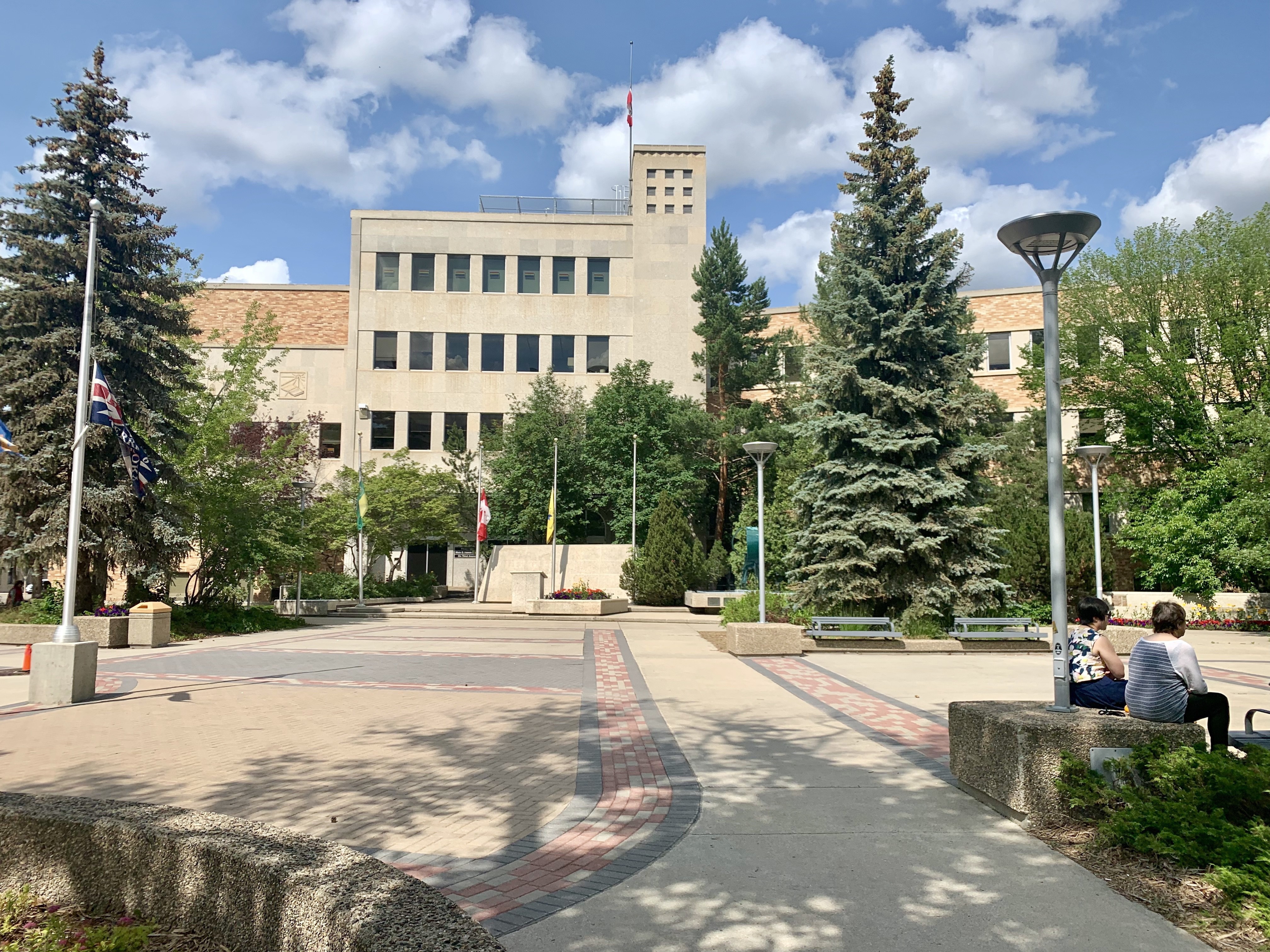
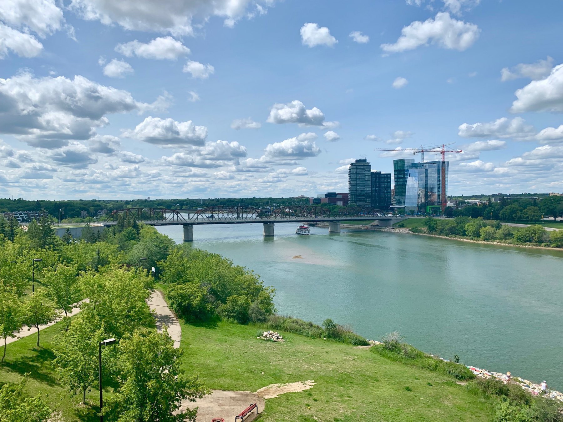
    Today was filled with guided tours of Saskatoon. So many I had to delay writing a blog post because the day was so packed.
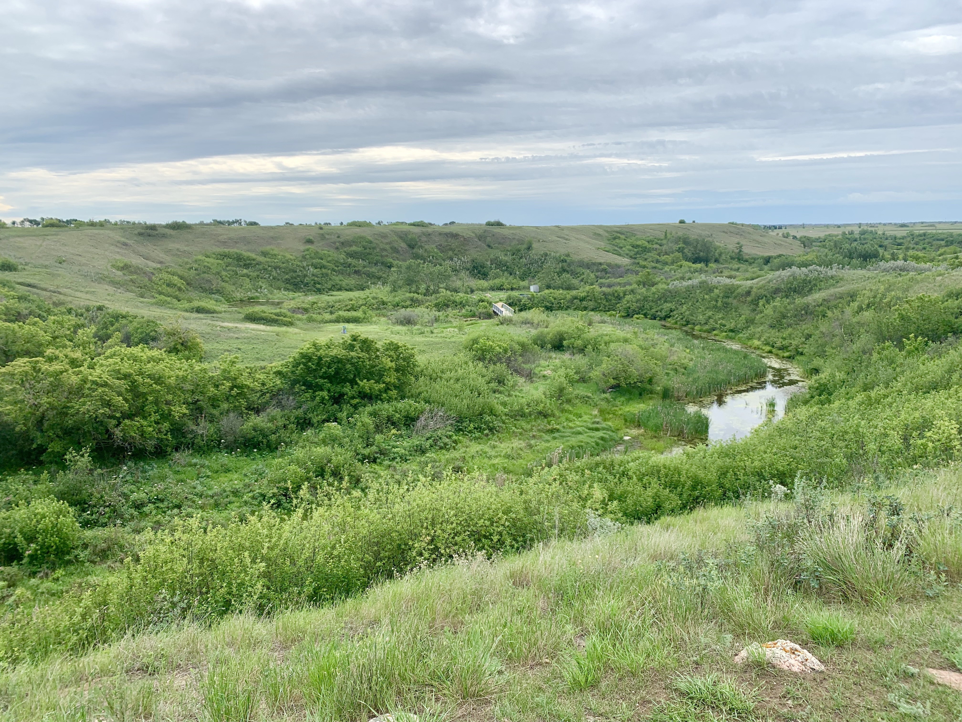
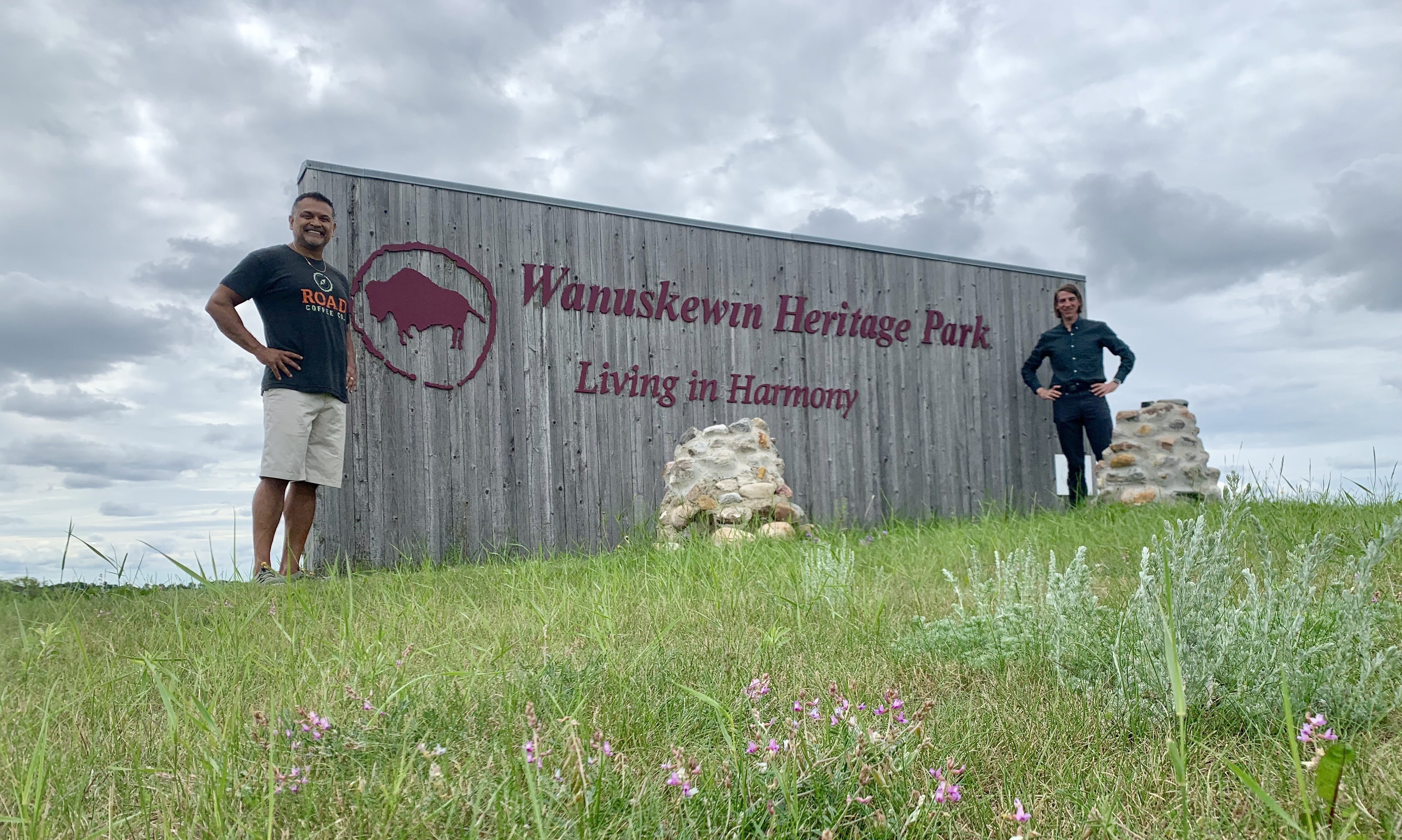
    After a delicious breakfast of over-easy eggs on buttered toast, Theresa drove me over to Sask Polytechnic, where I’d arranged an early-morning tour of their medical simulation centre (as I work at a similar place in Halifax). Kara and Audrey there were very welcoming, and showed me around their facilities. It’s heartening to know they’re struggling with the same interprofessional challenges we are.


    View from the control room

    Once the tour was done I texted Sanj, and he came to pick me up to go to Wanuskewin Heritage Park, a site of major archeological site that is applying for UNESCO World Heritage status. It has six kilometres of beautiful hiking trails where you can learn how indigenous peoples lived thousands of years ago.

    Sanj knew I was interested in bicycle infrastructure, and since he’s the type of person who knows everyone, he suggested we have lunch with his friend Henry Lau, who we met for dim sum. Henry’s an architect and artist who designed a lot of Saskatoon’s street furniture with an eye towards placemaking. He was heavily involved when they replaced the city’s thousands of parking meters with pay-and-display systems, and was able to show them that it was cheaper to adapt the old posts into proper bicycle parking racks than it would be to remove them. Halifax is about to go through a similar process, though I’m unsure whether they will make the same decisions Saskatoon did. Photo: Henry Lau
    Henry with one of his creations
    These double as a place to eat or to sit. Note the cupholder and place to hang a bag. 
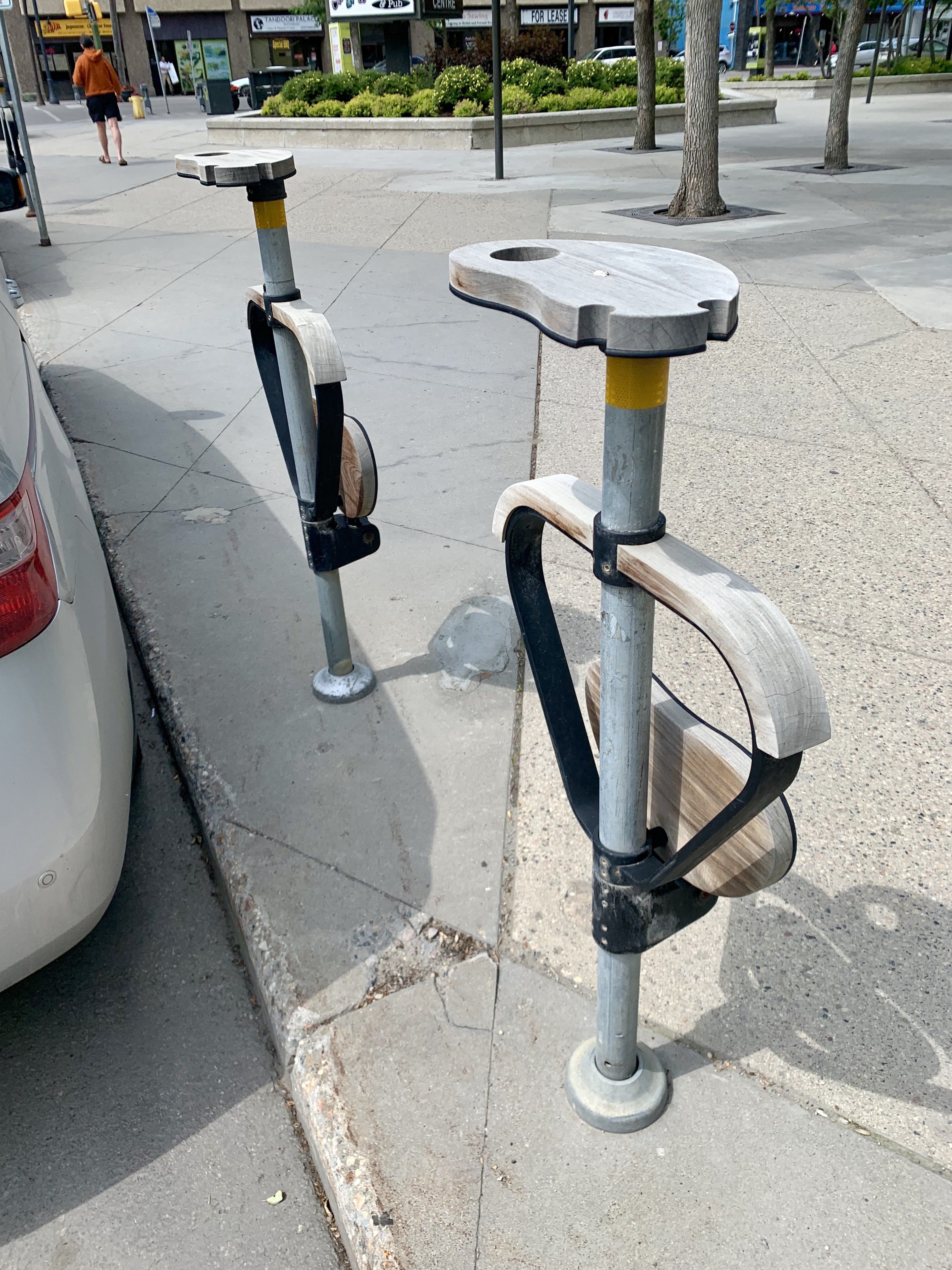
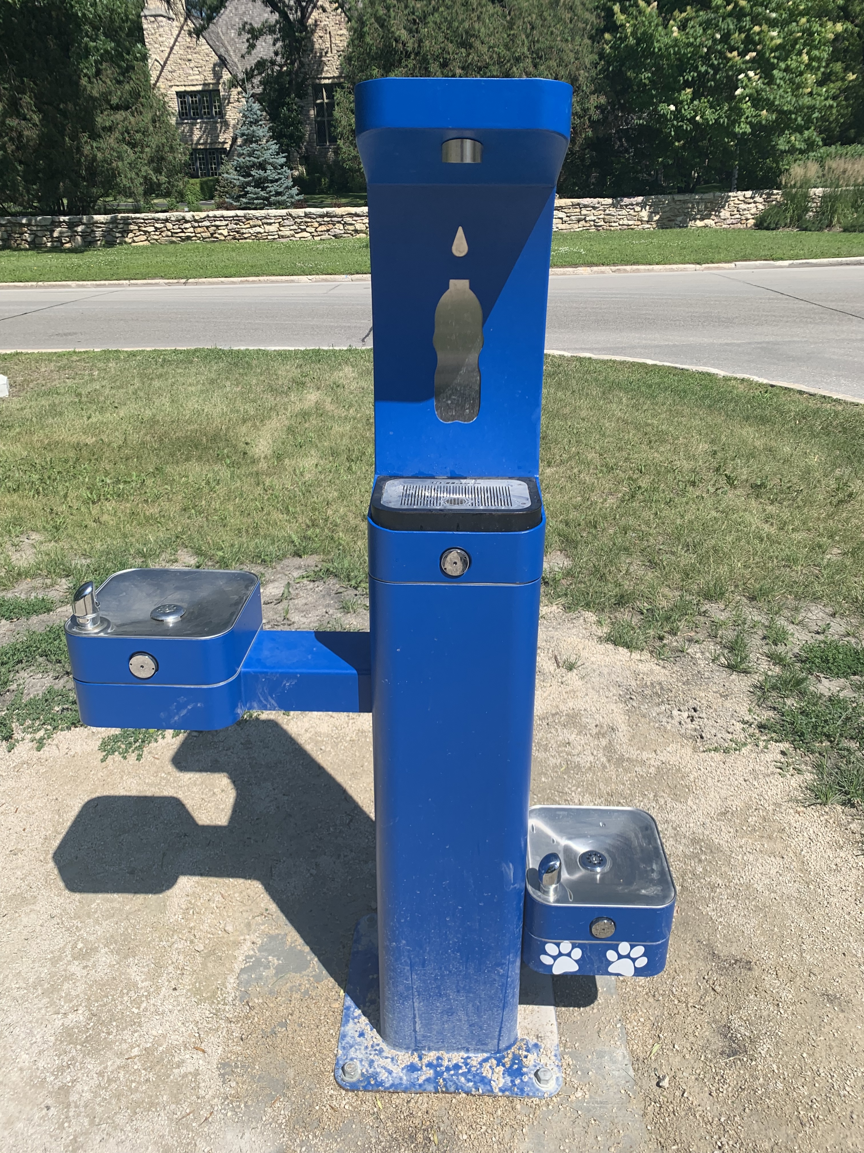
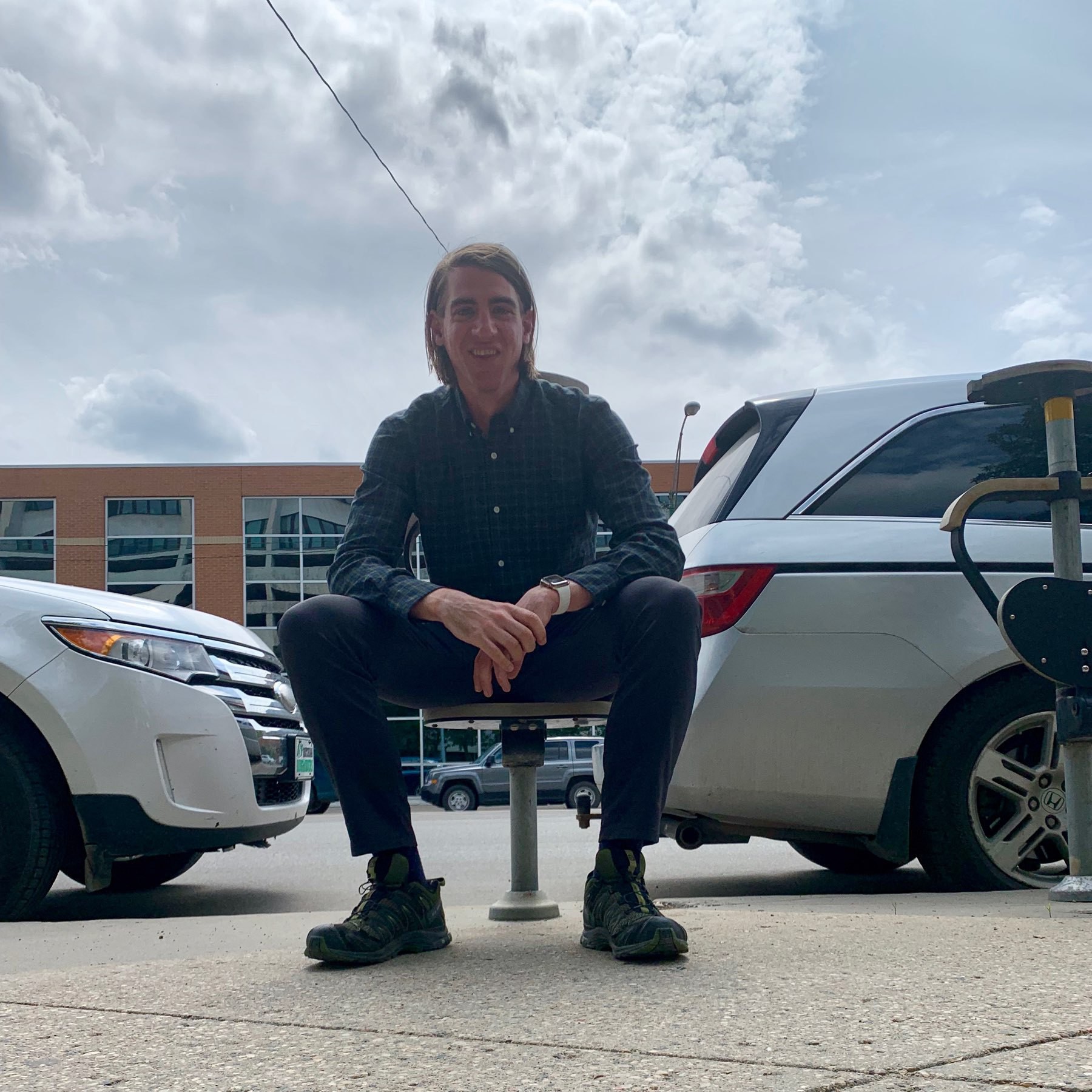
Henry designed these bike repair stands with foot pumps since many lack the strength to operate traditional floor pumps.

    We had such a wonderful conversation that Henry offered to take me around town to see his work. We jumped into his pickup truck, and I was amazed at the thought that went into his work. A lot of effort was put into designing infrastructure that incorporated local history, and would be useful in multiple situations by people of all walks of life. 
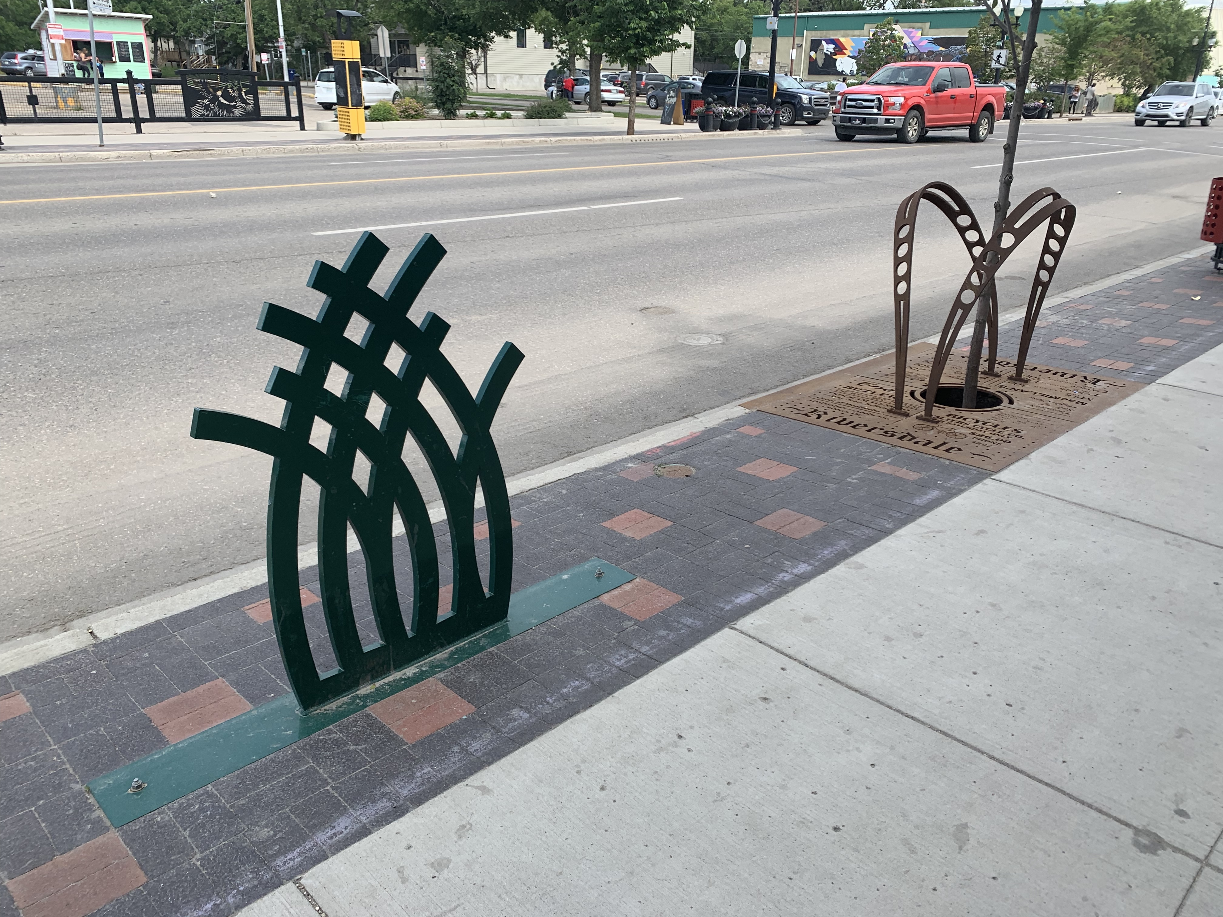
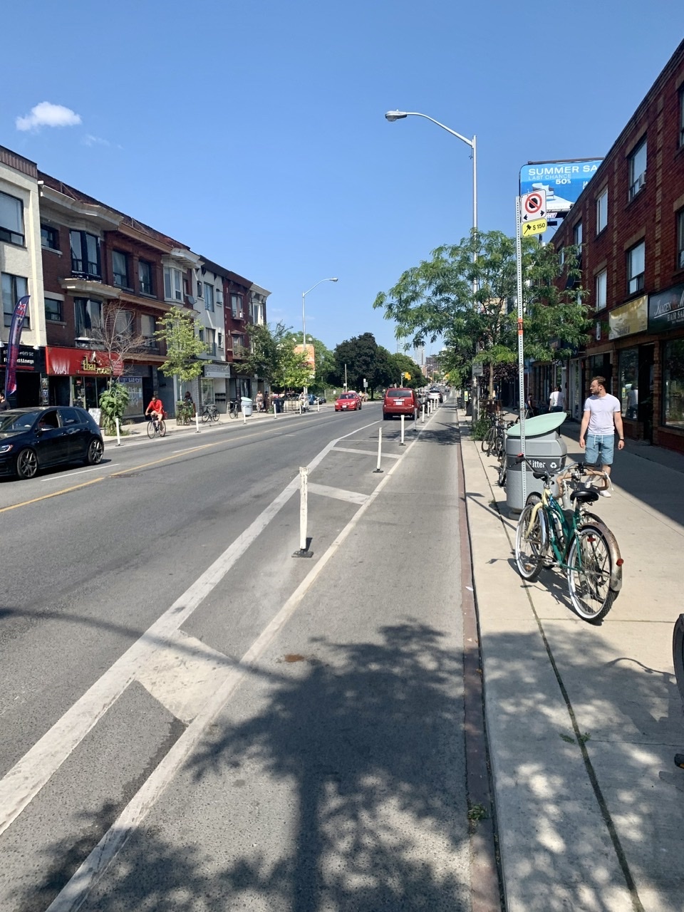
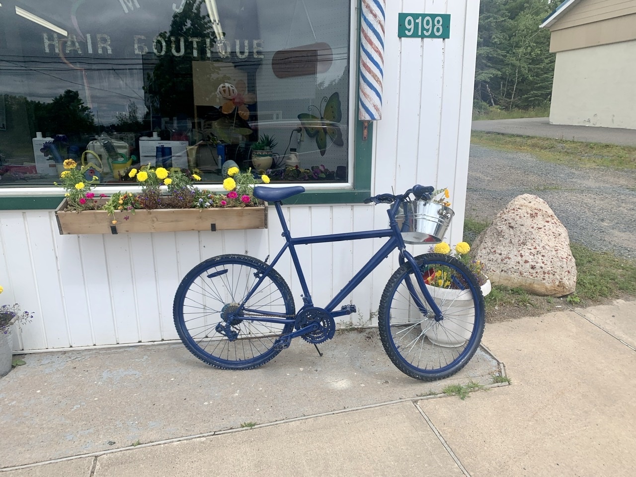
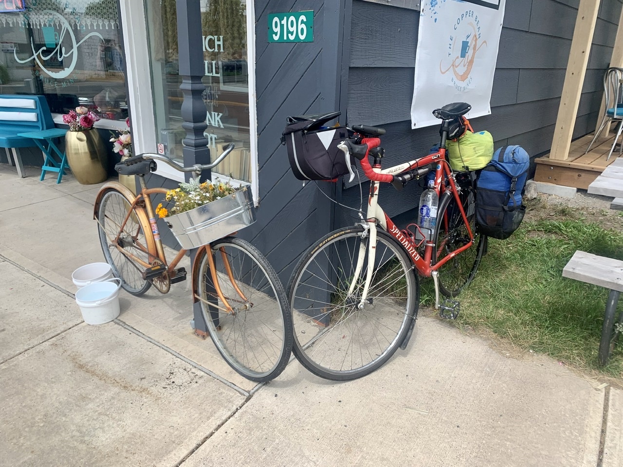
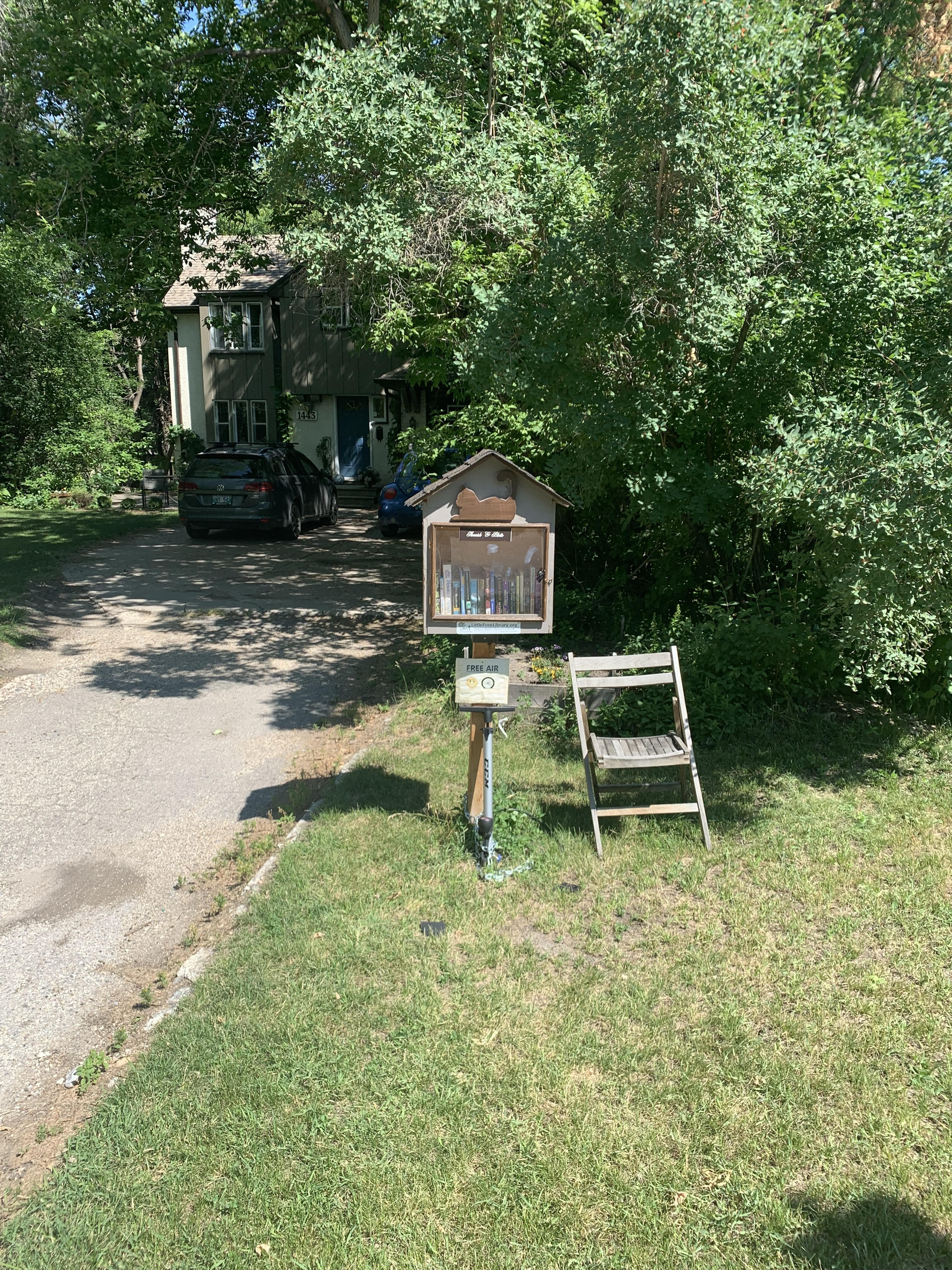
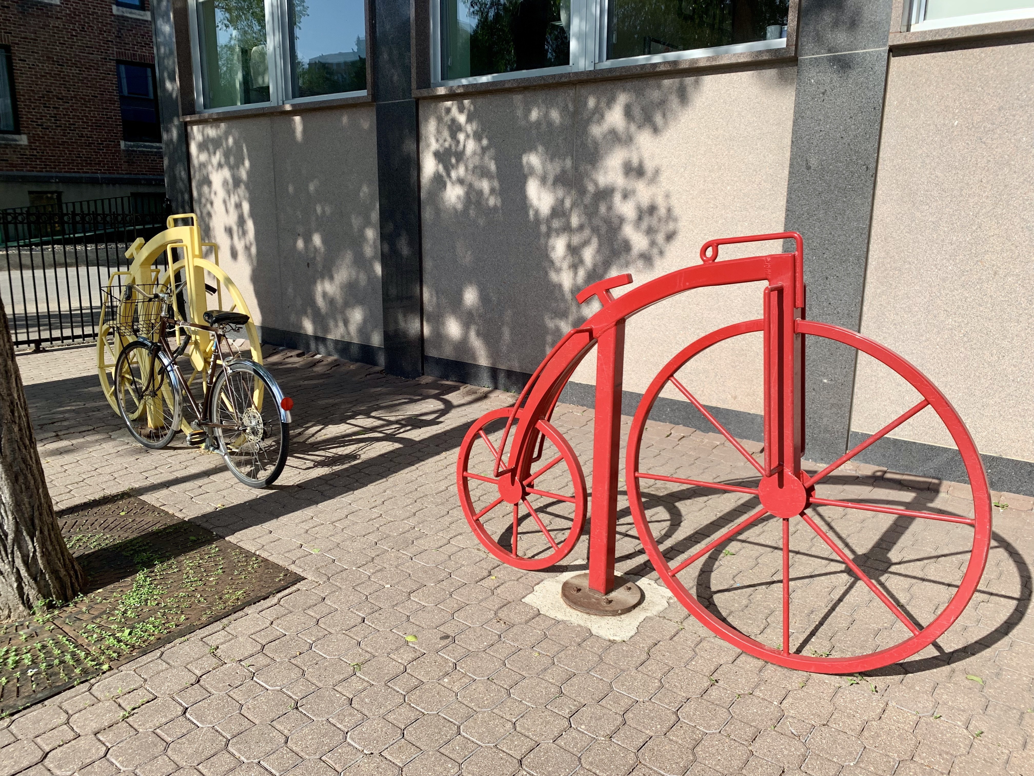
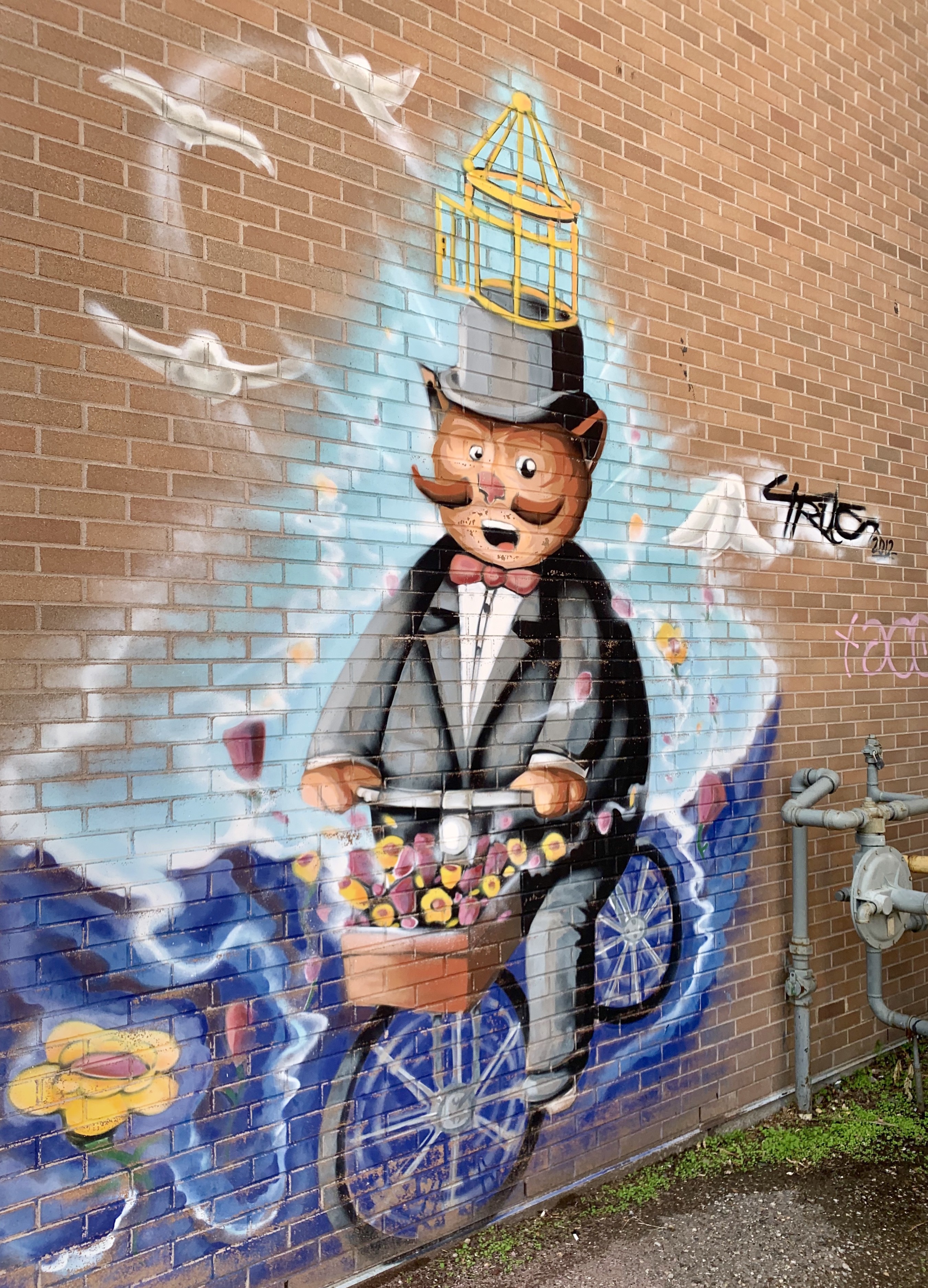
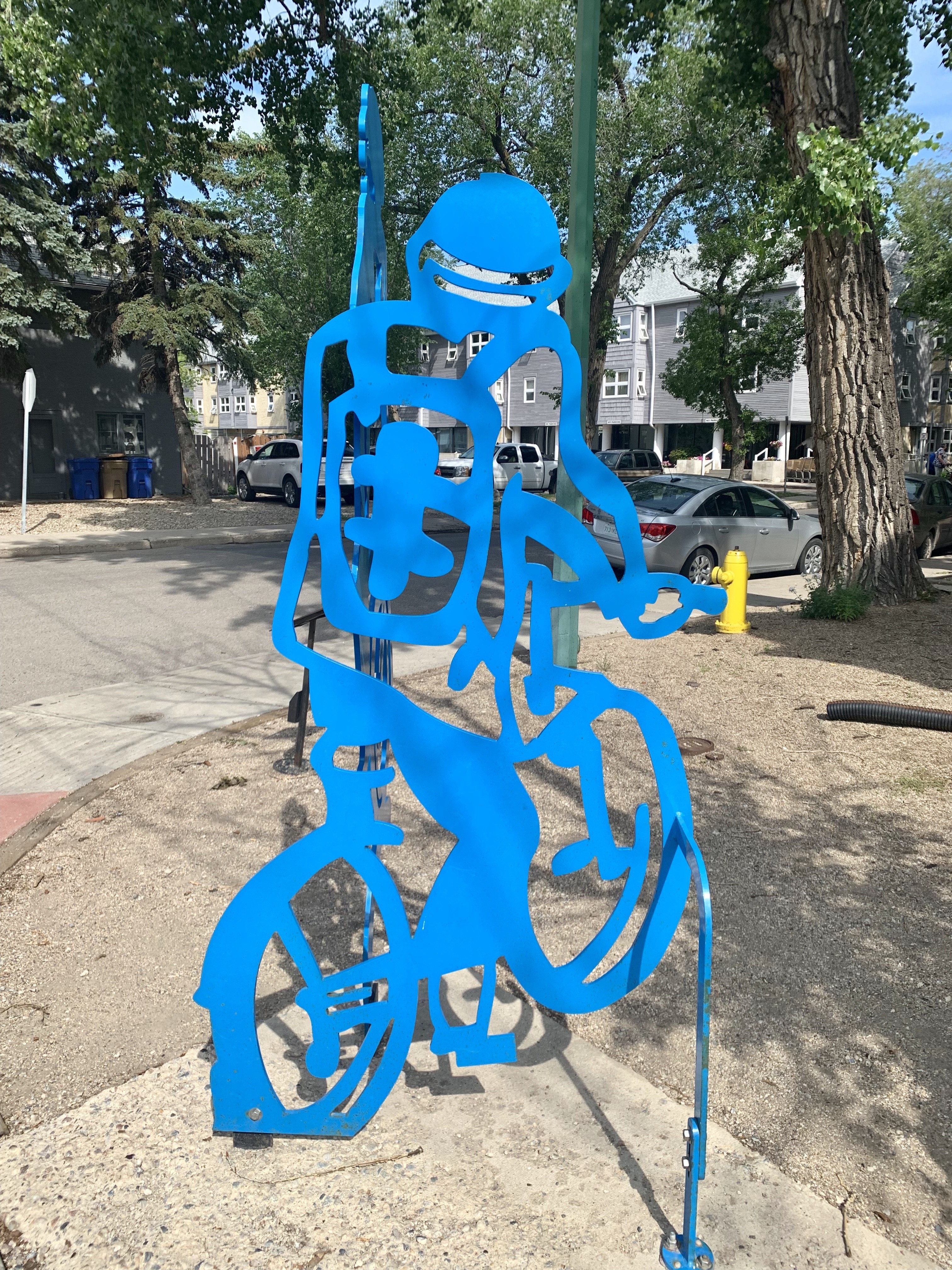
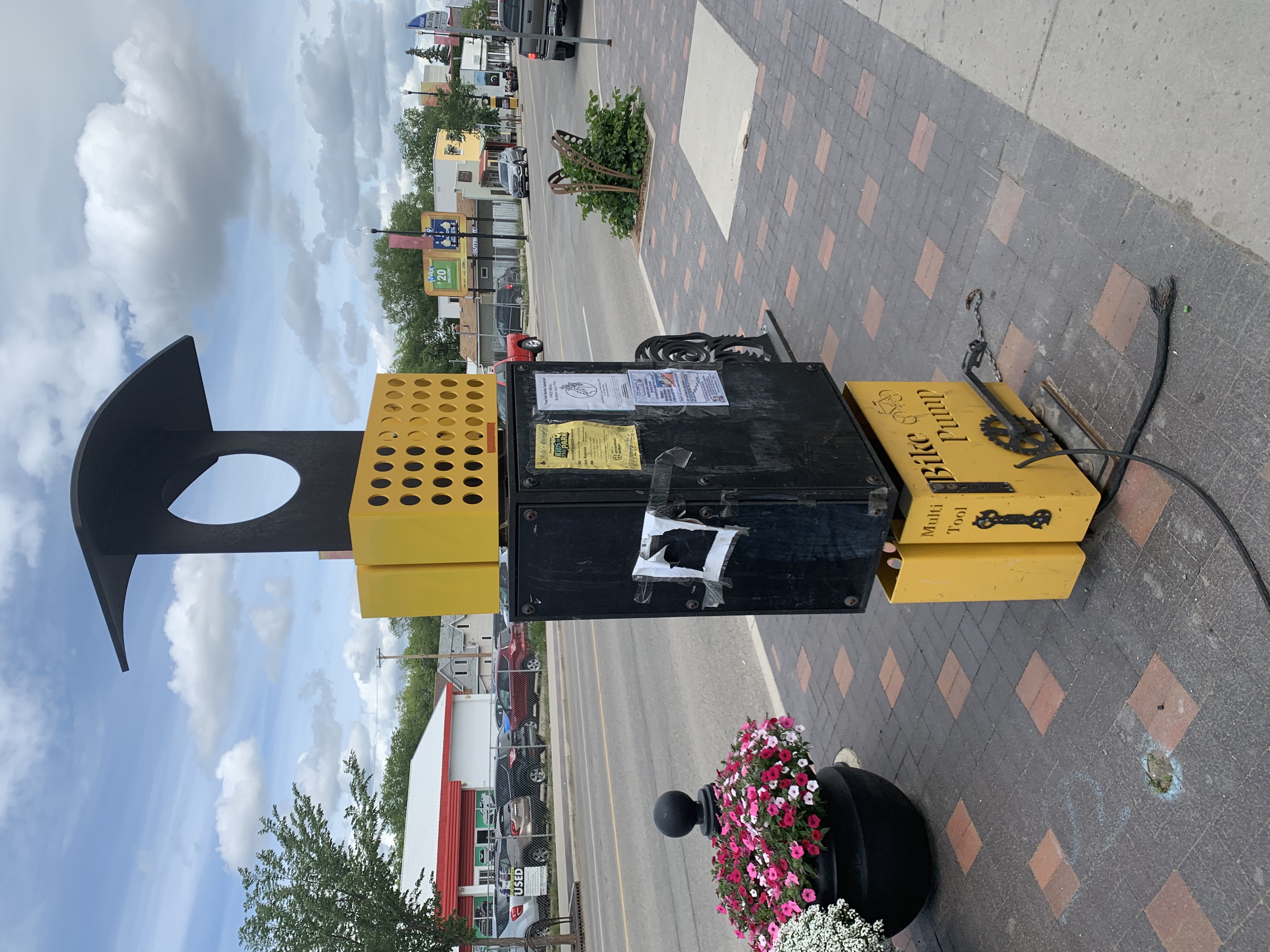
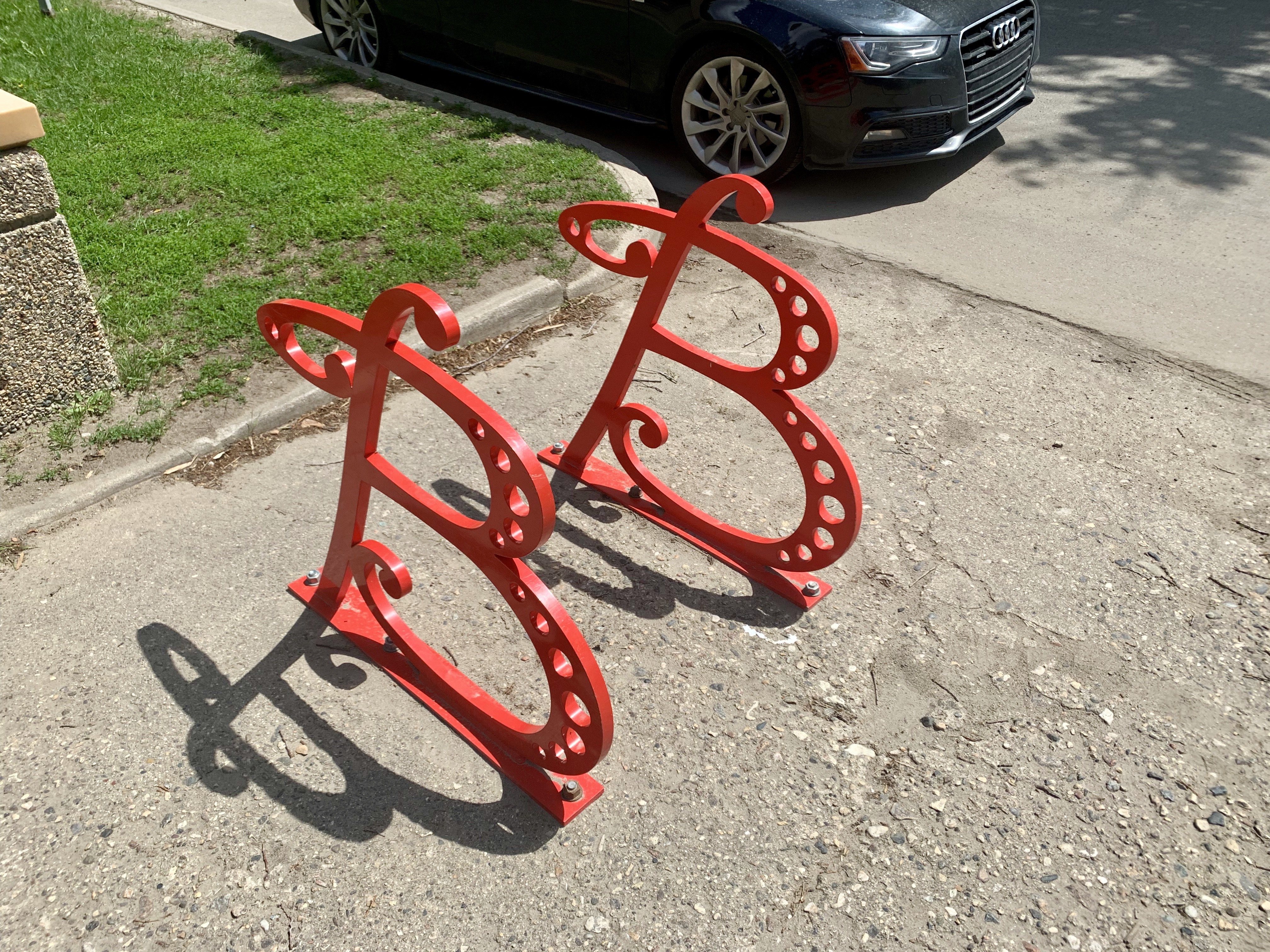
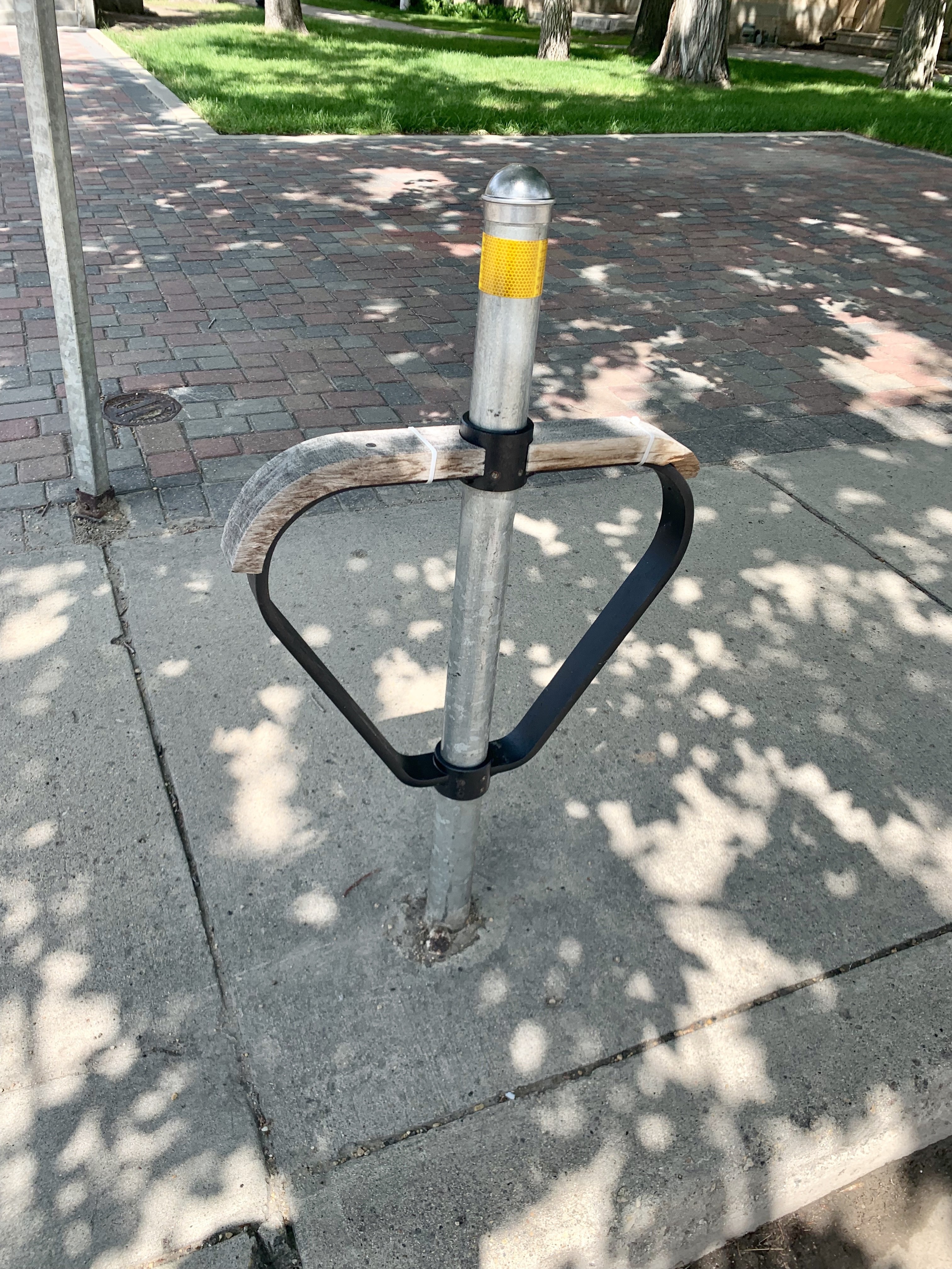
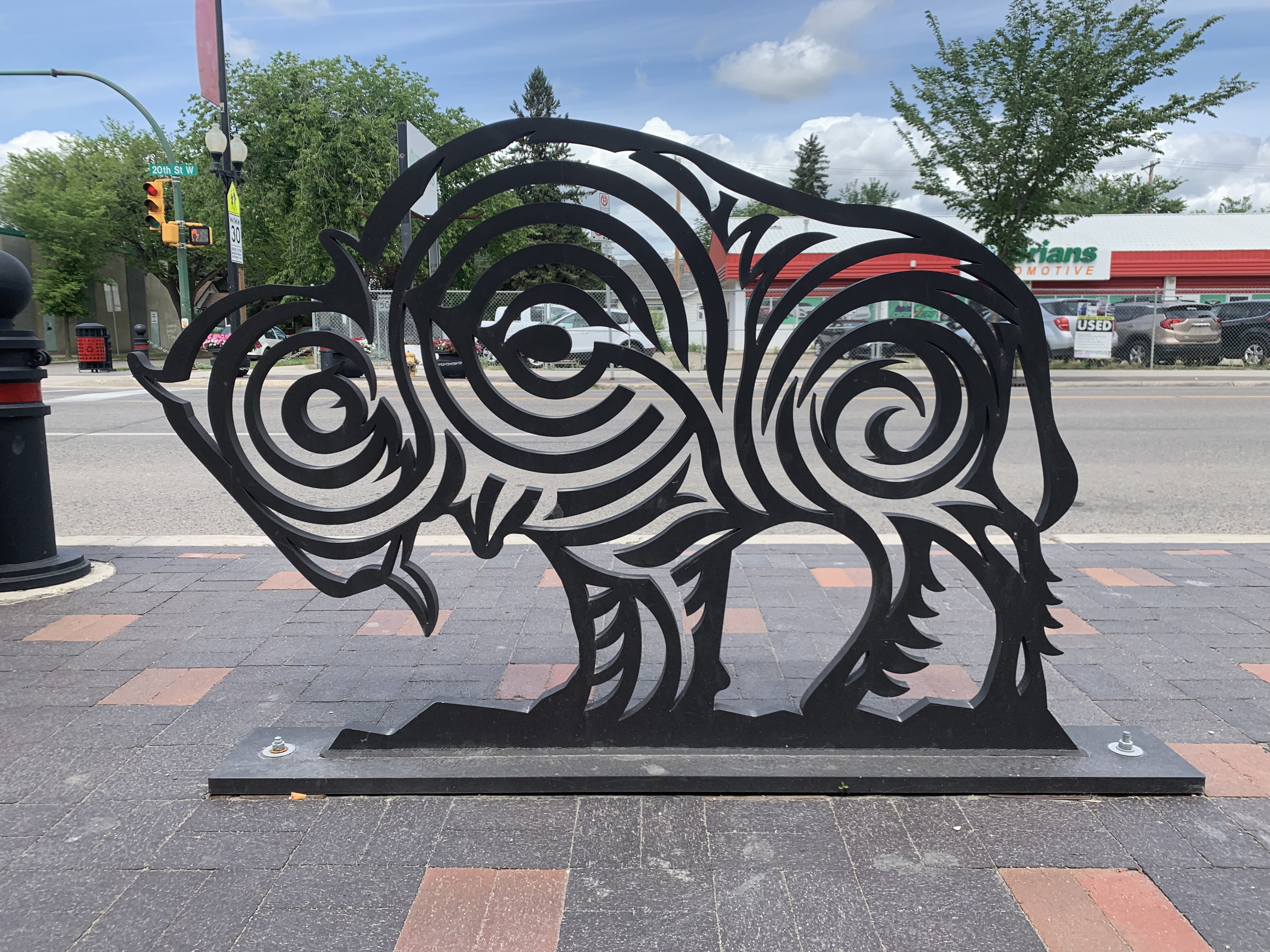
I have more examples of creative bicycle parking than I can fit in this post. 
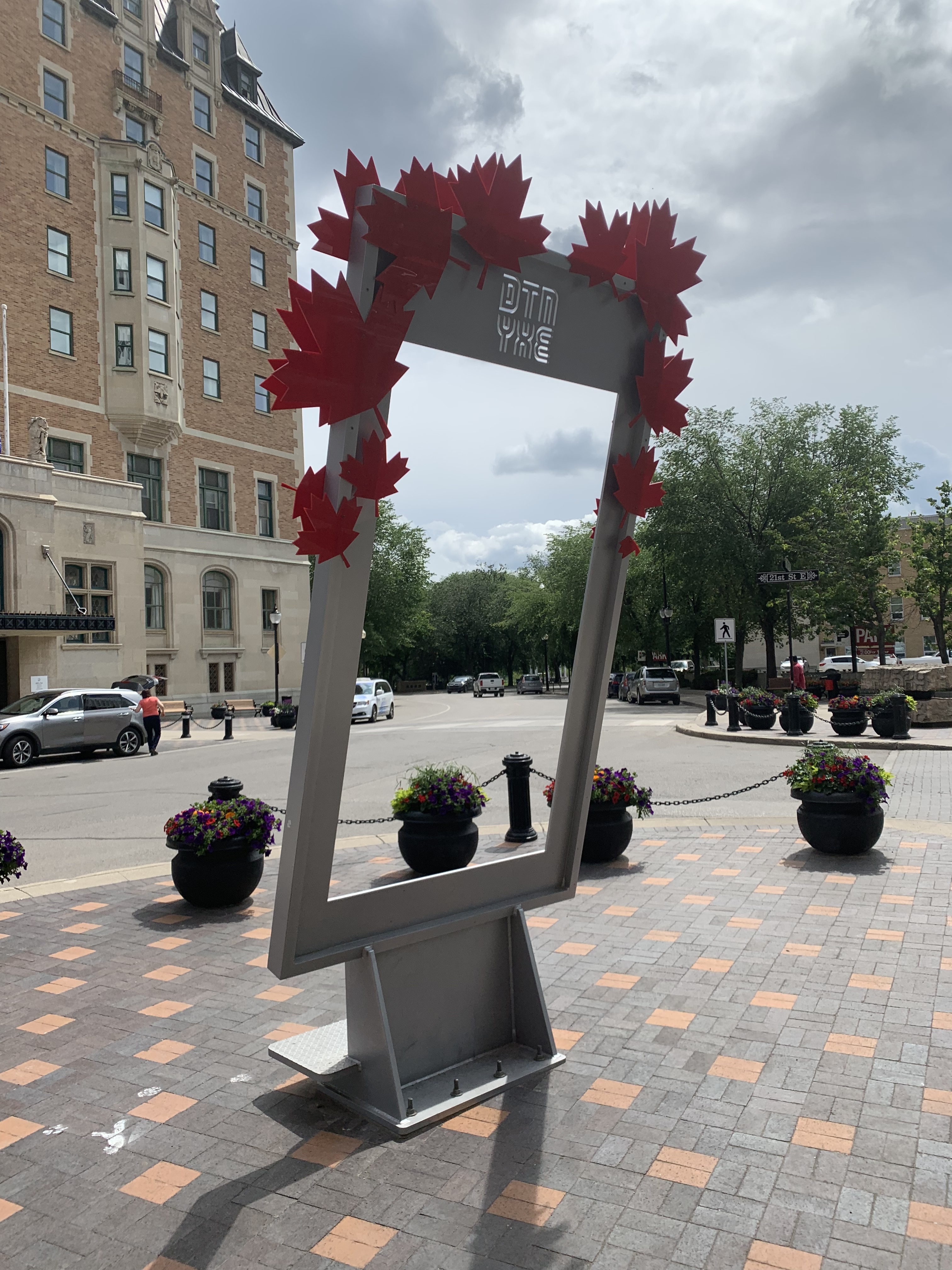
Henry had this selfie frame designed and built in a few weeks for Canada 150 
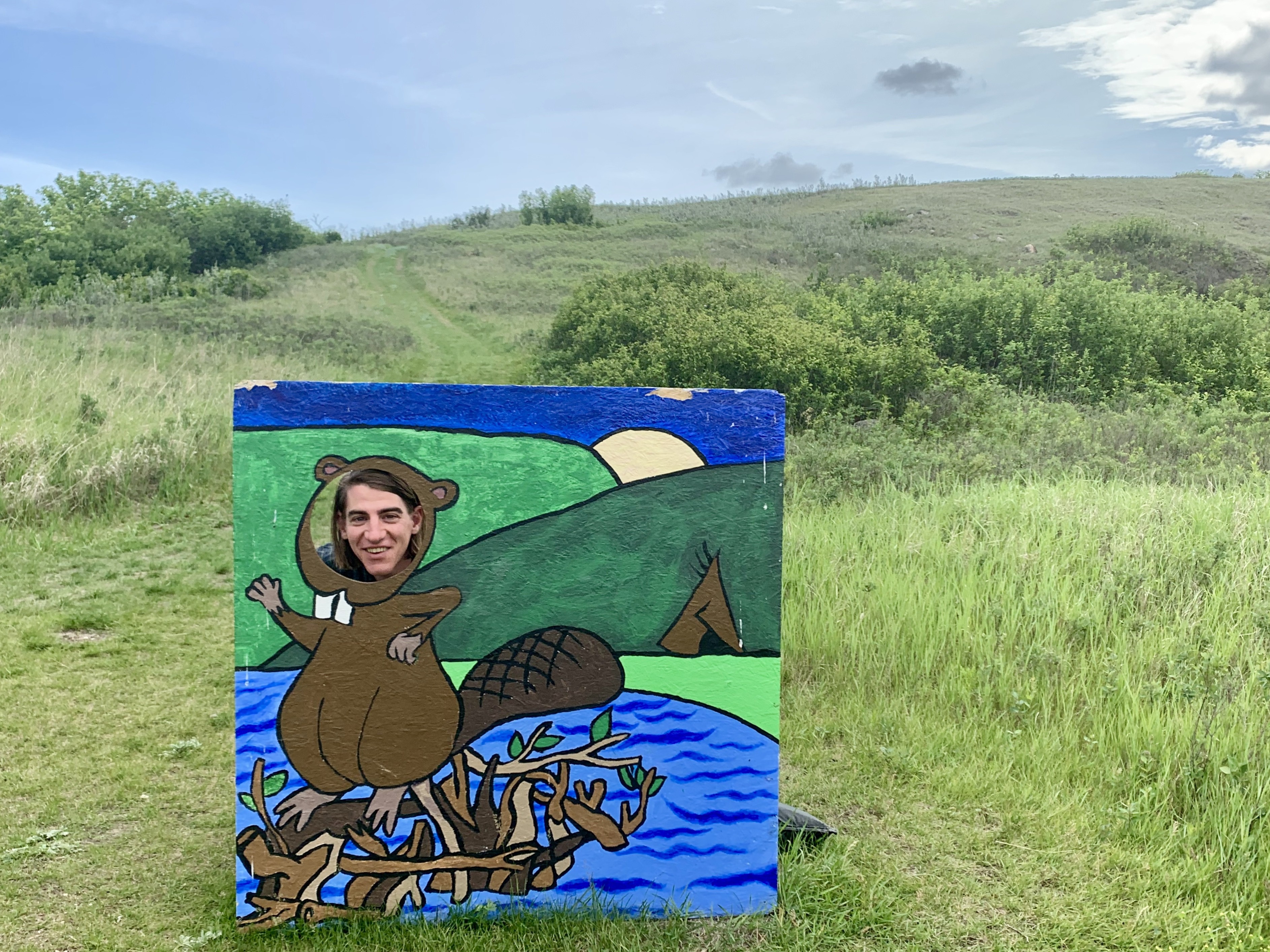
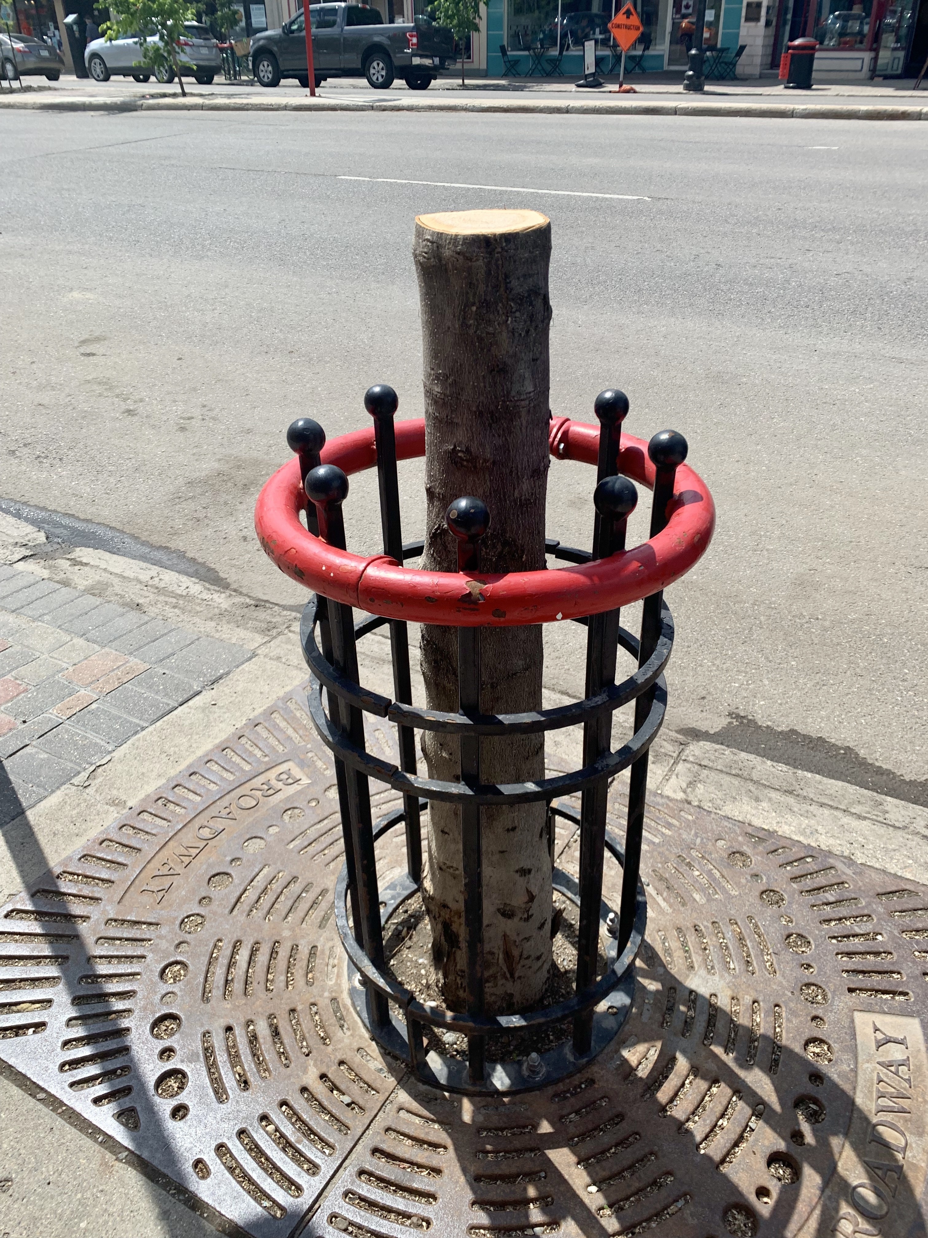
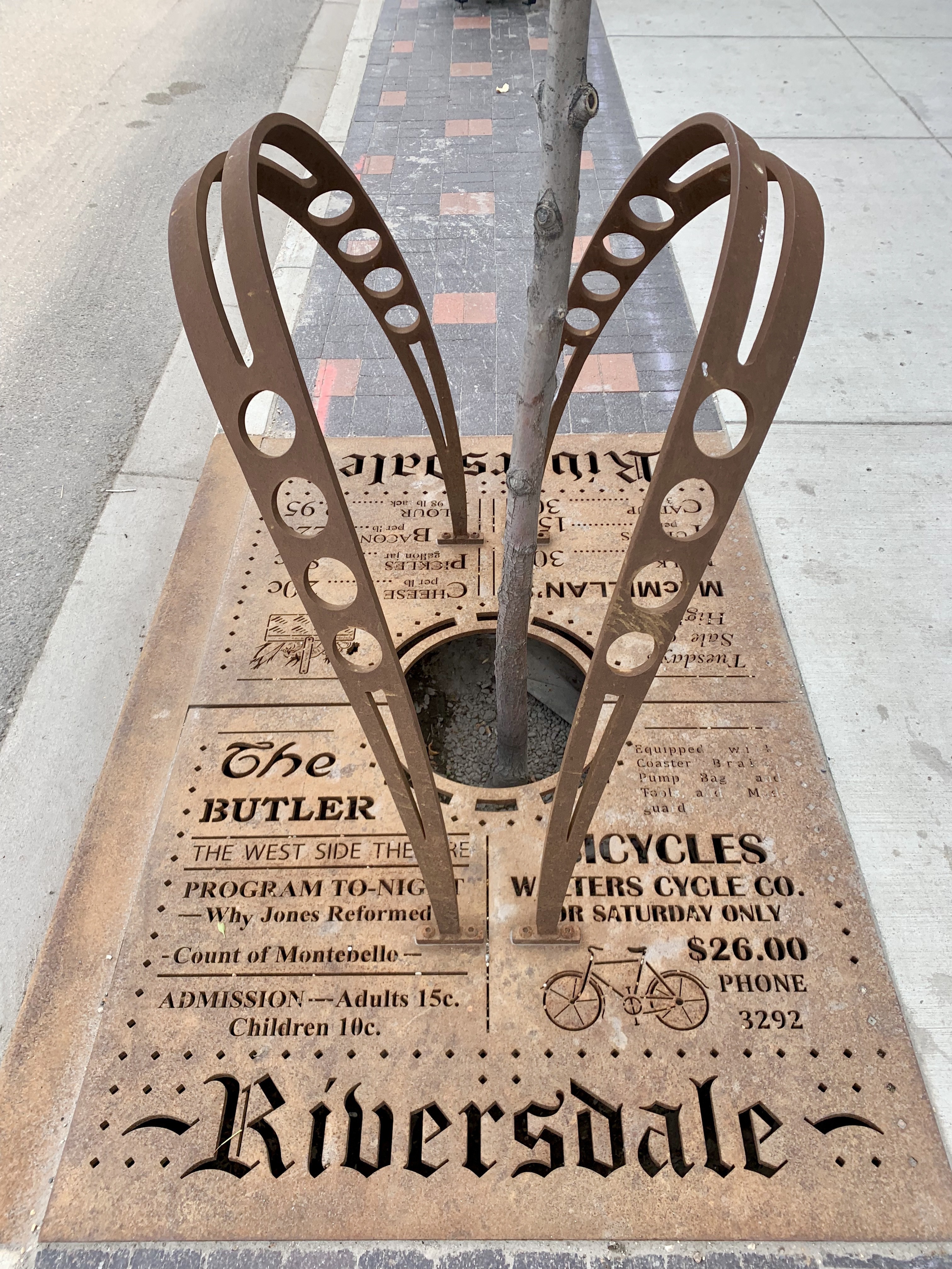
Historical local ads formed the basis of this stormwater grate in a commercial district.

    After the tour Henry brought me back to the Singhs to collect my bags, then brought me to the house of Greg, my former boss from Dal, who now works at the University of Saskatoon. Saying goodbye to the Singh family

    After I collected by bike from the repair shop, Greg gave me a great walking tour of the campus, which included an unexpected visit to Diefenbaker’s grave. I did not expect him to be buried at the university.

    We also some some great dinosaur fossils, and a statue of Farley Mowat. I’ve been thinking of Owls in the Family the whole time I’m here, especially when I see the back alleys in the older neighbourhoods and think of Mutt the dog walking on tops of the fences. 
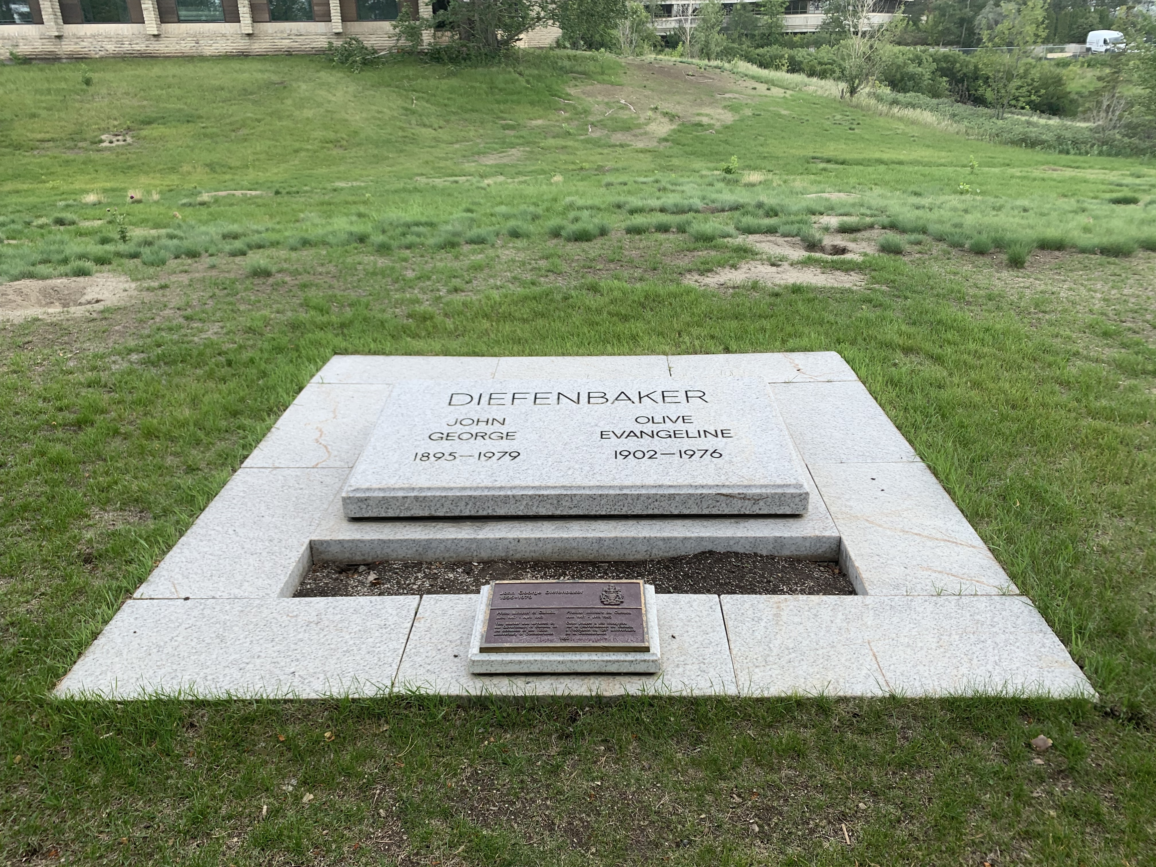
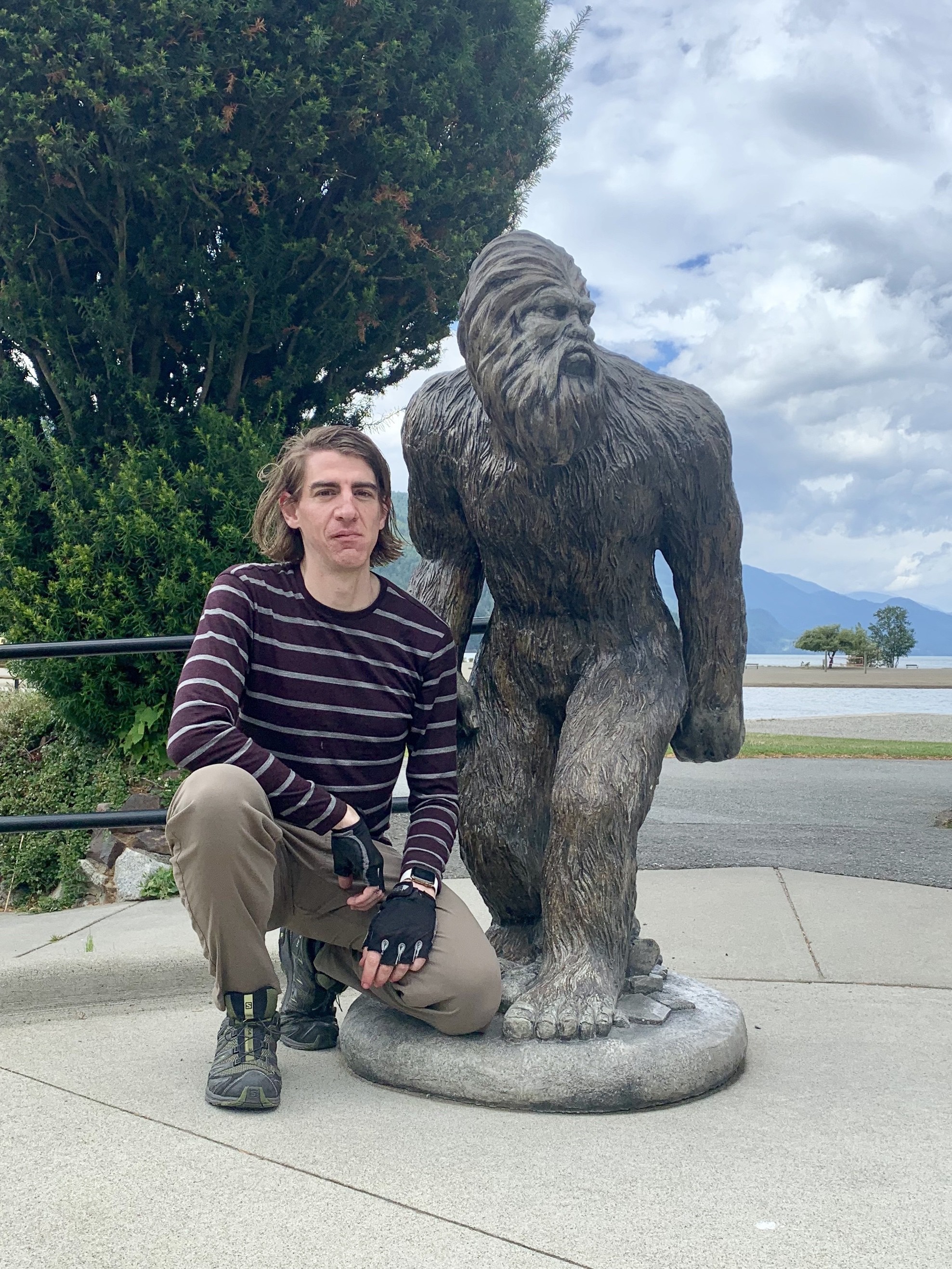
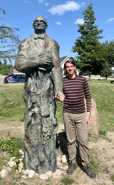
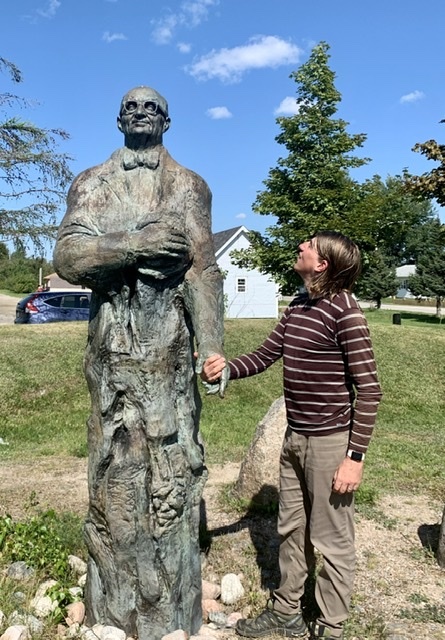
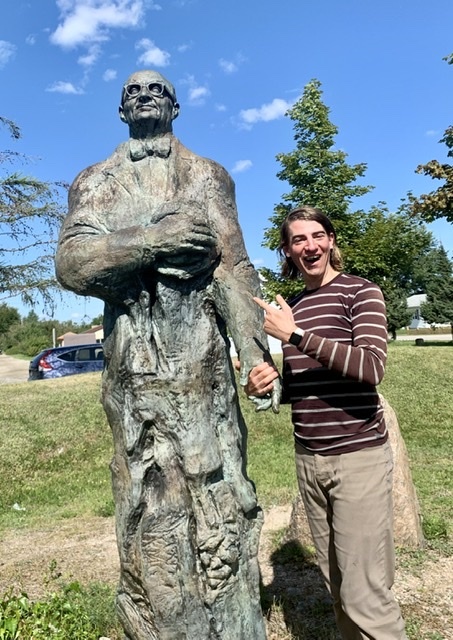
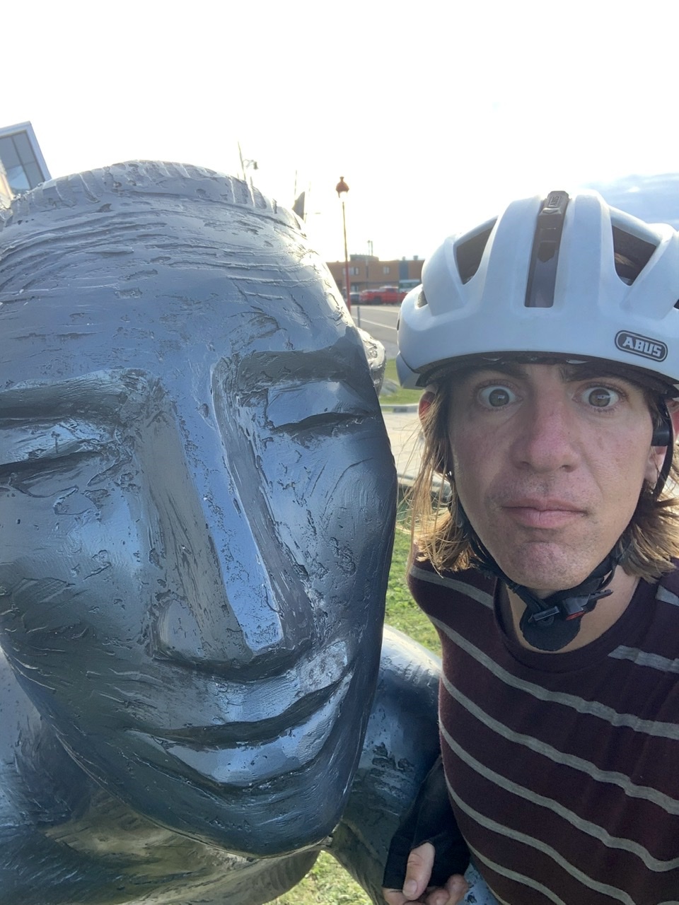
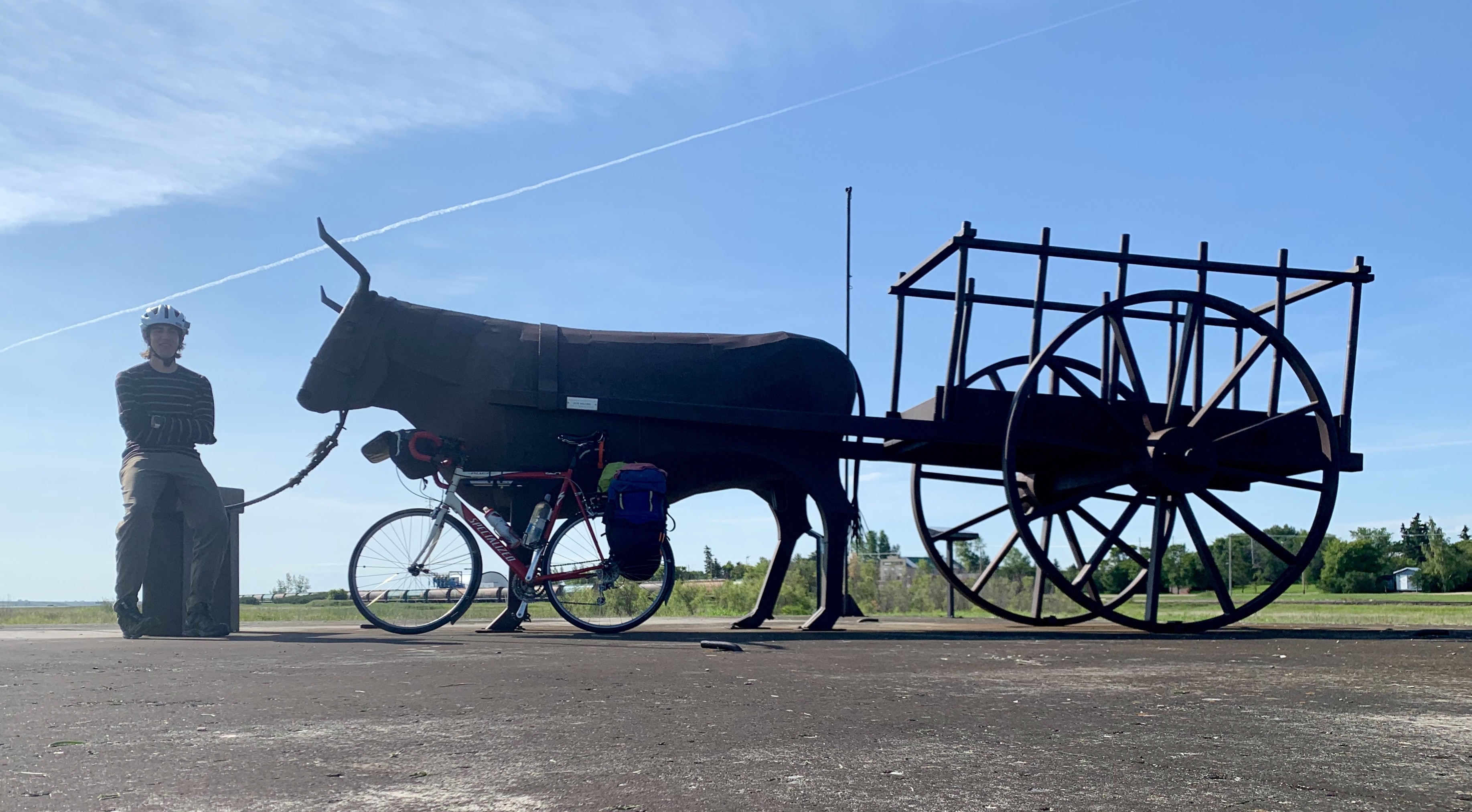
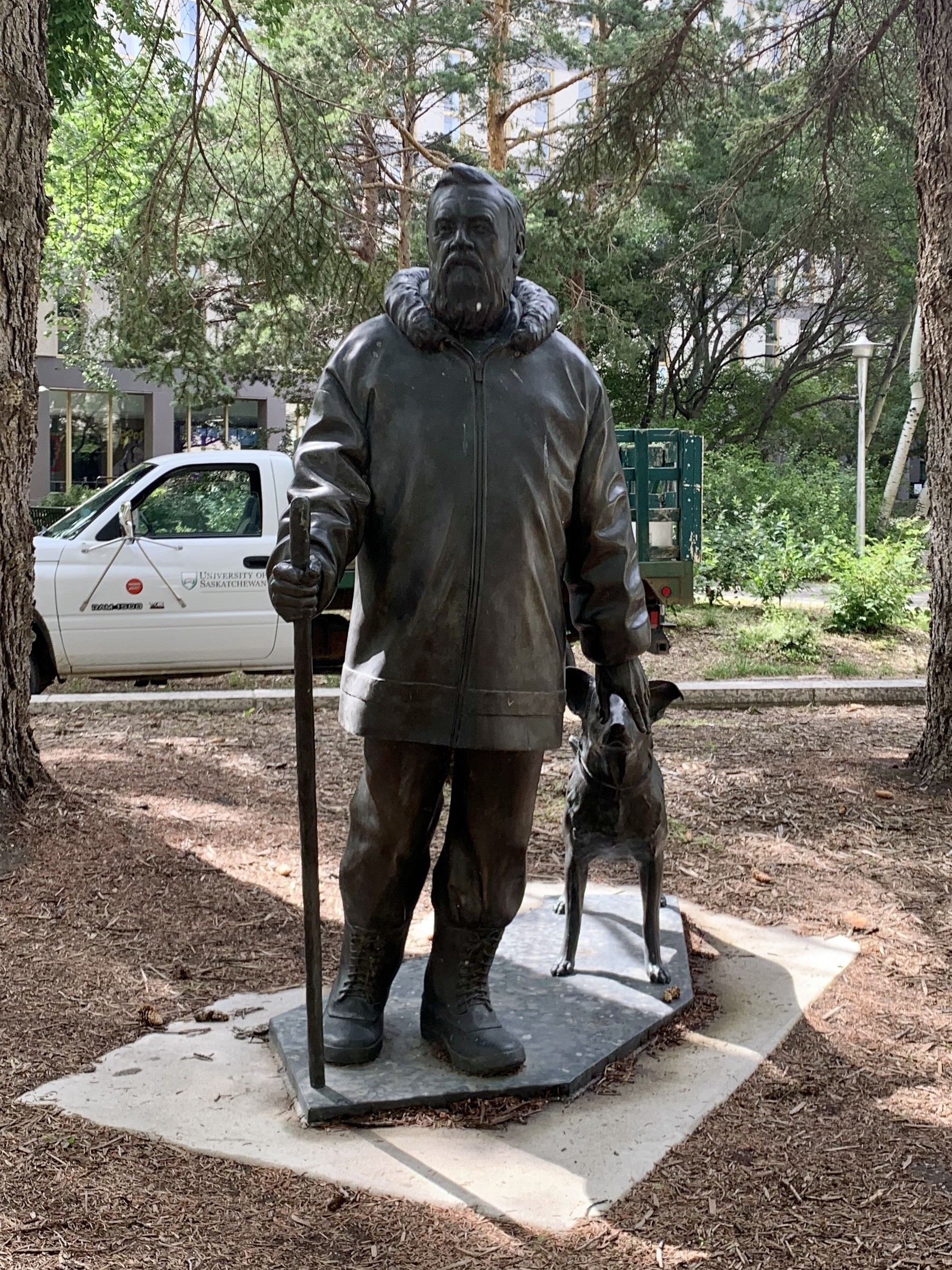
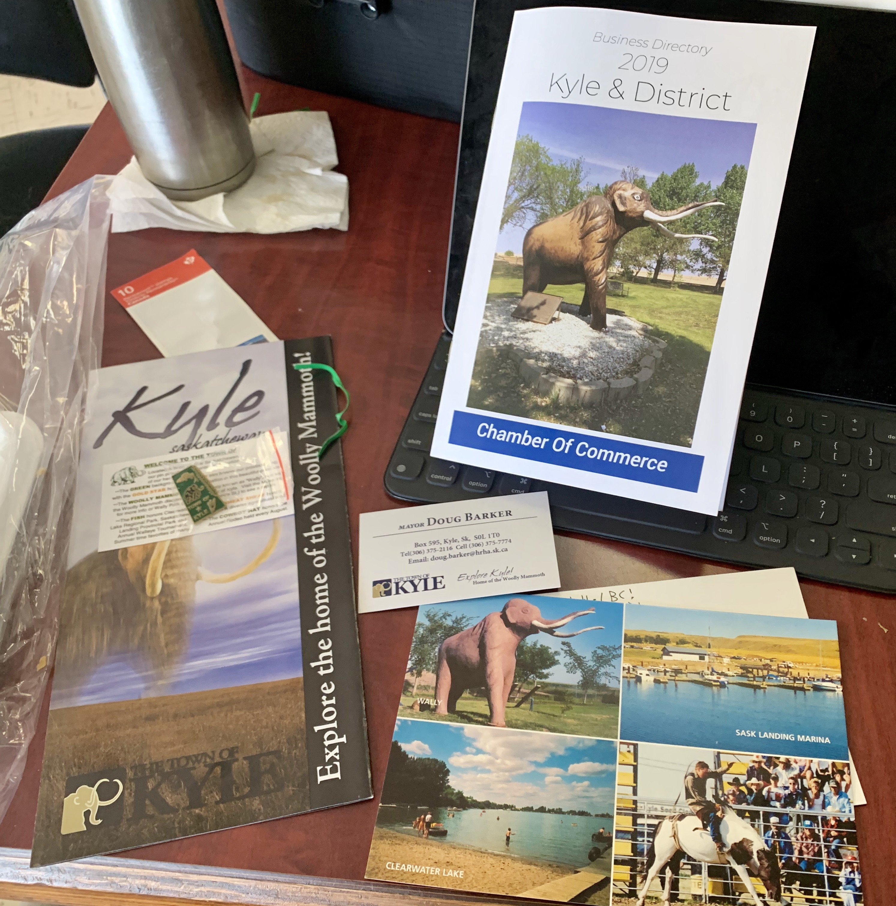
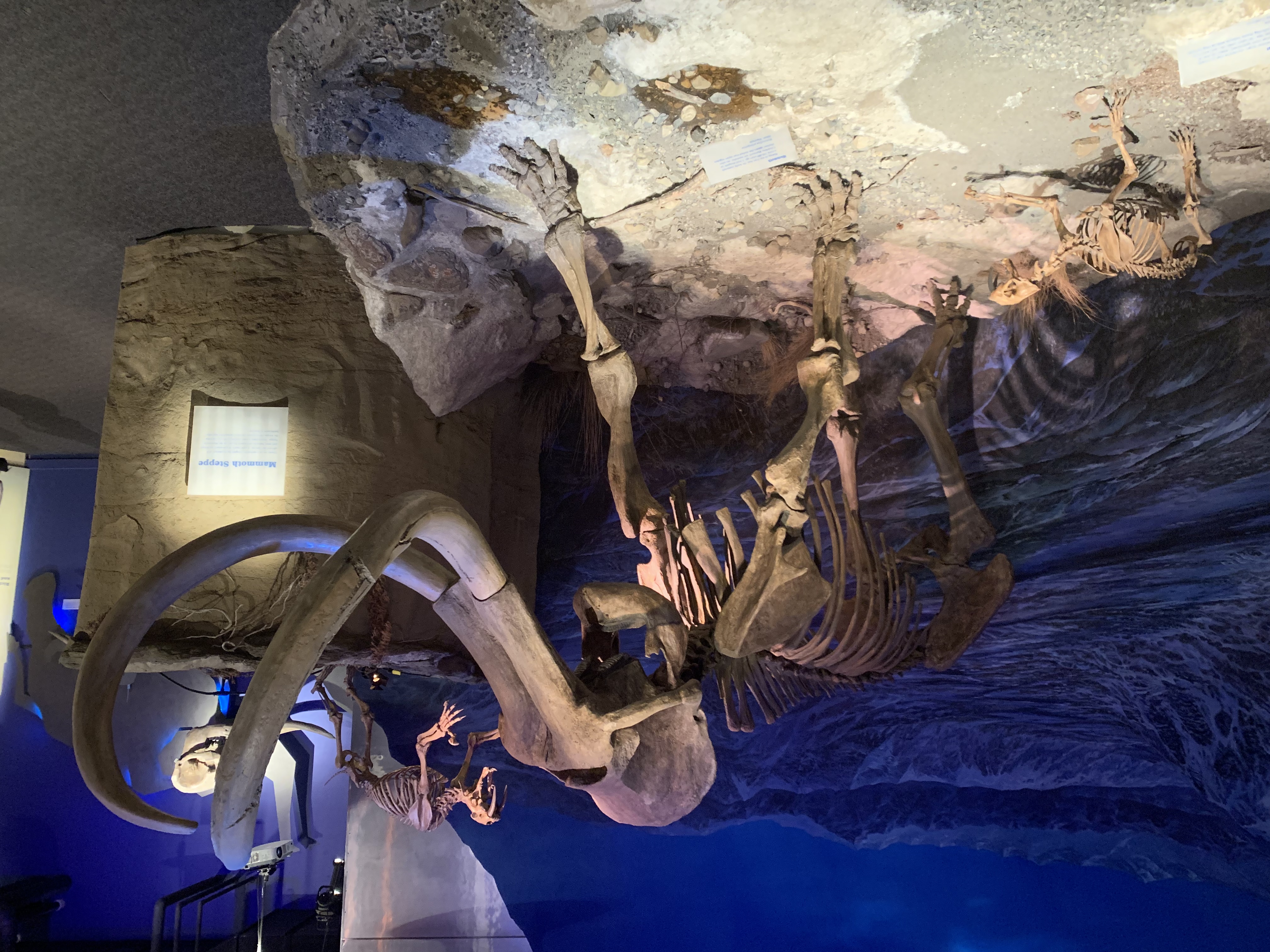
Carbon dating on the eyes proved inconclusive

    After the tour we had dinner at Greg’s place with his wife Jodie, than we three wandered over to their neighbour’s garage where an seven-piece rock band was playing the classics while we all sang along. We got to woo at the Nova Scotia reference in You’re So Vain. It was an amazing end to a wonderful day.

    Today’s Distance: 0 km Cumulative Distance: 2052 km

    → 5:45 PM, Jul 7
  • Biking Across Canada Day 18—Danielson Provincial Park to Saskatoon: Find the River

    I have got to leave to find my way

    Watch the road and memorize
    This life that passed before my eyes
    And nothing is going my way

    The ocean is the river’s goal
    A need to leave the water knows
    We’re closer now than light years to go
    I have got to find the river

    R.E.M., “Find the River”

    I spent today following the South Saskatchewan River, and never really seeing it. I could tell from the topography on my left that there was something there, but it was always just out of sight. After about 80 km of this, I put on Find the River by R.E.M., and was struck by how well it captures the wanderlust that drives one to take such a trip.

    I saw more of these highway signs then signs of the river

    R.E.M. was a big obsession of my teenage years. I even had a Geocities fan website at the time, which probably tells a lot about me. I was fortunate enough to see them live in 2001 and came home with the fruit bowl that Michael Stipe threw out to the crowd. I like that all these decades later their music can still fill me with exuberance and melancholy like it did in those impressionable times.

    I spent the first half of the morning trying to get ahead of a rainstorm I could see rolling in. Fortunately I had a partial tailwind, so the riding was easy. There weren’t many places to stop today—just a gas station cafe at the Whitecap First Nation. 

    Saskatoon has some decent protected bike lanes, but they also have their share of truck-filled murderstrips, that even in July are filled with sand and gravel from the previous winter.
    I was actually kind of impressed that this truck driver blocked the “car” lane instead of the bike lane. Don’t worry motorists, that bike lane ended abruptly shortly after.

    I made it to Saskatoon in the early afternoon, and made a beeline for the Bike Doctor so they can fix my wheel. I left my bike there and headed downtown for some sightseeing where I finally got to see that river.

    The South Saskatchewan River, finally

    While wandering around, I saw the railway hotel, city hall, and a long stretch of downtown closed to motor vehicles for a bustling "sidewalk sale."

    The Bez, as locals call it.
    This street was packed with people for blocks on an otherwise quiet Thursday afternoon. Great placemaking!
    The unassuming city hall had a nice plaza in the back with a podium so you don’t need to provide your own soapbox.

     I also noticed some wonderful street furniture, which I'll expand upon in my next post.

    Location-specific bike racks off Broadway
    This protective ring still provides bike parking long after the tree is gone.
    Parking meter turned into a bike rack. Halifax take note!

    Having hit 2000 km, or about 25% of my trip distance, I was in the mood to treat myself so I walked over to 9-Mile Legacy Brewing to try their beers. Tunnel of Love started playing as I walked in, and I looked over to see Dure Straights' Making Movies album, so I could tell I was in the right place. (That song was immortalized by Douglas Adams in So Long and Thanks For All The Fish when he wrote "she moved forward, put her arms round and kissed him, because the record had got to that bit which, if you knew the record, you would know made it impossible not to do this.")

    Dire Straits on the turntable
    The kettle sour was my fave
    Someone brought in a growler from the Banff Ave Brewing Co, where my brother works

    After enjoying a couple flights I caught a cab to Theresa and Sanj's house, parents of my friend Lauren from work. They did a spectacular job of making me feel welcome, making me a steak and salad for dinner, being incredibly friendly, and lining up a days' worth of activities for my rest day tomorrow.

    I went to bed tired and happy, looking forward to doing some more sightseeing in Saskatoon.

    Today's Distance: 106 km

    Cumulative Distance: 2052 km

    → 2:36 PM, Jul 6
  • No blog post today—busy getting a bunch of tours of Saskatoon —so check out these amazing parking meters turned into bike parking, seats, and tables!

    mp-photo-alt[]=

    → 5:17 PM, Jul 5
  • Made it to Saskatoon. I also crossed 2000 km today, or about 25% of the total distance for my ride across Canada.

    → 5:20 PM, Jul 4
  • Biking Across Canada Day 17—Beechy to Danielson Provincial Park: It's About Dam Time

    The dam’s spillway seemed to go on forever

    I knew I had a short day so I let myself sleep in. Since Beechy's campground doesn't have a bathroom I'd have to wait for the gas station to open, anyway. Combined with last night's early bedtime, I finally feel caught up on sleep. I should do this more often.

    Who says Saskatchewan is flat?

    Even though I didn't have a lot of distance to cover, it still seemed to take a long time. Today was the first day with a moderate headwind, and I find headwinds more draining than hills—at least every hill has a summit; winds are unrelenting. I kept inventing reasons to stop and take a break. "Maybe I should oil my chain? I should pump up my tires. Is my brake pad rubbing? I should true the wobble in my rear tire." Fortunately I had stretches where I was heading west instead of north, so it wasn't all into the wind.

    After a side trip though Lucky Lake for a picture, and a stop in Birsay for ice cream, I arrived at the Gardiner Dam atop Lake Diefenbaker. This is where all those rivers I'd been following (the Bow, Elbow, Red Deer) end up as the South Saskatchewan River, which I'll follow to Saskatoon. This dam is massive. Something about the shifty rock underneath meant they had to make it long and wind instead of long and tall. The spillway and turbine tunnels are over a kilometre long! Lake Diefenbaker itself has over 500 km of shoreline.

    The dam is so big it’s hard to capture in a photograph
    If you’re scared of Daleks you won’t like this place

    Next to the dam is part of Danielson Provincial Park. Possibly the best part, it has an interpretive centre, a restaurant, and my favourite, a beach. I finally get to go swimming after two weeks of biking! I'd had chances before, but the glacial waters in the mountains were too cold for more than wading, and all the ponds I'd seen in the prairies were either fenced off or too marshy. The water was still quite cold, so I only went in for a few minutes, but what a treat!

    Lots of families enjoying the giant sandy beach
    Going swimming let me check on my biker’s tan: an inch around the wrist, plus my knuckles. Everything else still pasty white.

    After drying off and having lunch I biked a few more kilometres to the campground entrance. They put me in the "overflow camping" area down by the lake since all the electric sites are booked up (fine with me), and only charged me $20 (also great) for a site with flush toilets and warm showers nearby. This is the first campsite I've stayed at with showers this trip, and I'm thrilled. I seem to be the only person staying in the overflow area, so it's nice and quiet.

    Some beautiful thistles dotted the campsite
    Just me and the lake tonight
    Watching the storm come in

    After setting up my tent, I went for a ride to the camp store and showers. I'd forgotten how differently my bike handles when it's not loaded with gear. So nimble! I went for an extra ride to explore the other camping areas since it was so much fun to ride unencumbered and helmet-less.

    I think I'll have another early bedtime. I may have a headwind heading north to Saskatoon tomorrow.

    Today's Distance: 87 km

    Cumulative Distance: 1946 km

    → 2:40 PM, Jul 4
  • Biking Across Canada Day 16—Lacadena to Beechy, SK: Kyle has Style

    When I got up this morning a pronghorn was staring interestingly at my tent. They’re so fast that by the time I got my camera ready he was too far away to get a picture.

    There’s a pronghorn in that picture looking back at me.

    I got packed up quickly this morning. The problem with stealth camping is they usually lack good bathroom facilities. I didn’t feel like digging a cathole by the side of the highway, so I had good motivation to get a move on.

    Somewhere after the town of White Bear I saw a small plane off in the distance. I’m still developing a sense of scale here, so at first I wasn’t sure if it was a model plane or a real one. It turned out to be a crop duster, and when the pilot spotted me taking pictures, he or she came and did a few fly-bys so I could get some close-up actions shots. It was incredible, though I couldn’t help thinking of that famous scene from North by Northwest where Cary Grant is attacked by a crop duster. Fortunately, this pilot meant me no harm.

    After a few hours I made it to Kyle, Saskatchewan, named after Jeremiah Kyle in 1926 (no relation—I checked with my uncle, the family’s genealogist). I first learned about Kyle, SK back in 2004 when I tried to register kyle.ca for my family’s email use. I couldn’t because the name was reserved for a small town in Saskatchewan. I opted to register kyles.ca instead, and to this day I sometimes have people think my name is John Kyles. Ever since then I’ve had it in my mind to visit the town someday, if only to get my picture by a “Welcome to Kyle” sign. Today I got that chance.

    My kids are such avid readers that we’ve long joked about opening up our own branch library. Now here’s precedent.

    After taking pictures of a bunch of things named Kyle, I settled into the Kyle Mammoth Bakery (the town is mammoth-crazy in the same way that Drumheller is dino-crazy) to eat pastries, drink coffee, and write a blog post and some postcards (so they would be postmarked Kyle, of course). The women at the next table started asking me some questions about my bike and my trip, and the next thing I knew Doug, the mayor, came across the street to meet me in his EMS uniform. He gave me some souvenirs—a postcard, an enamel pin, and some pamphlets. Then he asked if the reporter from the newspaper had come by yet. When I said no, he went and got Amy Wells, publisher of the Kyle Times. She asked me questions about me and my trip, took my picture, and gave me a copy of the latest issue. I used to work for the Canadian Press, so we had a nice chat about the her background, her business model, and the news industry in general. Maybe I’ll be in the next issue?

    Kyle swag
    “Kyle’s Woolly Mammoth,” 1981

    After I’d had my fill of danishes and buttercups, I rode on for a few hours to the town of Beechy. Whoever said that Saskatchewan is flat has not seen enough of it. It has its flat sections just like Alberta and southwestern Ontario, but it also has its rolling grassy hills, coulees, and river valleys. You cannot actually watch your dog run away for days. It’s beautiful here, and I’m glad I took this long detour away from the Trans Canada.

    Beechy is where I’m staying tonight. They have a campground in town that’s only $5 for tents. It lacks running water and a bathroom, but at least the price is right, and I don’t have to wait until dusk to set up my tent.

    Today’s Distance: 95 km

    Cumulative Distance: 1859 km

    → 10:29 AM, Jul 3
  • I got the personalized North-by-Northwest cropduster plane experience in Saskatchewan today. Taking the backroads has really paid off.

    mp-photo-alt[]=mp-photo-alt[]=

    → 1:39 PM, Jul 2
  • Biking Across Canada Day 15—Oyen AB(ish) to Lacadena SK(ish): Rider on the Storm

    Today was mostly uneventful, a good thing after the mechanical difficulties of the day before. My wheel has held together so far, so I think I'll make it to a bike shop in Saskatoon.

    I was greeted this morning by a beautiful canola field when I opened my tent this morning. After a quick 10km ride I made it to the Alberta/Saskatchewan border, which was mostly unmarked. The only way to tell (besides my GPS) was the road got much worse, and if I looked backwards there were signs marking the Alberta highway number. Still reason for celebration—two provinces done, eight to go!

    First SK selfie!

    I only had half a bottle of water when I woke up this morning, so after a few hours' riding I was happy to see Neil the farmer who brought me into his house to fill up my bottles. He even offered me a frozen bottle of water which I graciously declined as I didn't want to wait to drink it.

    The garbage cans were bigger than the monument

    I biked by lots of green fields before stopping in Eatonia for lunch. It's Canada Day, and the woman serving me lunch told me we had to go outside right now because there was a fighter jet from Cold Lake about to fly over town. It was a quick thrill to see it zoom overhead, then back inside to finish eating and blogging.

    Everyone was out to see the fighter jet
    Better than any roadside welcome sign

    After lunch I had to search for my sleeping bag. I'd laid it out on top of my bike to air out, forgetting about the prairie winds. It turned up about 100m away wrapped around a telephone, covered in dust from the gravel parking lot. I was lucky to find it.

    Lunchtime is a good chance to catch up on Twitter

    As I was leaving I could feel and see a brief thunderstorm coming. I had the sense that if I kept riding fast enough I could outrun the worst of it. That was mostly right. The wind was in the right direction, so if I kept my speed up I'd stay dry; if I lagged the raindrops would start to overtake me. Then the road condition changed for the worse so I couldn't stay ahead of it, plus there were starting to be lightning strikes off in the distance. I found a porch to shelter under, and Fay, the woman who lived there, came out to invite me in. We spent about 20 minutes watching the radar together with her dogs before I felt it okay to move on. Then I slowly followed the storm, watching all the lightning at the horizon. Having grown up and moved away from southwestern Ontario where thunderstorms are routine, this was a real treat.

    After the storm

    I arrived in Eston around dinner time. Being a holiday, nearly everything was closed. I was luck to find an open gas station where I could buy some provisions. The teenage cashiers were blown away by what I was doing, which never gets old. They told me about a small restaurant still open, so I stopped there and got a burger and fries for $9. While I was eating dinner another storm front rolled past, bringing NNW winds of 40–80kph. I had considered staying here for the night, but my route would be turning south soon, so I decided to hit the road to take advantage of the wind. I just had to hold on through that crosswind for another 20 kilos before I'd be able to turn it into a headwind. It was definitely a challenge, but the roads were empty, and when I turned south it was like the wind disappeared and I'd strapped an engine onto the back of my bike. I rode on until sunset, at which point I set up my tent next to a farmer's field and went right to sleep.

    Total Distance: 159 km

    Cumulative Distance: 1764 km

    → 1:16 PM, Jul 2
  • Personalized way-finding signs‽ Thanks Saskatchewan!

    → 10:54 PM, Jul 1
  • Biking Across Canada Day 13—Calgary to Drumheller: Dino-Mite!

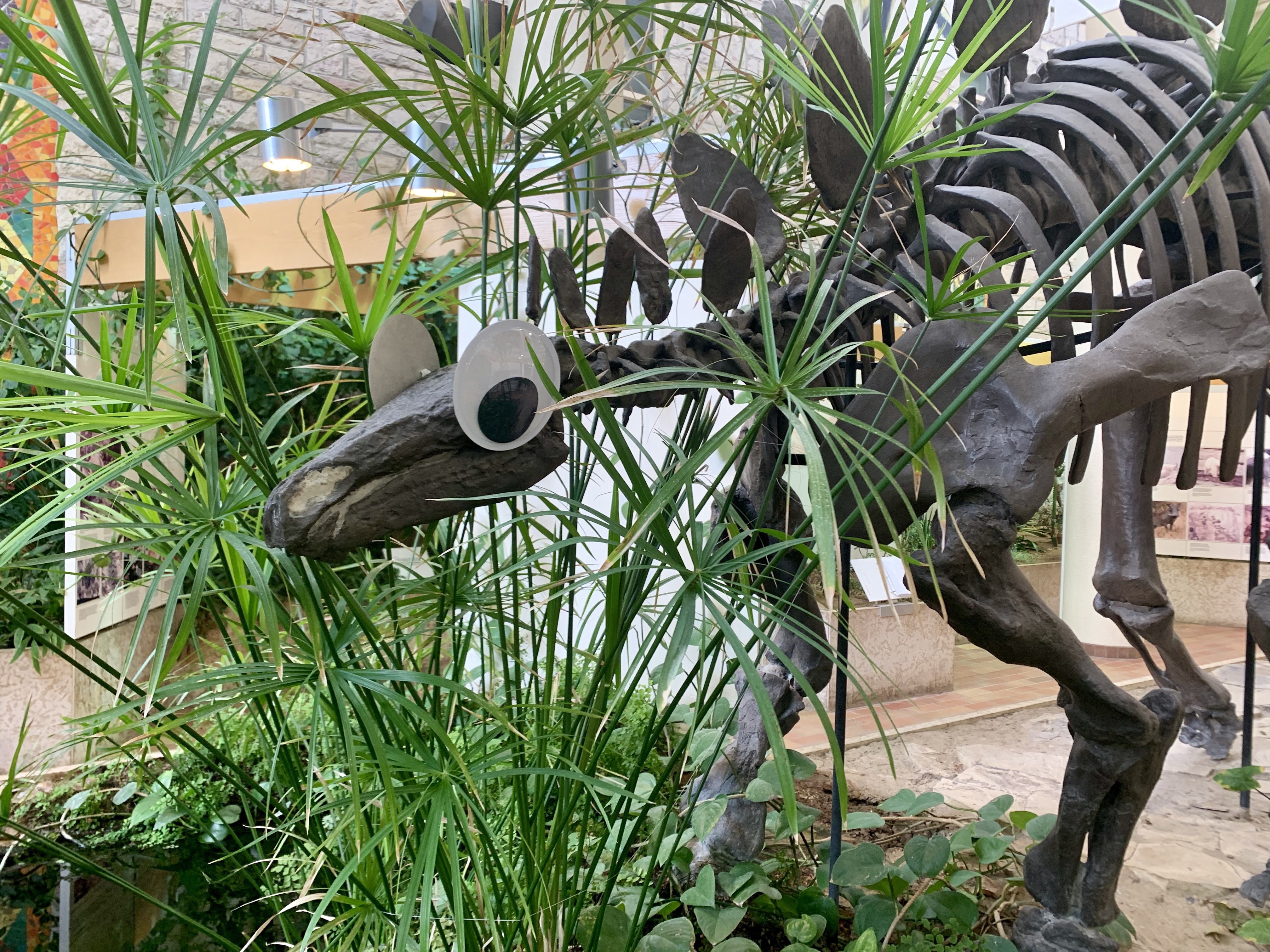
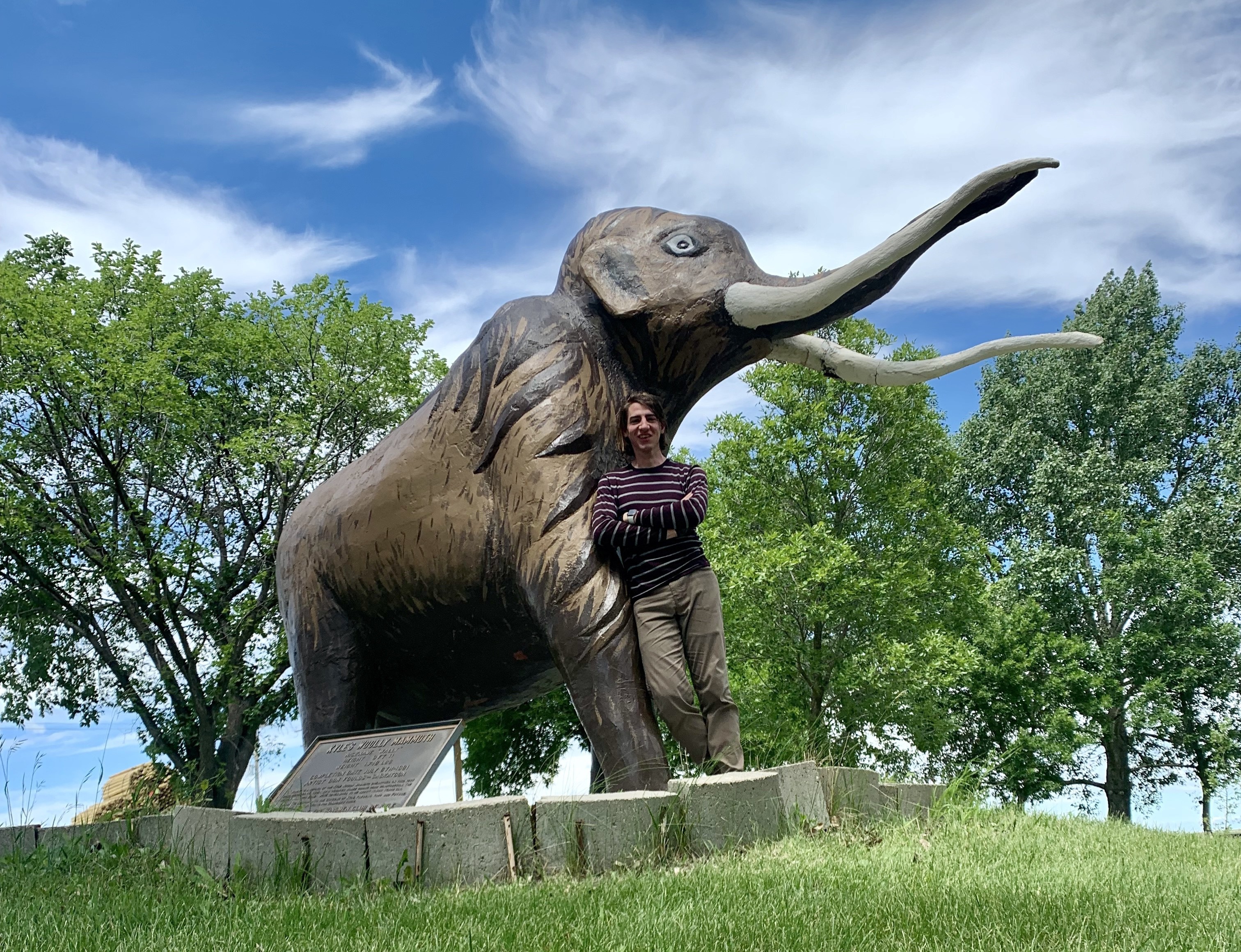
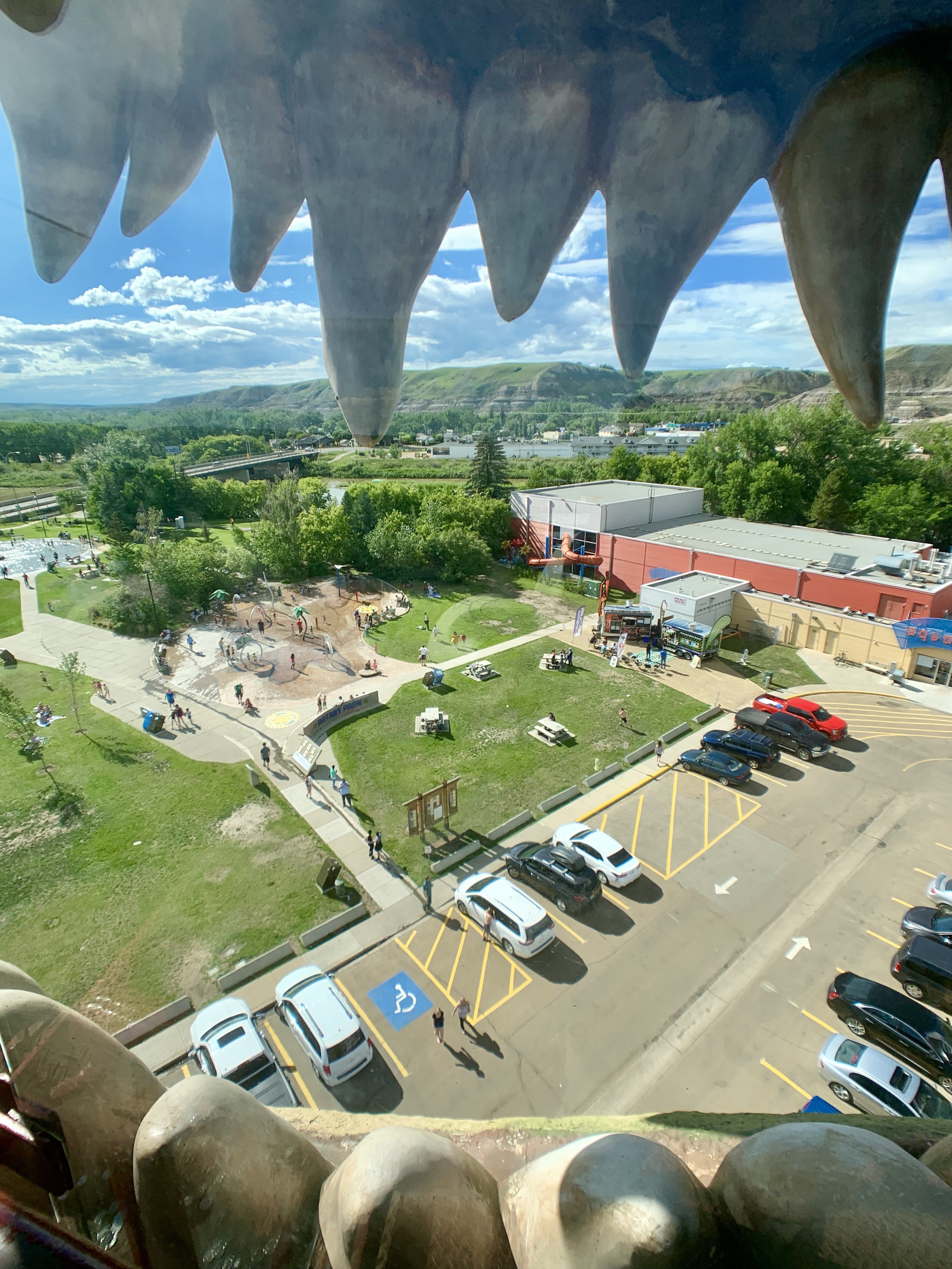
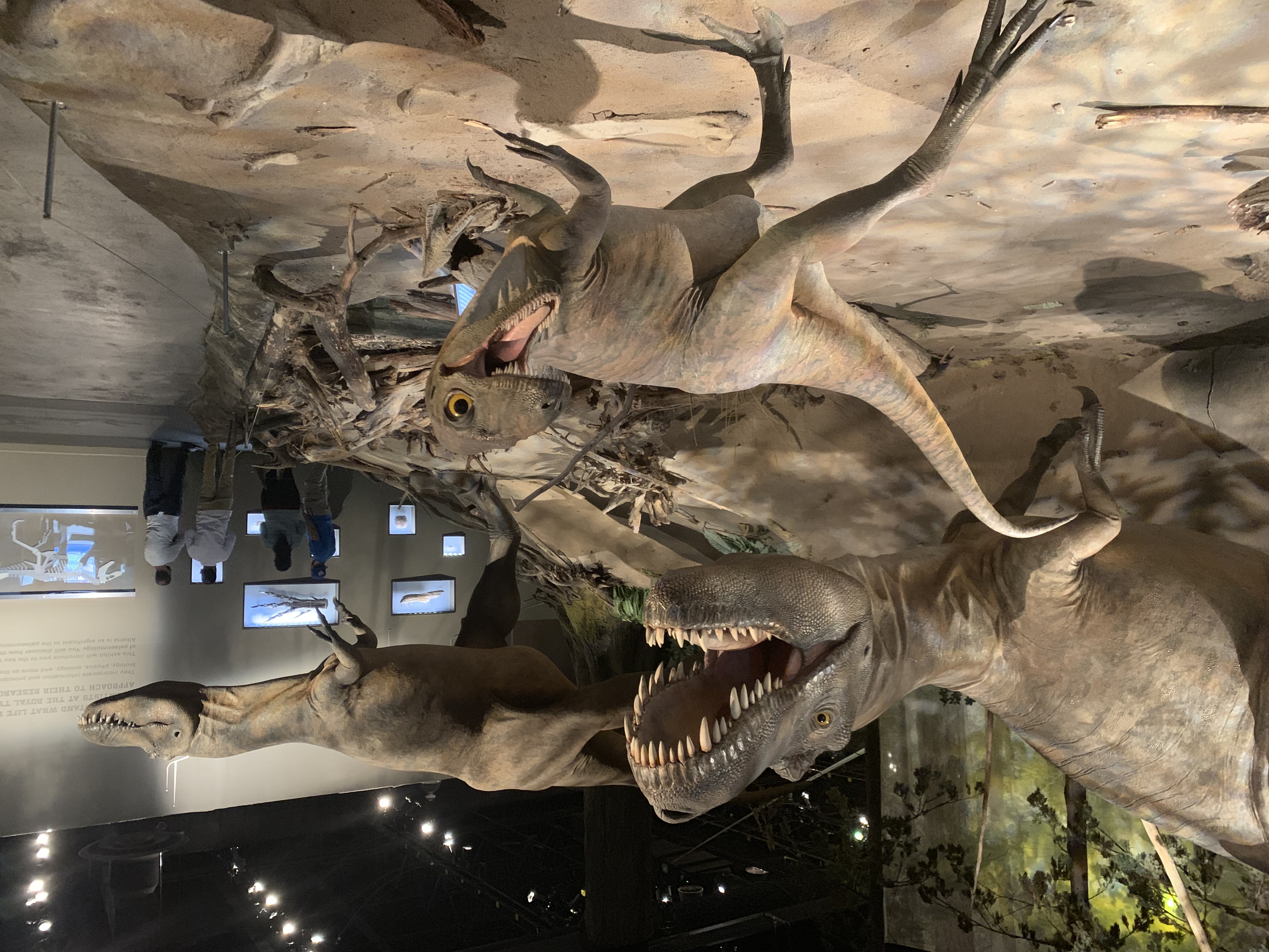
    How to shake a dinosaur’s hand

    My host were up before me for a change. Kyle and Kiera have a busy weekend planned so they got up early to get a head start on it.

    I took the Nose Creek pathway out of Calgary, which added a lot of distance but let me avoid a lot of traffic. It was pleasant, with lots of birds and prairie dogs to see. 
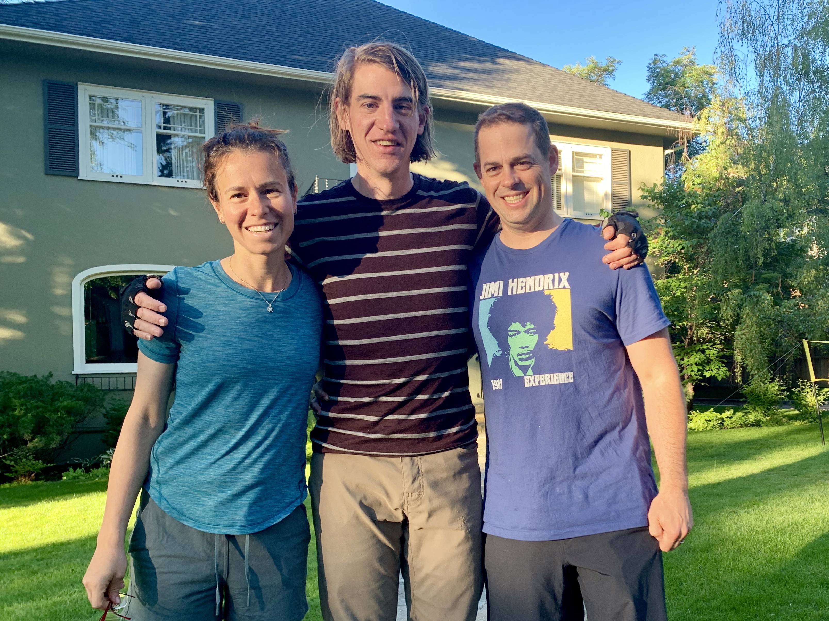
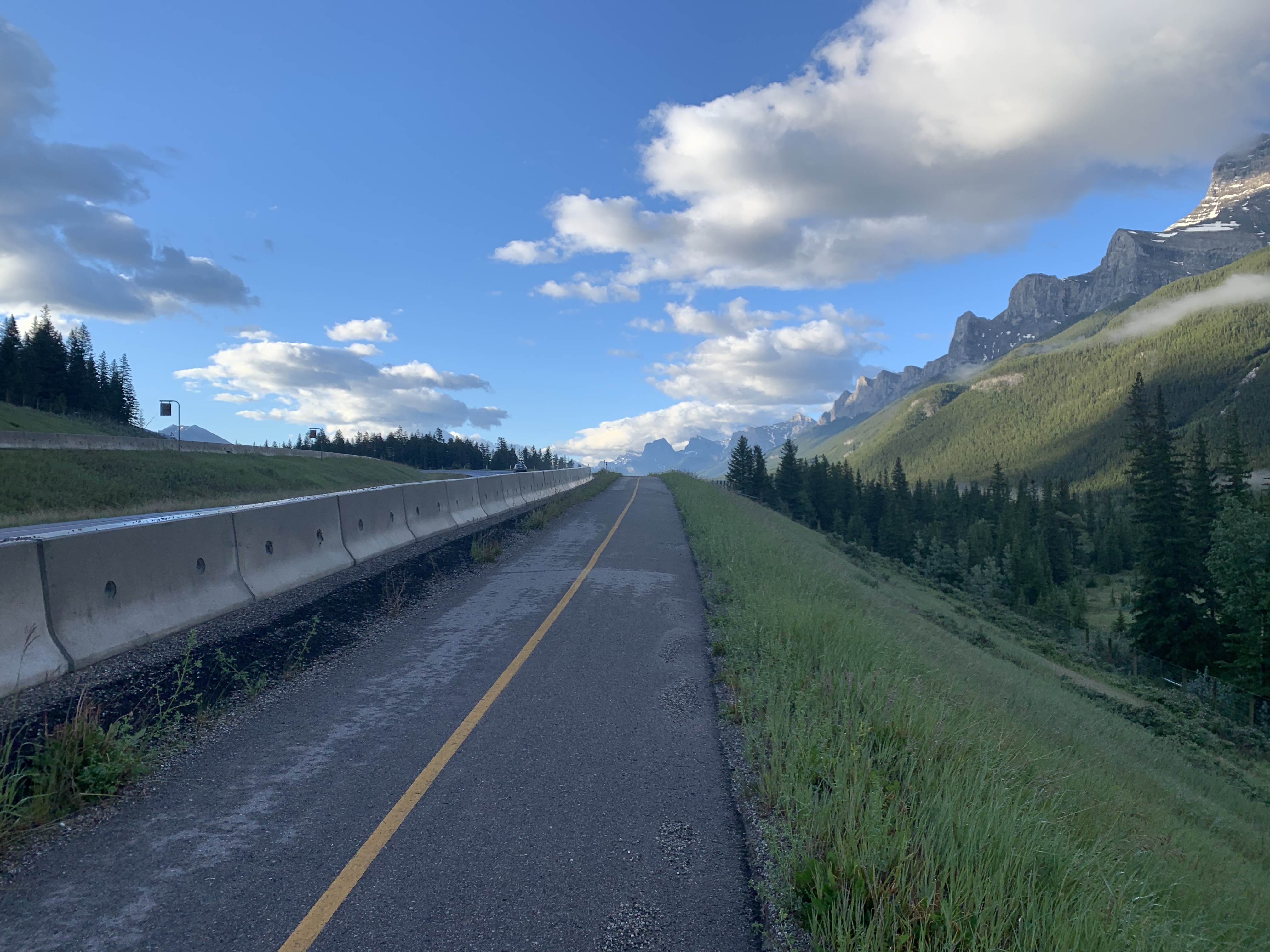
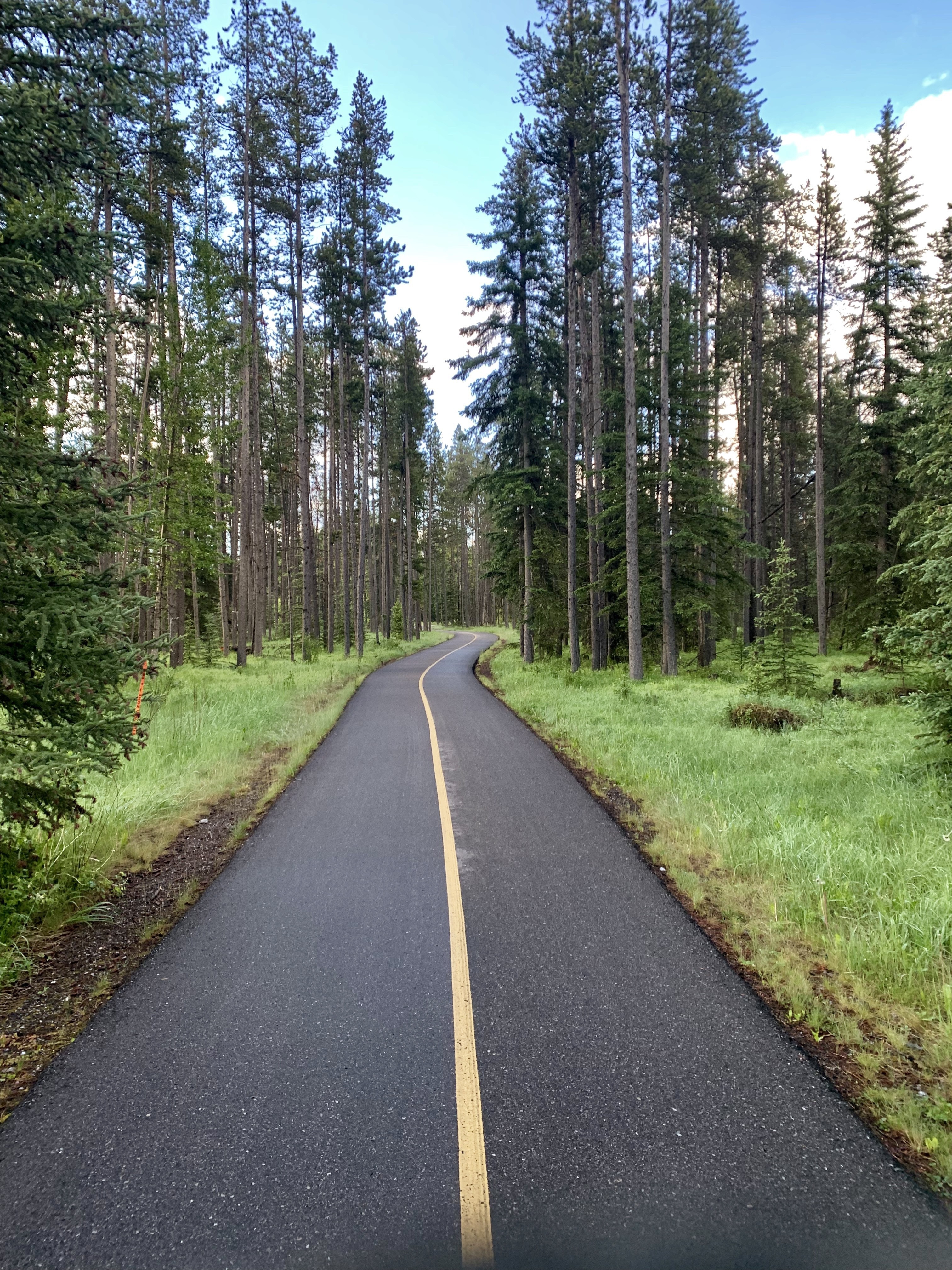
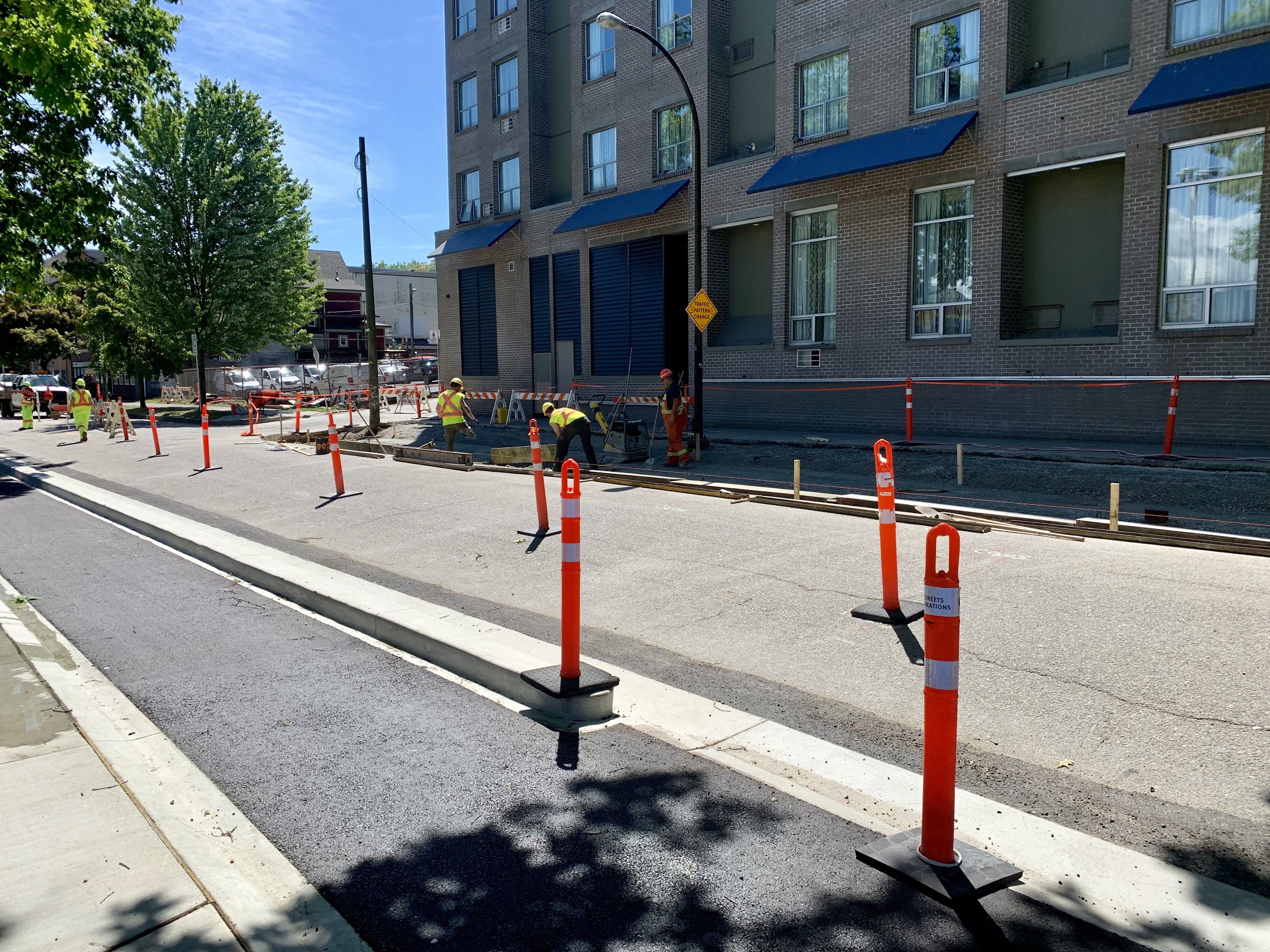
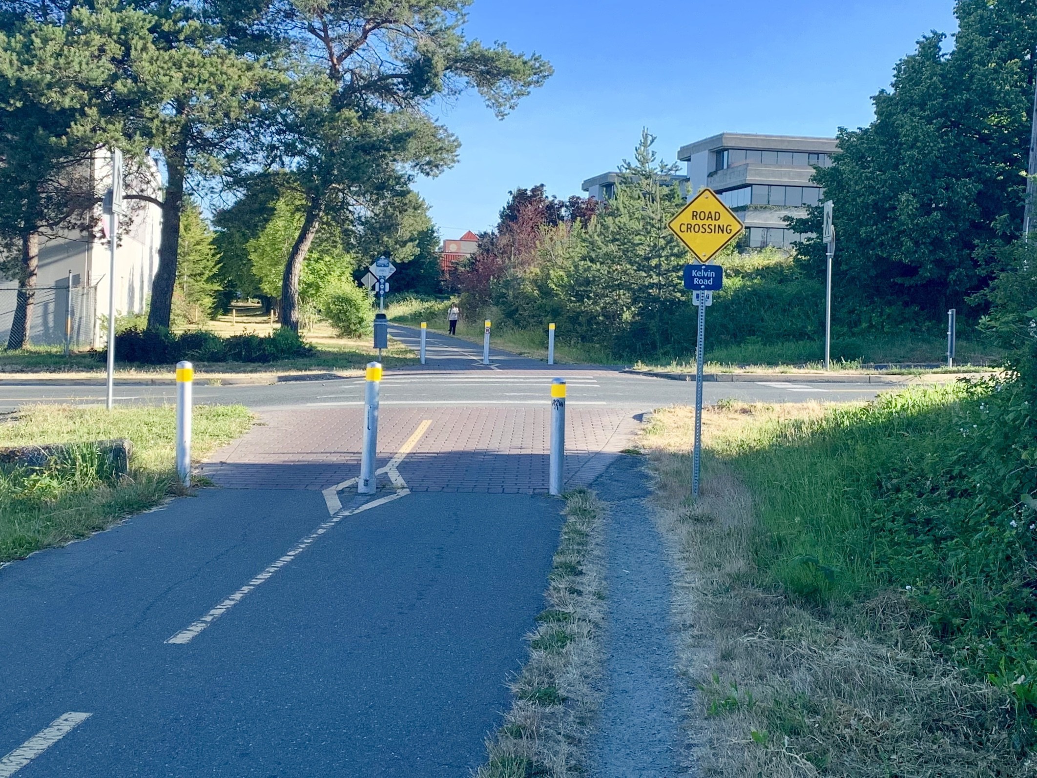
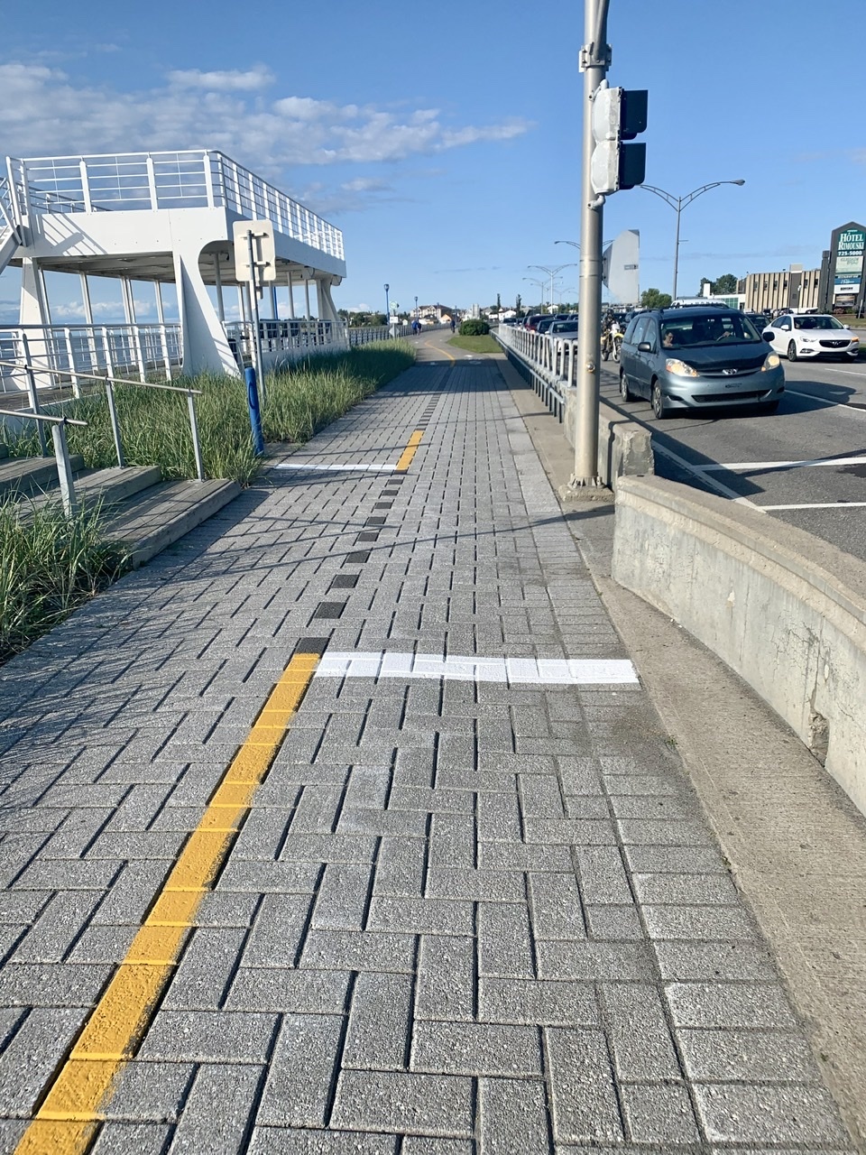
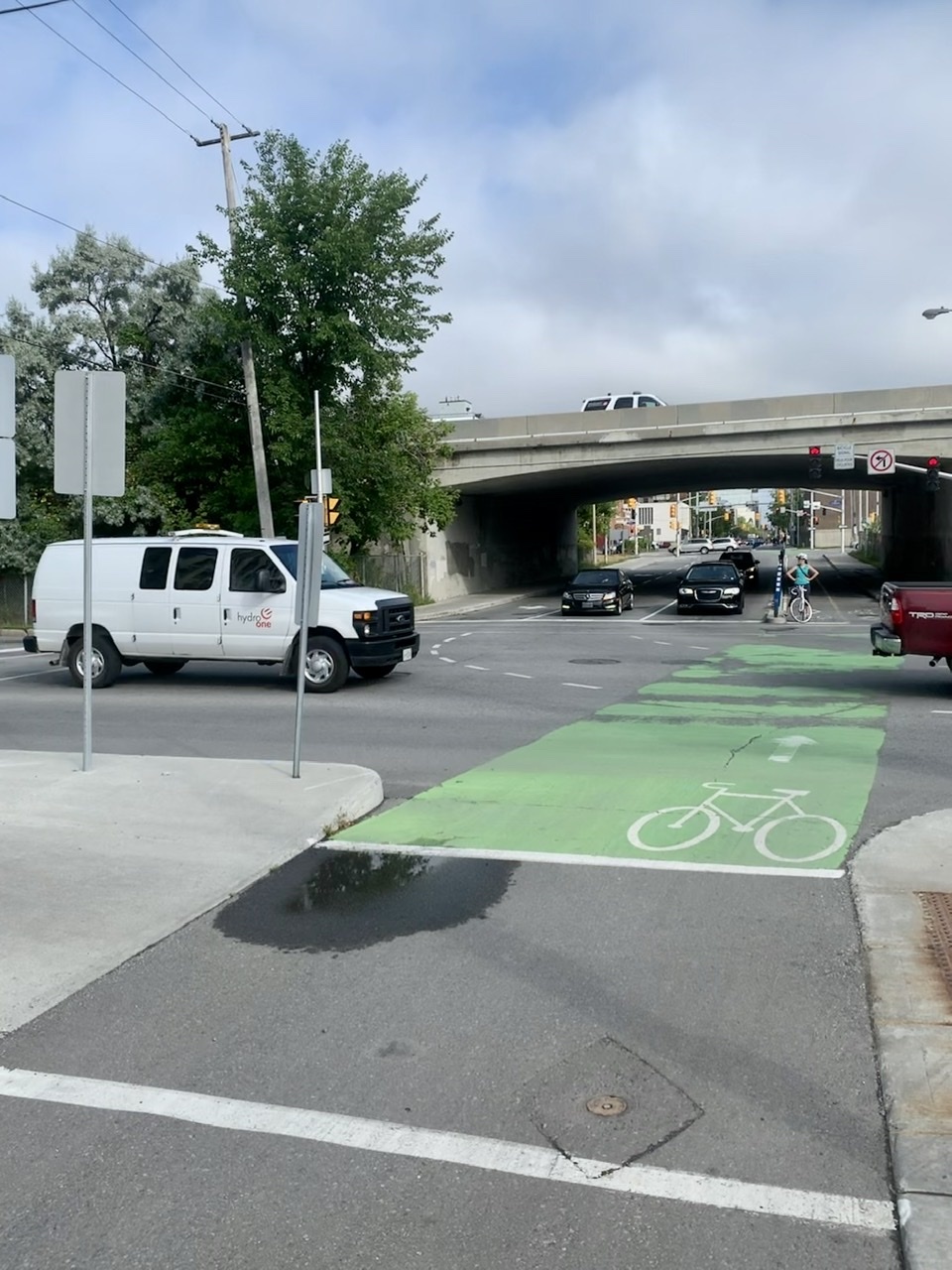
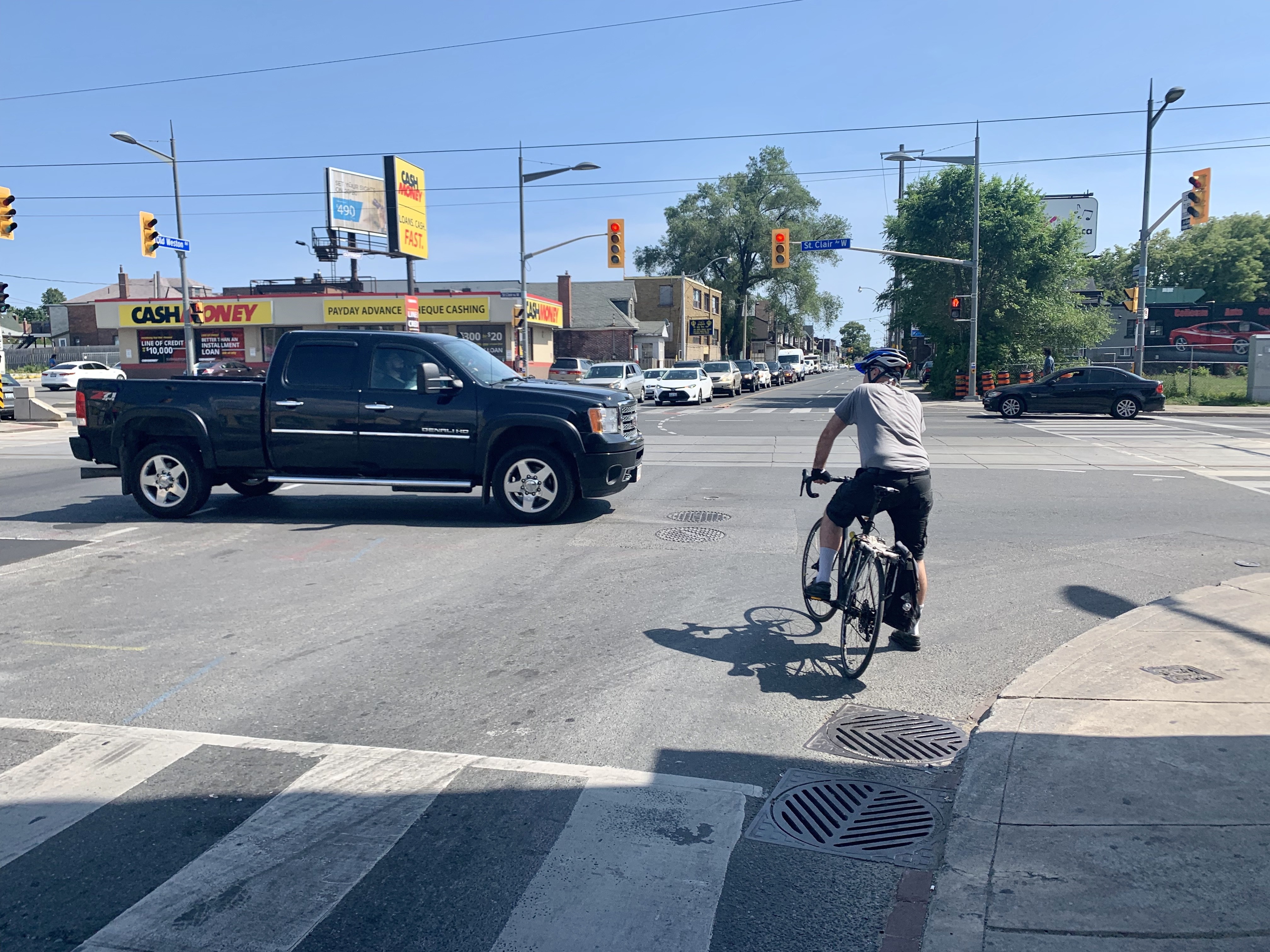
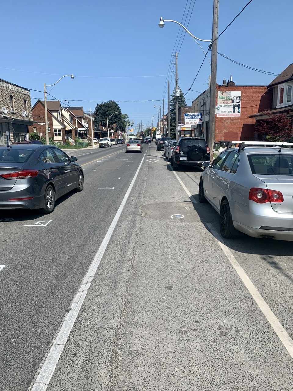
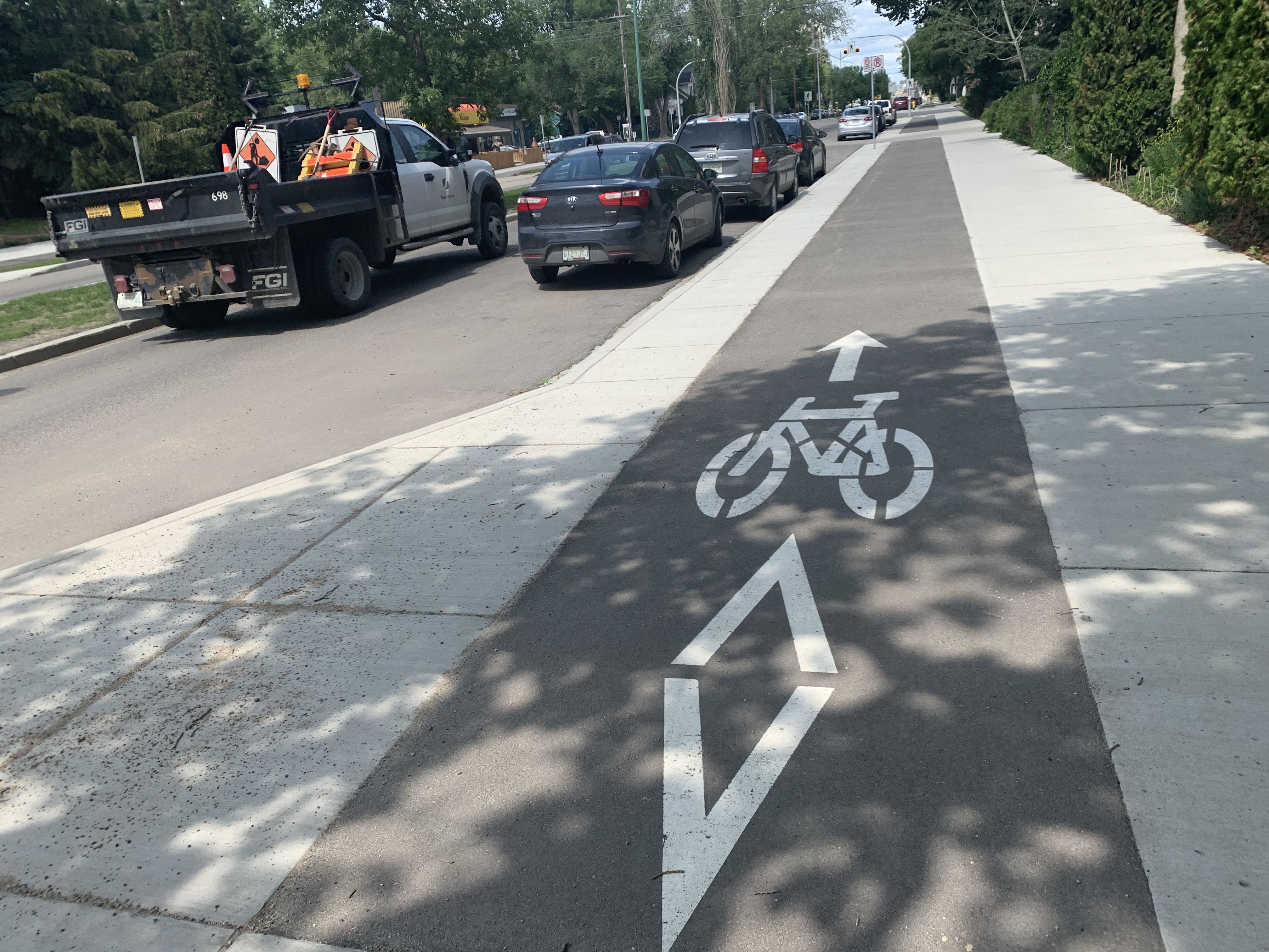
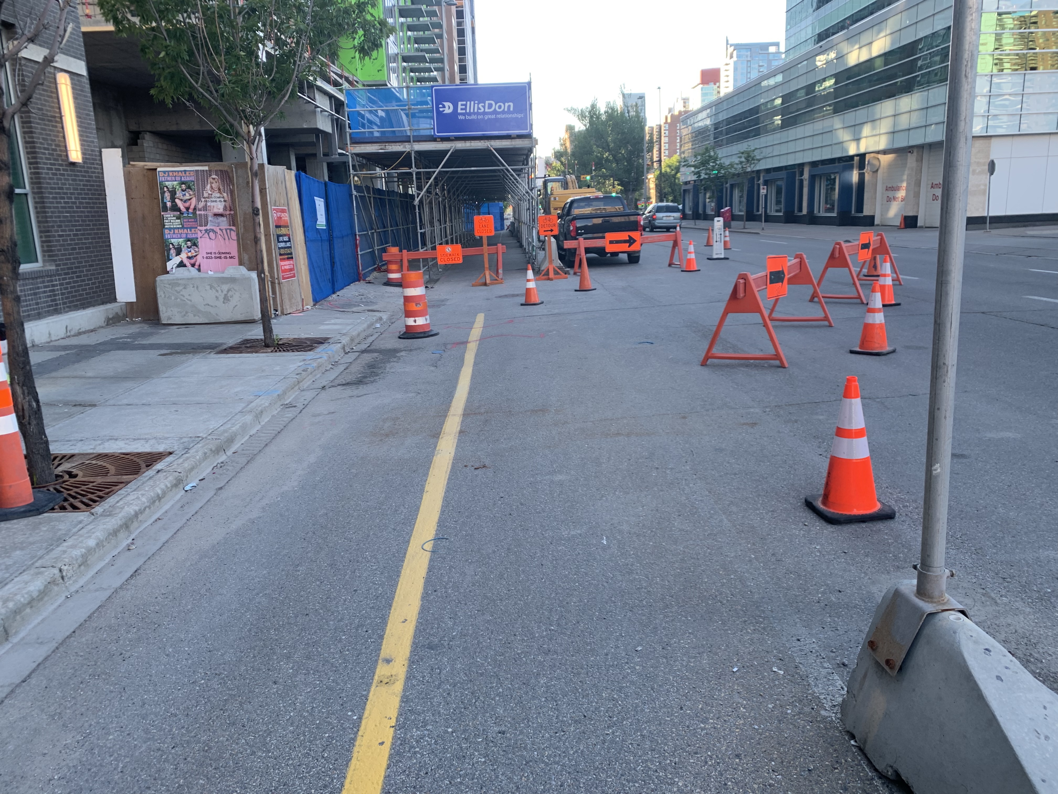
Look: a bidirectional bike lane routed around construction! What a concept!
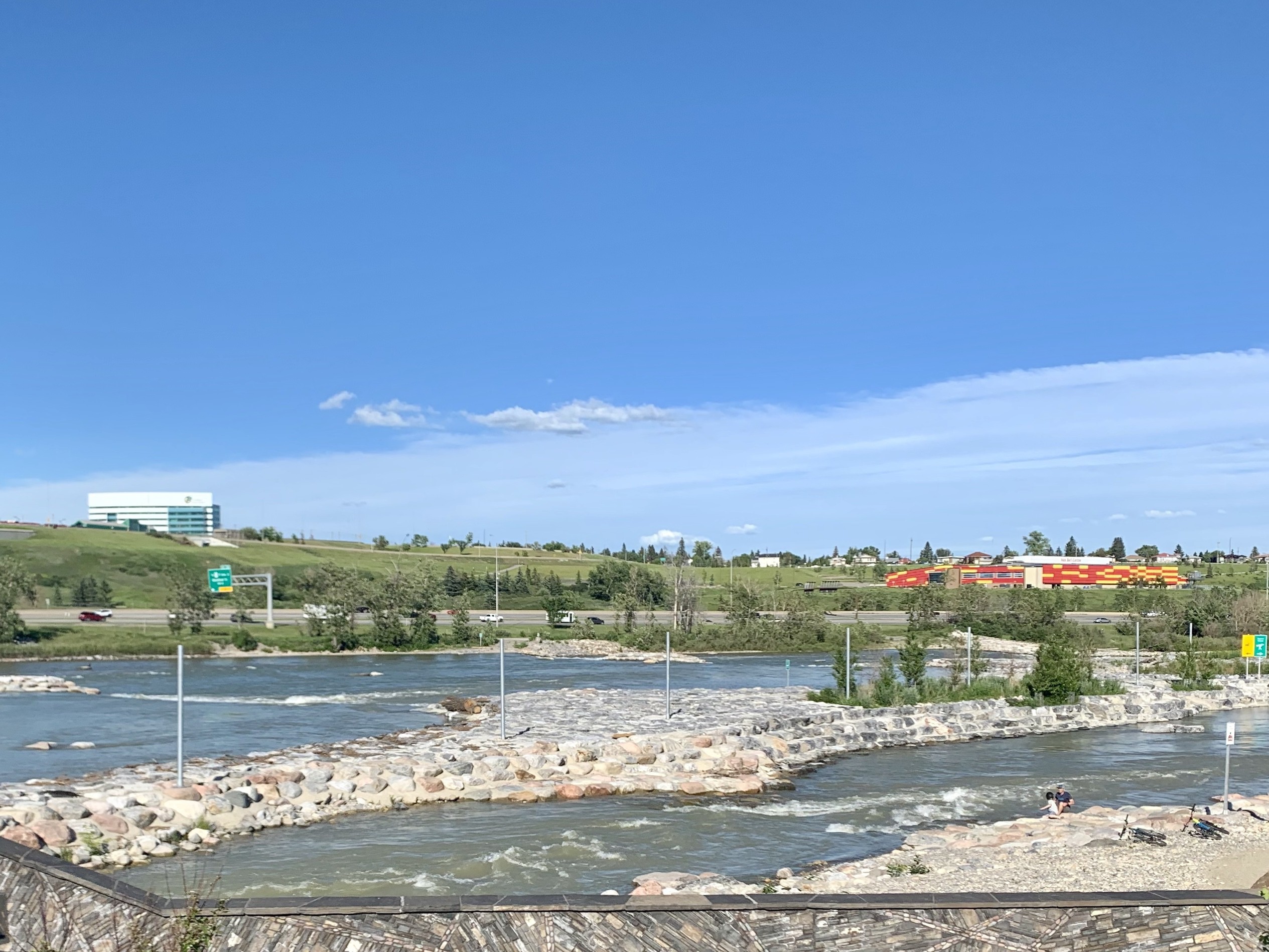
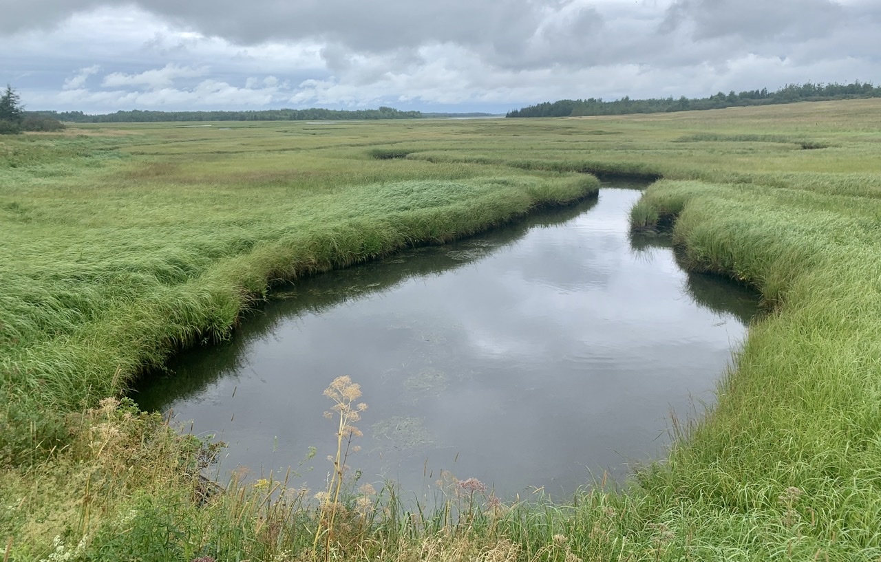
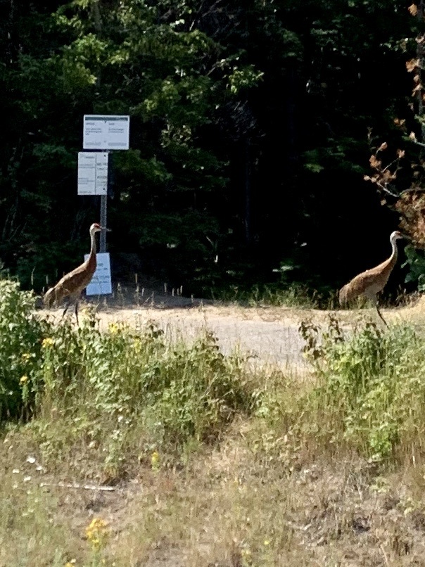
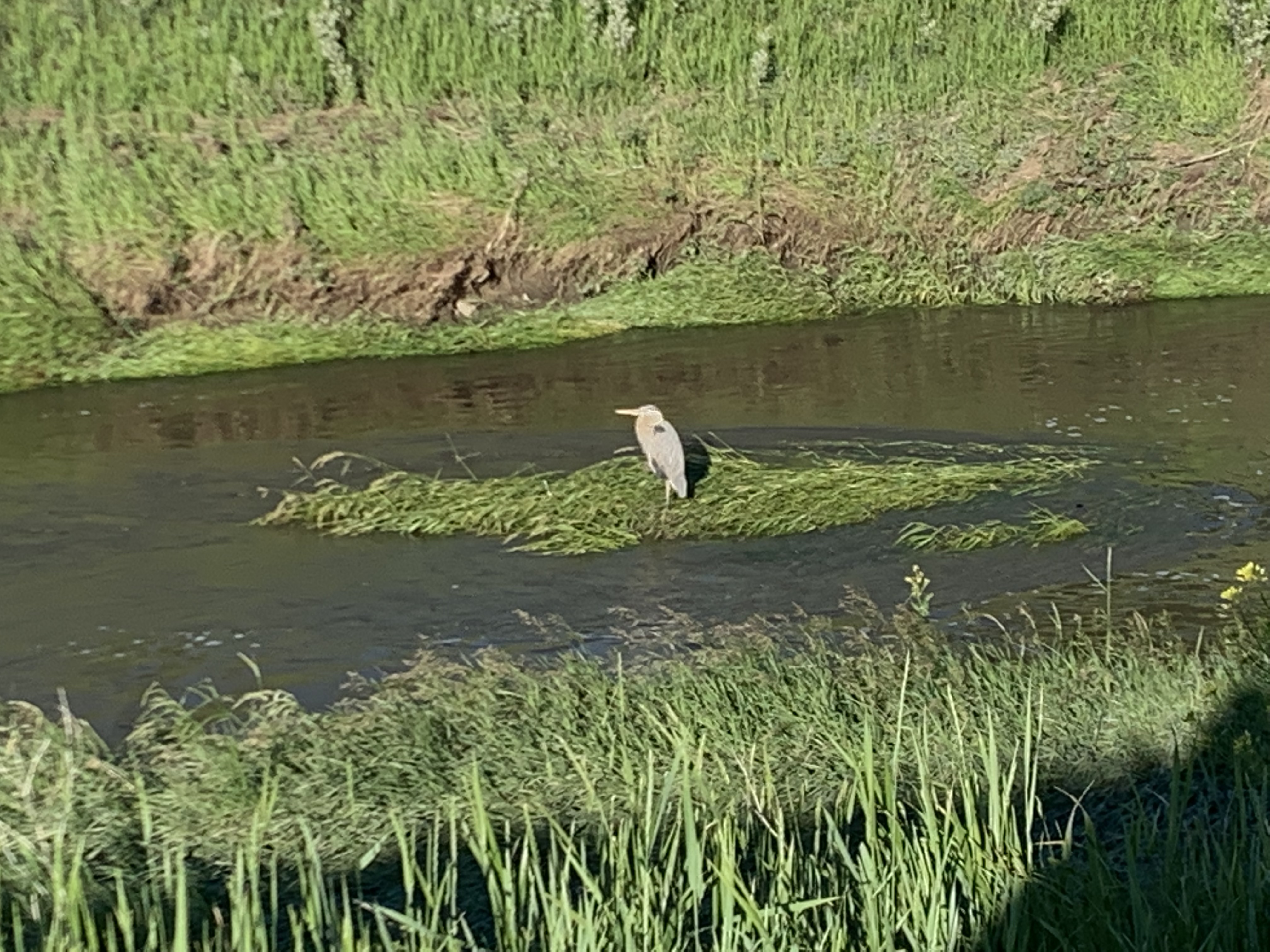
 Nose Creek Heron

    I was sleepy today. I don’t normally nap, but had to stop twice to be able to keep riding. Once in a Calgary park, once under a tree by the side of the highway. What was supposed to be a 130km day ended up being 170 after all the detours and side trips, so I really needed those naps. 
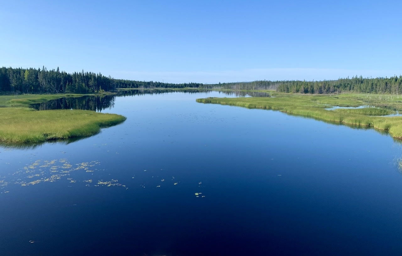
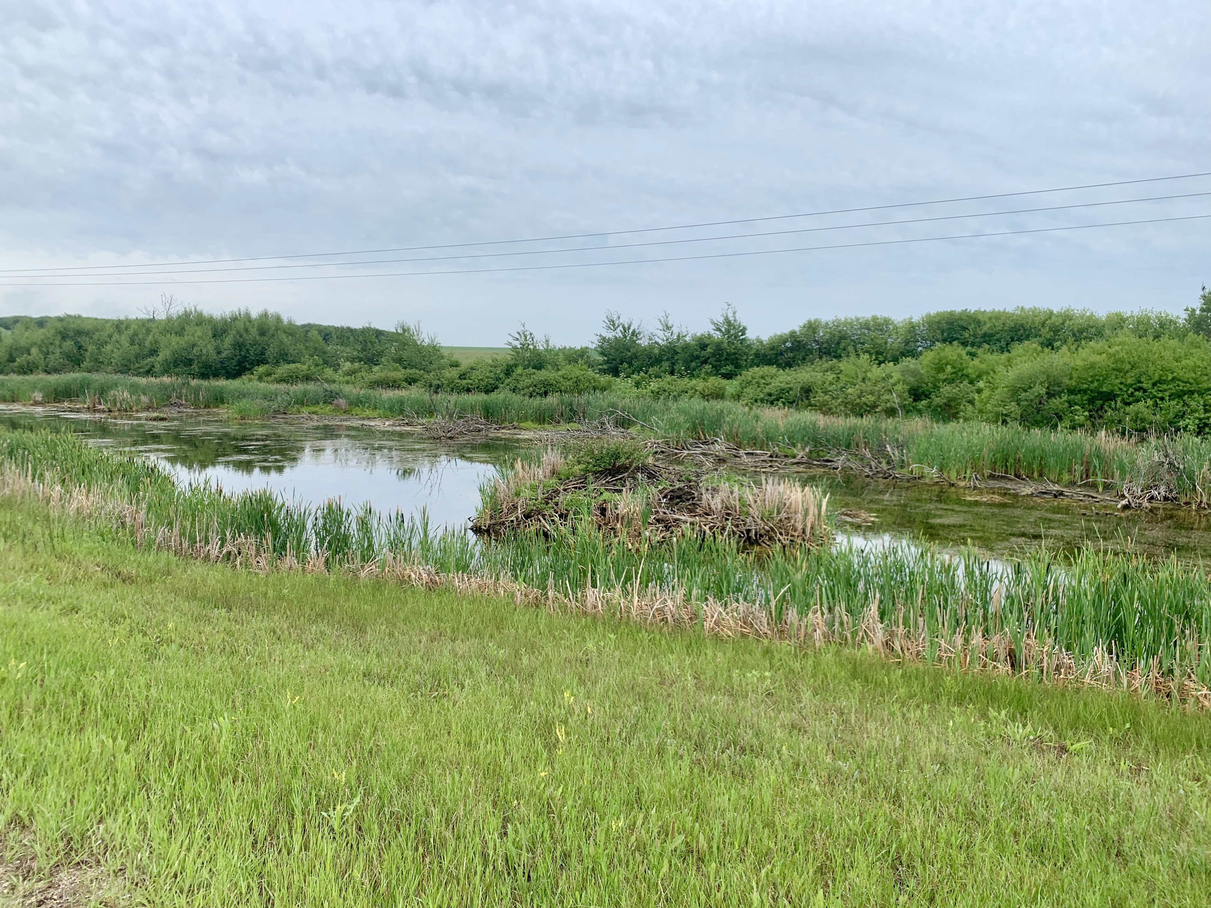
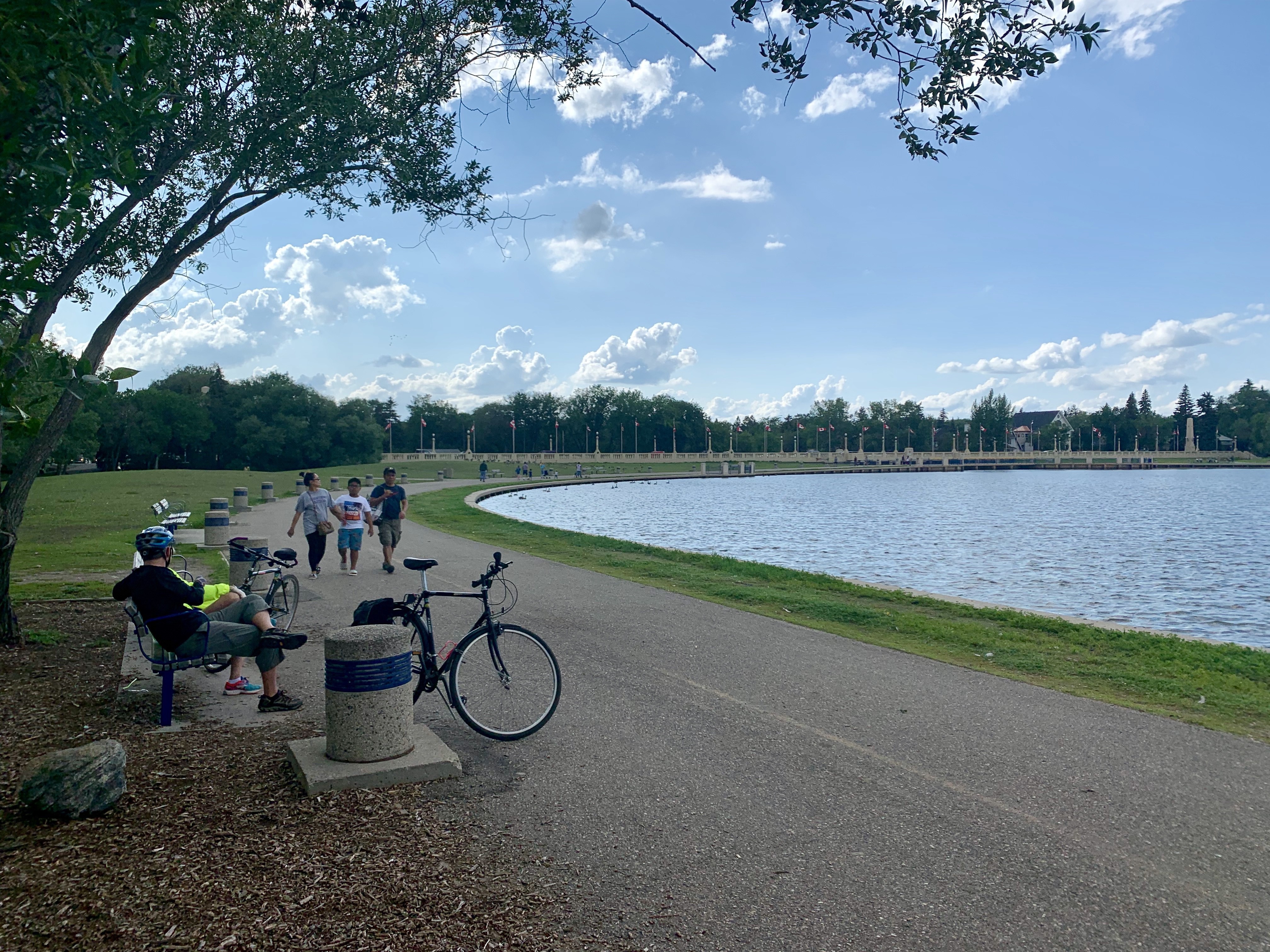
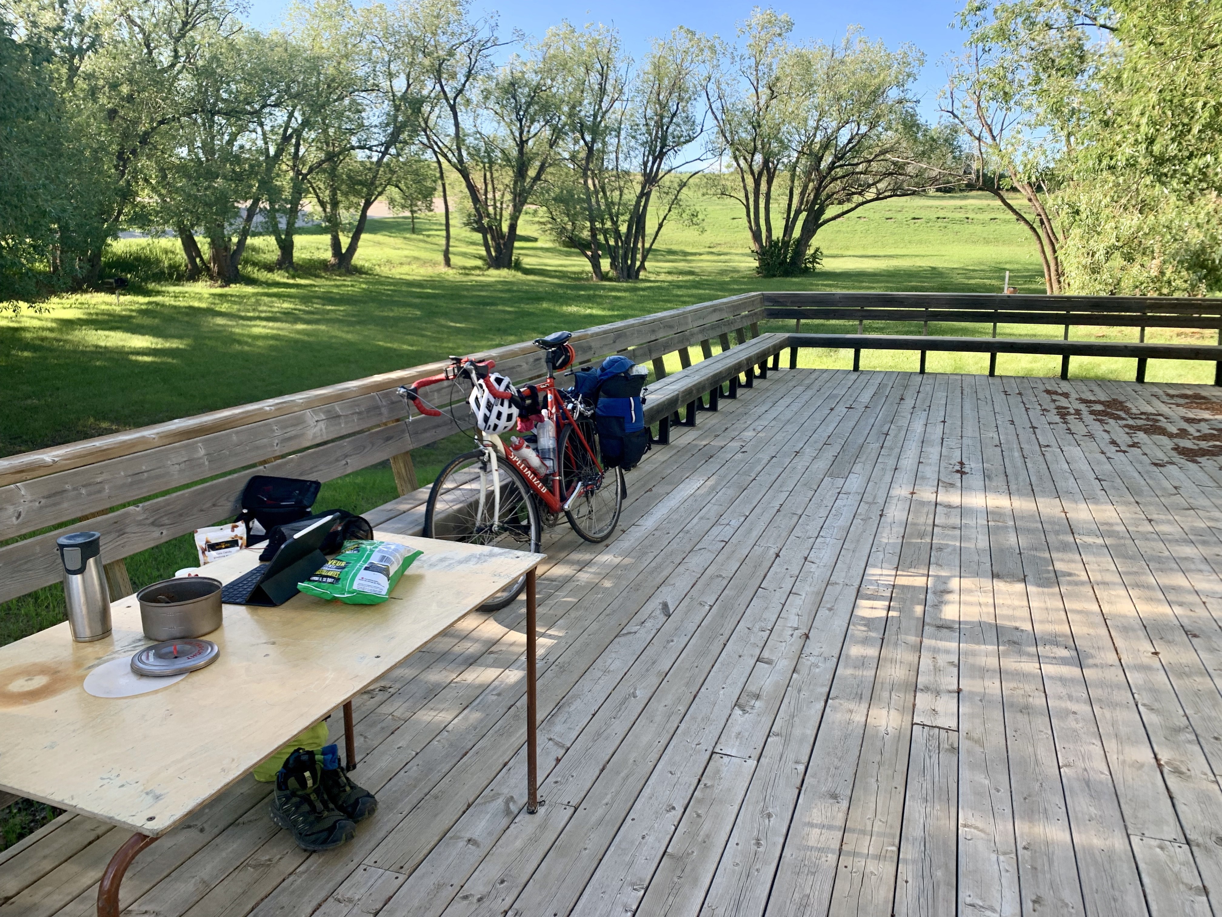
The spot of nap #1. Lots of baby ducks.

    I spent so much of today feeling like I was in a Windows XP desktop image—blue skys with occasional clouds above, green fields below. Very flat for the most part, but I could tell something was up as I approached Drumheller as the terrain started to get hilly again. Just begging for a Start menu at the bottom

    Riding down into the badlands, I stopped to take my picture with the dinosaur by the welcome sign. It would not be the last dinosaur. The town is dinosaur crazy, with fibreglass statues everywhere. The main attraction is what they bill as the largest dinosaur in the world, which is big enough that you can scale several flights of stairs to take pictures from inside its mouth. 
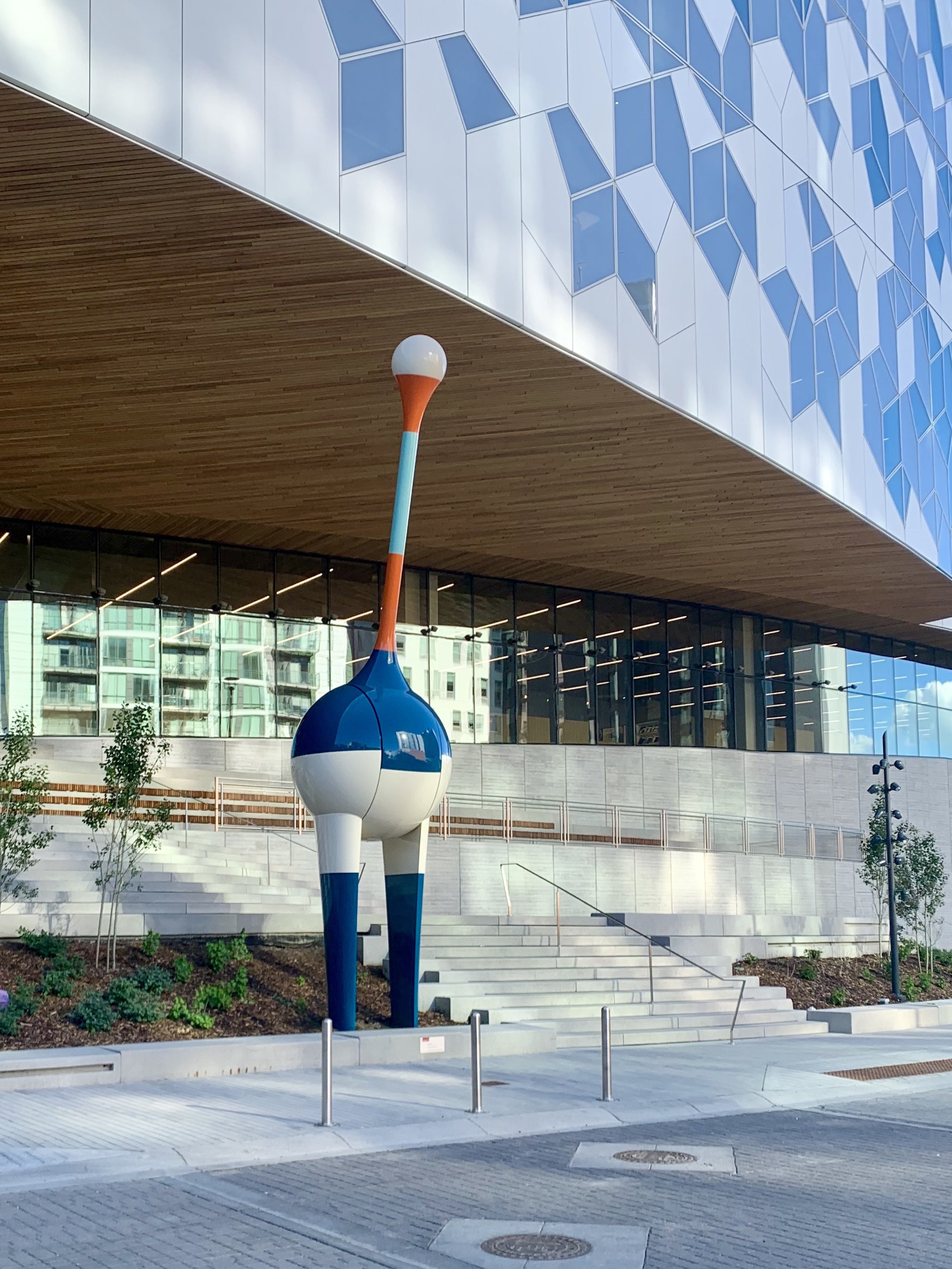
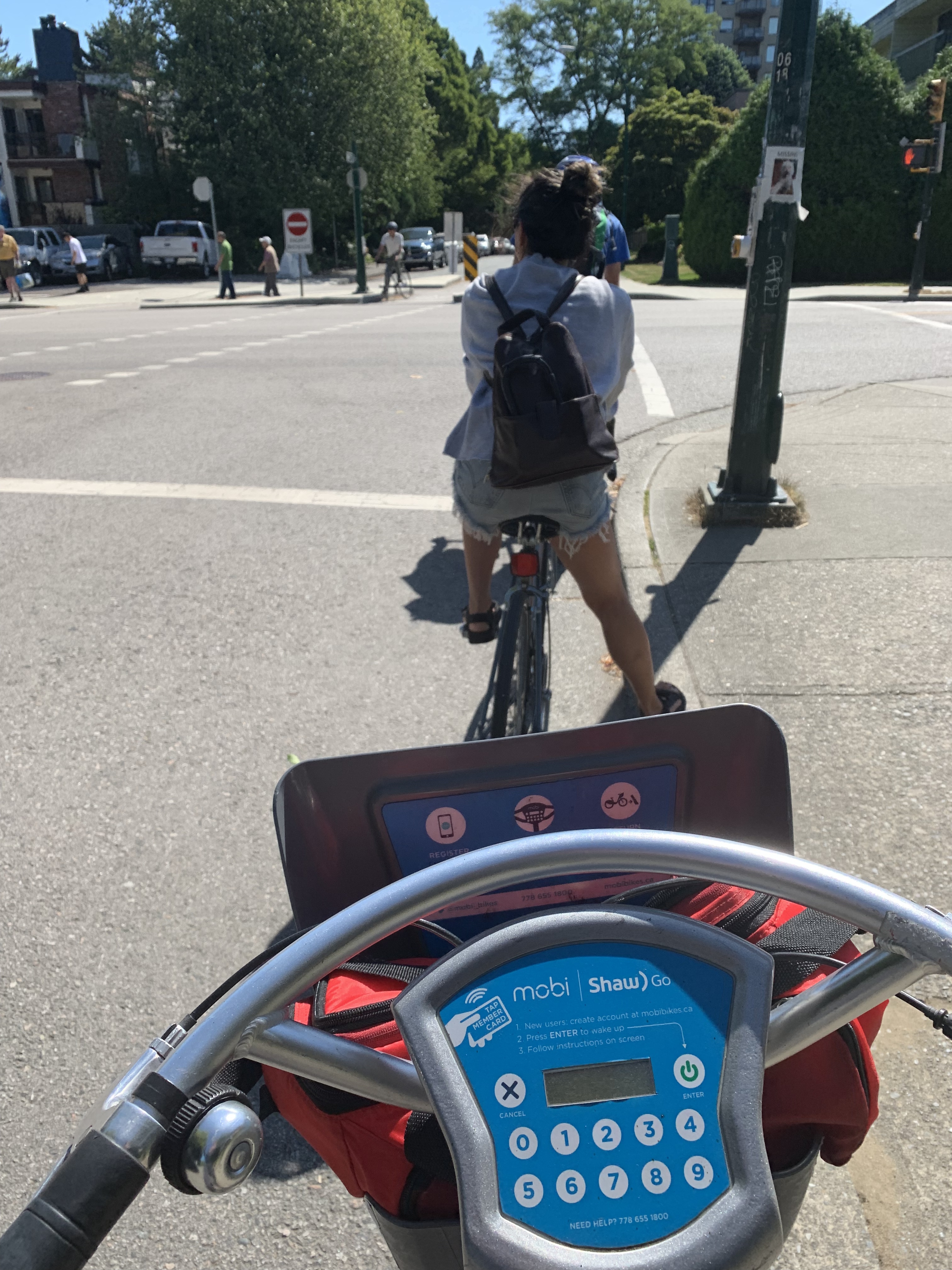
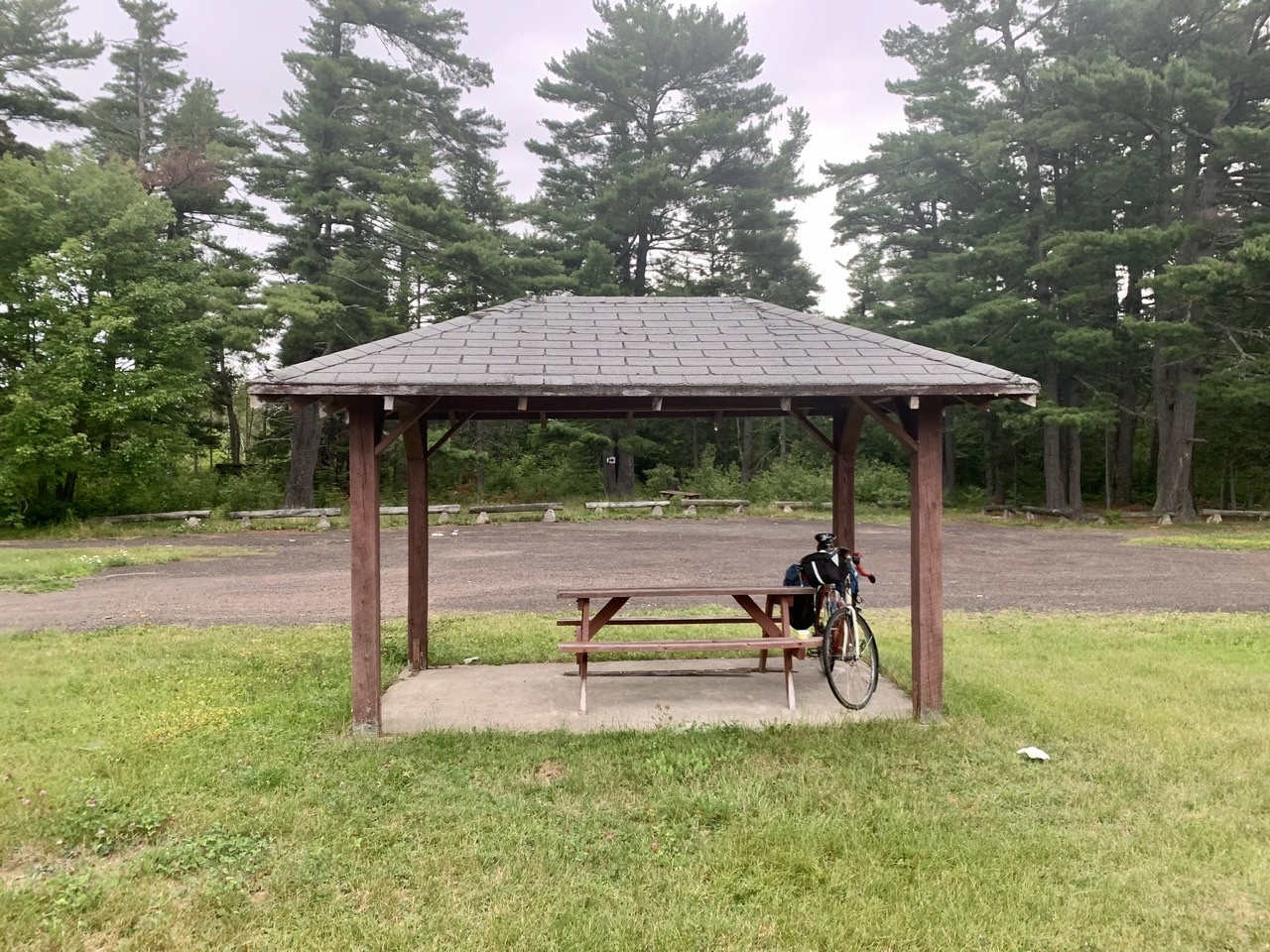
Once again, I’ve hidden my bike in the shot

    After a dinner of Sidekicks and tuna, I pedalled my way to the outskirts of town to check out the Royal Tyrrell Museum. It was really cool. So many amazing dinosaur and other creature fossils. I’d love to come back when I have more brain energy to focus on the descriptions, but I was so drained I stuck to being astounded by the wonderful dioramas. The museum staff recommend saving two to three hours for the visit, but I was done after 45 minutes.

    After the museum I made my way back to town, loaded up on supplies at the grocery store for the rural days ahead, and found a nice pine tree in the riverside park to sleep under. 
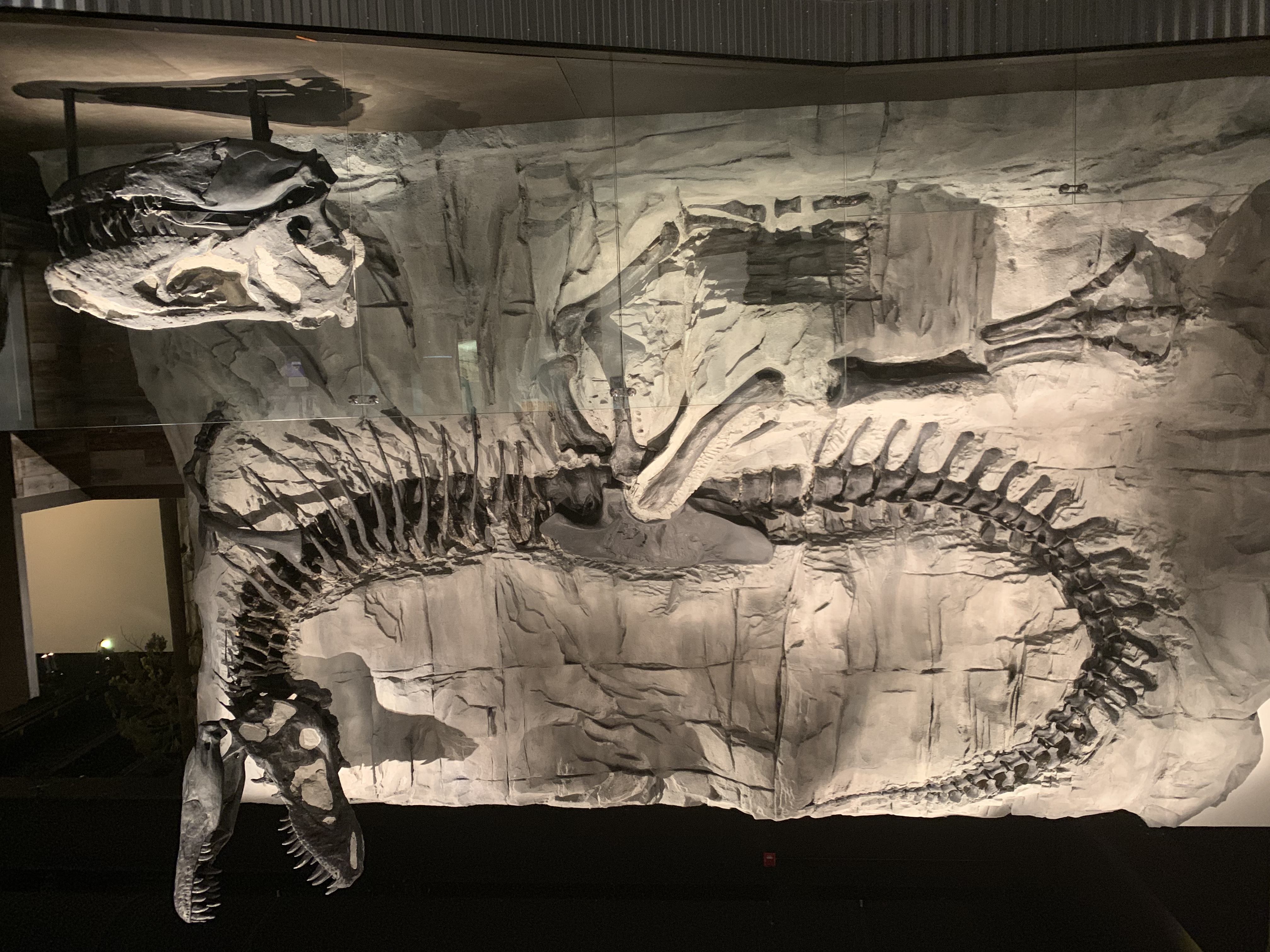
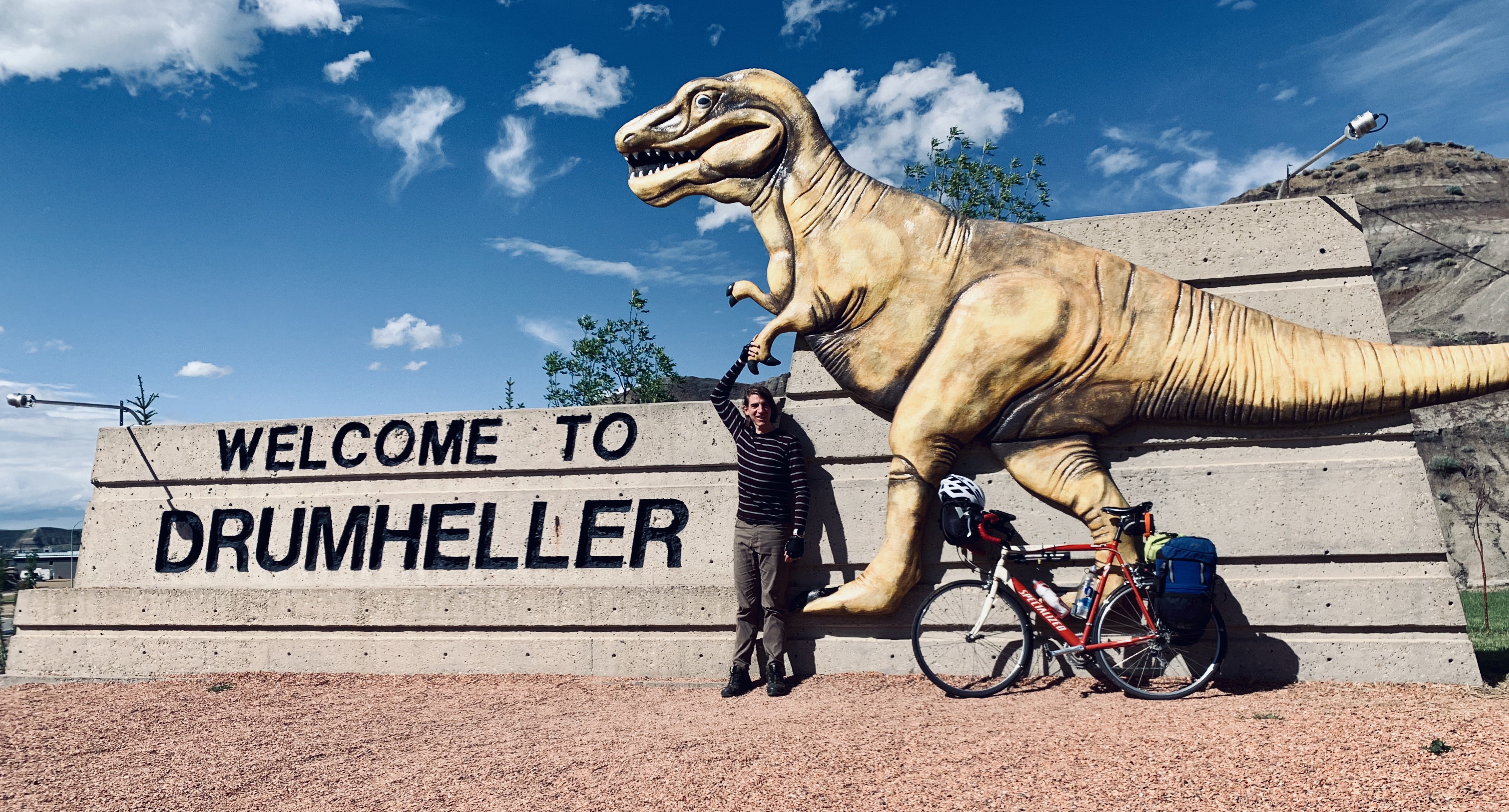
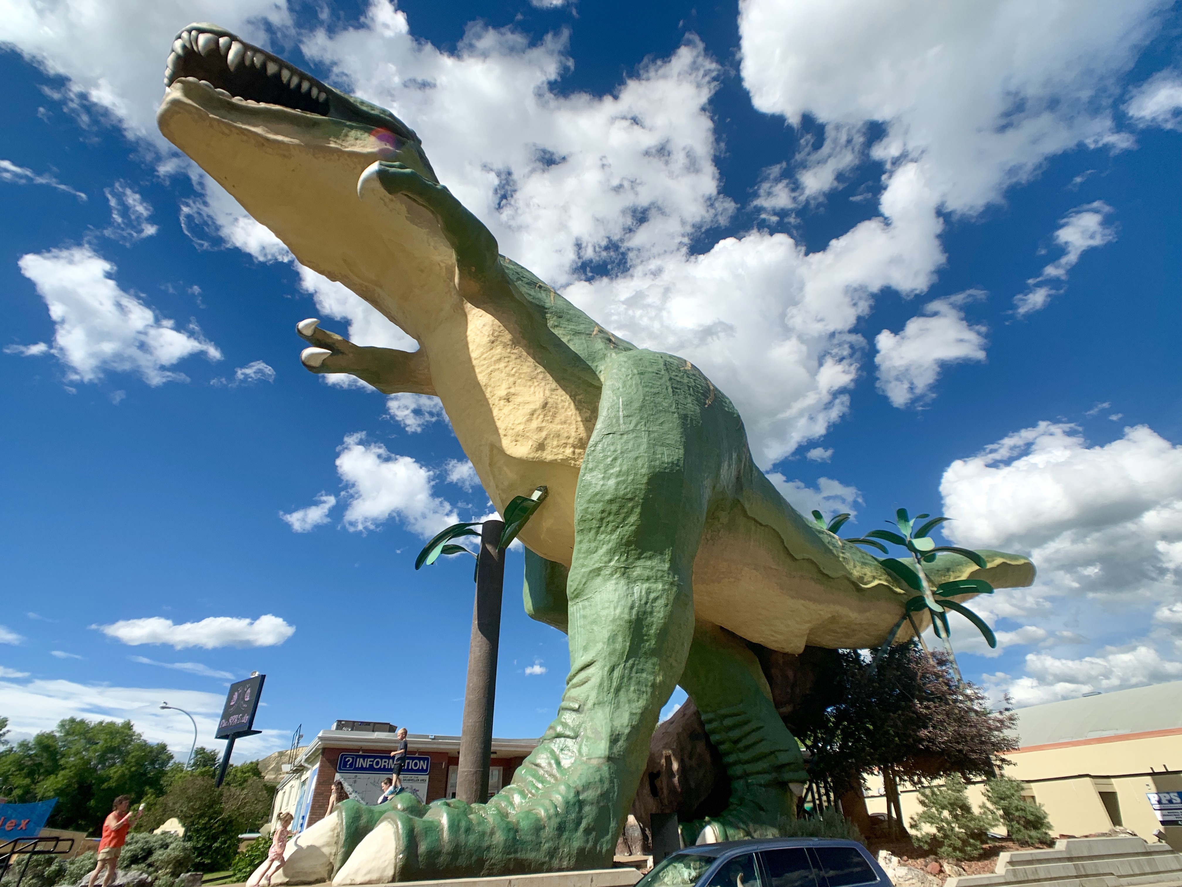
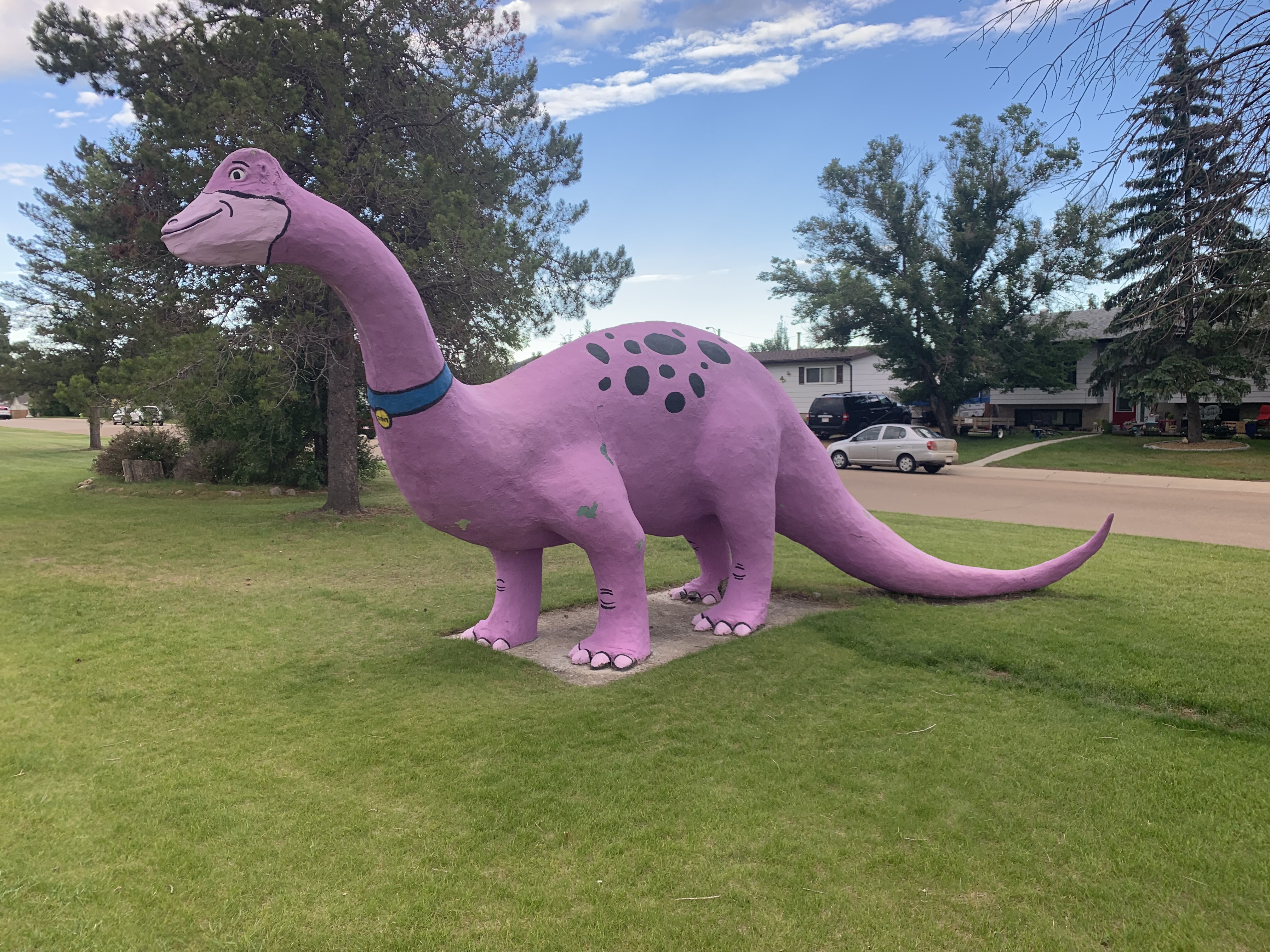
Out of all the dinosaur statues, this one is my favourite

    Today’s Distance: 170 km Cumulative Distance: 1399 km

    → 9:57 AM, Jul 1
  • I may not get a blog post out today due to limited Internet access, so here’s a t-shirt of a T-Rex riding fixed. No need for brakes if you can’t reach the handlebars.

    → 11:26 AM, Jun 30
  • Biking Across Canada Day 12—Banff to Calgary: Goodbye Mountains, Hello E-Bikes!

    Leaving Banff before everyone was awake
    The Calgary Tower, now in in it’s sixth decade.

    I’ve gotten lucky with the weather. My rest day was rainy, but today was beautiful and sunny with a lovely tailwind.

    Left Banff shortly after 6am. Tom got up to see me off. The streets were empty, and I quickly got onto the Banff Legacy Trail that connects to Canmore, which meant I was able to ride for more than an hour without encountering a car.

    After the trail ended in Canmore I switched over to the Bow Valley Trail, a two-lane highway similar to what I rode to Banff, though through more industrial areas so there were trucks. I ran into Hali and Boone, two cross-country cyclists also heading east. I’d met Hali two days ago heading into Banff. They’d spent the past two nights with a Warm Showers host in Canmore, but will be parting ways in Calgary. We rode together for an hour or so before a botched attempt to stop for coffee split us up, though not before we shared contact info.

    Despite following the railroad for almost two weeks, this was the first time I was stopped by a train. That’s Hali ahead of me. I can’t believe how much gear he’s hauling.

    Riding through the Bow Valley was beautiful. I’d see the mountains in my rear-view mirror, and the foothills ahead of me. I had my first (low-speed) tumble when I pulled over on to soft gravel to take a picture and my bike fell over underneath me. Both rider and bicycle were unharmed.

    This photo cost me a little bit of my dignity.

    I made a brief foray into Cochrane to visit a print shop to have some postcards printed, then continued on the 1A to Calgary, making great time due to the aforementioned tailwind. 

    Cochrane. Like Golden, it’s a heckuva climb out of town.

    I took the Bow River Pathway into downtown, getting a great view of the ‘88 Olympic facilities. My brother put on Cool Runnings as a joke last night to make sure I’d recognize them. We share a strange sense of humour.

    Can you see the ski jump and bobsled run?

    This trip has been a chance to visit much of the active transportation infrastructure that gets Bike Twitter excited. The Peace Bridge over the Bow River was one of those projects that I was thrilled to encounter.

    I wish I could have come back after dark to see it lit up

    Tonight I’m staying with my cousin Kyle (no, his name’s not Kyle Kyle, though we do share a paternal grandfather), but having dinner with my friend Evan. Originally from Nova Scotia, Evan went to the University of Waterloo with Rod & Quinn, my friends in Vancouver. Before dinner, Evan took me on a scenic bike tour of Calgary’s cycling infrastructure. He knew I like to try out bikeshare options, so we borrowed a couple Lime e-bikes and went on a 17-km ride.

    Evan doing his bicycle ambassador duty. Look: separated cycle tracks!
    One of Canada’s most famous bike counters. I rode by this a few times and it made me happy each time.

    The e-bike was a blast. Made all the hills disappear. It wasn’t as adjustable as I’d like, but it turned out not to matter because I didn’t have to push on the cranks hard enough to care about proper mechanical advantage. The dockless bikeshare was also great. We could hop off and ditch our bikes anytime we wanted—no need to keep track of where the nearest station was. I think e-bikes and scooters are the future of mobility for urban areas. You don’t have to be fit to bike, and they’re way safer and convenient than driving.

    Calgary has done incredible placemaking work done by the Bow River. So many places to linger.
    The rapids courses. I’m told it’s packed with dinghies and kayaks on a warm weekend day.
    A giant drinking bird statue outside the new library. It actually bobbled.

    After a yummy dinner at Evan’s favourite BBQ place downtown, I headed over to Kyle & Kiera’s. They just moved into a beautiful 1931 home south of downtown. It was like staying in Wayne Manor. I hadn’t seen them in I can’t remember how long, so it was nice catching up.

    Today’s Distance: 149 km (plus 17km of e-biking)
    Cumulative Distance: 1229 km

    → 4:13 PM, Jun 29
  • Biking Across Canada Day 11: Rest Day in Banff

    Some music, a beer, and a good set of tools made the maintenance work easy

    Today was quiet: an actual rest day for a change. I barely took any pictures.

    I had stayed out late celebrating with my brother and his friends, so had a bit of a sleep in (as much as my body clock would allow for). Then I spent the morning relaxing on the couch, staring at spreadsheets and maps while I replanned my itinerary for the next two weeks. I’d planned on visiting friends in Lethbridge, but they have to travel unexpectedly so I’ll cut that leg of my trip and spent the time seeing more of the prairies (as I’d previously been to Lethbridge in 2015).

    I’ve decided to go to Drumheller and cut over to Saskatoon. You can see my updated itinerary for more details.

    Banff Ave

    After my brother got up we went into town for late breakfast and some bike brake pads. Mine need replacing after all those mountain descents. Then a trip to Canmore for groceries, more searching for brake pads (couldn’t find them in Banff), and a trip to the thrift store so Tom and his roommate could buy a DVD player. Their other roommate just moved out, the Internet was in his name, so they are without Netflix for a little while.

    The park office. A beautiful place to work, though probably a little drafty.

    We spent the afternoon playing Mario Kart on a Super Nintendo, I fixed my brakes in Tom’s basement workshop, and we had barbeque for dinner. They made me a real feast to send me off.

    Tomorrow: Calgary

    Getting my gloves dirty

    Today’s Distance: 0 km

    Cumulative Distance: 1080 km

    → 12:34 PM, Jun 28
  • Biking Across Canada Day 10—Kicking Horse to Banff: It’s All Downhill From Here

    Lotsa mountains today

    I started out the day by visiting the two spiral tunnel viewpoints. They’re railway tunnels carved deep into the mountain to reduce the grade of the climb from 4.5% to 2.2%. Having biked the non-spiral-tunnel climb I can vouch for their need.

    The infographic at upper spiral viewing site, which is located lower than the lower spiral viewing site. Got it?
    Can you spot the upper spiral tunnel?
    Lower spiral tunnel
    A fun 3D model of the tunnels

    After a few more kilometers of climbing I reached the top of Kicking Horse Pass, which at 1643 metres is the highest point on the Trans-Canada Highway. The pass serves triple duty, as it also marks the divide between Yoho and Banff national parks as well as British Columbia and Alberta.

    The view from the top
    There wasn’t a BC sign at the Victoria airport. I’ll have to settle for this picture.

    After heading down from the pass I rode into Lake Louise. The climb from the village to the lake proper was steep, and at 1750 metres it’s higher than Kicking Horse, but it was worth it. The lake and hotel are both beautiful.

    I dipped my feet into the waters of the lake, and heard someone say “cold feet again?” It was the German couple who camped next to me last night, and who came down to the Kicking Horse River as I was dipping my feet in last night. We seemed to be on the same schedule.

    Leaving Lake Louise I opted for the Bow Valley Parkway instead of the Trans Canada, and was rewarded with the best riding of the trip so far. A two-lane highway with great scenery, paved shoulders, no trucks, and the only drivers on that road are also there for the scenery so they tend to be patient. Oh, and nearly all downhill! I loved it. Partway through I caught up with a cyclist named Bruce, and we road together for an hour or so into town. Bruce grew up in the prairies, moved to Banff 20 years ago, and bikes nearly every day he can.

    I spent about ten minutes waiting for the road to clear for this shot
    View from the Bow Valley Parkway
    This bust stop reminded me of My Neighbor Totoro. I imagine if I waited long enough the cat bus would come and get me.

    I got to Banff in the late afternoon. My brother was waiting for me with a beer. We haven’t seen each other in a few years, so it will be nice to spend a rest day here tomorrow catching up.

    Photo credit: Bruce
    My big little brother

    Today’s Distance: 96 km

    Cumulative Distance: 1078 km

    → 12:59 PM, Jun 27
  • Biking Across Canada Day 9—Rogers Pass to Kicking Horse: Anything's Passable with Enough Dynamite

    The beautiful lonely road out of Illecillewaet Campground

    Today turned into a slog. I'm not sure why I thought it was a good idea to travel 140+ kilometres in the mountains. The lack of campsites was a factor, so was wanting to get to Banff to see my brother, but I probably shouldn't have tried to do so much in a day.

    I got up early, said goodbye to Richard and Aaron, and headed out for a day of adventure. A few kilometres of climbing brought me to Rogers Pass, which has a nice commemorative site.

    Rogers Pass
    Artillery turned into avalanche tool
    The summit proper. Hard to believe the hills on the Coquihalla Highway are higher than this.

    Though I mostly listen to podcasts in quiet moments (using bone conduction headphones so I can still hear traffic, Mom), each day I seem to get a song stuck in my head, and the only cure is to sign along a doezn times or more. Yesterday it was Prince's Raspberry Beret. Today's groove was Talking Head's cover of Al Green's Take Me to the River. If you see a dude roaring down the highway on a bike while dancing along to the beat, that's me.

    The Columbia River
    Sometimes construction means I get a whole lane to myself. Sometimes I gotta squeeze in with cars.

    People keep asking/warning me about trucks on this trip. I find truckers to be consistently considerate. They give me space when they can't, and warn me when they can't. Shoutout to the trucker who waited patiently behind me for kilometres while I slowly made my way up hill through a narrow construction site, keeping all the impatient drivers behind him.

    After a long descent out of Rogers Pass, followed by another small summit, I made it to the Columbia wetlands, a wide marshy valley that I rode from Donald to Golden, though it continues beyond.

    The Columbia Wetlands

    The climb out of Golden was a challenge. A lot of elevation gained in a short period of time, with narrow or non-existent shoulders for stretches. You get some good views as a result, though. 🤷‍♂️

    I burned a lot of calories for this shot.

    Some time after Golden is the the 405-metre-long Park Bridge, which is the most impressive-looking engineering project on the route. Scratch that. The pass cut through the rocks right after the bridge is mind-boggling. How much dynamite did it take to cut that road out of the rocks?

    That’s a big bridge
    Why couldn’t I just take that road down there?
    -“Shouldn’t we just go around?” -“And waste all this dynamite‽”

    Late in the afternoon after entering Yoho National Park, I found myself dragging. I should have left Golden earlier. I promised myself a dinner in Field if I could just make it there.

    Field, seen from the Trans Canada
    An old house in Field
    I think this might have been the old railway station

    I arrived in Field just before 7, had a quick curry bowl at the Siding Cafe, and felt myself reenergized. Field has some pretty buildings. Apparently they renamed the town after some rich businessman who they hoped would invest some money here. Some things never change—remember all those desperate Amazon HQ2 bids?

    Made it to the Kicking Horse campground to find out they were rebuilding their shower facilities. They gave me a $5 refund as a result, but man was I looking forward to that shower. Oh well. I'll have to wait until Banff tomorrow.

    The view from my campsite
    Relieved to have made it
    A neat group cookstove in the picnic shelter

    Today's Distance: 152 km

    Cumulative Distance: 984 km

    → 3:53 PM, Jun 26
  • Made it to the top of Kicking Horse Pass, the highest point on the Trans Canada; the corollary is that it’s all downhill from here.

    → 1:29 PM, Jun 26
  • Biking Across Canada Day 8—Yard Park to Rogers Pass: Shoulda Sent a Poet

    A signpost to all the peaks I’m avoiding

    I got another early start, knowing I had a lot of climbing today. Shortly down the highway I stopped at Craigellachie, location of the the Last Spike in the Canadian Pacific Railway. I realized I should have stayed here last night. There was shelter, fresh water, flush toilets, and a power outlet, more than what my paid campsite had.

    More riding brought met to Revelstoke, where I stopped for a long coffee and second breakfast break to write up the previous day’s blog post.

    The Columbia River. I’ll spend a lot of time following and avoiding  it.
    Mountain View School in Revelstoke
    Aforementioned Mountain View

    I biked through Mount Revelstoke National Park where I stopped for lunch at Giant Cedars Boardwalk, which had a 500m trail among the giant trees. They lived up to the name.

    After Mount Revelstoke was a series of tunnels (always thrilling) and a long climb into Glacier National Park, where I stopped at Illecillewaet Campground, just a few kilometres short of the Rogers Pass summit.

    I keep wondering how the road will get me through these mountains. It can’t possibly go this way…

    All day I’ve been biking by these incredible mountain ranges. I can’t do them justice in either words or pictures. As Ellie Arroway said in Contact, “They should have sent a poet.”

    Here I ran into Richard and Aaron, two fellow cross-country cyclists. We agreed to share a site to split costs and swap stories. They’re both from Welland, outside Niagara Falls, and are biking home from Vancouver. My dad grew up in Niagara Falls, and I’ve done a lot of cycling in the region, so we had a lot to talk about besides our bicycle trips. It was nice to have company after so many days travelling alone.

    Sharing a site and campfire with my fellow travellers

    I was excited when I say Hannah Tooktoo’s support van pull up a few sites over. Hannah is an Inuit woman biking across Canada to raise awareness about suicides in indigenous communities. I’d heard about her trip around the start of mine. We both started in Victoria around the same time, but I feared my accelerated pace meant I’d missed encountering her.

    We chatted for a bit about her trip. She’s stopping in band offices as she goes, hearing their stories of colonization and how they got to where they are today. She also has a spouse and offspring back home, so we got a chance to share pictures. Later, she brought Richard, Aaron, and I some fresh-made bannock. It was a delight.

    Bannock!

    Tomorrow I’ll crest Rogers Pass, head through Golden, and then most of the way up Kicking Horse Pass on my way to Kicking Horse Campground.

    Today’s Distance: 127 km

    Cumulative Distance: 832 km

    → 5:22 PM, Jun 25
  • Biking Across Canada Day 7—Kamloops to Yard Creek: The Shuswap Hop

    I love the cursive writing on this sign

    I really like getting an early start. Hitting the road at six a.m. gives me a few hours of quiet riding before traffic picks up. I feel bad for my hosts, though, who feel obliged to see me off. Lindsay was a really good sport—she got up early and got on her bike to give me an escort out of town. I really appreciated it as it gave us a rare chance to ride together, and I had help navigating the patchwork connections of bike routes in Kamloops.

    I had a nice ride along the South Thomson River on my way to Shuswap Lake. Some rolling hills, but mostly flat. Today is a day with a surprising amount of climbing, but very little net elevation gain.

    I kept seeing these tubes on trucks and trains. I thought they might be for wind turbines until Jon pointed out they’re oil piplines
    Outside Chase I saw these rail vehicles and workers gathered for a railway maintenance convention, I presumed.

    Stopped for coffee and second breakfast at the Inside Out Coffee Shop in Chase. The proprietor was a fellow bicycle tourist, and he gave me a couple cookies for the road. They were yummy.

    Cookies! 😍🍪

    Radar is a wonderful thing. As I approached Salmon Arm I could see a storm was following behind me, giving me time to seek shelter. I found a peace gate in the park, and spent an hour eating snacks, calling my wife, and planning the route ahead.

    Pretty place to wait out a storm
    After the rain

    After the rain subsided I pushed on to Sicamous, which had a wonderful sign. Sicamous dubs itself the “Houseboat Capital of Canada” I had planned on stopping here for the night, but I had made good time, my legs felt strong, and the winds were favourable to I made the decision to press on.

    Lots of boats

    I made it to Yard Creek Park on the Eagle River. It’s my favourite type of frontcountry camping, where the sites are surrounded by trees and you can’t see the next site. The park has a muddied history, though. It was used as an internment camp for Japanese Canadians during the second world war who were put to work widening the highway between Sicamous and Revelstoke. The brochure said you could still see the foundations of the interment camp buildings, but I was tired so went right to bed after pitching camp and cooking dinner.

    Today marks the end of my first week. Tomorrow I’ll be hitting the mountains proper, making my way most of the way up Rogers Pass.

    Today’s Distance: 157 km

    Cumulative Distance: 705 km

    → 3:27 PM, Jun 24
  • Biking Across Canada Day 5—Merritt to Kamloops: Ear-Popping Descents

    I could easily get a speeding ticket here.

    Spent the night in the picnic shelter at Merritt's Central Park. It was a great place for stealth camping—covered roof, and walls to protect from the wind that kept me out of sight. I was able to roll out my sleeping bag and sleep undisturbed…by people.

    Notice how green the park grass is compared to the hills beyond. There's a reason for that.

    Turns out I should have been suspicious of that green green grass in the middle of the desert. Around 1 am they turned on the irrigation system. I stayed dry, but it made quite the racket on the metal roof I was sleeping under. 🤷‍♂️

    Once I got the road I was treated to some beautiful scenery, which was good because the climbing was challenging for this person who lives at sea level. It gave me many good excuses to stop and catch my breath. I also invented a lot of mechanical issues that required immediate attention while making my way to the summit.

    I'm told the climbing gets easier after this.

    Late in the morning I turned off the main highway and headed for Lac au Jaune Provincial Park, where my friend Jon met met for an escort into Kamloops. He drove in from town with his bike in the back of the van, with plans to retrieve it later. That meant I was able to ditch most of my luggage and enjoy an unencumbered ride. And what a ride it was!

    Next time I’ll bring a canoe

    We had about 800 m of elevation to shed on the way into town, which led to lots of fast riding on a twisty two-lane road. We'd scream down the hills, stop to equalize the pressure in our ears, and scream down the hills some more.

    This part of the ride was also a study in aerodynamics. I had one pannier and a handlebar bag, while Jon had none. He was able to coast past me on the downhills while I was pedalling hard. It shows how much of an effect my luggage has on my exertion levels. More justification for packing light.

    Kammy, you’re great. We won’t mention Husky the Muskie here.
    Taking a pano of me taking a pano

    Jon took me on a detour to see Kammy the trout, a carving of the Kamloops rainbow trout made for the 1993 World Fly Fishing Championship. Then we took the new multiuse pathway that opened this year. It was a beautiful trail, but decidely not an All-Ages-and-Abilities trail. The grade was way too steep for most cyclists. We were heading downhill, and had to brake the entire time to keep our speed to a reasonable level for a path shared with pedestrians. We could have easily hit 50 kph without pedalling (right before we would have crashed into one of the many switchbacks), and had to stop partway to let our rims cool down as we were risking tire blowouts. I wouldn't want to ride that trail uphill—it makes the Macdonald bridge access in Halifax seem trivial by comparison.

    This is great! No cars, and great views.
    Uh, this is really steep. I can’t let go of the brake.
    You’ve gotta be kidding me!

    It's the kind of bike infrastructure that makes it easier for people already cycling to keep cycling, but won't convince anyone new to try it. I wouldn't let my kids ride it—too dangerous.

    After a much-needed shower at Jon & Lindsay's house, Jon and I drove in his convertible sportscar back to Lac au Jaune to retreive the van we left behind. If you're going to own a convertible, Kamloops is the place to do it—the desert-like conditions give you a lot of sunny driving days, and there are plenty of curvy mountain roads to enjoy. It was strange taking those same roads I'd biked in a car. It was nice being a passenger and having the chance to gaze at the scenery—when you're riding a bike you spend a lot of time staring at the road a few metres ahead of your front wheel—but when I was driving the van I much preferred the bicycle experience. I guess that's why I'm doing this trip.

    Tomorrow (Saturday) will be a rest day in Kamloops visiting with Jon and Lindsay and their kids. I'm looking forward to it. Those two are dear friends and I don't see them enough.

    Today's Distance: 92 km

    Cumulative Distance: 548 km

    → 3:24 PM, Jun 22
  • Biking Across Canada Day 4—Hope to Merritt, BC: A Visit from the Roadside Fairies

    So happy to be done with all that climbing

    Spent the night at the Othello Tunnels parking lot, as the campground options in Hope weren’t appealing, especially after I’d already had a shower at the Harrison hot springs. There was a nice covered interpretive display, so I didn’t even need a tent. A cyclist came through shortly after 6 and we had a nice chat about his previous bicycle touring trips.

    A pleasant sight to wake up to
    Some people put books under their pillow in the hopes that they’ll learn the contents. I slept under the sign, which was just as effective.

    I spent most of the day riding the Coquihalla highway, which has a wide paved shoulder for most of the way. It has a bad habit of removing the shoulder to add another passing lane, giving you about a foot of space between the painted line and the concrete barrier. Thankfully all the truck drivers would move over to give me space, but I still spent a lot of time checking my rear view mirror to make sure.

    View from the highway
    Tunnel up ahead. Better pull out my bike lights.

    Shortly after I finished the bulk of climbing the Coquihalla summit, my friend Jon from Kamloops passed me in his van. He and his son were driving to Hope to see friends (more visitors from our shared hometown of London Ontario), saw me on the other side of the highway, pulled a U-turn and stopped to give me gatorade and water (He knew to expect me). It was very welcome, as I was running low on water at this point.

    Gifts from the roadside fairies

    Jon continued north towards Merritt so he could do another U-turn and continue his drive to Hope. He managed to pass me again when I reached the summit proper and take a picture of me celebrating climbing my first mountain pass.

    After the pass I quickly reached the Britain Lake rest station, which had a place to sit inside and free wifi. Free wifi! I was able to call my kids, eat a big lunch, charge my batteries, and write a blog post. It was great. I spent two hours there, which was probably too long given the rainstorm I rode into later.

    A pleasant place to spend a few hours

    The traffic was getting to me, so when my GPS and Google maps both suggested a quiet side road I turned off the main highway. Streetview hadn’t driven down the road, but the starts and ends were paved so I figured it couldn’t be too bad. Google didn’t know that the road was washed out at some point and was closed to cars. I pressed on, because I’d come this far and didn’t want to return to the freeway. For a while the trail was rough but passable, and then I got to the actual washout. Then it was pushing my bike up and down a steep trail carved into the riverbank. That was an adventure to navigate, but I’d probably still do it again.

    This wasn’t even my first warning.
    This doesn’t seem so bad.
    At this point I put down my bike and scouted ahead by foot. Seemed doable.
    Turned out there was a second washed out section
    At this point the trail was just carved out of the clay banks

    Once I got on the highway again it had started to rain. Hard. And the shoulder kept disappearing. I put on my rear light, gripped the handlebars tightly and got through the section as fast as I could. It was not pleasant—rain hurts when it’s hitting you at 60 kph, but I wanted to get off that highway fast. I whooped with relief when I got to the next side road. After that it was a quiet ride to Merritt following the Coldwater river, far away from all that truck traffic. No pictures for this section because I was cold and wet and just wanted to get somewhere warm. Now I’m sitting in a coffee shop that specializes in Bannock, warming up and waiting out the rain so I can go set up my tent.

    Today's Distance: 115 km
    Cumulative Distance: 456 km

    → 10:54 PM, Jun 20
  • I’m only a few days into my bike ride across Canada, and I could already do a whole @Cove17 style post about sewer grate designs

    → 5:53 PM, Jun 20
  • Day 3—Victoria to Hope, BC: Standing Next to Shoulders of Giants

    Rod is 6'9". Remember I said I'm only moderately tall? That's because Rod has always dwarfed me.
    This guy has some stories to tell.

    Got an early morning start, up at 5 and on the road by six. Said goodbye to Rod, but the rest of his family was still asleep. They had to settle for text messages.

    Had a really nice ride along the 10th Ave bikeway, then the Central Valley Greenway out to Warren's house in Burnaby. Said hi to the kids (who I last saw in 2015, so naturally they didn't remember me). Warren and I rode together to his friend Graham’s place in Maple Ridge, at which point he turned around to head to the office. He's casually fitting a 100km ride in before work.

    It was really nice riding with Warren. He rides more than anyone I know, so was able to provide excellent turn-by-turn navigations while leaving the city. Warren's wife Hillary went to university with my wife, they were roommates for a while, and she was one of our bridesmaids when we got married. Sara and I rode our tandem from Toronto to Kingston to attend their wedding. When they lived in Ottawa, we'd go visit them and go for bike rides together, and one winter we rented a yurt in Silent Lake provincial park for a cross-country skiing weekend. Sadly, Hillary died of cancer last year, and this was the first time I'd seen Warren since she was diagnosed. It was a good chance to talk about our grief, the intricacies of outliving your spouse while you're still in your thirties, and parenting through all that. Warren's been blogging about this since Hillary died, and I recommend reading it if you want to know more. It's heart-wrenching reading at times, but provides a window into what a lot of us idly speculate about.

    The ride was going well enough by mid-day that I opted for a detour to Harrison to visit the hot springs. I'm glad I did—I found a lovely natural cheese shop on the way. I got a few hundred grams of Rustica and went on my way.

    The hot springs were a nice place to relax my tired muscles. The town of Harrison has a sasquatch thing going on, so of course I took some fun selfies.

    A disconcerting sign. I made it through, obviously.
    Finally!
    The Fraser river
    I opted against a selfie here

    It was more nice riding on the #7 highway. Relatively quiet roads, but I was very happy to reach Hope as my legs (and everything else) were getting tired. They shot part of a Rambo movie here, and the town is still really excited about it. On the way out of town I took the Kettle Valley Railway trail to the Othello tunnels, which were phenomenal. Mostly hand carved out of stone (no tunnel-boring equipment), and fast twisty canyon river running underneath. Highly recommended.

    The "Window," a former tunnel which has been daylighted.

    Today's distance: 189 km (new personal record!)

    Cumulative distance: 340 km

    → 5:03 PM, Jun 20
  • Made it to the top of first mountain pass! Should have a new blog post later today.

    → 2:40 PM, Jun 20
  • Day 2: “Rest” Day in Vancouver.

    Today was a supposed rest day in Vancouver, but the problem with staying with friends you don’t see often is that you spend so much time visiting you don’t get much rest. I’ll have to catch up on sleep out of the city. 

     
    Some of that lovely placemaking that TJ Maquire loves so much

    Rod & Quinn were working today, and I had a few errands to run, stocking up on supplies before heading further west. That gave me the chance to try out Vancouver’s bike share system, and see how it compares to other cities. My verdict: the network is good, the bikes are not. There were tons of bikes everywhere downtown and the nearby neighbourhoods, and the price was reasonable (I paid $6 for 24 hours of access, with all trips under 30 minutes free). The bike was not adjustable enough. I’m not that tall, and still couldn’t get the seatpost high enough for comfortable cycling. A lack of a rear rack and a mediocre front basket limits your carrying capacity. This was my first time trying a bike share system that provides helmets, but they seem to mostly observe the letter of BC’s helmet law without observing the spirit—they were difficult to quickly adjust so I doubt the poor fit would provide much protection in a collision. Still nice to see bike share work in a place with helmet laws, which I’d previously didn’t think was possible.

    I spent time browsing stores in the outdoor outfitters district, but in a sign that I’ve done a good job preparing for this trip I didn’t buy anything. My reluctance to add any more weight to my pack certainly helps.

    After the MEC stop, I went to Famous Foods, which I heard had lots of hard-to-find dehydrated foods at good prices. I was not disappointed.

    Riding around town let me see a lot of Vancouver’s great bicycle infrastructure. It’s also nice to seem them actively improving the non-great stuff, like this local street bikeway on 10th Ave being upgraded to protected bike lanes. I did not mind having to get off and walk that section.

    Sensors that automatically detect bikes to trigger a green light!

    Still to many murderstrips, though.

    This is not an all-ages-and-abilities bike lane.

    I also made a point of visiting the new fully-protected intersection at Quebec and 1st. I rode through there a few times just to experience it in multiple directions.

    Some other highlights

    - Sushi lunch with my friend Warren, then coffee after to continue the conversation. Warren is going to ride out of Vancouver with me.

    - Visiting the fashion district and trying on a $1200 rain coat that is way out of my price range but would love to find on clearance some day. It looked _great.

    - A late-night beer with my sister-in-law. It was the first time we’d spent without our spouses there, so we finally had a chance to talk freely about this family we married into (who are reading this blog 😘).

    Today’s distance: 17 km Cumulative distance: 151 km

    → 3:42 PM, Jun 19
  • Tour du Canada Day 1: Victoria to Vancouver

    Got an early start today so I could get a few hours of riding in before traffic picked up. The nice thing about going from the east coast to the west is that the time zone change meant I got to get up at 5:30 am while simultaneously sleeping in until 9:30.

    My hosts, not accustomed to Atlantic time as I am, were still sleeping when I left, so I had to settle for a selfie with Dog, the dog.

    Dog puts up with a lot

    I rode down to the coast to do the typical cross-country bike tourist things, like dipping your rear tire in the Pacific Ocean, and posing with the Mile Zero marker. Then a quick stop at the legislature for some pictures. I should be able to hit nine of ten provincial legislatures on this tour. I’ll miss Edmonton, but I saw that way back in 2008.

    I do not recommend pushing a loaded bike through wet sand
    The view from Clover Point
    Careful bicycle placement hides the CAA logo

    The Galloping Goose Trail combined with the Lochside Drive trail meant I rode almost the entire way from Victoria to the Ferry terminal without encountering heavy traffic. The Galloping Goose is a shining example of how to design trail crossings: raise the crossing and make drivers stop instead of making cyclists dismount (side eye at you, Nova Scotia traffic laws that prevent this).

    The ferry to Tsawassan was lovely. I wish it was longer. I’m very fond of taking my bike on ferries. I hit three different ferries last month, so it’s nice to have the trend continue. I was eager for a coffee and snacks, so I opted to pay $13 for access to the SeaWest Lounge, where coffee and treats were complimentary, quiet was enforced, and wifi & power outlets were available. It was cheaper than what I’d pay for a coffee and croissant at the onboard café.

    View from the bow
    My obligatory picture of my bike on a ferry

    I’m meeting my friend Rod at his work in Richmond. We’ll ride from there to his place in Kitsilano. It was fairly nice riding between Delta and the Massey Tunnel to Richmond, but the tunnel is closed to non-motorized traffic. There’s a free shuttle that thought I’d try. Turns out it only runs every two hours outside of rush hour, which is how I ended up waiting for an hour at the side of a highway, trucks blaring by every few seconds. If Haligonians thought the Big Lift shuttle service was bleak, this place would make you cry.

    This was not a serent place to sit for an hour.
    The view from the bench. The sound and smell was even worse.

    While waiting for Rod, I took a detour to Steveston and checked out the Britainnia Shipyards National Historic Site, though I was pretty close to bonking at this point after poor eating decisions today so I didn’t stay for long. Paid way too much money for a latte and sandwich at a local café, but I needed it.

    The winch room. I like how that sounds.

    Rod and I have been friends for nearly 30 years. We were each other’s best man when we got married. Living on opposite coasts now means we see each other infrequently, but whenever we manage to get together it’s like no time has passed. I’m excited to get to spend a couple days together.

    Today’s distance: 109 km

    Cumulative distance: 134 km

    → 1:36 AM, Jun 18
  • Day 0: Halifax to Victoria

    I’m coming for you, mountains

    I caught an early morning flight to Victoria today. My bike survived the trip which was my biggest worry. Halifax Cycles did a great job boxing it up, and Air Canada managed to not lose or destroy it. The past few days have been a flurry of goodbyes interspersed with preparing our house for the people staying it in while we’re away. Now that I’ve arrived in BC I can finally relax—the trip is actually happening.

    I was very relieved when this showed up.

    I had Halifax Cycles stuff my luggage in the bike box since the airline doesn’t mind as long as you stay under their size and weight limits. They used a fat bike box to fit it all, but that ended up too long to fit in the back of my friend’s station wagon, so my attempt to avoid a $25 baggage fee inadvertently created a $80 cab fee. 🤷‍♂️

    This was a wonderful place to spend 90 minutes reassembling my bike and repacking my bags.

    The airport in Victoria is incredibly bicycle friendly. There’s a covered bicycle assembly area in the parking lot with bike lockers, tools, pumps, and a bike box library (I made a deposit today). 

    Water fountains are a welcome sight when you’re bike touring
    Pigs!

    Then the ride between the airport and Victoria is on many kilometres of protected bike lanes and local street bikeways with great wayfinding signs. I saw so many families riding bikes together on this sunny Sunday afternoon. Also, I rode by some pigs sleeping in the mud.

    Tonight I’m staying with Heather and James and their 4–6 kids. Heather was our maid of honour when we got married. They are foster parents with some full-time and some part-time charges, so the number of kids fluctuates throughout the week. I managed to leave my kids behind on Fathers Day so it’s nice having so many substitutes around.

    Years of planning leading to this moment—I’m finally ready to ride.

    Today’s Distance: 25 km

    → 12:24 AM, Jun 17
  • Phew. My bike made it. Biggest worry of the trip is over.

    → 4:32 PM, Jun 16
  • Okay, this isn’t so bad.

    → 6:49 AM, Jun 16
  • Tour Du Canada Itinerary

    I’m riding my bicycle across Canada this summer. This is a self-supported, solo trip. I’m hoping to see the country at a slower pace than driving or taking the train, and visit some friends and family along the way.

    If you know someone I can stay with, let me know! My email is contact@johnkyle.ca

    My Planned Itinerary

    #Leg Details Start Date End Date Leg Distance (km) Days, Rounded Ascent (m) Descent (m) Ascent (m/day)
    1 Fly to Victoria Sun, Jun 16, 2019 Sun, Jun 16, 2019 0 1.0
    2 Victoria to Vancouver Mon, Jun 17, 2019 Mon, Jun 17, 2019 91 1.0 390 353 390.0
    3 Rest Day Vancouver Tue, Jun 18, 2019 Tue, Jun 18, 2019 0 1.0
    4 Vancouver to Kamloops Wed, Jun 19, 2019 Fri, Jun 21, 2019 379 3.0 3489 3138 1288.8
    5 Rest Day Kamloops Sat, Jun 22, 2019 Sat, Jun 22, 2019 0 1.0
    6 Kamloops to Banff Sun, Jun 23, 2019 Wed, Jun 26, 2019 497 4.0 4207 3196 1185.1
    7 Rest Day Banff Thu, Jun 27, 2019 Thu, Jun 27, 2019 0 1.0
    8 Banff to Drumheller Fri, Jun 28, 2019 Sat, Jun 29, 2019 298 2.0
    9 Drumheller to Kyle, SK, to Saskatoon Sun, Jun 30, 2019 Thu, Jul 4, 2019 680 5.0
    10 Rest Day Saskatoon Fri, Jul 5, 2019 Fri, Jul 5, 2019 0 1.0
    11 Saskatoon to Regina Mon, Jul 8, 2019 Tue, Jul 9, 2019 272 2.0 334 242 171.9
    12 Rest Day Regina Mon, Jul 8, 2019 Mon, Jul 8, 2019 0 1.0
    13 Regina to Winnipeg Wed, Jul 10, 2019 Sat, Jul 13, 2019 577 4.0 360 708 87.3
    14 Rest Day Winnipeg Sat, Jul 13, 2019 Sat, Jul 13, 2019 0 1.0
    14b Attending Conference Sun, Jul 14, 2019 Wed, Jul 17, 2019 4.0
    15 Winnipeg to Kenora Thu, Jul 18, 2019 Fri, Jul 19, 2019 217 2.0 311 214 200.6
    16 Rest Day Kenora Sat, Jul 20, 2019 Sat, Jul 20, 2019 0 1.0
    17 Kenora to Thunder Bay (Via Fort Frances & Quetico) Sun, Jul 21, 2019 Wed, Jul 24, 2019 561 4.0 1981 2120 494.4
    18 Thunder Bay to Sault Ste. Marie Thu, Jul 25, 2019 Mon, Jul 29, 2019 706 5.0 4409 4413 874.3
    19 Sault Ste. Marie to Manitoulin Island Ferry Tue, Jul 30, 2019 Thu, Aug 1, 2019 354 3.0 272 176 107.6
    20 Tobermory to Toronto (via Collingwood and Humber River) Fri, Aug 2, 2019 Sat, Aug 3, 2019 332 2.0 1108 1192 467.2
    21 Rest Day Toronto Sun, Aug 4, 2019 Sun, Aug 4, 2019 0 1.0
    22 Rest Day Toronto Mon, Aug 5, 2019 Mon, Aug 5, 2019 0 1.0
    23 Toronto to Kingston to Ottawa Tue, Aug 6, 2019 Thu, Aug 8, 2019 474 3.0 943 962 278.5
    24 Ottawa to Quebec City (via Montreal and Trois Rivieres) Fri, Aug 9, 2019 Sun, Aug 11, 2019 466 3.0 569 556 170.9
    25 Rest Day Quebec City Mon, Aug 12, 2019 Mon, Aug 12, 2019 0 1.0
    26 Quebec City to Bathurst to Confederation Bridge Tue, Aug 13, 2019 Sun, Aug 18, 2019 909 6.0 2818 2901 434.0
    27 Confederation Bridge to Sydney Mon, Aug 19, 2019 Wed, Aug 21, 2019 445 3.0 2276 2269 716.0
    28 Rest Day Sydney & Ferry to NL Thu, Aug 22, 2019 Thu, Aug 22, 2019 0 1.0
    29 Port-Aux-Basques to St. John’s Fri, Aug 23, 2019 Wed, Aug 28, 2019 854 6.0 4142 4140 679.0
    30 Fly to Halifax Thu, Aug 29, 2019 Thu, Aug 29, 2019 0 1.0
    → 5:09 PM, Feb 2
  • RSS
  • JSON Feed
  • Micro.blog